
Where Flight Simulation Enthusiasts Gather from Around the World!
AVSIM Library - Search Results

| Category: Flight Simulator X - Scenery | |
| TACAN Replacements - US Complete |

|
File Description:
By default, all of the TACAN navigational aids present within FSX have the bearing component turned off, so as to properly represent the real world result of tuning in the DME component of a TACAN with a civilian plane. However, this limits their functionality when you wish to use them in conjunction with a plane (generally military) equipped with a representation of a functioning TACAN system.
This download contains 105 fixed/adjusted/changed navigational aids for the United States to represent all currently active TACAN stations. These navigational aids have all had the bearing component turned on, so that they are completely usable for navigation within the sim.
This package completely replaces any previous partial TACAN release for the United States.
| Filename: | TACAN_Replacements__US_Complete.zip |
| License: | Freeware |
| Added: | 17th June 2014, 16:15:09 |
| Downloads: | 1,228 |
| Author: | Jim Stewart |
| Size: | 111.71 KB |
| Category: Flight Simulator X - Scenery | |
| KLAX - Los Angeles International Airport, Photoreal Scenery (V3.0) |
|
Images related to this file:
File Description:
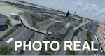
This Photo Real scenery is a complete rebuild for the FSX Default KLAX airport using the latest version of ADE ,Google SkecthUp, & SBuilderX scenery design tool. This new KLAX scenery, Version 3.0 includes new terminal buildings that have been resized and redesigned to look more realistic. I added terminal lights,(no night light lamps yet), new trees, cars to the parking garages, ground vehicles taxiway usage fixed, and several other nice details to enhance the KLAX experience. Other details included are the New Tom Bradley International Terminal, buildings located on W.Cenury Blvd, 9 Airbus A380 parking spots, and Photo Real ground textures. The runways and airport aprons are aligned to match Google & Yahoo satellite imagery. I hope you enjoy the scenery.
| Filename: | KLAX__Los_Angeles_International_Airport_Photoreal_.zip |
| License: | Freeware |
| Added: | 27th November 2011, 19:16:05 |
| Downloads: | 14,399 |
| Author: | Glenn Johnson |
| Size: | 16.28 MB |
| Category: Flight Simulator X - Scenery | |
| KDAY - Dayton International Airport - Vandalia, Ohio |
|
Images related to this file:
File Description:
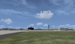
The Dayton International Airport, located 11 miles north of Dayton in Vandalia, Ohio, is a medium sized commercial airport serving nearly three million passengers annually with daily nonstop service to about twenty destinations.
This scenery includes a custom terminal building, moving jetways, and an AFX file with accurate parking assignments. Also modeled is the new air traffic control tower, terminal parking garage, the Fed Ex building, the PSA Airlines headquarters and maintenance hanger, the former Emery Worldwide cargo sort facility, the airport hotel, and hangers for fixed base operators Stevens Aviation and Wright Brothers Aero.
More than a thousand objects have been added to enhance detail around the airport using Flight 1's excellent instant scenery program. AI Traffic has been tested to ensure efficient flow. The landclass file has also been adjusted to better reflect the real airport.
| Filename: | KDAY__Dayton_International_Airport__Vandalia_Ohio.zip |
| License: | Freeware |
| Added: | 2nd December 2012, 22:32:37 |
| Downloads: | 1,571 |
| Author: | Matt Parr |
| Size: | 5.78 MB |
| Category: Flight Simulator X - Scenery | |
| D52 - Geneseo - Geneseo, New York v2.0 |
|
Images related to this file:
File Description:
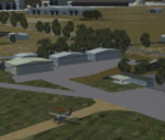
This is a corrected airfield layout of D52 in Geneseo NY, I have flown there in the real world and was very disappointed in how incorrect the FSX version was placed, and it looked nothing like the real D52!, so I decided to make it all better!. I used photo scenery and ADEX to correct placement of the field (off by quite a bit!), placed the trees where they should be, "close" at both ends of the runway! Its those trees that make D52 so fun to fly in and out of!. So I hope you find this as fun a field as I have!. "THIS IS VERSION 2 W/AFCAD & PHOTO" In my first attempt at an AVSIM upload I left out the AFCAD file!
If you had already downloaded my previous version then please download this fixed one!.
| Filename: | D52__Geneseo__Geneseo_New_York_v20.zip |
| License: | Freeware |
| Added: | 8th April 2013, 12:59:49 |
| Downloads: | 535 |
| Author: | Darrell Meadr |
| Size: | 18.51 MB |
| Category: Flight Simulator X - Scenery | |
| KLCI - Laconia Municipal Airport - Laconia, NH |
|
File Description:
Here is an improved version of the stock Laconia Municipal Airport. This airport had a lot of issues with
buildings on roads or in the water, boundary fences in the water, etc. I fixed those issues and adjusted and
added aprons,roads and taxiways to more closely match reality. I replaced most default buildings and added
additional buildings. I added the parking lot and static vehicles, aircraft, light poles, and other filler objects.
The runway at Laconia was lengthened in real life and I corrected the length in FSX. It was lengthened
primarily to accomodate biz jets of race teams and others attending the NASCAR events at nearby Loudon, NH.
Laconia Airport is located on scenic Lake Winnipesaukee and not far from Weirs Beach. Laconia hosts a
week-long motorcycle rally each June, usually a week after the Americade Rally in Lake George, NY.
| Filename: | KLCI__Laconia_Municipal_Airport__Laconia_NH.zip |
| License: | Freeware |
| Added: | 22nd January 2009, 03:28:31 |
| Downloads: | 764 |
| Author: | Jim Cook |
| Size: | 10.18 KB |
| Category: Flight Simulator X - Scenery | |
| Murray river + SE victoria airports ****UPDATED****. YRIO Robinvale YBRN Balranald YDLQ Deniliquin YLEG Leongatha YYRM Yarram |
|
Images related to this file:
File Description:
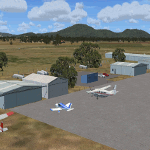
This is an updated version (original July 2018) with some ground texture problems fixed plus a lot of added and improved objects. There are 5 airports. 3 airports near the Murray river in Victoria and NSW - YRIO Robinvale, YBRN Balranald, YDLQ Deniliquin. 2 airports in SE Victoria - YLEG Leongatha, YYRM Yarram. A few airports but this is no quicky slap dash effort but hundred+ hours. Surrounding scenery modified to match real life. Towns have been added or shifted. Forests cut down or added. Race courses, sewage treatment ponds and other stuff added. Local obstacles (towers etc) added. Included are 2 AI traffic files that covers the airports. These files are for Flight Simulator X. Made using Airport Design Editor using some objects borrowed from Robert Budd's excellent Baccus Marsh. RECOMMENDED The scenery is designed to interface with ORBX FTX_AU scenery for Australia (payware). It will work without ORBX but will not interface as well with standard scenery.
| Filename: | Murray_river__SE_victoria_airports_UPDATED_YRIO_Ro.zip |
| License: | Freeware |
| Added: | 22nd February 2019, 18:09:09 |
| Downloads: | 272 |
| Author: | Colin Jeffery |
| Size: | 3.44 MB |
| Category: Flight Simulator X - Scenery | |
| Mid West Victoria UPDATED. 14 airports. YARA YSWL YMBU YSTA YDOD YWYF YBIR YHPN YKER YSLK YSWH + *NEW* YNHL YHML YWKB |
|
Images related to this file:
File Description:
This is an updated version (original Jan 2018). Fixed some ground texture problems plus a lot of added and improved objects and 3 NEW airports. There are 14 airports starting at Ararat and extending up to the Murray at Swan Hill. YARA Ararat YSWL Stawell YMBU Maryborough YSTA Saint Arnaud YDOD Donald YWYF Wycheproof YBIR Birchip YHPN Hopetoun YKER Kerang YSLK Sealake YSWH Swanhill + *NEW* YNHL Nhill YHML Hamilton YWKB Warracknabeal. A lot of airports but not a quicky slap dash effort. It is several hundred hours over many months. Surrounding scenery modified to match real life. Towns, race courses, forests, sewage treatment ponds, obstacles (towers etc) have been added. Included is an AI traffic file that covers all airports that don't already have AI. These files are for Flight Simulator X. Made using Airport Design Editor using some objects borrowed from Robert Budd's excellent Baccus Marsh. RECOMMENDED The scenery is designed to interface with ORBX FTX_AU scenery for Australia (payware). It will work without ORBX but will not interface as well with standard scenery.
| Filename: | Mid_West_Victoria_UPDATED_14_airports_YARA__YSWL__.zip |
| License: | Freeware |
| Added: | 16th May 2019, 18:19:35 |
| Downloads: | 419 |
| Author: | Colin Jeffery |
| Size: | 5.23 MB |
| Category: Flight Simulator X - Scenery | |
| Teterboro Airport, New Jersey |
|
File Description:
Teterboro Airport is located across the Hudson River in New Jersey, just 12 miles from midtown Manhattan, Teterboro Airport is considered a general aviation reliever airport. As a reliever airport, it does not offer scheduled airline service, nor does it permit operations of any aircraft in excess of 100,000 pounds on any airport surface. Teterboro Airport has five Fixed Base Operators (FBOs), Atlantic Aviation, Jet Aviation, First Aviation, Meridian, and Signature Aviation. Scenery includes Phototexture to cover the unattractive stock FSX airport ground texture. Along with Night, Fall and Winter varience textures. Autogen is placed on top of phototexture in specific areas. ALL airport objects have been placed in proper position to photoscenery. Aprons and taxiways in alignment with photostexture. Supports AI traffic for the pilots who use. Numerous Airport vehicles and stacic aircraft on the gounds. There are a few GMAX scenery objects along with Stock FSX objects. If you have cast ground shadows checked in your display feature, some of the vegetation will show black blocks on its base, so uncheck this if you wish. I designed this for all the Charter and General Aviation pilots out there, including myself.
| Filename: | Teterboro_Airport_New_Jersey.zip |
| License: | Freeware |
| Added: | 7th July 2010, 00:47:37 |
| Downloads: | 1,786 |
| Author: | Eric McCloud |
| Size: | 36.84 MB |
| Category: Flight Simulator X - Scenery | |
| Teterboro KTEB version 2.0 |
|
File Description:
FSX Scenery--Teterboro Airport (KTEB), NJ. Teterboro Airport is located across the Hudson River in New Jersey, just 12 miles from midtown Manhattan. Teterboro Airport is considered a general aviation reliever airport. As a reliever airport, it does not offer scheduled airline service, nor does it permit operations of any aircraft in excess of 100,000 pounds on any airport surface. Teterboro Airport has five Fixed Base Operators (FBOs), Atlantic Aviation, Jet Aviation, First Aviation, Meridian, and Signature Aviation. Teterboro - KTEB version 2 includes the latest google earth photo texture that depics the completed construction work of the taxiways and aprons. Photo texture includes summer, fall, winter, and spring variance textures. Night textures also included,along with snow textures in the winter months. Vegetation autogen has been re-worked. All taxiways, taxisigns are present and depicted to real-life. Custom taxilights and runway ground markings included, the ground detail is exact. All stock FSX hangars have been replaced with custom hangars. Animated people and birds are found on the airfield. Numerous SAMM generated static business jets and some light general aviation aircraft are present. Enjoy!
| Filename: | Teterboro_KTEB_version_20.zip |
| License: | Freeware |
| Added: | 14th April 2011, 16:57:39 |
| Downloads: | 2,621 |
| Author: | Eric McCloud |
| Size: | 52.63 MB |


© 2001-2026 AVSIM Online
All Rights Reserved
Privacy Policy |