
Where Flight Simulation Enthusiasts Gather from Around the World!
AVSIM Library - Search Results

| Category: Flight Simulator X - Scenery | |
| Barbados Island Scenery V2 |

|
File Description:
UPDATED 01/05/2017
Photoscenery for Barbados island for FSX/P3D
Thank you for downloading my first scenery.
I've decided to make my first scenery of my home island Barbados, am very proud of my work and I hope you enjoy it.
UPDATE:
Fixed the Blendmask
Fixed the watermask
added rivers, port and more to the watermask
Barbados is a sovereign island country in the Lesser Antilles, in the Americas. It is 34 kilometres (21 miles) in length and up to 23 km (14 mi) in width,
covering an area of 432 km2 (167 sq mi). It is situated in the western area of the North Atlantic and 100 km (62 mi) east of the Windward Islands and the Caribbean Sea;[6] therein,
it is about 168 km (104 mi) east of the islands of Saint Vincent and the Grenadines and 400 km (250 mi) north-east of Trinidad and Tobago. Barbados is outside of the principal Atlantic hurricane belt.
Its capital is Bridgetown. Barbados is 1,600 mi (2,600 km) Southeast of Miami.
| Filename: | Barbados_Island_Scenery_V2.zip |
| License: | Freeware |
| Added: | 6th January 2017, 08:36:45 |
| Downloads: | 1,794 |
| Author: | Shakur Jones |
| Size: | 80.48 MB |
| Category: Flight Simulator X - Scenery | |
| ENHA - Hamar Lufthavn (Stafsberg) Update v 1.01 |
|
File Description:
The airport of Stafsberg located in Hamar, Norway (ENHA) Including all custom made ground, runway and 3D buildings. This VFR airport is located some 40 miles north of the capital Oslo, close to Lillehammer who hosted the 1994 Winter Olympics! Enjoy flying in one of the most beautifull countries in the world! Please read the included readme file for instructions on how to correctly install.
Update: Added New, like "The Real" one, NDB, removed default FSX NDB. Fixed some issues with effects file and some minor adjustments.
| Filename: | ENHA__Hamar_Lufthavn_Stafsberg__Update_v_101.zip |
| License: | Freeware, limited distribution |
| Added: | 5th September 2012, 00:30:44 |
| Downloads: | 2,123 |
| Author: | Thomas Lorentzen, Stein-Ove Rud |
| Size: | 1.11 MB |
| Category: Flight Simulator X - Scenery | |
| KTMA - Henry Tift Myers Airport - Tifton, Georgia (V1.1 Update) |
|
Images related to this file:
File Description:
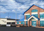
The scenery represents KTMA FA08 Henry Tift Myers Airport in Tifton, Tift county, Georgia, USA. Used for training by the USSAC in WWII it returned to civil authorities in 1947. The airport was renamed Henry Tift Myers Airport in honour of Tifton native Colonel Henry T. "Hank" Myers, who was the first pilot of Air Force One.
The scenery includes custom built objects representing the characteristic terminal and T-hangars. The surrounding grounds are made by land class polygons.
v1.1 fixed some flickering on rwy15.
| Filename: | KTMA__Henry_Tift_Myers_Airport__Tifton_Georgia__V11_Update.zip |
| License: | Freeware |
| Added: | 16th October 2012, 08:43:22 |
| Downloads: | 1,115 |
| Author: | Vassilios Dimoulas |
| Size: | 1.2 MB |
| Category: Flight Simulator X - Scenery | |
| McDill AFB (KMCF) |
|
File Description:
After reading a forum thread about freeway traffic on the KMCF aprons, it became apparent to me that users of UTX-USA needed this airport to be fixed so that taxiways and aprons are in the correct locations. Fortunately, the FSX default runway is correctly located. Taxiways and aprons have been relocated according to Google Earth, and while at it, some buildings have been changed, taxiway designations corrected, parking added, connecting roads added, landclass and boundary fences around the airfield changed and some library objects placed (including B52s on the ramp).
| Filename: | McDill_AFB_KMCF.zip |
| License: | Freeware |
| Added: | 14th February 2009, 20:57:33 |
| Downloads: | 975 |
| Author: | Art Poole |
| Size: | 117.42 KB |
| Category: Flight Simulator X - Scenery | |
| RCGM Taoyuan Air Base, Taiwan |
|
File Description:
This is an improvement of the default RCGM Taoyuan Air Base in Northern Taiwan. RCGM was the home base of several ROC Air Force units, including the 35th "Black Cat" Squadron that flew deep penetration missions into China using U-2. The base was turned over to the ROC Navy in 2007 and now serves as the home for fixed-wing ASW aircraft. Satellite imagery available online were used to reposition taxiways, add and resize aprons, and add civilian gates and military aircraft parking. Prominent buildings were represented using stock library objects. Created using Airport Design Editor 1.39b by Mike Huang.
| Filename: | RCGM_Taoyuan_Air_Base_Taiwan.zip |
| License: | Freeware |
| Added: | 13th March 2009, 03:22:33 |
| Downloads: | 1,500 |
| Author: | Mike Huang |
| Size: | 365.69 KB |
| Category: Flight Simulator X - Scenery | |
| Montery Peninsula Airport (KMRY), Version 2 |
|
Images related to this file:
File Description:
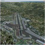
Scenery for Monterey Peninsula Airport Version 2, located on the coast in Central California. The Monterey Peninsula Airport has regular flights that are available to San Francisco, Los Angeles, Phoenix, Denver and Las Vegas where connecting flights can take you anywhere in the world. There are five fixed base operators located here: APR Aviation, Million Air, Monterey Bay Aviation, Monterey Jet Center and Navy Flying Club.
Version 2 adds the following: Photoscenery to cover within airport grounds, all aprons, taxiways, buildings placed correctly on phototexture, GA Static aircraft, apron lights, taxi lights, animated windsock with segmented circle and pattern markers and a variety of custom hangars and eye-candy.
| Filename: | Montery_Peninsula_Airport_KMRY_Version_2.zip |
| License: | Freeware |
| Added: | 4th September 2010, 03:16:41 |
| Downloads: | 3,349 |
| Author: | Eric McCloud |
| Size: | 11.27 MB |
| Category: Flight Simulator X - Scenery | |
| ENTA - Masjok Airfield - Tana (Finnmark), Norway *v2* |
|
Images related to this file:
File Description:
**This is a second version of the Masjok Airfield. This version fixed the taxiways and location of the airfield. If you have the old scenery, please disable it!** . I made this because i wanted to fly at my nearest airfield. The airfield can operate everything smaller than a Twin Otter. It's in the middle of the region East-Finnmark in Norway, so you can fly to a lot of other airports around the region. Happy flying :D
Check out my Facebook page for repaints!: http://facebook.com/krijagrepaints
Check out my page for other repaint and scenery download's: http://krijagrepaints.wix.com/krijag-repaints
| Filename: | ENTA__Masjok_Airfield__Tana_Finnmark_Norway_v2.zip |
| License: | Freeware |
| Added: | 9th March 2016, 22:44:50 |
| Downloads: | 505 |
| Author: | Kristian Jaegervand |
| Size: | 6.37 KB |
| Category: Flight Simulator X - Scenery | |
| Centrair RJGG V3.0 complete |
|
Images related to this file:
File Description:
Chubu Centrair International Airport (IATA: NGO, ICAO: RJGG) is an airport on an artificial island in Ise Bay, 22 miles south of Nagoya in central Japan. Chubu is Japan's third off-shore airport, after Nagasaki Airport and Kansai International Airport, and is also the second airport built in Japan on a man-made island.
In this final version are added:
cars on parking garages
parking areas
static Air stairs
more realistic bagage loader
ANA logo on ground vehicles
Changed Skychefs catering trucks to NAC ( Nagoya Air Catering) catering trucks as in real life
benches on Chubu Airport's Sky Deck
lights on some static vehicles at night
fixed the readme desciption
| Filename: | Centrair_RJGG_V30_complete.zip |
| License: | Freeware |
| Added: | 20th November 2011, 00:13:22 |
| Downloads: | 8,079 |
| Author: | Morten Thomas van der Linden |
| Size: | 43.07 MB |
| Category: Flight Simulator X - Scenery | |
| Nashua Municipal Airport (Boire Field) - KASH |
|
File Description:
This airport was made using Airport Design Editor 9x. (ADE9x). Nashua Municipal Airport, or Boire Field is a general aviation airport located in Nashua, New Hamshire. I made it based on Google Earth and Bing maps. I have replaced most of the stock buildings and added more accurate ones. The flight simulator made the taxiways 75 feet wide but they are only supposed to be 50 feet wide. That is something else I fixed. I also added static aircraft on the ramp and cars in the parking lot. The scenery complexity can not be set to to very sparse or nothing will not show up. Please read the readme for instructions. This file is for Flight Simulator X only.
| Filename: | Nashua_Municipal_Airport_Boire_Field__KASH.zip |
| License: | Freeware |
| Added: | 11th December 2011, 06:40:36 |
| Downloads: | 345 |
| Author: | Tyler Lawrence |
| Size: | 11.38 KB |
| Category: Flight Simulator X - Scenery | |
| EGLC - London City Airport |
|
Images related to this file:
File Description:
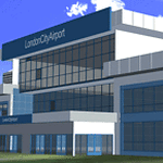
Scenery for FSX sp2 and Acceleration Pack.
Airport is located in London,on a former Docklands site in the London Borough of Newham, some 6 NM (11 km; 6.9 mi) east of the City of London and a rather smaller distance east of Canary Wharf. These are the twin centres of London's financial industry, which is a major user of the airport. The airport was developed by the engineering company Mowlem in 1986-87.
London City Airport has a single 1,500-metre (4,900 ft) long runway.Only multi-engine, fixed-wing aircraft with special aircraft and aircrew certification to fly 5.5° approaches are allowed to conduct operations at London City Airport.
| Filename: | EGLC__London_City_Airport.zip |
| License: | Freeware, limited distribution |
| Added: | 7th August 2014, 10:02:18 |
| Downloads: | 8,672 |
| Author: | Ashish Singh |
| Size: | 46.38 MB |


© 2001-2026 AVSIM Online
All Rights Reserved
Privacy Policy |