
Where Flight Simulation Enthusiasts Gather from Around the World!
AVSIM Library - Search Results

| Category: Flight Simulator X - Scenery | |
| VYMM Mawlamyine Intl Airport V2.0 with Traffic-Pack 2 |

|
File Description:
Mawlamyine International Airport in Burma, Myanmar, include Traffic-Pack 2. Traffic-Pack 1 comes with vyyy4tp1.zip. Traffic-Pack 3 comes soon too. This scenery was produced based of suppositions, stories and voices. It is therefore pure speculation. Whether this airport is ever increased, the God know. If the planned Asean-Highway leads at it past, this airport should gain importance very quickly. Version 2.0 with new docks, jetways, already extended runway, taxiways and new taxisigns. First of all we corrected the airport location to the real one. With Myanmar Air Force area, Helipads and even more parkings for civilian airplanes. You need mai321x.zip, mai738x.zip and mai744x.zip to use with this. Many Thanks go to Harald Nehring and Frank Weiss,
Robert Versluys, Mike Stone and the teams of HOUSE-RP in Burma, FSX Planner, SceneGenX, SBuilder X, Open Ports Scanner, AFXBgDownloader, FSUIPC, Google Earth and AI Flight Planner. This scenery is pure fiction and for FSX only, for FS2004 please download newVYMMfs9.zip and newVYMMup.zip. By HOUSE-RP, Switzerland and Burma
| Filename: | VYMM_Mawlamyine_Intl_Airport_V20_with_TrafficPack_.zip |
| License: | Freeware, limited distribution |
| Added: | 6th June 2008, 15:34:08 |
| Downloads: | 672 |
| Author: | HOUSE-RP, Robby Pauletto |
| Size: | 3.42 MB |
| Category: Flight Simulator X - Scenery | |
| Branson Airport KBBG--New Airport, Scenery, and Flight Plans |
|
Images related to this file:
File Description:
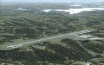
This project adds a new, detailed Branson Airport KBBG (Missouri) to FSX, which opened in May 2009, and is a privately developed commercial airport. The construction of the airport, which involved the flattening of several Ozark Mountains, is claimed to be the largest earthmoving project in Missouri history. As a result, the airport actually sits on a manmade plateau, surrounded by rolling hills. The airport uses the ICAO identifier BBG, however, the airlines use the IATA code BKG. The airport is served by AirTran, Frontier, and ExpressJet (Branson AirExpress), and is located in hilly terrain. Aircraft equipped with a terrain avoidance warning system may experience system activation on final approach. Birds are in the vicinity of the airport. AFCAD with sloping terrain created using Airport Design Editor X v1.47.07, and the hilltops were cleared and flattened and roads were added using SBuilderX 3.13. The terminal, hangar, FBO, and cars were added and modified from stock FSX scenery, using the FSX Object Tool, to resemble as closely as possible the actual airport.
| Filename: | Branson_Airport_KBBGNew_Airport_Scenery_and_Flight.zip |
| License: | Freeware |
| Added: | 5th August 2010, 01:08:33 |
| Downloads: | 2,005 |
| Author: | Carlyle Sharpe |
| Size: | 6.02 MB |
| Category: Flight Simulator X - Scenery | |
| TTCPx Patch Ver. 1.2 ( Rev. 8 ) |
|
Images related to this file:
File Description:
Unofficial LatinVFR Tobago TTCP for FSX Expansion Pack. This freeware patch contents: New photoreal scenery with seasons to airport area ( day and night for winter/fall and summer/spring seasons ); New ADE with correction of the NDB TAB 323 and park positions, activation of the RWY's 11 and 29, and other minor fixes; Addition of fuel-repair trigger points to the airport ( JetA to Gates 1-4 area, JetA1 to Gates 5-6 area, and AV100 to Gate 7 area ); New land and water classiffication in the entire island of Tobago; Correction of the entire island terrain including a better flatten around the airport area; More buildings, objects, vegetation and life around on the island of Tobago ( FSX default fictitious objects ); More road traffic over the photoreal area; Full set of the TTCP airport charts ( Use for Virtual Flight Only ); Other fixes. It's not a cumulative patch, so remove any previous version to install. System Requirements: LatinVFR Tobago TTCP v1.1 for FSX and Microsoft Flight Simulator X SP2 or Acceleration.
| Filename: | TTCPx_Patch_Ver_12__Rev_8_.zip |
| License: | Freeware |
| Added: | 22nd August 2010, 08:59:46 |
| Downloads: | 2,429 |
| Author: | Gladson Moreira |
| Size: | 32.76 MB |
| Category: Flight Simulator X - Scenery | |
| Mid West Victoria UPDATED. 14 airports. YARA YSWL YMBU YSTA YDOD YWYF YBIR YHPN YKER YSLK YSWH + *NEW* YNHL YHML YWKB |
|
Images related to this file:
File Description:
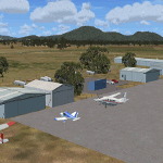
This is an updated version (original Jan 2018). Fixed some ground texture problems plus a lot of added and improved objects and 3 NEW airports. There are 14 airports starting at Ararat and extending up to the Murray at Swan Hill. YARA Ararat YSWL Stawell YMBU Maryborough YSTA Saint Arnaud YDOD Donald YWYF Wycheproof YBIR Birchip YHPN Hopetoun YKER Kerang YSLK Sealake YSWH Swanhill + *NEW* YNHL Nhill YHML Hamilton YWKB Warracknabeal. A lot of airports but not a quicky slap dash effort. It is several hundred hours over many months. Surrounding scenery modified to match real life. Towns, race courses, forests, sewage treatment ponds, obstacles (towers etc) have been added. Included is an AI traffic file that covers all airports that don't already have AI. These files are for Flight Simulator X. Made using Airport Design Editor using some objects borrowed from Robert Budd's excellent Baccus Marsh. RECOMMENDED The scenery is designed to interface with ORBX FTX_AU scenery for Australia (payware). It will work without ORBX but will not interface as well with standard scenery.
| Filename: | Mid_West_Victoria_UPDATED_14_airports_YARA__YSWL__.zip |
| License: | Freeware |
| Added: | 16th May 2019, 18:19:35 |
| Downloads: | 419 |
| Author: | Colin Jeffery |
| Size: | 5.23 MB |
| Category: Flight Simulator X - Scenery | |
| North Victoria v2 for ORBX v2 YBLA Benalla YECH Echuca YYWG Yarrawonga |
|
Images related to this file:
File Description:
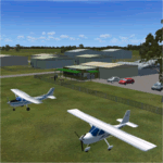
'North Victoria v2' is made to match ORBX Australia v2 scenery. Use 'YBLA Benalla' 'YECH Echuca' 'YYWG Yarrawonga' for ORBX v1 or no ORBX. There are 3 airports YBLA Benalla YECH Echuca YYWG Yarrawonga. ORBX has done these as they have done every airport included with FSX in Australia to a reasonable standard. If I had not already done them for ORBX V1 I would not have bothered. However these are better than ORBX because the surroundings have been modified to match real life. Towns have been added or shifted. Forests cut down or added. There are also custom accurate versions of the actual terminal buildings/hangers. In short a lot more time spent. ORBX had to do every airport has in Australia! Orbx have AI traffic files that cover all 3 airports. These files are for Flight Simulator X. Made using Airport Design Editor using some objects borrowed from Robert Budd's excellent Baccus Marsh and 'Static aircrafts' by Jean-Pierre Fillion. REQUIRED The scenery is designed to interface with ORBX FTX_AU V2 scenery for Australia (payware).
| Filename: | North_Victoria_v2_for_ORBX_v2___YBLA_Benalla_YECH_.zip |
| License: | Freeware |
| Added: | 2nd November 2019, 18:57:53 |
| Downloads: | 325 |
| Author: | Colin Jeffery |
| Size: | 10.01 MB |
| Category: Flight Simulator X - Scenery | |
| Mesh South America / MeSA A02 |
|
File Description:
FSX Mesh South America Project:
This terrain mesh file is a part of a whole project covering all the Continent of South America and some islands, divided in tiles identified in a map by its column (letters) and rows (numbers).
Those files were multi-LOD compiled from 90m SRTM2 source data, reprocessed with 3DEM to remove voids and spikes, providing a 76.4m (LOD9) horizontal resolution topography intended for use only in FSX updated with SP1.
Although not well documented, to improve performance, the updated FSX loads DEM files in threads and only the closer terrain (about 5 NM from the point of view) is rendered in high detail, while at far distances FSX shows up its default low resolution mesh, when there is not a third part terrain mesh compiled in all others intermediate level of details (multi-LOD).
THIS FILE:
FSX_MeSA_A02
Column A x Row 02
This file covers the area inside the boundaries:
N = 11º 15' N; S = 5º 37,5' N;
W = 90º 0' W; E = 82º 30' W;
AUTHORS:
Hely Heck Junior - Magrao ( [email protected] )
and Jose Lobo ( [email protected] )
TerraBrasilis: www.terra-brasilis.org
| Filename: | Mesh_South_America__MeSA_A02.zip |
| License: | Freeware |
| Added: | 11th June 2007, 00:02:15 |
| Downloads: | 1,595 |
| Author: | Hely Heck Jr. and José Lôbo |
| Size: | 10.95 MB |
| Category: Flight Simulator X - Scenery | |
| Mesh South America / MeSA A03 |
|
File Description:
FSX Mesh South America Project:
This terrain mesh file is a part of a whole project covering all the Continent of South America and some islands, divided in tiles identified in a map by its column (letters) and rows (numbers).
Those files were multi-LOD compiled from 90m SRTM2 source data, reprocessed with 3DEM to remove voids and spikes, providing a 76.4m (LOD9) horizontal resolution topography intended for use only in FSX updated with SP1.
Although not well documented, to improve performance, the updated FSX loads DEM files in threads and only the closer terrain (about 5 NM from the point of view) is rendered in high detail, while at far distances FSX shows up its default low resolution mesh, when there is not a third part terrain mesh compiled in all others intermediate level of details (multi-LOD).
THIS FILE:
FSX_MeSA_A03
Column A x Row 03
This file covers the area inside the boundaries:
N = 5º 37,5' N; S = 0º 0' S;
W = 90º 0' W; E = 82º 30' W;
AUTHORS:
Hely Heck Junior - Magrao ( [email protected] )
and José Lôbo ( [email protected] )
TerraBrasilis: www.terra-brasilis.org
| Filename: | Mesh_South_America__MeSA_A03.zip |
| License: | Freeware |
| Added: | 11th June 2007, 00:02:40 |
| Downloads: | 1,424 |
| Author: | Hely Heck Jr. and José Lôbo |
| Size: | 1.52 MB |
| Category: Flight Simulator X - Scenery | |
| Mesh South America / MeSA A01 |
|
File Description:
FSX Mesh South America Project:
This terrain mesh file is a part of a whole project covering all the Continent of South America and some islands, divided in tiles identified in a map by its column (letters) and rows (numbers).
Those files were multi-LOD compiled from 90m SRTM2 source data, reprocessed with 3DEM to remove voids and spikes, providing a 76.4m (LOD9) horizontal resolution topography intended for use only in FSX updated with SP1.
Although not well documented, to improve performance, the updated FSX loads DEM files in threads and only the closer terrain (about 5 NM from the point of view)is rendered in high detail, while at far distances FSX shows up its default low resolution mesh, when there is not a third part terrain mesh compiled in all others intermediate level of details (multi-LOD).
THIS FILE: FSX_MeSA_A01
(Column A x Row 01)
This file covers the area inside the boundaries:
N = 16º 52,5' N; S = 11º 15' N;
W = 90º 0' W; E = 82º 30' W;
AUTHORS:
Hely Heck Junior - Magrao ( [email protected] )
and Jose Lobo ( [email protected] )
TerraBrasilis: www.terra-brasilis.org
| Filename: | Mesh_South_America__MeSA_A01.zip |
| License: | Freeware |
| Added: | 11th June 2007, 00:03:00 |
| Downloads: | 1,960 |
| Author: | Hely Heck Jr. and José Lôbo |
| Size: | 49.55 MB |
| Category: Flight Simulator X - Scenery | |
| Mesh South America / MeSA B01 |
|
File Description:
FSX Mesh South America Project:
This terrain mesh file is a part of a whole project covering all the Continent of South America and some islands, divided in tiles identified in a map by its column (letters) and rows (numbers).
Those files were multi-LOD compiled from 90m SRTM2 source data, reprocessed with 3DEM to remove voids and spikes, providing a 76.4m (LOD9) horizontal resolution topography intended for use only in FSX updated with SP1.
Although not well documented, to improve performance, the updated FSX loads DEM files in threads and only the closer terrain (about 5-10 NM from the point of view) is rendered in high detail, while at far distances FSX shows up its default low resolution mesh, when there is not a third part terrain mesh compiled in all others intermediate level of details (multi-LOD).
THIS FILE: FSX_MeSA_B01 (Column B x Row 01)
This file covers the area inside the boundaries:
N = 16º 52,5' N; S = 11º 15' N;
W = 82º 30' W; E = 75º 0' W;
AUTHORS:
Hely Heck Junior - Magrao ( [email protected] )
and Jose Lobo ( [email protected] )
TerraBrasilis: www.terra-brasilis.org
| Filename: | Mesh_South_America__MeSA_B01.zip |
| License: | Freeware |
| Added: | 11th June 2007, 15:56:55 |
| Downloads: | 1,403 |
| Author: | Hely Heck Jr. and José Lôbo |
| Size: | 1.53 MB |
| Category: Flight Simulator X - Scenery | |
| Mesh South America / MeSA B06 |
|
File Description:
FSX Mesh South America Project:
This terrain mesh file is a part of a whole project covering all the Continent of South America and some islands, divided in tiles identified in a map by its column (letters) and rows (numbers).
Those files were multi-LOD compiled from 90m SRTM2 source data, reprocessed with 3DEM to remove voids and spikes, providing a 76.4m (LOD9) horizontal resolution topography intended for use only in FSX updated with SP1.
Although not well documented, to improve performance, the updated FSX loads DEM files in threads and only the closer terrain (about 5-10 NM from the point of view) is rendered in high detail, while at far distances FSX shows up its default low resolution mesh, when there is not a third part terrain mesh compiled in all others intermediate level of details (multi-LOD).
THIS FILE:
FSX_MeSA_B06 (Column B x Row 06)
This file covers the area inside the boundaries:
N = 11º 15' S; S = 16º 52,5' S;
W = 82º 30' W; E = 75º 0' W;
AUTHORS:
Hely Heck Junior - Magrao ( [email protected] )
and Jose Lobo ( [email protected] )
TerraBrasilis: www.terra-brasilis.org
| Filename: | Mesh_South_America__MeSA_B06.zip |
| License: | Freeware |
| Added: | 11th June 2007, 22:10:10 |
| Downloads: | 1,426 |
| Author: | Hely Heck Jr. and José Lôbo |
| Size: | 12.99 MB |


© 2001-2026 AVSIM Online
All Rights Reserved
Privacy Policy |