
Where Flight Simulation Enthusiasts Gather from Around the World!
AVSIM Library - Search Results

| Category: Flight Simulator X - Scenery | |
| MYXY - Duncan Town, Ragged Island Chain, Bahamas - Version 2 |

|
File Description:
The Ragged Island Chain consists of a string of small islands in the Bahamas. Only one island, Ragged Island, has a settlement on it which is known as Duncan Town. This FSX scenery improves the airstrip at Duncan Town and creates a new private airstrip on Nurse Cay. The airstrip at MYXY (Duncan Town) has been lengthened by 500 feet and widened by 25 feet. Six parking ramps now exist as well as a fuel pump and helipad. Additional taxiways have been added and lights for the runway, taxiways and apron. A small building has been added to serve as a combined terminal, control tower, and customs office. There is also a hangar to protect your plane from tropical storms. These improvements were necessary to accomodate the increased air traffic due to the new high rise tropical hotel, the Ragged Island Resort. There is also a lighthouse on the island and a cruise ship with helipad just off to the east. A large private yacht just to the north also has a helipad. You can watch dolphins swim at both of those locations - the helipads make great viewing spots. About 20 miles north of Ragged Island is Nurse Cay (MYXN). This is where my private airstrip and villa are located. The airstrip has a 2500 ft concrete runway and a parallel taxiway as well as a helipad. The runway, taxiways, and apron are all lit for night operations. The airstrip was built right on a marsh so wandering off the runway or taxiways could result in getting wet. You will find a variety of birds flying around at various locations throughout this scenery. A flight plan is also included for a dusk flight from Ragged Island (MYXY) to Nurse Cay (MYXN). So come on out to Ragged Island, because it's better in the Bahamas! This is version 2 and supercedes my original file - this version corrects the runway numbers at MYXN.
| Filename: | MYXY__Duncan_Town_Ragged_Island_Chain_Bahamas__Ver.zip |
| License: | Freeware |
| Added: | 24th August 2007, 15:55:49 |
| Downloads: | 2,408 |
| Author: | Mike Lanza |
| Size: | 13.43 KB |
| Category: Flight Simulator X - Scenery | |
| Hawaiian Airports Part 3 |
|
Images related to this file:
File Description:
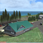
Hawaiian Airports Part 3
This scenery features the airports at Princeville, Port Allen, Waimea and Upolu. HI01-Princeville and PAK-Port Allen are located on the island of Kauai, the film location made famous by Stephen Spielberg's blockbuster, Jurassic Park. PHMU-Waimea and PHUP-Upolu are located in the North West of Hawaii, also known as the Big Island. All runways, aprons, taxiways and buildings have been repositioned to their correct locations, and the scenery has been recreated based on photos of the real airports. The scenery features many animated objects including people, aircraft, animals, waves, cars, trucks and many more. Full night textures with light maps are included.
All the scenery files have been sub-divided so they can be switched on or off according to user preference and hardware configuration. It has been designed for, and tested in DX9 and FSXA only. The airports include sloped flattens so they can also be used with high density mesh. This file also includes updates for Hawaiian Airports Part 2. Please enjoy, and I hope you like my scenery as much as I enjoyed building it.
| Filename: | Hawaiian_Airports_Part_3.zip |
| License: | Freeware, limited distribution |
| Added: | 8th February 2015, 21:23:05 |
| Downloads: | 6,972 |
| Author: | George Keogh |
| Size: | 82.23 MB |
| Category: Flight Simulator X - Scenery | |
| Dieuze - Gueblange V2 |
|
Images related to this file:
File Description:
This scenery depicts Dieuze-Gueblange aerodrome located in the north east of France. It is a very accurate rendition of this aerodrome made with photoreal textures for the ground and the objects. The ground is covered with volumetric grass. I have modelled an animated sock that indicates the wind direction and velocity. To see this windsock, Sode (Sim Objects Display Engine) module must be installed (module availabale here : http://sode.12bpilot.ch/?page_id=9). A user manual (pdf) is included.
The windsock library may be used in your own sceneries. If you share a scenery using this library, you must add the BJP_SOCKS folder without any modification in order to avoid duplicate files. Please include my name in any of your included documents. This new release is now compatible with a landclass environment: snowy ground and trees in the hard winter (from the first day of december to the last day of january). Please read the specific enclosed manual.
| Filename: | Dieuze__Gueblange_V2.zip |
| License: | Freeware, limited distribution |
| Added: | 1st February 2015, 23:14:45 |
| Downloads: | 1,453 |
| Author: | Jacques-Paul Bollard |
| Size: | 21.98 MB |
| Category: Flight Simulator X - Scenery | |
| PicNic 1.0 - Add grass in Flight Simulator |
|
File Description:
After the success of TreeX, it was logical to improve the ground of Flight Simulator. This is why PicNic was carried out. But PicNic is much more than grass! It makes it possible to improve the ground in general, giving to basic textures an aspect more contrasted and also while bringing more relief. PicNic run olso on the photo-realistic sceneries bringing an additional dimension to them!
It also makes it possible to better appreciate its speed, making the flights at very low altitude more alive.
The pilots of helicopter will appreciate the precision which PicNic during the operations of landing and hoovering. PicNic is FS2004 compatible.
| Filename: | PicNic_10__Add_grass_in_Flight_Simulator.zip |
| License: | Freeware |
| Added: | 10th October 2007, 12:41:28 |
| Downloads: | 28,254 |
| Author: | Aimé Leclercq - Interface: Jacky Brouze |
| Size: | 11.28 MB |
| Category: Flight Simulator X - Scenery | |
| Freeware Project Kobe X (RJBE) Japan |
|
Images related to this file:
File Description:
Freeware project KOBE X (RJBE) Japan. Contains fully detailed airport with custom ground polygons. Accurate 3d model and texture of all the building of the airport including the terminal, control tower, hangars, bridge and many more. Please note that this project was my initial experience in many fields of scenery design so take it as it is and enjoy flying in Japan. The design is never done but I think it was ready to be released. Still have some work to do with the animated jetways and night lighting for my next "payware" project (KSAN, San Diego Intl). It's going to be far better than this freeware.
You can download the world of ai installer and install the All Nippon Airways package and maybe the JAL too. The jetways are not animated but you can park a 747 in gate 1, a 767 in gate 5 and a 737 in gate 6 and be perfectly aligned with the jetway door.
Also I've not try this scenery in a less powerful computer than mine. I run a Windows 7, I7-950 @ 3.8 GHz and a GTX 570. So don't get mad if you're having bad performances :). With all sliders in the "display settings" set to max I've around 20 fps in the virtual cockpit of the level-d 767. You'll get a nicer airport with also the global texture resolution set to max, water effects set to High 2.x and traffic to ultra-high. Do not turn on Ground scenery shadows as it will make a shadow for the entire airport (ground poly).
I've some tutorial on my YouTube channel (n170toga) on how to make fsx sceneries if you are interested. Don't forget to subscribe there and have updates for the upcoming scenery. Please review this airport if you like as I will learn a lot for my next
project and it's only going to be better.
This scenery is a freeware and should be considered as a freeware. Arigato, Sagga Toure (Devinci), Devinci Design and Development (3De)
| Filename: | Freeware_Project_Kobe_X_RJBE_Japan.zip |
| License: | Freeware |
| Added: | 12th June 2011, 08:28:51 |
| Downloads: | 6,656 |
| Author: | Sagga Toure |
| Size: | 66.48 MB |
| Category: Flight Simulator X - Scenery | |
| YMHB - Hobart Airport, v2.1 |
|
Images related to this file:
File Description:
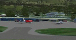
Featuring custom GMAX models, landclass changes, satellite imagery, and AFCAD airport update, Hobart International Airport (YMHB) is the result of several years development. The model itself has been designed with first hand knowledge and is highly accurate to the real airport, with photoreal textures been used. This download includes the nearby Mt. Wellington observatory and signal tower. It is recommended to be flown with FTX landclass installed. A free no restrictions demo of Tasmanian landclass is available from FTX at www.fullterrain.com/freeware.html. v2.1 makes several improvements on the previous version, with upgrades including: updated afcad; enhanced satellite imagery; several new custom models; and a significant improvement to the helicopter area behind the main terminal.
| Filename: | YMHB__Hobart_Airport_v21.zip |
| License: | Freeware, limited distribution |
| Added: | 10th May 2010, 07:30:16 |
| Downloads: | 7,764 |
| Author: | Matthew and Sean Devenish |
| Size: | 16.2 MB |
| Category: Flight Simulator X - Scenery | |
| YPNW Pannawonica, Western Australia town and strip |
|
File Description:
YPNW Pannawonica with FSX default and ORBX tints condensed into one zipfile. The town of Pannawonica is an iron-ore mining town located in the Pilbara region of Western Australia, near the Robe River, about 200��� km south-west from Karratha. In 2006, it reportedly had the highest median weekly income of any town in Australia, due to the high income of its mine workers. Pannawonica was built in 1970 by Cleveland-Cliffs Robe River Iron (predecessor of the present Robe River Iron Associates) and was gazetted as a townsite in 1972. The township�¢����s name was derived from nearby Pannawonica Hill, named by a surveyor in 1885 after the corresponding Aboriginal placename which is said to mean "the hill that came from the sea". The traditional legend is that two local Aboriginal tribes were arguing over the ownership of the hill which was located by the sea. The sea spirit decided to resolve the dispute by moving the hill inland. As the hill was dragged over the land it left a deep indentation which became the Robe River. Pannawonica is one of a number of remote-area iron-ore-mining towns built throughout the Pilbara to house workers operating open-cut mines and the loading of ore trains. It is a 'closed town', having limited facilities for visitors, the company's accommodation being reserved for its staff and visiting contractors. Some visitor accommodation is available at the Pannawonica Tavern. Pannawonica is home to more than 800 people, comprising Robe and Pilbara Iron employee families, staff on fly-in fly-out (�¢����fifo�¢����) roster from Perth, and those involved in support services. It is accessible by road, rail and light aircraft. REQUIRES Blencowe_LibraryKit.zip
REQUIRES blencowe_librarykit_309494.zip (Available HERE)
| Filename: | YPNW_Pannawonica_Western_Australia_town_and_strip.zip |
| License: | Freeware |
| Added: | 28th February 2013, 14:00:44 |
| Downloads: | 287 |
| Author: | Alan Blencowe |
| Size: | 3.38 MB |
| Category: Flight Simulator X - Scenery | |
| CZBB - Boundary Bay, BC, Canada (2011) Version 2 |
|
Images related to this file:
File Description:
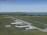
CZBB (2011) portrays the Boundary Bay (British Columbia, Canada) Airport (CZBB) - Canada's fifth-busiest airport by number of operations - and surrounding area as it appeared in mid-2011. Every significant structure on the airfield (50+) is included - all modeled with GMax and painted with hand-drawn textures. CZBB (2011) is compatible with ORBX FTX USA Canada Pacific Northwest, Ultimate Terrain and Vancouver+. A selection of SAMM-generated static aircraft are scattered around the aprons supplemented by a number of AI aircraft that do touch 'n gos from time to time.
Aside from the new custom approach and airfield lighting, generally, this new version is visually identical to its predecessor - even though quite different internally. As well, to the extent possible, it is compatible with Prepar3Dv2.
| Filename: | CZBB__Boundary_Bay_BC_Canada_2011_Version_2.zip |
| License: | Freeware, limited distribution |
| Added: | 20th June 2014, 05:10:24 |
| Downloads: | 3,489 |
| Author: | Don Grovestine |
| Size: | 73.9 MB |
| Category: Flight Simulator X - Scenery | |
| Quebec CYQB |
|
File Description:
All pilots have used or heard the word "Quebec" during their radio communication but not many pilots actually landed at Quebec International airport (CYQB). A great number of Head of States, VIPs, tourists came to Quebec City for summits, special occasions or to visit the city declared a World Heritage Site by UNESCO in 1985. Quebec airport is also hosting a great airshow and this year in June, to celebrate the 400th anniversary of Quebec City, five of the world best aerobatic squadrons will perform simultaneously over Quebec: the British "Red Arrows", the French "La Patrouille de France", the US Navy "Blue Angels", the USAF "Thunderbirds" and the Canadian "Snowbirds". It will be quite a sight.
This very accurate scenery will give you the opportunity to visit CYQB with your simulator. Months of effort were devoted to make this scenery as real as possible. This package includes more that 25 highly detailed hangars and buildings all having night textures, some of them have windows with specular effect. Light poles provide aprons lighting. The adjacent mount Belair have communication towers with strobe lights visible for over 12nm which provides a good visual reference coming into the airport. Exceltech, a maintenance facility has static aircrafts parked in front. A second publication will include the new terminal which is presently under construction.
| Filename: | Quebec_CYQB.zip |
| License: | Freeware |
| Added: | 20th February 2008, 22:13:36 |
| Downloads: | 8,241 |
| Author: | Gilles Boily |
| Size: | 6.21 MB |
| Category: Flight Simulator X - Scenery | |
| EICM Galway Airport, Ireland |
|
File Description:
Ireland EICM Galway Airport. Galway airport is a small regional airport situated on the West coast of Ireland. The runway is 1289m(4230ft) in length and is therefore only suitable for GA and small jets. This scenery also includes EICA Connemara and the three airstrips of the Aran Islands, EIIM Inishmore, EIMN Inishmaan, and EIIR Inisheer. EICA Connemara plays host to the shortest scheduled airline service in the world, operated by Aer Arann, and appropriately using BN2 Islanders. In June of 1919, Alcock and Brown crashlanded their converted Vickers Vimy in a Connemara bog, having successfully completed the first non-stop transatlantic flight.
All the terminals and buildings are custom made and static aircraft add a sense of realism. The BGL files have been subdivided so the user can switch various elements of the scenery on or off according to preference. For added realism I have also added some sound effects, animations, people, grass, and rocks. Each airport has a complete set of night textures with wash lighting in the carparks and terminal areas.
The scenery has been primarily designed for VFR photographic scenery using 10m mesh, but will also work with the default terrain, although there are some variations with the default 38m mesh at Inishmore. All the five airports use objects from my Ireland Static object library, 3d aircrew and VFR trees. Full installation instructions are given in the Readme file. I hope you enjoy the scenery as much as I enjoyed making it.
| Filename: | EICM_Galway_Airport_Ireland.zip |
| License: | Freeware |
| Added: | 5th November 2011, 22:04:59 |
| Downloads: | 3,162 |
| Author: | George Keogh |
| Size: | 77.27 MB |


© 2001-2026 AVSIM Online
All Rights Reserved
Privacy Policy |