
Where Flight Simulation Enthusiasts Gather from Around the World!
AVSIM Library - Search Results

| Category: Flight Simulator X - Scenery | |
| Project OTHH - Hamad International Airport (New Doha), Qatar |

|
Images related to this file:
File Description:
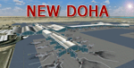
Hamad International Airport (New Doha). Ground surrounding is photoreal captured with FS Earth Tiles. It includes GMAX Main terminal, Concourses A, B, C, Tower, biggest hangars. All additional objects have been placed with Instant Scenery 2 from (Flight 1). Airport ground textures are made with SBuilderX & FS Earth Tiles. Dedicated AFCAD is set to "OTBD" ICAO to use actual AI Flightplans. Include official OTHH ATC frequencies, rwy lightning, runway settings, ILS, and approaches and many other surprises... Visit my web site www.christophebouville.com
| Filename: | Project_OTHH__Hamad_International_Airport_New_Doha.zip |
| License: | Freeware, limited distribution |
| Added: | 5th October 2013, 18:28:56 |
| Downloads: | 42,687 |
| Author: | Christophe Bouville |
| Size: | 54.41 MB |
| Category: Flight Simulator X - Scenery | |
| Kaipara Flats (NZKF) |
|
File Description:
This download contains fully customised Gmax buildings and objects (with glass reflections, no night textures), phototrees, updated facility information and placed library objects.
Kaipara Flats (ICAO: NZKF) is a small airstrip west of Warkworth, a township north of Auckland in New Zealand. It is a grass strip with an offset thresholds giving a useable length of 839m, width of 30m and a group rating of 6. The runway is aligned 07/25. It isn’t lit and AvGas 100 fuel is available.
I decided to model it after doing a roadtrip north of Auckland and taking lots of reference photos of the smaller airfields suitable for the size of aircraft I fly in real life. I am also planning to model SpringHill and Parakai aerodromes in the near future
The airstrip makes a perfect stopping point for training flights around the Auckland region with Ardmore and Northshore aerodromes to the south, Springhill to the north, and Parakai to the west
| Filename: | Kaipara_Flats_NZKF.zip |
| License: | Freeware, limited distribution |
| Added: | 24th April 2009, 23:56:22 |
| Downloads: | 1,629 |
| Author: | Tim Barnes |
| Size: | 2.26 MB |
| Category: Flight Simulator X - Scenery | |
| Ridge Soaring 79N Julian PA |
|
Images related to this file:
File Description:
Ridge Soaring Gliderport (79N) is a public-use glider airport located two nautical miles (4 km) southwest of the central business district of Unionville, in Centre County, Pennsylvania, United States. It is privately owned by Knauff & Grove, Inc. Tom Knauff and Doris grove are among the whos who in American and International soaring community.
Portions of the 1999 movie The Thomas Crown Affair were filmed here.
Co-owner Thomas L. Knauff set five FAI world records, and over 50 NAA national records flying from this airport.
Co-owner Doris Grove set three FAI feminine world records flying from this airport, and was the first woman to fly a glider more than 1000 km.
This FBO airport is world famous for ridge, thermal and wave soaring. It is located on U.S. Route 220 (alternate) 8 miles south of Interstate 80, between Unionville and Julian, at the base of the Bald Eagle Mountain ridge. It is approximately 10 miles from State College and approximately midway between Altoona and Lock Haven in the Bald Eagle Valley. Visitors can look at an entire wall of U.S. National and World records that have been set from this airfield.
Sadly as with so many small airports, Ridge Soaring is in risk of disappearing. for sale for many years, with no takers it may be sold to developers and disappear forever.
In FSX the airport was on the wrong side of the highway and cut into a mountain, I moved it to its proper location and heading, made the runway the correct size and heading, and added all the current buildings.
| Filename: | Ridge_Soaring_79N_Julian_PA.zip |
| License: | Freeware |
| Added: | 11th June 2014, 16:24:59 |
| Downloads: | 292 |
| Author: | Jon Davidson |
| Size: | 16.52 MB |
| Category: Flight Simulator X - Scenery | |
| KLGB Long Beach Airport - Modernized terminal |
|
File Description:
The airport I chose is Long Beach Airport. This airport has been around for
many years and has had everything from the Air Force One to the 787 Dreamliner land here!
The airport is located between downtown Los Angeles and Orange County and offers a great
landing for tourists that do not want to land in the fifth busiest airport in the world,
Los Angeles International.

The reason why I decided to create this airport was because it is my home airport
and I am located only about five miles from it. Also, there is no good freeware FSX scenery for this airport.
Features included!:
- Modern Terminal with correct gate placements
- changed and edited roads and other buildings around airport
- added the jetBlue offices on the airport
- Cars added (all over the place!!!)
- trees added near drop off (California Palm trees)!
- baggage cars and other airport cars added.
- buses and car parking lots added
- "spring street" flight schools and private terminal added.
- Vehicles, AI aircraft, grave yard aircraft, and many other static joys throughout the airport!
- "Runup" aircraft near runway 34R.
- Boeing C-17 facility (no aircraft C17 there)
- updated taxi ways and heliports
- Airport Service vehicle roads updates and made with help from Google Earth.
- Accurate fence, jetblast fence, and boarders of airport.
- Cargo terminals added for ups and dhl
- Private (gulfstream and other private) jet spots added.
- Flight Schools such as Long Beach Flight Academy (one I go to!!!) accurately made.
- New taxi ways and terrain
- Aflite fuel truck spaces added
- Correct runway lengths of 25L
- More items you just need to see to believe!!!
Distribution limits (MUST CONTACT ME FOR REDISTRIBUTION).
| Filename: | KLGB_Long_Beach_Airport__Modernized_terminal.zip |
| License: | Freeware, limited distribution |
| Added: | 26th March 2012, 11:10:01 |
| Downloads: | 2,717 |
| Author: | Rohan Patel |
| Size: | 3.57 MB |
| Category: Flight Simulator X - Scenery | |
| Slovenia - LOD11 (19 meters resolution) Mesh |
|
Images related to this file:
File Description:

Slovenia, no matter how small, is a country with wide variety of landscapes.
From flat lands in the North-Eastern part one can see lovely rolling hills in
southern regions and razor sharp edges of 8500 ft peaks of the Alps in the
North-Western region.
SRTM elevation data that was used and is provided as default FS X terrain simply
can't cope with the task of representing our terrain in at least a little close
to reality manner, shapes and altitudes of some of our nicest peaks are deformed
beyond recognition, our highest mt. Triglav is with 38 meters SRTM mesh falling
short by almost 3000 ft!
So Slovenia Scenery Team developed this 19 meters resolution using FSX compatible
tools for it's payware scenery, but after development of even finer mesh with 10
meters resolution, we decided to offer the original 19 meters mesh to general
fligt simulation public. Mesh is FS X only and is not compatible with FS9.
Even if released as freeware, this files were uploaded to only some selected
flight simulation sites and redistribution of this scenery is not allowed without
written permission from the authors.
File is packed into a convenient installer that should perform all of the actions
automatically, but, please, do read the License agreement and "Read me" file
included in the installation.
| Filename: | Slovenia__LOD11_19_meters_resolution_Mesh.zip |
| License: | Freeware, limited distribution |
| Added: | 15th May 2012, 19:03:19 |
| Downloads: | 2,215 |
| Author: | SST - Slovenia Scenery Team |
| Size: | 45.15 MB |
| Category: Flight Simulator X - Scenery | |
| Dragon Peaks AFB (AW56), South Africa |
|
Images related to this file:
File Description:
A Gmax representation of Dragon Peaks Air Force Base also referred to as CL van Wyngaard Airfield (fictional ID: AW56), Northern Drakensberg, South Africa withphotoreal textures.
AFB Dragon Peaks is a small airfield nestled between the hills on the slopes of the Northern Drakensberg of South Africa. The airfield is situated only a few hundred meters from the Dragon Peaks Mountain resort as well as the home of the famous Drakensberg Boys Choir.
The grass runway is aligned 06/24 and 458m long and sits at an elevation of 3 986ft.
| Filename: | Dragon_Peaks_AFB_AW56_South_Africa.zip |
| License: | Freeware |
| Added: | 18th November 2017, 16:04:29 |
| Downloads: | 597 |
| Author: | Kobus van Wyk and Frits Beyer |
| Size: | 9.52 MB |
| Category: Flight Simulator X - Scenery | |
| Skiathos - Greece |
|
Images related to this file:
File Description:
SkiathosDN
AS REAL AS IT GETS.
This is a detailed photorealistic scenery of the beautiful islands of Voreies Sporades
including Skiathos, Skopelos, Alonisos, Peristera, Kyra Panagia, Skatzoura, Gioura kai
Adelfi WITH NIGHT TEXTURES.
Skiathos and Skopelos are highly detailed, all the other islands are of a lower detail
(because of the lack of high resolution Satelite Images) never the less, there are
many picturesque coves, bays and inlets to enjoy.
The scenery contains many objects like cars and boats in the cities and ports all around the islands.
| Filename: | Skiathos__Greece.zip |
| License: | Freeware |
| Added: | 24th November 2016, 17:39:20 |
| Downloads: | 1,761 |
| Author: | Angelo Tassoglou |
| Size: | 15.28 MB |
| Category: Flight Simulator X - Scenery | |
| YUSL Useless Loop Salt Mine and works, Shark Bay, Western Australia |
|
File Description:
YUSL Useless Loop Salt Mine - now with bgl textures for ORBX. Useless Loop is located in the Southern Region of Shark Bay, Western Australia and is a closed company town, servicing the Solar Salt Operation Shark Bay Salt which has been in operation since 1968 and whose salt is renowned as the purest in the world. The first half of Useless Loop's unusual name was bestowed upon it by French explorer Henri-Louis de Saulces de Freycinet, who dubbed the area "Havre Inutile" ("Useless Harbour"), because he believed the inviting harbour to be entirely blocked by a sandbar. Model includes salt mining and village site. In real life the airstrip can be used "by permission" or in emergencies. REQUIRES Blencowe_LibraryKit.zip
REQUIRES blencowe_librarykit_309494.zip (Available HERE)
| Filename: | YUSL_Useless_Loop_Salt_Mine_and_works_Shark_Bay_We.zip |
| License: | Freeware |
| Added: | 28th February 2013, 13:56:48 |
| Downloads: | 247 |
| Author: | Alan Blencowe |
| Size: | 6.57 MB |
| Category: Flight Simulator X - Scenery | |
| Santa Cruz de la Sierra - Bolivia |
|
File Description:
Scenery Photoreal: Santa Cruz de la Sierra, Bolivia
Santa Cruz de la Sierra: (English: Holy Cross of the Mountain Range), commonly known as Santa Cruz, is the
capital of the Santa Cruz department in eastern Bolivia (17 45', South, 63 14', West)at 416 m above sea level.
The city of Santa Cruz is located not far from the easternmost extent of the Andes Mountains and they are
visible from some parts of the city its Situated too on the Pirai River.
The city of Santa Cruz and its metropolitan area are home to over 70% of the population of the department and
it is one of the fastest-growing cities in the world.
Airports: (NOT included in this package, just Scenery Photoreal of the city)
Viru Viru International Airport (IATA: VVI, ICAO: SLVR) in Santa Cruz de la Sierra, Bolivia is Bolivia's largest
international airport. Viru Viru handles domestic, regional, and international flights from Bolivia to
North America, South America and Europe and is the hub for Bolivia's biggest airline Boliviana de Aviacion (BoA).
The airport is able to handle the largest commercial jets.
El Trompillo Airport (IATA: SRZ, ICAO: SLET) is located in the south part of Santa Cruz, Bolivia, about 2 km
(1.25 miles) away from the central plaza. Airport type:(Public / Military).
Compatible with both FSX and P3D.
| Filename: | Santa_Cruz_de_la_Sierra__Bolivia.zip |
| License: | Freeware |
| Added: | 23rd June 2015, 17:09:33 |
| Downloads: | 1,722 |
| Author: | Marcos A. Rivas Torrez |
| Size: | 69.85 MB |
| Category: Flight Simulator X - Scenery | |
| Dieuze - Gueblange V2 |
|
Images related to this file:
File Description:
This scenery depicts Dieuze-Gueblange aerodrome located in the north east of France. It is a very accurate rendition of this aerodrome made with photoreal textures for the ground and the objects. The ground is covered with volumetric grass. I have modelled an animated sock that indicates the wind direction and velocity. To see this windsock, Sode (Sim Objects Display Engine) module must be installed (module availabale here : http://sode.12bpilot.ch/?page_id=9). A user manual (pdf) is included.
The windsock library may be used in your own sceneries. If you share a scenery using this library, you must add the BJP_SOCKS folder without any modification in order to avoid duplicate files. Please include my name in any of your included documents. This new release is now compatible with a landclass environment: snowy ground and trees in the hard winter (from the first day of december to the last day of january). Please read the specific enclosed manual.
| Filename: | Dieuze__Gueblange_V2.zip |
| License: | Freeware, limited distribution |
| Added: | 1st February 2015, 23:14:45 |
| Downloads: | 1,453 |
| Author: | Jacques-Paul Bollard |
| Size: | 21.98 MB |


© 2001-2026 AVSIM Online
All Rights Reserved
Privacy Policy |