
Where Flight Simulation Enthusiasts Gather from Around the World!
AVSIM Library - Search Results

| Category: Flight Simulator X - Scenery | |
| EGSG Stapleford |

|
File Description:
This package adds all the hangers and replaces grass with asphalt where appropriate.
In real life runway 04R has an asphalt insert for part of its length and as FS does not allow this I have taken the liberty of making the whole runway Asphalt instead of the default all grass.
It also provides parking spots and ATC interaction along with some AI traffic to liven things up a bit.
| Filename: | EGSG_Stapleford.zip |
| License: | Freeware, limited distribution |
| Added: | 23rd September 2007, 21:38:34 |
| Downloads: | 1,389 |
| Author: | Len Hickman |
| Size: | 9.8 KB |
| Category: Flight Simulator X - Scenery | |
| Sardinia Photoreal 7/14 - Baronia and Ogliastra (2/4) |
|
Images related to this file:
File Description:
Baronia and Ogliastra are two provinces in eastern Sardinia. In Ogliastra is placed Arbatax - Tortoli airport (LIET).
The package Baronia and Ogliastra 1/4, 2/4, 3/4 and 4/4 coverage photoreal scenery of Barbagia area, Posada, Gulf of Orosei, Calagonone, Nuoro, Arbatax, Perdasdefogu, until Villasimius. Part 2 of 4 (baronia_ogliastra_1.4.zip, baronia_ogliastra_3.4.zip and baronia_ogliastra_4.4.zip are required).
Credits: Aerial photos summer 2012 courtesy of Microsoft Virtual Earth.
| Filename: | Sardinia_Photoreal_714__Baronia_and_Ogliastra_24.zip |
| License: | Freeware |
| Added: | 16th June 2013, 17:22:52 |
| Downloads: | 2,573 |
| Author: | Diego PAPARELLA |
| Size: | 483.6 MB |
| Category: Flight Simulator X - Scenery | |
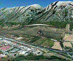
| Kavik Rivier Camp, Alaska |
|
Images related to this file:
File Description:
Kavik airstrip is part of the "Dew Line" set up as a defensive radar line in Alaska to counter the threat of a U.S.S.R attack. Made famous by the TV series "Flying Wild Alaska" and with a population of one! Completely custom built airport and objects, and even comes with a outhouse ! If you have Ultimate Terrain Alaska installed just remove the file called "cvxKAVIC_RIVER.bgl" from your scenery folder.
| Filename: | Kavik_Rivier_Camp_Alaska.zip |
| License: | Freeware |
| Added: | 4th March 2011, 17:54:50 |
| Downloads: | 2,070 |
| Author: | Frits Beyer, Jacques Botha |
| Size: | 525.57 KB |
| Category: Flight Simulator X - Scenery | |
| Denmark V1.4 |
|
Images related to this file:
File Description: FSX Denmark Scenery v1.4 Part Two. The scenery includes a number of airports,
airfields and VFR landmarks throughout the country, with special attention to
the cities Copenhagen and Aalborg. This scenery is compatible with photo
sceneries, "Denmark Map x" and default FSX.

It is recommended to read the wiki:
http://www.fsonline.dk/en/index.php?title=Denmark_Scenery
before installing this package.
| Filename: | Denmark_V14.zip |
| License: | Freeware |
| Added: | 10th November 2012, 16:21:42 |
| Downloads: | 8,872 |
| Author: | The Denmark Scenery Team |
| Size: | 246.75 MB |
| Category: Flight Simulator X - Scenery | |
| Caribbean SeaPlane Tours, Bahamas |
|
File Description:
Part 3 of a 5 part series cover the Caribbean with custom airports and Seaplane Docks. "Caribbean SeaPlane Tours, Florida Operations" and Caribbean SeaPlane Tours, Caribbe West" are required for the scenery to display correctly. Please read the "Read-Me" files of all sceneries for installation information and hints. This scenery pack includes the following airports and seaplane docks: The airports - Nassau International, Walker's Cay, Deep Water Cay, Grand Bahamas International, Spanish Cay, Treasure Cay, Marsh Harbor Airport, Castaway Cay, Little Whale Cay, Exuma International, Hog Cay, Arthur's Town, Cutlass Bay, Rum Cay, Deadman's Cay, Duncan Town, Colonel Hill, Pittstown Point, Parrot Cay, Pine Cay, Conch Bay, Salt Cay, Mayaguna Island and a hidden Smuggler's scenery near Crooked Island. SeaPlane Docks - Nassau Lakeside, Nassau Oceanside, Paradise Island, Walker's Cay, Grand Bahamas, Treasure Cay, Castaway Cay, Hog Cay, Cutlass Bay, Rum Cay, Deadman's Cay, Parrot Cay, Pine Cay, Conch Bay, and Salt Cay. There are navigational aids included....Make sure you read the "Read-Me" File!
| Filename: | Caribbean_SeaPlane_Tours_Bahamas.zip |
| License: | Freeware, limited distribution |
| Added: | 24th November 2007, 17:16:16 |
| Downloads: | 5,457 |
| Author: | Chris Carel |
| Size: | 47.12 MB |
| Category: Flight Simulator X - Scenery | |
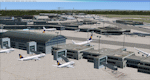
| Frankfurt Main Airport (EDDF) v7 - manual install package |
|
Images related to this file:
File Description:

This major update represents EDDF in the December 2012 timeframe.
With the increasing development of the proposed Terminal 3 area now in use as extended apron parking, this update provides operational ramps for G and H gates including ramp parking for both airline and cargo aircraft, helicopter parking at gates H8 and H12, apron night lighting, vehicular traffic etc. In addition this update features a new Gmax custom fuel tank farm along with custom Frankfurt logos, the recently opened A-plus terminal (7 new gates including 4 A380 gates) in October 2012, a new Air Rail Center model and a new set of cargo offices/buildings that have been placed in the South Cargo area as well as the replacement of the standard FSX blast fences with a new Gmax fence model which adds even further realism to this scenery.
Also, a first time feature for this scenery, it now supports GSX (Ground Services for FSX). The G and H aprons have been customized to support GSX functionality with the correct positioning of the ground service vehicles and pushback operations based on scenery topology. The associated airport .ini file is supplied in this package.
Default FSX scenery is required. See readme/help file for more details.
| Filename: | Frankfurt_Main_Airport_EDDF_v7__manual_install_pac.zip |
| License: | Freeware |
| Added: | 23rd December 2012, 22:29:21 |
| Downloads: | 6,001 |
| Author: | Mark Aldridge |
| Size: | 13.82 MB |
| Category: Flight Simulator X - Scenery | |
| Frankfurt Main Airport (EDDF) v7 - auto install |
|
Images related to this file:
File Description:
This major update represents EDDF in the December 2012 timeframe.
With the increasing development of the proposed Terminal 3 area now in use as extended apron parking, this update provides operational ramps for G and H gates including ramp parking for both airline and cargo aircraft, helicopter parking at gates H8 and H12, apron night lighting, vehicular traffic etc. In addition this update features a new Gmax custom fuel tank farm along with custom Frankfurt logos, the recently opened A-plus terminal (7 new gates including 4 A380 gates) in October 2012, a new Air Rail Center model and a new set of cargo offices/buildings that have been placed in the South Cargo area as well as the replacement of the standard FSX blast fences with a new Gmax fence model which adds even further realism to this scenery.
Also, a first time feature for this scenery, it now supports GSX (Ground Services for FSX). The G and H aprons have been customized to support GSX functionality with the correct positioning of the ground service vehicles and pushback operations based on scenery topology. The associated airport .ini file is supplied in this package.
Default FSX scenery is required. See readme/help file for more details.
| Filename: | Frankfurt_Main_Airport_EDDF_v7__auto_install.zip |
| License: | Freeware |
| Added: | 23rd December 2012, 22:28:57 |
| Downloads: | 12,700 |
| Author: | Mark Aldridge |
| Size: | 13.43 MB |
| Category: Flight Simulator X - Scenery | |
| North Central Ecuador v3, including SEQM (SEQU) and SEIB |
|
Images related to this file:
File Description:
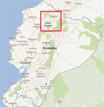
FSX/P3D Version 3 of this scenery is a completely new build of SEQM from the ground up. The entire complex is rendered using FSX objects along with the new highway that connects to the highway infrastructure with AI road traffic. The airport is now at a mean altitude that better blends with the newly included NASA SRTM GL1 30m mesh for the region. The tower is at the correct altitude. Buildings use more accurate footprints, new models, floating jetways, and updated landclass, and work seamlessly with the roads added by FTX Global/Vector. Lakes are corrected within roughly 100 square miles. Although the Ibarra/Atahualpa (SEIB) airport no longer exists, there is an option to add it back. Startup files are included to fly from the lakes and the Ibarra/Atahualpa (SEIB) airport. As a “bonusâ€, SEQU was restored in this version, because much of the footprint of the airport still remains as part of its conversion to a park. As such, a custom and fully functional SEQU is included for users who would like to revisit the old airport. AI Traffic can be restored at SEQU by simply using the "Reversed SEQU-SEQM AI Traffic" option. Scenery was created using Airport Design Editor X v1.76.6715, SBuilderX 3.13, and the FSX Object Placement Tool. Scenery objects were added and modified from stock FSX scenery to resemble as closely as possible the actual airport. Bill Leaming's Ramp Lights for P3D/FSX illuminate the aprons.
| Filename: | North_Central_Ecuador_v3_including_SEQM_SEQU_and_S.zip |
| License: | Freeware |
| Added: | 22nd March 2020, 22:13:37 |
| Downloads: | 4,089 |
| Author: | Carlyle Sharpe |
| Size: | 29.44 MB |
| Category: Flight Simulator X - Scenery | |
| RAF Topcliffe - Yorkshire, England |
|
File Description:
RAF Topcliffe (ICAO: EGXZ) is a Royal Air Force station in North Yorkshire, England. It is a satellite station serving in the role of a Relief Landing Ground for Tucano aircraft of the Central Flying School (CFS) based nearby at RAF Linton-on-Ouse (one of two, the other being Dishforth Airfield). As such, no RAF personnel are based permanently at the airfield and airfield services are provided by personnel assigned to RAF Linton-on-Ouse.
Topcliffe is also used by the Air Training Corps as a motor glider airfield for Gliding induction courses and Gliding scholarships.
| Filename: | RAF_Topcliffe__Yorkshire_England.zip |
| License: | Freeware |
| Added: | 1st January 2016, 17:50:08 |
| Downloads: | 404 |
| Author: | Terry Boissel |
| Size: | 1.34 MB |
| Category: Flight Simulator X - Scenery | |
| Alaska Navaid Update 2011 |
|
Images related to this file:
File Description:
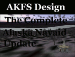
The default Flight Simulator database of VOR/NDB's is fast becoming out of date, Making
VOR navigation using current IFR en-route charts impractical to impossible. When flying along
charted airways, this discrepancy can cause you to become far off course. This update solves
that problem by re calibrating all navigation aids in Alaska based on information submitted to
the FAA January 13, 2011. This allows you to accurately navigate using any navaid in Alaska
while using current IFR en-route charts. This update includes magnetic variation data, and
navaid position. All data was compiled from the ground up. http://akfsnavaid.zzl.org
| Filename: | Alaska_Navaid_Update_2011.zip |
| License: | Check within download |
| Added: | 29th March 2011, 00:56:19 |
| Downloads: | 1,107 |
| Author: | Wilson Malone |
| Size: | 499.91 KB |
© 2001-2026 AVSIM Online
All Rights Reserved
Privacy Policy |