
Where Flight Simulation Enthusiasts Gather from Around the World!
AVSIM Library - Search Results

| Category: Flight Simulator X - Scenery | |
| WASHINGTON X DEMO |

|
Images related to this file:
File Description:

WASHINGTON X DEMO features an extremely detailed scenery of large area of Washington, Dstrict of Columbia, United States, fully compatible with FSX, FSX STEAM, P3D v1/v2/v3/v4 and FSW by Dovetail.
With this product you are free to fly to any of 5 airports (KDCA, KCGS, KADW, KVKX, W32) and many heliports in the area, admire some of the world-renowned landmarks like Capitol or Pentagon, or simply pay a visit to The President of the United States.
This Demo version of the commercial product is a fully functional freeware scenery, featuring same airport layout as in the full version but with limited 3D objects and low resolution textures. This ensures no problems with online (VATSIM, IVAO and multiplayer) flying in case some users have the payware scenery and some don't.
It's equipped with an automatic installer, which means that the scenery will be automatically added to the Flight Simulator Scenery Library.
Please uninstall all previous versions of the above-mentioned airports you may have installed before. Please make also sure that no duplicated AFCAD files are installed.
Enjoy your virtual flying with Drzewiecki Design!
| Filename: | WASHINGTON_X_DEMO.zip |
| License: | Freeware, limited distribution |
| Added: | 10th August 2017, 18:01:30 |
| Downloads: | 2,812 |
| Author: | Drzewiecki Design |
| Size: | 39.38 MB |
| Category: Flight Simulator X - Scenery | |
| MIAMI CITY X DEMO |
|
Images related to this file:
File Description:

MIAMI CITY X DEMO features an extremely detailed scenery of Miami City in Florida, United States, fully compatible with FSX/FSX:SE/P3Dv1/P3Dv2/P3Dv3/P3Dv4 and FSW by Dovetail.
This Demo version of the commercial product is a fully functional freeware scenery, perfectly aligned with the full payware version. This ensures no problems with online (VATSIM, IVAO and multiplayer) flying in case some users have the payware scenery and some don't. The demo gives a few downtown buildings and AFCAD files for KMIA, KTMB and KOPF airports.
Miami is a city located on the Atlantic coast in southeastern Florida and the county seat of Miami-Dade County. This product gives you the possibility to fly over a very large area of Miami City, with ground, autogen, hundrieds of custom-made photoreal buildings, including lite sceneries of KMIA, KTMB and KOPF airports.
It's equipped with an automatic installer, which means that the scenery will be automatically added to the Flight Simulator Scenery Library.
Please uninstall all previous versions of this airport you may have installed before. Please make also sure that no duplicated AFCAD files are installed.
Enjoy your virtual flying with Drzewiecki Design!
| Filename: | MIAMI_CITY_X_DEMO.zip |
| License: | Freeware, limited distribution |
| Added: | 23rd August 2017, 01:36:12 |
| Downloads: | 1,665 |
| Author: | Drzewiecki Design |
| Size: | 15.39 MB |
| Category: Flight Simulator X - Scenery | |
| Crosswind Runways for California Central Coast Scenery for FSX with CCFSXMSG.ZIP or CCFSXMS.ZIP Installed |
|
Images related to this file:
File Description:
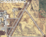
This scenery contains several revised files for my previously uploaded California Central Coast sceneries CCFSXMSG.ZIP and CCFSXMS.ZIP. These are the versions of my CCC scenery for FSX with MegaScenery Earth. The "G" version also requires Genesis Terrain Mesh but is the most complete version. Included here are revised AFCAD files for the major airports in those sceneries which will add interesting crosswind capability to C80, PRB, SBP, SMX and SBA airports. Additionaly, revised AFCAD and associated files for IZA, LPC, L52 and VBG are included. In some cases ground traffic has been added, a few glitches repaired and minor improvements effected. The crosswind AFCAD's for the 5 airports with tangential or crossing runways were revised using the technique developed by Jim Vile and executed by Airport Design Editor (ADEX). This procedure will unavoidably bolix up the ATIS runway advisories at the 3 tower controlled airports with ATIS (SBA, SBP and SMX) but will make all of the runways useable for AI traffic depending on wind conditions. This is not a problem at C80 and PRB since they are uncontrolled fields and have no ATIS available. Therefore, I've included revised AFCADs for SBA, SBP and SMX that do not have crosswind provisions that can be substituted if desired.
| Filename: | Crosswind_Runways_for_California_Central_Coast_Sce.zip |
| License: | Freeware |
| Added: | 7th January 2010, 22:05:25 |
| Downloads: | 514 |
| Author: | Al Wheeler |
| Size: | 194.42 KB |
| Category: Flight Simulator X - Scenery | |
| Iguassu Falls - Save The Planet |
|
Images related to this file:
File Description:
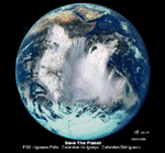
The Iguassu Falls, Itaipu Hydroelectric Power Plant, Foz do Iguassu City and Land Class Package for FSX
Save The Planet is my version of the Iguassu Falls, Itaipu Dam, bridges and landclass scenery for FSX.
Differently from my other version for MSFS 2004, I created a mesh of 5 meter resolution for Iguassu Falls area
to give me some idea how I could proceed. So, I decided to use on this addon
an image background avaliable at server (VirtualEarthSatellite). Thanks Microsoft.
Non-Airport Scenery - ICAO (SBFI). coming soon at www.Terra-Brasilis.org
Portuguese: Cataratas do Iguassu,
Spanish: Cataratas del Iguazu are waterfalls of the Iguassu River located on the border of the Brazilian state of Parana (in the Southern
Region) and the Argentinian Province of Misiones.
The Falls are shared between the Iguazu National Park (Argentina) and Iguacu
National Park (Brazil). The parks were designated UNESCO World Heritage Sites.
The Itaipu Hydroelectric Power Plant is located in the Parana River, in the stretch of the frontier between Brazil and Paraguay, 14 km north of the Friendship Bridge.
The area of the project extends from Foz do Iguassu, in Brazil, and Ciudad del Este, in Paraguay, in the south, up to Guaira (Brazil) and the Guaira Falls (Paraguay), in the north.
Enjoy FSX Iguassu Falls Scenery!
| Filename: | Iguassu_Falls__Save_The_Planet.zip |
| License: | Freeware |
| Added: | 9th December 2010, 01:57:00 |
| Downloads: | 2,847 |
| Author: | Cicero Costa |
| Size: | 31.71 MB |
| Category: Flight Simulator X - Scenery | |
| CVN68_Carrier_North Sea_V1 |
|
Images related to this file:
File Description:
This scenery is based on the great CVN 68 Nimitz carrier model from Javier Fernandez.
The scenery shall replace my current CVN 75 scenery in the North Sea.
The scenery includes the following scenery elements, objects and dynamic traffic:
The carrier CVN 68 Nimitz and a lot of stuff on deck, 2 flying Helicopters over the Carrier,
4 Navy-Destroyers escorting the Carrier, 2 moving Destroyer based on a "Boats Traffic Plan
which are traveling around the group, 1 moving Tanker,a Oilrig about 30 nm northwest from the Carrier with a landable Platform !!
Seven F-18 Hornets as AI traffic, three F-18 Hornets based on recorded flights.
For the re-play of the start and landing traffic, the tool FSRecorder is required. The tool is part of this scenery package.
The carrier is built up as an airport with the code " CV68 ".
For installation and more info see the documentation inside the zip file.
For full carrier operation (catapul/cable catch) you need one of the two tools: RCBCO-30.zip, or ArrCab26.zip both available at the AVSIM lib.
CREDIT goes to :Javier Fernandez for his super great carrier model and to
Matthias Neusinger for his excellent FSRecorder tool.
| Filename: | CVN68_Carrier_North_Sea_V1.zip |
| License: | Freeware |
| Added: | 2nd June 2010, 01:37:06 |
| Downloads: | 2,919 |
| Author: | Dietmar Loleit |
| Size: | 32.58 MB |
| Category: Flight Simulator X - Scenery | |
| Carrier CVN75_V2 North Sea |
|
File Description:
This is a update version of my scenery DL_CVN75.zip.
Changes in Version 2 of the cenery:
1.The Carrier model is now a private object and no longer part of the standard FSX object lib..
This allows the installation and registration in FSX scenery setting to be done like any
other addon objects.
The registration of the scenery in FSX below " Global, Generic & Vehicle Libraries" is no
longer required !!!!
2.Version 2 has more stuff on deck of the carrier.
3.The Number 75 is more accurate according to the real carrier.
4.The ILS frequencies ( e.g. GS) is more accurat adjusted in relation to the cable zone.
Scenery: Carrier Group North sea. Close to the Island of Sylt The Scenery includes: - The USS Carrier Harry Truman, CVN 75 with full function as an Airport with ILS approach capability.
F18-Fighters and a Navy-Heli on the Carrier. - 2 flying Helicopters over the Carrier. - 4 Navy-Destroyers escorting the Carrier. In addition to the Carrier-Group: - A Oilrig about 30 nm northwest from the Carrier. The Heli-Pat is a landable Platform !! - 2 moving Destroyer based on a "Boats Traffic Plan" which are moving around the group according to the time schedule in the plan.
| Filename: | Carrier_CVN75_V2__North_Sea.zip |
| License: | Freeware |
| Added: | 26th December 2008, 10:44:37 |
| Downloads: | 3,485 |
| Author: | Dietmar Loleit |
| Size: | 4.83 MB |
| Category: Flight Simulator X - Scenery | |
| EDTQ Pattonville |
|
Images related to this file:
File Description:
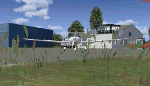
Airfield Pattonville (ICAO-Code: EDTQ)
See http://pattonville.pa.funpic.de/ for more information.
The Airfield Pattonville is a small airfield north of Stuttgart in southern germany. It is used by several aviator-clubs and hosts the base for a rescue helicopter. The runway suits for planes up till 3.5 tons.
This airfield was built bevor 2nd world war between Kornwestheim and Remseck-Aldingen. After WW2 it was used by the US-army and named "Ludwigsburg Army Airfield" and hosted missile-Launchpads during the Korea-war.
Since 16th of Juli 2003 The Airfield Pattonville is name as �������¢����������������Sonderlandeplatz Pattonville�������¢���������������� and has ICAO-Code EDTQ.
Due to the rising amount of airtraffic at Airport EDDS Stuttgart, the rescue-helicopter 'Christoph 51' moved to Pattonville at 1st of October 2009.
| Filename: | EDTQ_Pattonville.zip |
| License: | Freeware |
| Added: | 18th May 2012, 23:00:49 |
| Downloads: | 2,338 |
| Author: | Joe Herwig |
| Size: | 12.96 MB |
| Category: Flight Simulator X - Scenery | |
| Moscow City X DEMO |
|
Images related to this file:
File Description:
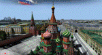
Moscow City X DEMO is a very detailed model of Moscow metropolitan area in Russia, together with lite sceneries of 7 airports (UUWW Vnukovo, UUDD Domodedovo, UUBW Zhukovski, UUMO Ostafyevo, UUBM Myachkovo and UUMB Kubinka), many heliports and thousands of buildings. This product is fully compatible with FSX/FSX:SE/P3Dv1/P3Dv2/P3Dv3/P3Dv4 and FSW by Dovetail.
It's a fully functional DEMO version of the commercial payware product, copmatible with both UUEE Moscow Sheremetyevo X by Drzewiecki Design and UUDD Moscow Domodedovo FSX/P3D by MDesign. It features same airport layout as in the full version but with limited 3D objects and low resolution textures. Using this free demo ensures no problems with online (VATSIM, IVAO, multiplayer etc.) flying in case some users use the payware scenery and some don't.
Moscow is the capital city and the most populous federal subject of Russia. It's the second most populous city in Europe after Istanbul and the 8th largest city proper in the world, as well as the largest amongst high income economies.
It's equipped with an automatic installer, which means that the scenery will be automatically added to the Flight Simulator Scenery Library.
Please uninstall all previous versions of the airports included in this package that you may have installed before. Please make also sure that no duplicated AFCAD files are installed!
Enjoy your virtual flying with Drzewiecki Design!
| Filename: | Moscow_City_X_DEMO.zip |
| License: | Freeware, limited distribution |
| Added: | 23rd August 2017, 01:37:04 |
| Downloads: | 4,118 |
| Author: | Drzewiecki Design |
| Size: | 18.56 MB |
| Category: Flight Simulator X - Scenery | |
| Eagle Field - Port Matilda, PA |
|
Images related to this file:
File Description:
Eagle field- 09PA Port Matilda PA.
Private Glider field Owned by Karl Striedieck. Karl is a world record setting glider pilot and a member of the U.S. Soaring Hall of Fame. He was an early pioneer of ridge soaring in the Ridge-and-valley Appalachians in the 1960s, ultimately setting nine world records flying gliders there. He was selected for the U.S. national soaring team 12 times, and won a silver medal in the world championships in 1978 and 1983.
Mr. Striedieck was a U.S. Air Force pilot from 1959 to 1962, flying the F-86 Sabre and F-102 Delta Dagger, then continued his military service until 1981 in the Pennsylvania Air National Guard, where he transitioned to the A-7 Corsair II. A year before graduating from Pennsylvania State University in 1965, he started flying gliders when he and Bill Clark co-founded the Nittany Soaring Club, flying out of the former State College Air Depot. He has over 15,000 flying hours, with nearly half of that total in gliders.
Mr. Striedieck moved his home to the Eagle Field private airport on top of Bald Eagle Mountain, near State College, Pennsylvania in 1966, and now lives there with his second wife, Iris.
Basically a manicured farm field, this private glider field offers access to the famous ridge lift of central Pennsylvania.Nearby Ridge Soaring is another one of my airfields available.
| Filename: | Eagle_Field__Port_Matilda_PA.zip |
| License: | Freeware |
| Added: | 11th June 2014, 16:30:28 |
| Downloads: | 323 |
| Author: | Jon Davidson |
| Size: | 16.52 MB |
| Category: Flight Simulator X - Scenery | |
| Whale Island (Hi Resolution Photo and mesh), New Zealand |
|
Images related to this file:
File Description:
Whale Island (Maori Name: Moutohora) is a small island located off the Bay of Plenty coast of New Zealand's North Island. It is located about 12 kilometers north of the town of Whakatane. A whaling station existed on the island during the 19th century. The 1.43 km island is a remnant of a complex volcano which has eroded, leaving two peaks. This is still an area of volcanic activity and there are hot springs on the island in Sulphur Valley, McEwans Bay, and Sulphur Bay.
This Hi Resolution scenery was created from a 0.25m pixel resolution Ortho-rectified Aerial mosaic owned by Environment Bay of Plenty (The Bay of Plenty Regional Council) and flown in 2007. The imagery has been slightly de-sampled for use in Flight Simulator X and utilizes the a custom hi resolution 5m Mesh derived from photogrammetry data off the photos. The textures are intended for summer daylight flying only, although due to the evergreen nature of New Zealand's native bush, the Islands appearance remains relatively constant throughout the year.
The island contains a small helicopter pad which is used for checking the various radio antennas on the Island. There is also a small Department of Conservation hut near the south western tip of the Island. These objects have been added from the FSX library of objects. Make sure to turn up your graphics sliders to make the most of this data! To find the Island fly north from Whakatane airport.
| Filename: | Whale_Island_Hi_Resolution_Photo_and_mesh_New_Zeal.zip |
| License: | Freeware, limited distribution |
| Added: | 20th January 2010, 10:12:14 |
| Downloads: | 4,650 |
| Author: | Tim Barnes |
| Size: | 9.94 MB |


© 2001-2026 AVSIM Online
All Rights Reserved
Privacy Policy |