
Where Flight Simulation Enthusiasts Gather from Around the World!
AVSIM Library - Search Results

| Category: Flight Simulator X - AFCAD Files | |
| Trenton-Robbinsville Airport (N87), NJ v1.1 |

|
File Description:
Located 01 miles E of Robbinsville, New Jersey on 139 acres of land, Trenton-Robbinsville Airport is a public asphalt strip 4275' in length. Airport improvements over stock include non-precision runway markings added, PAPI lights placed accurately and glide slopes adjusted, segment circle rendered and all parking locations placed. If a parking spot is labeled RAMP_GA it is occupied or blocked by a static scenery object and should not be selected by the user. (All static scenery by parking locations has collision disabled). All tiedown locations are RAMP_GA_SMALL that can accommodate planes with wingspans up to 40 feet. There is hangar parking, noted by a DOCK_GA parking identifier, that can handle aircraft with wingspans up to 60 feet. Fuel is available by stopping next to the fuel tank in the middle of the tarmac area. Windsock (wind tee within seg circle) is out of service indefinitely. Scenery constructed with use of satellite images/streetview/aerial photos - the author has not been there in person. This scenery is meant to be used in conjunction with MegaScenery Earth New Jersey/Delaware 002. It is not required, but apron use is minimized to allow satellite scenery to show through as much as possible, and objects are placed based on the MSE textures - lack of it may make scenery look out of place.
| Filename: | TrentonRobbinsville_Airport_N87_NJ_v11.zip |
| License: | Freeware |
| Added: | 17th July 2011, 02:18:52 |
| Downloads: | 208 |
| Author: | Drew Sikora |
| Size: | 965.92 KB |
| Category: Flight Simulator X - AFCAD Files | |
| B J Farms Airport (NJ06), NJ |
|
File Description:
Located 03 miles E of Shiloh, New Jersey, B J Farms Airport is an undefined grass strip 1500' in length. Because it is not a visible strip, this scenery removes the default grass runway that is located there. If you are looking to visit this area, JY17 is less than 1 mile away. (http://www.mseairports.com/index.php?page_id=781)
Scenery constructed with use of satellite images/streetview/aerial photos - the author has not been there in person.
This scenery is meant to be used in conjunction with MegaScenery Earth New Jersey/Delaware 004. It is not required, but apron use is minimized to allow satellite scenery to show through as much as possible, and objects are placed based on the MSE textures - lack of it may make scenery look out of place.
| Filename: | B_J_Farms_Airport_NJ06_NJ.zip |
| License: | Freeware |
| Added: | 14th June 2011, 02:15:45 |
| Downloads: | 163 |
| Author: | Drew Sikora |
| Size: | 179.16 KB |
| Category: Flight Simulator X - AFCAD Files | |
| Matthews Airport (NJ09), NJ |
|
File Description:
Located 03 miles S of Belvidere, New Jersey, Matthews Airport is a private turf strip 2000' in length. No services are offered for transient aircraft. A parking spot is available for users to start on the concrete pad in front of the hangar. Field is not lit, daytime VFR only is recommended.
Scenery constructed with use of satellite images/streetview/aerial photos - the author has not been there in person.
This scenery is meant to be used in conjunction with MegaScenery Earth New York 007. It is not required, but apron use is minimized to allow satellite scenery to show through as much as possible, and objects are placed based on the MSE textures - lack of it may make scenery look out of place.
| Filename: | Matthews_Airport_NJ09_NJ.zip |
| License: | Freeware |
| Added: | 14th June 2011, 06:09:05 |
| Downloads: | 272 |
| Author: | Drew Sikora |
| Size: | 572.92 KB |
| Category: Flight Simulator X - AFCAD Files | |
| ZHHH Wuhan-Tianhe |
|
Images related to this file:
File Description:
ZHHH Wuhan - Tianhe airport (China) enlarged and adapted to its present condition according to what can now be seen on Google Earth.
| Filename: | ZHHH_WuhanTianhe.zip |
| License: | Freeware |
| Added: | 23rd June 2011, 09:59:18 |
| Downloads: | 918 |
| Author: | Yves Flinn |
| Size: | 36 KB |
| Category: Flight Simulator X - AFCAD Files | |
| Long Beach Airport Updated |
|
File Description:
This file contains the updated Long Beach Airport ( upto 6/30/11 ) Runway 25L now has a threshold, 34R does as well.
Runway 30 has been resized to the current size in the FAA Facility's Directory. This was the first airport I have updated and would love feedback to my email: [email protected].
This is an awesome airport with rich history and I would recommend anyone flying into the LA area to check it out. Also where I have done my flight training.
| Filename: | Long_Beach_Airport_Updated.zip |
| License: | Freeware |
| Added: | 26th June 2011, 05:06:58 |
| Downloads: | 320 |
| Author: | Mitchell Lancaster |
| Size: | 15.97 KB |
| Category: Flight Simulator X - AFCAD Files | |
| Linden Airport (KLDJ), NJ v1.1 |
|
File Description:
Located 01 miles SE of Linden, New Jersey on 188 acres of land, Linden Airport is a public asphalt strip 4137' in length. Numerous changes have been made to this airport to bring it closer to its real-life counterpart including proper non-precision runway markings for R09 while only basic markings are used for R27; The 4-box VASI has been accurately located; the traffic pattern height has been adjusted; All 130 tiedown locations have been accurately placed. RAMP_GA spots are taken by static aircraft (all of which have collision disabled) so they should not be selected unless you want to start inside another aircraft! RAMP_GA_SMALL spots can be occupied by aircraft with wingspans up to 40 feet and RAMP_GA_MEDIUM spots can be occupied by aircraft with wingspans up to 60 feet. There are 4 open hangars labeled as GA_DOCK. The main hangar (NW Parking) can hold aircraft with wingspans up to 60 feet. The three smaller hangars (SW Parking) can hold aircraft with wingspans up to 35 feet. The W Helipad start location will put you in front of the smaller main tarmac hangar within the coned-off section. Fuel is only available by taxiing to a stop in front of either fuel tank to the west of the main tarmac. No AI aircraft will spawn in the SW Parking area.
Scenery constructed with use of satellite images/streetview/aerial photos - the author has not been there in person.
This scenery is meant to be used in conjunction with MegaScenery Earth New York 005. It is not required, but apron use is minimized to allow satellite scenery to show through as much as possible, and objects are placed based on the MSE textures - lack of it may make scenery look out of place.
| Filename: | Linden_Airport_KLDJ_NJ_v11.zip |
| License: | Freeware |
| Added: | 28th June 2011, 00:03:41 |
| Downloads: | 511 |
| Author: | Drew Sikora |
| Size: | 1.23 MB |
| Category: Flight Simulator X - AFCAD Files | |
| Sam Mbakwe Airport DNIM |
|
Images related to this file:
File Description:
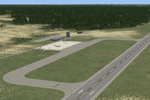
Airport and default airport replacement files for Sam Mbakwe International Cargo Airport (aka Imo State Airport, aka Owerri Airport) of Owerri, Nigeria - ICAO code DNIM, IATA code QOW. This airport is based on the default FSX DN52, which has since been assigned a proper ICAO code, which is being used in current AI flightplans. This revision adds parking, taxiways, and basic airport buildings, and includes a BGL for removing the default DN52 scenery.
| Filename: | Sam_Mbakwe_Airport___DNIM.zip |
| License: | Freeware, limited distribution |
| Added: | 20th October 2011, 20:39:51 |
| Downloads: | 238 |
| Author: | Chris Thompson |
| Size: | 587.76 KB |
| Category: Flight Simulator X - AFCAD Files | |
| LFRV Meucon-Vannes |
|
File Description:
Vannes-Meucon Airport is a regional airport in France (IATA: VNE, ICAO: LFRV). It supports general aviation with no commercial airline service scheduled.
Summary of Changes:
Realigned runway 9/27 to runway 8/26 (as it is in real life). Note that in FSX although this runway is not closed, ATC will never assign this runway, as it is a grass strip, and ATC prefers the asphalt 4/22 instead. IRL 4/22 is actually 3/21 but I couldn't realign this runway, as it has a localiser approach which can't be removed or moved in ADE
Added taxiways B+D to allow traffic to taxi to/from the end of runway 22 via runway 8/26 without causing pileups. Whilst not completely accurate, its very close.
Added fuel trucks to top end of apron, (on the charts this area is designated as a hangar, I chose not to include this, as the FSX hangars look rubbish) Note that only 1 fuel truck moves at a time.
Added a few extra parking spaces. I dislike the method of using every free space for parking, so I have only included parking where LFRV really has designated parking. The airport now has 11 GA parking spaces small-medium.
| Filename: | LFRV_MeuconVannes.zip |
| License: | Freeware, limited distribution |
| Added: | 20th November 2011, 00:26:06 |
| Downloads: | 326 |
| Author: | Martin Joy |
| Size: | 5.89 KB |
| Category: Flight Simulator X - AFCAD Files | |
| Luis Munoz Marin International Airport - TJSJ |
|
Images related to this file:
File Description:
REUPLOADED with minor enhancements and fixes -- TJSJ represents a modification to the stock FSX scenery. Updated or new taxiways, airport Terminal, custom Terminal airline assignments, updated approaches, landclass, vehicle paths and much more. See installation file enclosed for more detail.
| Filename: | Luis_Munoz_Marin_International_Airport__TJSJ.zip |
| License: | Freeware |
| Added: | 23rd May 2010, 01:38:50 |
| Downloads: | 1,365 |
| Author: | Kambiz Agazi |
| Size: | 1.33 MB |
| Category: Flight Simulator X - AFCAD Files | |
| Amsterdam Schiphol (EHAM) AFCADS V2.1 - Fully up to date & corrected runways use |
|
File Description:
FSX AFCAD FOR AMSTERDAM AIRPORT SCHIPHOL (EHAM)
This package contains 5 different .BGL files, for each wind direction: North, East, South, West. Plus one with all the runways open.
RUNWAY USAGE:
- North:
Take Off: 36L & 36C
Landing: 36R & 06
- East:
Take Off: 09
Landing: 06
- South:
Take Off: 24 & 18L
Landing: 18R & 18C
- West
Take Off: 24
Landing: 27.
OTHER DIFFRENCES:
- Added J-Apron
- Added H-concourse
- Added radio frequencies
- Correct gates, with the correct airlines
Updated in V2.1:
- Taxiways C & D
- Taxiways W1 - W12
- Taxiway Y
- Taxi signs
| Filename: | Amsterdam_Schiphol_EHAM_AFCADS_V21__Fully_up_to_da.zip |
| License: | Freeware, limited distribution |
| Added: | 25th May 2010, 03:08:39 |
| Downloads: | 3,141 |
| Author: | Rene Dijkema |
| Size: | 340.36 KB |


© 2001-2026 AVSIM Online
All Rights Reserved
Privacy Policy |