
Where Flight Simulation Enthusiasts Gather from Around the World!
AVSIM Library - Search Results

| Category: Flight Simulator X - Scenery | |
| ENHV - Honningsvag-Valan - Honningsvag, Norway |

|
Images related to this file:
File Description:
ENHV is the most northern airport in Europe (self-promotion of the airport). It it situated on a promontory 46 feet above the sea a few miles southeast of the Nordkap.
This scenery is not a stand-alone-scenery. It is an update of the Airports of Norway (AoN) where ENHV is already included. So AoN has to be installed first to see the buildings and the objects on this airport.
In addition the Nordkap is included with the rock, the museum and the viewing point.
AON you can download here:
http://www.flightsimnorway.com/addons/default.php?funct=dl&pack=aon
Also recommended is to install are the corresponding Photo sceneries AoN Phatopack 1 + 2:
http://www.flightsimnorway.com/addons/default.php?funct=dl&pack=aon
There are some errors corrected In ENHV that occur in the AoN:
1. The altitude is adjusted to the correct height of 46 feet.
2. The sea is where it should be.
3. The land classes are partially adjusted.
4. The town of Honningsvag is involved.
5. The Northern Cape is included, but can be installed separately.
| Filename: | ENHV__HonningsvagValan__Honningsvag_Norway.zip |
| License: | Freeware |
| Added: | 19th October 2015, 18:54:47 |
| Downloads: | 1,925 |
| Author: | Wolfgang Allers |
| Size: | 131.64 MB |
| Category: Flight Simulator X - Aircraft Repaints, Textures and Modifications | |
| Aerosoft F-16 Aerodynamic Performance Upgrade - VIPER 3.0 Package |
|
Images related to this file:
File Description:
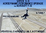
This is an aerodynamic performance upgrade for the payware Aerosoft F-16 (the download version, NOT the version available through Steam...you can't "upgrade" that one!). Simply put, this upgrade will make ALL 21 of your Aerosoft F-16 models AWESOME fun to fly in FSX! I went through and individually "tuned up" ALL of the aircraft models that come with the Aerosoft purchase/download (excluding the 2 AI jets), so now ALL "CAT-I" models can pull & maintain 9g, all "CAT-III" models can pull & maintain 7g. Each jet can perform quick, precise aerobatic maneuvers and still be smooth and easy to fly while mid-air refueling or just cruising at altitude.
A few more "upgraded" performance capabilities include...
Maintain 7g in "CAT-3" model jets, 9g in "CAT-1" model jets (tested at 500kts and 10,000')
Realistic Roll Rate
Max Speed w AB @ 40,000' (Clean) - Mach 1.8+
Max Speed Mil Power @ Sea Level (Clean) - Mach 0.95
Cruise Speed - Mach 0.80
...and MUCH MORE!
I've streamlined the installation/upgrade process so it will only take a few minutes of easy cut/paste/replace work to get your F-16's upgraded and ready to fly!
| Filename: | Aerosoft_F16_Aerodynamic_Performance_Upgrade__VIPE.zip |
| License: | Freeware |
| Added: | 1st June 2024, 14:27:08 |
| Downloads: | 101 |
| Author: | Daniel Gregory |
| Size: | 915.23 KB |
| Category: Flight Simulator X - Missions | |
| FSX/MSFS - FSX-RWT_v2-0 : FSX Real World Training Missions - Includes MSFS compatible flight files |
|
File Description:
New with version 2-0 :
- MSFS Supports (Missions flight files, ready to be loaded into MSFS Free Flight environment. MSFS Preset Weather files for all the missions.
- Three new missions
- Chap_24_Multiplayer : The Icefields Parkway Photo Shoot.
- Chap_25_VirtualL_Airlines: First Solo Flight over the Atlantic.
- Chap_26_Virtual_ATC: First English Channel Crossing.
- Consolidate all changes brought through update v1-1, v1-2, v1-3 & v1-4.
- Access to a Scenario Browser window from the overview panel.
- Scenarios, Charts and pictures can be viewed in separate windows while flying the mission.
Integrates into the FSX environment the flight exercises from the "FSX Real World Trainning for Pilots" book.
All the files have been grouped into a new FSX Mission Category: Real World Training.
Under the FSX Mission panel, this new category provides the following access:
* Over 100 Flights exercises from the book:
- BEGINNER: covers Chapter 2 thru Chapter 9.
- INTERMEDIATE: covers Chapter 10 thru Chapter 14.
- ADVANCED: covers Chapter 15 thru Chapter 19.
- EXPERT : covers Chapter 20 thru Chapter 26, plus the two Bonus Chapters.
The scenarios describes "What to do" only. please refer to the book for the "Why" and "How".
| Filename: | FSXMSFS__FSXRWT_v20__FSX_Real_World_Training_Missi.zip |
| License: | Freeware, limited distribution |
| Added: | 12th January 2021, 23:09:33 |
| Downloads: | 277 |
| Author: | Gilbert Laprise |
| Size: | 182.09 MB |
| Category: Flight Simulator X - Scenery | |
| Murray river and SE Victoria v2 for ORBX v2. YRIO Robinvale YBRN Balranald YDLQ Deniliquin YLEG Leongatha YYRM Yarram |
|
Images related to this file:
File Description:
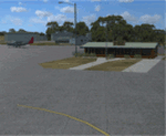
'Murray and SE Victoria v2' is made to match ORBX Australia v2 scenery. Use 'Murray + SE Victoria airports' for ORBX v1 or no ORBX. There are 5 airports. 3 airports near the Murray river in Victoria and NSW - YRIO Robinvale, YBRN Balranald, YDLQ Deniliquin. 2 airports in SE Victoria - YLEG Leongatha, YYRM Yarram. ORBX has done these as they have done every airport included with FSX in Australia to a reasonable standard. If I had not already done them for ORBX V1 I would not have bothered. However these are better than ORBX because the surroundings have been modified to match real life. Towns have been added or shifted. Forests cut down or added. Race courses, sewage treatment ponds and other stuff added. Local obstacles (towers etc) added. There are Included are 2 AI traffic files that cover the airports. These files are for Flight Simulator X. Made using Airport Design Editor using some objects borrowed from Robert Budd's excellent Baccus Marsh and 'Static aircrafts' by Jean-Pierre Fillion. REQUIRED The scenery is designed to interface with ORBX FTX_AU V2 scenery for Australia (payware).
| Filename: | Murray_river_and_SE_Victoria_v2_for_ORBX_v2_YRIO_R.zip |
| License: | Freeware |
| Added: | 15th December 2019, 19:06:10 |
| Downloads: | 317 |
| Author: | Colin Jeffery |
| Size: | 10.06 MB |
| Category: Flight Simulator X - Scenery | |
| Bhutan Airports and Paro Valley |
|
Images related to this file:
File Description:
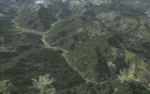
This project adds and updates all of the airports of Bhutan. Bathpalathang (VQBT) and Gelephu (VQGP) are added, Yongphulla (VQ10) is updated and recoded as VQTY, and Paro (VQPR) is fully updated to reflect current satellite imagery. These are all fully functioning AI airports as well. Special attention was given to the entire Paro Valley, and numerous road/river vectors were updated around Gelephu. Accurate coastlines, lakes, road and river data, as well as corrected landclass are provided based on the latest available satellite imagery. They are optimized to fit seamlessly with FTX Vector's roads/water, but they should be fully functional in all FSX configurations.
GA-encoded flight plans for the Buddha Air/Kathmandu charter are provided to enhance service to Paro. NASA SRTM Global 3 arc second terrain mesh is also included for all of Bhutan. Updates were created or rebuilt in a manner which carefully aligned airport data with current satellite imagery, when available. Scenery was created using Airport Design Editor X v1.61.5298, SBuilderX 3.13, and the FSX Object Placement Tool. Scenery objects were added and modified from stock FSX scenery to resemble as closely as possible the actual airports.
| Filename: | Bhutan_Airports_and_Paro_Valley.zip |
| License: | Freeware |
| Added: | 19th January 2015, 06:09:17 |
| Downloads: | 11,432 |
| Author: | Carlyle Sharpe |
| Size: | 21.4 MB |
| Category: Flight Simulator X - Aircraft Repaints, Textures and Modifications | |
| Guyana Airways 707-323 Adv 1992 |
|
Images related to this file:
File Description:

This is a repaint of the 707-323 Adv. in Guyana Airways colors. The payware 707-300 by Captain Sim is needed for this repaint. Guyana Airways was formed in 1963 in Georgetown Guyana, and a network of scheduled services was developed through the 1960s and 1970s linking Georgetown with 24 domestic destinations, as well as Miami, Boa Vista (Brazil), and such Caribbean spots as Barbados and Port of Spain. Guyana Airways virtually leased all its aircraft, which is why many different aircraft types were used during the airline's operations. In 1978 its fleet consisted of a DC-6A, 2 Hawker Siddeley HS 748s, 2 DHC-4A Caribou, 2 DHC-6 Twin Otters, and 1 Cessna 310. Later on Tu-154s, L-188 Freighters, 2 707-300s, a 737-200, and a 757-200 were added to the fleet. The 707s were used for the direct service between Paramaribo and New York. In 1999 the airline ceased operations due to financial problems. Textures are HiDef 32bit dds. DXT5 dds textures are also included as well. This repaint was tested FSX-SE. It should work on FSX & P3D v1-3.
| Filename: | Guyana_Airways_707323_Adv_1992.zip |
| License: | Freeware |
| Added: | 6th September 2019, 14:59:31 |
| Downloads: | 107 |
| Author: | Ted Giana |
| Size: | 15.18 MB |
| Category: Flight Simulator X - AFCAD Files | |
| Ocean City Municipal Airport (26N), NJ |
|
File Description:
Located 02 miles SW of Ocean City, New Jersey on 60 acres of land, Ocean City Municipal Airport is host to quite a few GA aircraft, and has plenty of room for anyone looking to fly in for a few days. Around 60 tiedown spots are available on the tarmac. The main tarmac can host planes with wingspans up to 40 feet. If you managed to fly in anything larger than that head for the west end of the field to tie down. FSX may spawn some AI craft in that area but it is not attached to the main taxi network so no planes will leave from there - the majority of planes FSX spawns in that larger spot can't handle the runway length! Be sure to check your aircraft can handle takeoffs without freezing temps and a ton of headwind before you fly in. You can gas up by stopping near the fuel truck by the terminal or by the gas tank at the west end of the tarmac. Don't ask me what that yellow circle is on the tarmac - if anyone knows you can tell *me* :P It's in the airport photos so its there. Runway touchdown markings are enabled as in real life, but apparently FSX decides not to draw them because the runway is too thin.
Scenery constructed with use of satellite images/streetview, the author has not been there in person.
This scenery is meant to be used in conjunction with MegaScenery Earth New Jersey/Delaware 003. It is not required, but apron use is minimized to allow satellite scenery to show through as much as possible, and objects are placed based on the MSE textures - lack of it may make scenery look out of place.
| Filename: | Ocean_City_Municipal_Airport_26N_NJ.zip |
| License: | Freeware |
| Added: | 10th October 2010, 13:25:12 |
| Downloads: | 320 |
| Author: | Drew Sikora |
| Size: | 443.39 KB |
| Category: Flight Simulator X - Utilities | |
| FS Remote version 1.0 |
|
File Description:
Email: [email protected]
Name: Hans Elzer
Current version 1.0
Version 1.0 contains various little bug fixes plus Fuel management in the Engines dialog
FS-Remote a utility for remotely controlling FSX
The Zip file contains:
* Readme text file
* .NET 2.0 FS-Remote executable
* Configuration file for FS-Remote
* Document file in MSWord format
What you need to run FS-Remote:
* .NET 2.0 or 3.0 installed on the computer where you want to run FS-Remote
* FSUIPC4 (registered) on the computer where you run FSX
* WideClient (FSUIPC4 FSWide remote) if you want to run FS-Remote on a remote computer
It does what the title says FS-Remote controls FSX remotely through FSUIPC.
Just take a look at the (word) document that is contained in the zip file and look at some screen shots.
It can view and control the following items in FSX through FSUIPC:
* Aircraft - Control aircraft switches like Lights, Doors, Pushback, De-Ice and Jetway plus call fuel truck
* Auto Pilot - Control auto pilot switches plus reset altimeter and heading indicator instruments
* Radio - Control radio stack switches and push buttons plus view navigation status information
* Attitude - View attitude information and warnings plus convert and view various items in feet, meter, knots, mph and km/p
* Engines - Control engines auto start and stop plus fuel management
* Weather - not implemented jet (next version)
* Environment - View the local date, time and position environment information
* Date Time - Control and view the flight simulator date and time
* Message - View and send messages to flight simulator message bar
* FPS - View real-time flight simulator frames per second FPS rate
* About - View version information about FS-Remote, FSUIPC4 and FSX
Hope that you like it.
| Filename: | FS_Remote_version_10.zip |
| License: | Freeware |
| Added: | 9th September 2007, 15:26:14 |
| Downloads: | 1,439 |
| Author: | Hans Elzer |
| Size: | 353.2 KB |
| Category: Flight Simulator X - Utilities | |
| FSRemote 2.0 |
|
File Description:
Current version 2.0
Version 2.0 contains a new more graphical interface
Version 1.0 contains various little bug fixes plus Fuel management in the Engines dialog
FS-Remote a utility for remotely controlling FSX
The Zip file contains:
* Readme text file
* .NET 2.0 FS-Remote executable
* Configuration file for FS-Remote
* Document file in MSWord format
What you need to run FS-Remote:
* .NET 2.0 or 3.0 installed on the computer where you want to run FS-Remote
* FSUIPC4 (registered) on the computer where you run FSX
* WideClient (FSUIPC4 FSWide remote) if you want to run FS-Remote on a remote computer
It does what the title says FS-Remote controls FSX remotely through FSUIPC.
Just take a look at the (word) document that is contained in the zip file and look at some screen shots.
It can view and control the following items in FSX through FSUIPC:
* Aircraft - Control aircraft switches like Lights, Doors, Pushback, De-Ice and Jetway plus call fuel truck
* Auto Pilot - Control auto pilot switches plus reset altimeter and heading indicator instruments
* Radio - Control radio stack switches and push buttons plus view navigation status information
* Attitude - View attitude information and warnings plus convert and view various items in feet, meter, knots, mph and km/p
* Engines - Control engines auto start and stop plus fuel management
* Weather - not implemented jet (next version)
* Environment - View the local date, time and position environment information
* Date Time - Control and view the flight simulator date and time
* Message - View and send messages to flight simulator message bar
* FPS - View real-time flight simulator frames per second FPS rate
* About - View version information about FS-Remote, FSUIPC4 and FSX
Hope that you like it.
| Filename: | FSRemote_20.zip |
| License: | Freeware |
| Added: | 9th November 2007, 22:24:52 |
| Downloads: | 1,674 |
| Author: | Hans Elzer |
| Size: | 620.8 KB |
| Category: Flight Simulator X - AFCAD Files | |
| KLVN - Airlake Airport - Lakeville, MN, USA |
|
File Description:
KLVN - Airlake Airport beta version .3 - by Jason Boche
This is an update of the default FSX KLVN airport. Aside from the original 12/30 runway, everything else at this airport has been completely ripped and replaced.
Enhancements include:
-Extended runway on each end to depict current configuration
-Accurate taxiways including Hamburg Ave. and buildings representing the current general aviation hangars
-Added navigational equipment on the field
-Added a few asphault and dirt service roads
-Added FBO and other buildings as close as I could match them
-Added some general aviation aircraft, civilians, vehicles at the FBO and hangars, and two fuel trucks
-Moved fuel station to where I believe it is currently according to Google maps with 100LL fuel trigger functional
-Moved the windsock to accurate location
-Moved the beacon to accurate location
-Moved GA parking spots
-Added trees around FBO and beacon
-Added utility poles
-Added a few square miles of Lakeville city, farm, and residential land class and autogen according to Google maps. This is probably the biggest improvement. It now looks like people live, work, and shop north/northwest of KLVN.
-Reworked the runway 12/30 blast pads to what I believe is the "proper" method. Instead of freehand polygon asphault, they are now actual runway extensions on both ends with yellow chevron markings
-Reworked the land class on the southwest end of the airport where I believe hangar expansion is intended. Prior to this, there was a sharp contrast between where the KLVN airport boundary ended and where generic farm landclass began which was right in the middle of the southwest taxiways and it looked bad. Now that whole region is grass and looks to be part of the airport parcel.
-Minor building adjustments west of the FBO to better match actual placement. Will only be shown on high scenery detail.
-Fixed a gap on the southeast end of Hamburg ave taxiway where it rounds the corner for the rwy 30 hold short line
-Randomized the directional facing of some of the cars parked at GA hangars
-Renumbered the parking spots 1-4 with #5 being the refueling spot
-Reversed the start direction of parking spots 1-3.
-Pulled the refueling parking "start" spot back because on start the engine cowling & prop were too far forward inside the fuel pump equipment
-Added an autogen exclusion to the rwy 12 short final due to trees popping up on short final path.
-KLVN tower viewpoint 25 meters above FBO.
-Removed the perimeter fence around the entire field
| Filename: | KLVN__Airlake_Airport__Lakeville_MN_USA.zip |
| License: | Freeware |
| Added: | 22nd November 2013, 23:26:10 |
| Downloads: | 225 |
| Author: | Jason Boche |
| Size: | 446.33 KB |


© 2001-2026 AVSIM Online
All Rights Reserved
Privacy Policy |