
Where Flight Simulation Enthusiasts Gather from Around the World!
AVSIM Library - Search Results

| Category: Flight Simulator X - Scenery | |
| CWY9 "Your Own Airport" |

|
File Description:
You download a plane.-----where do you go and fly it ????...
NY...San Francisco, N.O., LA, Rio, Madrid.....Panama??? what a hassle!!!! you have to choose from so many Airports..........
Now you can have Your Very Own Airport....It Includes:
8500 ft Re-enforced Concrete Runway....125ft Wide!!!!!!!!
Taxiways, also Re-enforced Cement of the best quality.
Lighted from Dawn to Dawn!!!!!.....powerful bulbs all around!!!!
Lighted Aprons.....Terminal for your Passangers..a fair Town with good Hotels and around 13 Bars!!!!!!! two have all night Shows!!!!!!very near the terminal, two plush Marinas!!with Hotels and many boats for rent and Sale.....and some crazy traffic to boost!!!!!..This scenery is located in a beautiful cove up north in Canada near all major airports of the West Coast. and its called "YourOwn" ICAO =CWY9.......Oh!! you can land anything here..FREE Parking!!!!!!
Oh Yea...it includes, an AFCAD for your runway, Scenery Galore, and an AircraftCarrier and other ships nearby.....Hummm, Hummmm...................
| Filename: | CWY9__Your_Own_Airport.zip |
| License: | Freeware, limited distribution |
| Added: | 18th November 2008, 18:26:55 |
| Downloads: | 1,438 |
| Author: | Gera Godoy Canova |
| Size: | 4.69 MB |
| Category: Flight Simulator X - Scenery | |
| Lost River ASU Observatories |
|
Images related to this file:
File Description:
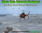
This is a fictitous scenery of the Alaska State University operated North-Western observatories.
It is located near LSR_Lost River and AK45_Lost River_2 on the Western coast of Alaska.
LSR, AK45 and KPC_Port Clarence have been upgraded with hangers and various objects.
LSR, AK45 and the (2) mountain top observatories have been upgraded with helipads along with various ground vehicles including snocats, aircraft, misc buildings and hangers. The main observatory complex has a main rooftop pad and a heli-tower. These helipads were designed for heli practice. some are on the ground and others are a bit more challenging.
There is a map included which shows the locations of the observatory complexes in relation to the airports. There is also a small research facility located to the east which is indicated on the map. This fictional scenery was design with default FSX 3D objects and (1) addon library, fa_ez-arctic_set by Finney Air, Robert Finnegan.
| Filename: | Lost_River_ASU_Observatories.zip |
| License: | Freeware |
| Added: | 11th November 2009, 19:11:39 |
| Downloads: | 557 |
| Author: | Tim Durham |
| Size: | 3.41 MB |
| Category: Flight Simulator X - AI Aircraft | |
| LCL Cargo Saab 340F |
|
File Description:
This is a complete "Project AI " Saab 340F aircraft of " LCL Cargo ".
That stands for " Low Cost Logistics ".
This ficticious airline/aircraft serves as a "newcomer" in the world of
parcel logistics , not seriously competing with the DHL's and Fedex.
To keep the operatingcosts in place , the airline is powered by
DFW Cargo , member of "The DFW group",
All just as ficticious.
This LCL-airline has a busy program of flying cargo runs in eastern France.
Routes are to :
Gap , Frejus and Toulon in the PACA-region (Provence/Alpes/Cote dAzur),
Grenoble and Chambery in the Isere and Savoie region respectively,
Dole-Tavaux in the Jura provence,
Metz / Nancy in the Lorraine / Moselle, up north in France
and serving Luxembourg Findel airport to connect with Cargolux ,
giving them the gateway to the rest of the world .
Original aircraft and flightdynamics by the "ProjectAI.com" website.
The re-paint is done by; " The DFW group " .
| Filename: | LCL_Cargo_Saab_340F.zip |
| License: | Freeware |
| Added: | 20th November 2009, 23:57:14 |
| Downloads: | 525 |
| Author: | Stellweg |
| Size: | 3.06 MB |
| Category: Flight Simulator X - Scenery | |
| Frankfurt Main Airport (EDDF), v3 |
|
Images related to this file:
File Description:
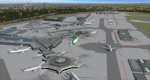
This is a major update to the previous airport package (Frankfurt ILS25R V2.2 package) using ADE 1.47 and represents the layout of the airport in June 2010.
Features now include updated ILS/DME capabilities to runways as per recent changes, a completely revised South City Cargo area, updated aprons including new flood lit lighting and a new Lufthansa A380 hangar built in Gmax.
Revised airline gate allocations for Terminal 1 and Terminal 2 included plus the addition of 5 new A380 gates at Terminal 2. A new control tower on the north parking apron has been added in preparation for the A-plus terminal expansion.
Runways and several taxiway textures changed to asphalt as per resurfacing work at real airport.
Improved quality CAT II/III signage available at intersections and new No Entry signage added for specific taxiways for extra realism.
Many other features from the previous packages are still included. See readme file for detailed information
| Filename: | Frankfurt_Main_Airport_EDDF_v3.zip |
| License: | Freeware |
| Added: | 25th October 2010, 10:30:49 |
| Downloads: | 3,692 |
| Author: | Mark Aldridge |
| Size: | 2.93 MB |
| Category: Flight Simulator X - Aircraft Repaints, Textures and Modifications | |
| FS2004/FSX KLM Royal Dutch Airlines PH-BUF Boeing 747-206(B) "Flight 4805" |
|
Images related to this file:
File Description:

(TEXTURES ONLY)
(ONLY TESTED IN FSX: STEAM EDITION)
This specific aircraft, PH-BUF, was involved in a horrific accident leading to the Worst Aviation Accident in History, the Tenerife Airport Disaster. It was on March 27, 1977 when 583 souls were killed on this accident. It involved two planes, this plane PH-BUF which is operated by KLM and N736PA, operated by Pan American World Airways, or "Pan Am" for short. This plane first was delivered in October 19, 1971 and was named "The Rhine" or "Rijn" It wore the "1971 - 1991" Colors. The plane was supposed to fly to Gran Canaria Airport from Amsterdam Schipol Airport, but a terrorist attack happened at the airport, forcing the KLM plane to land at Tenerife North Airport, or "Los Rodeos Airport" on the Canary Islands. This aircraft is a tribute to the 248 occupants that died that day, as well as the other 335 occupants on the Pan Am plane. Instructions are included. Model by Project Opensky.
| Filename: | FS2004FSX_KLM_Royal_Dutch_Airlines_PHBUF_Boeing_74.zip |
| License: | Freeware |
| Added: | 16th September 2024, 16:48:16 |
| Downloads: | 58 |
| Author: | Ryubunao |
| Size: | 7.14 MB |
| Category: Flight Simulator X - AFCAD Files | |
| FGBT - Bata Airport - Bata, Equatorial Guinea |
|
File Description:
Bata Airport (IATA: BSG, ICAO: FGBT) is the second largest airport in Equatorial Guinea, after Malabo Airport, and is the only other paved runway. The airport is located some way north of Bata and a short way south of Utonde, it has a
2.3 km runway that operates only during the daytime and in good light. The state carrier and four other private companies make up the majority of Bata's industry, transporting passengers from Bioko's international airport or the two
800m strips on Annobon or Mongomo. The airport is large enough to accommodate a Boeing 737. Bata served 15,000 passengers in 2001. In July 2002, all staff at the airport were arrested for allowing the leader of the Popular Union, an o
pposition party, to board a flight to the Gabon. The tower frequency is 118.800 MHz (VHF).
Airport elevation and two runways were corrected also the aprons and buildinds. Airport charts cortesy of vatcaf.flyvatsimafrica.org
This work is dedicated to West Wind Airlines.
| Filename: | FGBT__Bata_Airport__Bata_Equatorial_Guinea.zip |
| License: | Freeware |
| Added: | 19th May 2013, 17:22:05 |
| Downloads: | 766 |
| Author: | Anwar Gonzalez |
| Size: | 677.55 KB |
| Category: Flight Simulator X - Scenery | |
| YCRW Crawley Bay, Western Australia, US Catalina Base - QANTAS base (Historic 1942) |
|
File Description:
YCRW Crawley Bay USAF Catalina Base - QANTAS base (Historic 1942). This location was where the famous double sunrise flights left for Lake Koggala in Sri Lanka (Ceylon) between 1943 and 1946. Suited to Rick Stone's PBY5A Catalina. The USAF used the north side of the point and QANTAS used what is now the boat ramp at Nedlands. Remember, Perth was only about two or three stories high in those days so for a realistic enactment, totally overload the aircraft (towards the front) and just point between the buildings until you gain some height. To cover the distance, cruise at about 110kts and 500 feet. Don't forget the passengers stand at the front on takeoff and can be seated after you are in the air. (move the weights backwards after taking off) REQUIRES Blencowe_LibraryKit.zip
REQUIRES blencowe_librarykit_309494.zip (Available HERE)
| Filename: | YCRW_Crawley_Bay_Western_Australia__US_Catalina_Ba.zip |
| License: | Freeware |
| Added: | 25th February 2013, 09:02:15 |
| Downloads: | 303 |
| Author: | Alan Blencowe |
| Size: | 865.95 KB |
| Category: Flight Simulator X - Scenery | |
| YKAE Kalannie, Western Australia |
|
File Description:
YKAE Kalannie, about 300km north-east of Perth, lies in some of the best wildflower country in Australia and at the heart of WA���¢������s largest wheat producing area. The district also claims more species of wattle (acacias) than anywhere else in the world. Kalannie is also situated approximately 30 mins from Dalwallinu in what is called the northern wheatbelt region and is within the Dalwallinu Shire and hence council administration for the area is managed from Dalwallinu. Kalannie has a population of approximately 300 people in the town and immediate region around Kalannie. There is no accommodation at Kalannie except for the Caravan Park. The airstrip is gravel with a windsock and is marked with white plough disks. REQUIRES Blencowe_LibraryKit.zip
REQUIRES blencowe_librarykit_309494.zip (Available HERE)
| Filename: | YKAE_Kalannie_Western_Australia.zip |
| License: | Freeware |
| Added: | 28th February 2013, 13:51:08 |
| Downloads: | 212 |
| Author: | Alan Blencowe |
| Size: | 2.31 MB |
| Category: Flight Simulator X - Scenery | |
| Cape_Verde_Mesh |
|
File Description:
To improve performance, FSX updated with SP1 loads DEM files in threads and only
the closer terrain (about 10 NM from the point of view) is rendered in high
detail, while at far distances FSX shows up its default low resolution mesh,
if it is not available a multi-resolution one. This terrain mesh file was multilod compiled from 90m SRTM2 source data, reprocessed with 3DEM to remove voids and spikes, providing a 76.4m (LOD9) horizontal resolution topography intended
for use only in FSX updated with SP1.
It covers the Cape Verde, a group of islands in the North Atlantic Ocean, that consist of two small archipelagos, about 400 miles off the western coast of Senegal (Africa), including: Boa Vista, Brava, Maio, Mosteiros, Paul, Praia, Porto Novo, Ribeira Grande, Sal, Santa Catarina, Santa Cruz, Sao Domingos, Sao Filipe, Sao Miguel, Sao Nicolau, Sao Vicente and Tarrafal (Geographic coordinates: 16ºN/24ºW).
Authors:
Hely Heck Junior - Magrao ( [email protected] ) and Jose Lobo (
[email protected] ) TerraBrasilis: www.terra-brasilis.org
| Filename: | Cape_Verde_Mesh.zip |
| License: | Freeware |
| Added: | 21st June 2007, 16:26:23 |
| Downloads: | 4,335 |
| Author: | Hely Heck Jr. and José Lôbo |
| Size: | 1.55 MB |
| Category: Flight Simulator X - Scenery | |
| Dieuze - Gueblange V2 |
|
Images related to this file:
File Description:
This scenery depicts Dieuze-Gueblange aerodrome located in the north east of France. It is a very accurate rendition of this aerodrome made with photoreal textures for the ground and the objects. The ground is covered with volumetric grass. I have modelled an animated sock that indicates the wind direction and velocity. To see this windsock, Sode (Sim Objects Display Engine) module must be installed (module availabale here : http://sode.12bpilot.ch/?page_id=9). A user manual (pdf) is included.
The windsock library may be used in your own sceneries. If you share a scenery using this library, you must add the BJP_SOCKS folder without any modification in order to avoid duplicate files. Please include my name in any of your included documents. This new release is now compatible with a landclass environment: snowy ground and trees in the hard winter (from the first day of december to the last day of january). Please read the specific enclosed manual.
| Filename: | Dieuze__Gueblange_V2.zip |
| License: | Freeware, limited distribution |
| Added: | 1st February 2015, 23:14:45 |
| Downloads: | 1,453 |
| Author: | Jacques-Paul Bollard |
| Size: | 21.98 MB |


© 2001-2026 AVSIM Online
All Rights Reserved
Privacy Policy |