
Where Flight Simulation Enthusiasts Gather from Around the World!
AVSIM Library - Search Results

| Category: Flight Simulator X - Scenery | |
| FIMP - Sir Seewoosagur Ramgoolam Intl - Mauritius *New Terminal & Airport Layout* |

|
Images related to this file:
File Description:

This scenery adds the new terminal and taxiways, and rebuilds the aprons and runway to provide a fully functioning AI traffic extension for runway 14. The airport is assigned a mean elevation, allowing it to blend naturally with the surrounding terrain, and landclass is provided for the entire island. This scenery is most effective when used in combination with "mauritius_fsx.zip" by Max Kraus. This scenery is optimized to fit seamlessly with FTX Global/Vector and should also be fully functional in all FSX configurations. The airport is updated to reflect current satellite imagery and positioning. Scenery was created using Airport Design Editor X v1.61.5298, SBuilderX 3.13, and the FSX Object Placement Tool. Scenery objects were added and modified from stock FSX scenery to resemble as closely as possible the actual airport. The FSX apron lights included are from the set created by Jim Dhaenens.
| Filename: | FIMP__Sir_Seewoosagur_Ramgoolam_Intl__Mauritius_Ne.zip |
| License: | Freeware |
| Added: | 10th July 2015, 16:16:40 |
| Downloads: | 8,806 |
| Author: | Carlyle Sharpe |
| Size: | 5.06 MB |
| Category: Flight Simulator X - AFCAD Files | |
| KEGE - Eagle County Regional - Eagle, Colorado USA * FIX * |
|
File Description: KEGE - Eagle County Rgnl - Eagle, CO, USA version 1.1 by Jason Boche
This is an update of the default FSX KEGE airport.
Enhancements include:
-Runway 7/25 lengthened to current, displaced threshold and markings added
-Blast pads added
-Updated taxiways to current
-PAPI lights moved to right/north side of runway 25
-Updated LOC frequency for runway 25 to 109.75
-Moved and added additional LOC antennea to the west end of runway 7
-Tower moved and model replaced
-Realistic terminal parking spots 1-10
-Asphalt and concrete aprons added/updated, ground lighting updated
-Asphalt, concrete, and gravel roads added
-Many bulidings updated
-All applicable runway signs updated
-Added airport, civilian, and construction vehicles
-Airport perimeter fencing updated
-Runway demolition fencing added
-National Guard helipads added
-GA refueling moved to the north end of the field
Please provide any feedback and suggestions to me at the email address listed
in the readme.txt. Thank you.
Acknowledgements:
Airport Design Editor (ADE -Freeware) - Jon Masterson.........http://www.scruffyduck.org.uk/
This also has a download centre for many other ADE files.
Please visit here for more information...........http://www.airportdesigneditor.co.uk
Any questions relating to ADE can be answered at www.fsdeveloper.com/forum......look
for Airport Design Editor author
Ray Smith for providing so many freeware airports and airport updates which
inspired me to give ADE a try.
Jason Boche
| Filename: | KEGE__Eagle_County_Regional__Eagle_Colorado_USA__F.zip |
| License: | Freeware |
| Added: | 30th November 2013, 10:42:48 |
| Downloads: | 1,477 |
| Author: | Jason Boche |
| Size: | 373.01 KB |
| Category: Flight Simulator X - Scenery | |
| FALE - King Shaka Airport, Durban, South Africa V2 |
|
File Description:
King Shaka International Airport, named after Shaka, leader of the Zulu nation in the early 19th century, also known as La Mercy Airport (after the area in which it is situated) and abbreviated as KSIA, will be the primary airport serving Durban, South Africa. Located at La Mercy, approximately 35 kilometers (22 mi) north of the city centre, it is expected to open on May 1, 2010 (just over a month before the start of the 2010 FIFA World Cup); replacing the existing Durban International Airport. All flights handled by Durban International Airport will terminate on April 30, 2010 and will move to King Shaka International Airport overnight, with KSIA handling its first flight on May 1, 2010.
This updated version caters for AI flight plans and Aircraft.
| Filename: | FALE__King_Shaka_Airport_Durban_South_Africa_V2.zip |
| License: | Freeware |
| Added: | 8th April 2010, 00:07:56 |
| Downloads: | 2,147 |
| Author: | Pierre Cornelissen & Mundus Yssel |
| Size: | 22.17 KB |
| Category: Flight Simulator X - Aircraft Repaints, Textures and Modifications | |
| Supermarine Spitfire P7346 PR-M |
|
Images related to this file:
File Description:

Repaint for the A2A Wings of Power III Spitfire by Jan Kees Blom, based on the paintkit by Martin Catney: Supermarine Spitfire IIa P7346 PR-M was the aircraft flown by Belgian ace Jean Offenberg, while flying with 609 squadron from Biggin Hill. He shot down his first aircraft, a Dornier during the German attack on Belgium, and later managed to escape via Corsica and North Africa to England, where he joined the RAF. While on a lone 'training mission' near Cherbourg, he shoots down three aircraft, which earns him the DFC. He later joins 609 Squadron, where a Belgian flight is being formed. Jean Offenberg is killed during a training accident on 22 january 1942, when a Spitfire from another squadron performs a mock attack and collides with him.
| Filename: | Supermarine_Spitfire_P7346_PRM.zip |
| License: | Freeware |
| Added: | 6th February 2011, 15:11:20 |
| Downloads: | 272 |
| Author: | Jan Kees Blom |
| Size: | 13.85 MB |
| Category: Flight Simulator X - Scenery | |
| RAF Kelstern - Lincolnshire, England |
|
File Description:
RAF Kelstern is a former Royal Air Force station located 3.6 miles (5.8 km) south east of Binbrook, Lincolnshire and 4.9 miles (7.9 km) north west of Louth,
Opening for business in late September of 1943 the first Sqn to be based at the station was actually formed there (No 625) and became operational in mid October 1943 and was undertaking their first operational tour with 9 Lancasters bombing Hanover afew nights later. As with many RAF Stations, of the era, RAF Kelstern was placed on care and maintenance and finally closed in August 1946. The Station was sold off to various farmers during the 60s with very little left to show of an active airfield. Third party add-on's will be required. See the readme.txt file for details.
| Filename: | RAF_Kelstern__Lincolnshire_England.zip |
| License: | Freeware |
| Added: | 31st October 2015, 12:25:45 |
| Downloads: | 151 |
| Author: | Terry Boissel |
| Size: | 9.63 KB |
| Category: Flight Simulator X - Scenery | |
| RAF Spanhoe - Northamptonshire, England |
|
File Description:
RAF Spanhoe (also known as Harringworth or Wakerley) (ICAO X3SE) is a former World War II airfield in Northamptonshire, England. The airfield is located approximately 4 miles (6.4 km) east of Uppingham; about 80 miles (130 km) north-northwest of London
Opened in 1943, it was used by both the Royal Air Force and United States Army Air Forces. During the war it was used primarily as a transport airfield,
it was closed in late 1945 after the WWII.
Today, much of the airfield has been returned to agriculture, however; the remains of some of the runways can be seen from the air and a part of the old peri track is used by various privately owned light aircraft which are housed at the old airfield. Source: Wikipedia
| Filename: | RAF_Spanhoe__Northamptonshire_England.zip |
| License: | Freeware |
| Added: | 7th March 2016, 21:40:28 |
| Downloads: | 222 |
| Author: | Terry Boissel |
| Size: | 2.36 MB |
| Category: Flight Simulator X - Scenery | |
| X3LR - RAF Langar - Langar, Nottinghamshire, England |
|
File Description:
RAF Langar (ICAO X3LR) is a former Royal Air Force station located near the village of Langar, Nottinghamshire, England. The airfield is located approximately 6 miles (9.7 km) east-southeast of Radcliffe on Trent and about 100 miles (160 km) north-northwest of London, England.
Opened in 1942 during World War II, it was used by both the Royal Air Force and United States Army Air Forces. During the war it was used primarily as troop carrier transport airfield. After the war it was provided to the Royal Canadian Air Force which used it as an operational base until 1963.
Today the airfield is the location for the British Parachute Schools, who use the original control tower for their headquarters. The former Avro industrial complex is used by private industry.
| Filename: | X3LR__RAF_Langar__Langar_Nottinghamshire_England.zip |
| License: | Freeware |
| Added: | 19th March 2016, 12:18:06 |
| Downloads: | 229 |
| Author: | Terry Boissel |
| Size: | 1.88 MB |
| Category: Flight Simulator X - Scenery | |
| OOMS - Seeb Muscat Int'l Airport 2015 - Oman |
|
Images related to this file:
File Description:
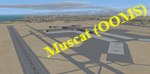
Muscat - Seeb Int'l airport, Oman, serving the the capital of the Sultanate of Oman, is undergoing a major construction of new passenger terminal (North Civilian Apron). The new northern runway (08L/26R) is fully operational with ILS and RNAV, 4000m X 60m.
The current default airport aprons and taxiway remain the same, so simmers could still taxi in and out from the old operational apron to the new runway (A long way though!). An updated version will be pushed once the construction is completed.
Compatible with both FSX and P3D.
| Filename: | OOMS__Seeb_Muscat_Intl_Airport_2015__Oman.zip |
| License: | Freeware, limited distribution |
| Added: | 15th February 2016, 20:23:01 |
| Downloads: | 1,429 |
| Author: | Ahmed Abdessalam |
| Size: | 237.04 KB |
| Category: Flight Simulator X - Scenery | |
| RAF Lindholme (1940s) |
|
File Description:
RAF Lindholme is located 3.9 miles (6.3 km) south of Thorne and 6.9 miles (11.1 km) north east of Doncaster and was initially called RAF Hatfield Woodhouse and started life as an
expansion scheme aerodrome built on the wide expanse of Hatfield moors, some five miles east of Doncaster. The site, to the east of the A614 Thorne to Bawtry road, was a mile
south of the small village of Hatfield Woodhouse, the name first selected for the new station. Work began in the spring of 1938 taking in approximately 250 acres (1.0 km2) of
pasture for the airfield itself and a further 150 for the camp and support facilities.
RAF lindholme had a long a varied career, details of which cam be found at:- https://en.wikipedia.org/wiki/RAF_Lindholme
Source:Wikipedia
| Filename: | RAF_Lindholme_1940s.zip |
| License: | Freeware |
| Added: | 4th March 2017, 19:57:23 |
| Downloads: | 87 |
| Author: | Terry Boissel |
| Size: | 1.24 MB |
| Category: Flight Simulator X - Flight Plans | |
| Mail Run for Volunteers...1939 |
|
File Description:
A Salute to the RCAF pilots who never returned...The war in Europe is nearing and the Canadian Armed Forces are beefing up.
North Mail Route-34 flown by Conrad Wooly and yourself for more than ten years is a weekly routine
flying to several towns and fishing communities along the northwest shores.
This week the RCAF has sent to many volunteers their acceptance papers who
will probably be flying in European Skies soon. This then, is a proud flight, knowing you
are being part of the hammer which will bring the Nazis to their end.---The flight is flown by "Pilotage", eyeballing your map and terrain so I have includded instructions on how to place it in your FSX kneeboard...." They Flew higher than eagles, they flew to Peace"
| Filename: | Mail_Run_for_Volunteers1939.zip |
| License: | Freeware, limited distribution |
| Added: | 16th May 2008, 21:52:59 |
| Downloads: | 528 |
| Author: | Gera Godoy Canova |
| Size: | 585.85 KB |


© 2001-2026 AVSIM Online
All Rights Reserved
Privacy Policy |