
Where Flight Simulation Enthusiasts Gather from Around the World!
AVSIM Library - Search Results

| Category: Flight Simulator X - Scenery | |
| Ireland VFR Small Airports part 1 |

|
File Description:
Ireland VFR Small Airports Part 1.
This scenery includes 5 small airports in Ireland. EIDL Donegal is in the far North West, EIAB Abbeyshrule is located in the centre of Ireland. EIKL Kilkenny is located in the South East and Newcastle can be found on the East coast. EITM is a small grass strip to the north West of Dublin. Donegal and Abbeyshrule have paved runways whilst the others consist of small grass strips.
The scenery includes animals, vegetation and rural objects. It also includes sound effects, animations, some high definition people, and aircraft painted using real Irish aircraft photos. Many of the airports include open hangers and buildings modelled from real photographs. Although Donegal is the only one with ILS, full night textures are included for all the airports.
Many of the files are stand alone and can be switched on or off according to user preference. The scenery can be used as a standalone, however it also uses objects from my other scenery addons.
The scenery has been tested with FSXA only and is designed to complement vfr photographic scenery. It will also work with the FSX default terrain, however all objects have been placed using ordinance survey data and may therefore appear misplaced in the default.
Full installation instructions are included in the Readme file.
I hope you enjoy using the airports as much as I enjoyed making them.
| Filename: | Ireland_VFR_Small_Airports_part_1.zip |
| License: | Freeware |
| Added: | 21st December 2011, 00:18:25 |
| Downloads: | 4,975 |
| Author: | George Keogh |
| Size: | 51.33 MB |
| Category: Flight Simulator X - Scenery | |
| KSNA, John Wayne-Orange County Airport |
|
Images related to this file:
File Description:

John Wayne Airport (IATA: SNA, ICAO: KSNA, FAA LID: SNA) is an airport in an unincorporated area in Orange County, California, with its mailing address in the city of Santa Ana, which is also the county seat, hence the International Air Transport Association (IATA) airport code. The main entrance to the airport is off of MacArthur Blvd in Irvine, the city that abuts the airport from the north and east. Newport Beach and Costa Mesa form the southern and western boundaries, respectively, together with a small unincorporated area along the Corona del Mar (73) Freeway. Santa Ana lies just north, not actually touching the airport directly. Originally named Orange County Airport, the county Board of Supervisors renamed it in 1979 to honor the actor John Wayne, who resided in neighboring Newport Beach and died that year. It also became the first airport to be named after an entertainer.
The main runway, at 5,701 feet (1,738 m), is one of the shortest of any major airport in the United States, resulting in most passenger aircraft operating from the airport to be no larger than the Boeing 757. However, some larger cargo aircraft, such as the FedEx A310/300, fly from SNA. Some gates are built to handle planes up to the size of a Boeing 767, which can operate with payload/fuel load restrictions. No wide-body passenger aircraft are currently in scheduled service at the airport.
| Filename: | KSNA_John_WayneOrange_County_Airport.zip |
| License: | Freeware, limited distribution |
| Added: | 11th October 2011, 08:25:20 |
| Downloads: | 11,006 |
| Author: | Mateusz Stabryla MK-Studios |
| Size: | 66.92 MB |
| Category: Flight Simulator X - Scenery | |
| YWWI - Woodie Woodie Manganese Mine, Western Australia |
|
File Description:
YWWI Woodie Woodie Manganese Mine - Pilbara Manganese, a wholly owned subsidiary of Consolidated Minerals (Consmin), operates the Woodie Woodie mine, which produces high-grade manganese ore of superior quality. The ore is sold to the international steel industry. Production in 2010 was 1,238,000t @ 46.2% Mn, with a capacity of 2.5mtpa of high grade lump and fines. The high-grade lump produced by the mine is an ideal blending material with high manganese and is very low in phosphorus. Furthermore, the lump is hard, has very low degradation and high thermal stability. The mine has a 100.5km2 mining corridor and approximately 5,500km2 of greenfield areas outside this corridor. Multiple open pits are in operation and owner mining of ore is used to promote selectivity and to minimise dilution. The mine also employs contract mining of waste to promote efficient bulk mining practices. The mineral processing techniques include crushing, screening and heavy media separation. Woodie Woodie has a new camp and an all-weather air-strip constructed in 2009, suitable for large aircrafts. Ore is trucked to Port Hedland for shipment. Consmin has committed in excess of A$34 million to exploration in 2011, with the intention to explore more than 60 corridor targets and more than 130 regional targets from nine prospect areas. www.consminerals.com.au/m/files/fs/woodie-woodie-fact-sheet.pdf REQUIRES Blencowe_LibraryKit.zip
REQUIRES blencowe_librarykit_309494.zip (Available HERE)
| Filename: | YWWI__Woodie_Woodie_Manganese_Mine_Western_Austral.zip |
| License: | Freeware |
| Added: | 28th February 2013, 17:07:43 |
| Downloads: | 271 |
| Author: | Alan Blencowe |
| Size: | 3.17 MB |
| Category: Flight Simulator X - Aircraft Repaints, Textures and Modifications | |
| "Red, white, silver, and black" Embraer EMB-505 Phenom 300 (N64RM) |
|
Images related to this file:
File Description:

This is a modification to one of the default liveries from Carenado. The original was the flag bearer of the Embraer sales team for several years but there are too many of the smaller brother Phenom 100s out there with the same paint job.
I removed all the drips and wrap around subtle coloring up front and now we have a solid white front end. I changed the weak orange looking color to a bright red for the wide bold stripe that tends to identify Phenoms and I replaced the orange stripe on the tail that makes the reverse C with the same bright red plus a white border to make it stand out. I added an American Reg Number just for the heck of it - N64RM.
This is a beautiful livery and should be just different enough to make you want to fly it often. It could make a personal aircraft for many Carenado Phenom 300 pilots. There will be a couple of slight changes to this livery down the road. I am working on one with a blue band and it will be N54RM. I'm not sure of the color for N44RM but it will be coming.
You will need to have the Carenado payware EMB505 HD Phenom 300 installed to use this repaint. It is for FSX, P3D, and FSX:Steam only.
| Filename: | Red_white_silver_and_black_Embraer_EMB505_Phenom_3.zip |
| License: | Freeware |
| Added: | 3rd October 2015, 18:34:51 |
| Downloads: | 724 |
| Author: | Ray Marshall |
| Size: | 26.91 MB |
| Category: Flight Simulator X - Aircraft Repaints, Textures and Modifications | |
| Delta Airlines A330-302 (242 Tonne) N828NW |
|
Images related to this file:
File Description:
BlackBox Simulations [BBS] Airbus Xtreme Series A330 V0.802 or above is required for this repaint. FSX/P3D ONLY. Airbus announced Delta Airlines as the launch customer of the increased weight, 242 tonne, A330-300 for more route
options as well as added passenger comfort. The new A330ceo is also the base of the A330neo but with the standard wings
and an upgraded General Electric GE CF6-80E1 engine option. Delta is the first of 12 customers to fly this increased
range A330. The plane can fly up to 6,100nm and has 2% less fuel consumption.
This repaint is part of FlightsimFX's HIGH DETAIL SERIES (HDS) which is essentially a study level repaint of select few
liveries. Enjoy more than 250 layers of custom texture additions/changes to the stock paintkit supplied!
BlackBox simulations has contributed to our community with the release of their advanced Airbus Aircraft series. As good
as the gauges and cockpit is, it is lacking greatly in the texture department.
I have taken initiative to fix their plastic looking, overall sub par, textures with my newer ones. There is a lot of work
that will still be added but as of now, I believe this is a stable amount of fixes to the BBS A330 Texture sets. I have
also included my "Optional BBS Common Texture Changes" folder if you are interested in the other work to make the BBS a
bit more realistic. Stay tuned for more enhancements.
| Filename: | Delta_Airlines_A330302_242_Tonne_N828NW.zip |
| License: | Freeware, limited distribution |
| Added: | 30th August 2016, 12:31:58 |
| Downloads: | 2,446 |
| Author: | Rohan Patel |
| Size: | 37.38 MB |
| Category: Flight Simulator X - Scenery | |
| ZGGG Guangzhou Baiyun Int'l Airport 2017 |
|
File Description:
Guangzhou Baiyun International Airport (ZGGG) is the major airport of Guangzhou, China. Located in Guangzhou's Baiyun District, it opened on August 5, 2004, but has gone through major changes since FSX was created. The default version only has one terminal and two runways and is slightly out of place from the actual location. I placed the airport in its real location based upon the charted latitude and longitude of the airport reference point. Guangzhou Baiyun Int'l Airport now has three runways. The third runway opened in February 2015. The centerpiece is the new Terminal 2, faithfully rendered here as much as possible. The terminal footprint and gates are accurate. The 3D terminal itself is a simple Sketchup project with generic textures (including night textures). The scenery converted and placed using MCX's amazing Convert and Place Wizard. I added the FBO ramp and the FEDEX Cargo Ramp Aprons and added some hangars to both locations, all default FSX buildings, so no additional library downloads are required. The new runway (now called 02R/20L) was added with Airport Design Editor. The old runway 02R/20L was renamed to the current runway 02L/20R and the old runway 02L/20R was renamed to the current runway 01/19. All taxiways are accurately drawn and designated with taxisigns using the latest AIRAC 1712 Jeppesen chart for ZGGG. All six ILS approaches are rendered as well as ADE would let me.
| Filename: | ZGGG_Guangzhou_Baiyun_Intl_Airport_2017.zip |
| License: | Freeware |
| Added: | 26th November 2017, 22:43:37 |
| Downloads: | 1,083 |
| Author: | Randy Tyndall |
| Size: | 490.4 KB |
| Category: Flight Simulator X - Aircraft Repaints, Textures and Modifications | |
| Consolidated PBY-5 RNZAF 6 Sqn XX-N |
|
Images related to this file:
File Description:

A repaint for the Aerosoft PBY-5 Catalina in the colors of PBY-5 (Bu08450) NZ4012 XX-N 'The Naughty Nine" of the RNZAF, as it looked while flying with FltLt Guy Rogers and crew from the Solomon Islands in 1945 with 6 Flying Boat Squadron. Following Japan's entry into the war in December 1941, the RNZAF had to switch from primarily training pilots to Europe into a combat force. No. 6 Squadron RNZAF was formed as an army co-operation unit at Milson in February 1942 flying Vickers Vildebeest and Hawker Hind aircraft. At the same time, No. 5 Squadron RNZAF moved to Fiji with Short Singapores and Vickers Vildebeest and Vincent biplanes. Modern maritime patrol flying boats (and more Hudson light bombers) were requested under Lend Lease and when the first Consolidated Catalinas arrived a detachment of men from No. 5 Squadron was assigned to convert to these types as No. 6 Squadron. Before the squadron was officially formed these men successfully completed their first air-sea rescue of a downed US aircrew. From May 1943 No. 6 squadron undertook action against the Japanese. The Squadron also conducted search and rescue missions for allied aircrew and seamen, and undertook many open sea rescues. XX-N arrived in Fiji on 20 june 1943. It was declared surplus to requirements in 1951, and was broken up in Hobsonville in 1952.
Repaint by Jan Kees Blom, based on the paintkit by Aerosoft
| Filename: | Consolidated_PBY5_RNZAF_6_Sqn_XXN.zip |
| License: | Freeware |
| Added: | 13th July 2018, 20:40:11 |
| Downloads: | 132 |
| Author: | Jan Kees Blom |
| Size: | 9.44 MB |
| Category: Flight Simulator X - Scenery | |
| Mid West Victoria v2 for ORBX v2. 14 airports. YARA YSWL YMBU YSTA YDOD YWYF YBIR YHPN YKER YSLK YSWH YNHL YHSM YWKB |
|
Images related to this file:
File Description:
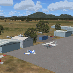
'Mid Western Victoria v2' is made to match ORBX Australia v2 scenery. Use 'Mid West Victoria update' for ORBX v1 or no ORBX. NOTE this is an UPDATE with Horsham replacing Hamilton in the instructions (it is Horsham in the actual scenery). There are 14 airports starting at Ararat and extending up to the Murray at Swan Hill. YARA Ararat YSWL Stawell YMBU Maryborough YSTA Saint Arnaud YDOD Donald YWYF Wycheproof YBIR Birchip YHPN Hopetoun YKER Kerang YSLK Sealake YSWH Swanhill YNHL Nhill YHSM Horsham YWKB Warracknabeal. A lot of airports but this is several hundred hours of effort over many months. ORBX has done these as they have done every airport included with FSX in Australia to a reasonable standard. If I had not already done them for ORBX V1 I would not have bothered. However these are better than ORBX because the surroundings have been modified to match real life. Towns have been added or shifted. Forests cut down or added. Race courses, sewage treatment ponds and other stuff added. Local obstacles (towers etc) added. There are 6 custom terminal buildings accurate to real life. Included is an AI traffic file that covers airports that dont already have AI. These files are for Flight Simulator X. Made using Airport Design Editor using some objects borrowed from Robert Budd's excellent Baccus Marsh and 'Static aircrafts' by Jean-Pierre Fillion. REQUIRED The scenery is designed to interface with ORBX FTX_AU V2 scenery for Australia (payware).
| Filename: | Mid_West_Victoria_v2_for_ORBX_v2_14_airports_YARA_.zip |
| License: | Freeware |
| Added: | 2nd May 2020, 23:11:14 |
| Downloads: | 255 |
| Author: | Colin Jeffery |
| Size: | 10.49 MB |
| Category: Flight Simulator X - AI Aircraft | |
| AI Lineas Aereas Azteca Htai Bombardier Learjet 31 XA-OLE |
|
Images related to this file:
File Description:
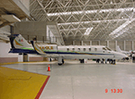
This is the aircraft of the extinct mexican airline "Lineas Aereas Azteca", the Bombardier Learjet 31 with the registration: XA-OLE. LÃneas Aéreas Azteca was an airline based in Mexico City, Mexico. It operated domestic scheduled services and international services to the USA. Its main base was Mexico City International Airport, with a hub at General Abelardo L. RodrÃguez International Airport, Tijuana. The airline was established on 9 May 2000 and started operations on 1 June 2000, operating domestic services with Boeing 737 aircraft. It started up after TAESA closed down and some of the staff and assets were taken over. The airline's operations were suspended by the government in March 2007 due to safety problems, and in October 2007 the Mexican government permanently revoked its air operator's certificate because the company hadn't solved those problems. On 10 October 2007, the General Civil Aeronautics Directorship (DGAC) of Mexico's Communications and Transport Secretariat permanently revoked LÃneas Aéreas Azteca's air operator's certificate, because the airline did not have a sound financial statement after the previous suspension. The fleet consisted in 6 Boeing 737-300 (XA-AAU, XA-AAV, XA-CAS, XA-TWG, XA-UCL, XA-UCP), 3 Boeing 737-700 (XA-AEP, XA-AEQ, XA-TWF), and 1 Bombardier Learjet 31 (XA-OLE). The models of this traffic are HENRY TOMKIEWICZ AI (HTAI) Bombardier Learjet 31. This is my website: https://el-mundo-de-los-aviones-ai-traffic.jimdosite.com I hope you enjoy it!
| Filename: | AI_Lineas_Aereas_Azteca_Htai_Bombardier_Learjet_31.zip |
| License: | Freeware |
| Added: | 29th May 2023, 21:00:06 |
| Downloads: | 72 |
| Author: | Jesus Gibran Soriano Solleiro |
| Size: | 23.97 MB |
| Category: Flight Simulator X - Scenery Design | |
| (Version 2.0) KEFD -Ellington 2025 Refresh FSX (Circa 2006-2010)- Johnson Space Center Houston |
|
Images related to this file:
File Description:
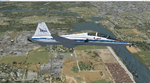
Version 2.0 covers landclass across the entire greater Houston area, with a large increase in LOD. This version significantly tightens up and improves the landclass from version 1.0, and adds a vast amount of scenery objects that brings the Bay Area-KEFD area into the modern era. This improves and adds a highly accurate runway 17 approach with accurate placement of buildings and scenery around the year 2011-modern day. In addition, includes several new files including a new airport/helipad via Houston Clear lake regional airport, T41 La Porte Municipal and surrounding shipping ports, Kemah Boardwalk, and a giant improvement to Johnson Space Center Houston. Rundway 35 and Runway 22 landclass is significantly increased, and more accurate as well. You can fly an accurate VFR approach or set up an ILS for any one of KEFD's runways with ease with this improvement.List of Version 2.0 additions and changes: - I added a ton of scenery objects and tightened up the landclass at Johnson Space Center Houston- NASA Control Center--- Added Talon Park with T38s (via static objects)--- Added Gemeni V rocket and 747 for the shuttle transporter--- And a whole bunch of vegetation, new buildings, and tour buses.- Added Kemah boardwalk and several boat docks- Removed a TON of highrise textures and replaced with medium and large city suburb landclass.- Added Clear Lake regional Hospital with helipad and surrounding scenery by Walter Reed Park- Added El Jardin or "Bayport Container port" with several scenery objects and significantly tightened up landclass.-- Looks great when setting up ILS approach for RWY 22- Tightened up Bay Area BLVD landclass, "adding" University of Houston Clear Lake"-- UHCL was semi already present, just made it more pronounced.- Made Red Bluff road landclass super recognizable!-- Red Bluff road is used to set up VFR approach and or field break for RWY 22 and RWY 17 R.----- Its common to see private jets and the USAF doing a break along Red Bluff road.- Added First Baptist Church, and water tower to Pasadena Convention center- Made Fairmont Parkway pronounced with landclass- Added Houston Port Authority at Morgan's Point--- Another Landmark for the RWY 22 ILS approach, NASA religiously uses this to line up the 10 mile ILS.- Tightened up landclass at Village Grove East and along Fairmont Parkway- Added a TON of scenery objects and landclass corrections for approach of RWY 17 L and 17 R.---- Added Home Depot, Lowes, Walmart Super center, Guitar center etc.---- added South Main Baptist Church--- Bondy Jr High, Turner Elementary, and Pasadena Memorial High School--- Added Saint Luke's Hospital--- Added Hampton Inn Suites and HCA rehab hospital--- Added a ton to the container facility behind best buy and storage facility--- Added smaller churches on RWY 17 approach--- Added a ton of scenery at the base of RWY 17 R, i.e., concrete plant, containers, trucks-- Added gas stations on the corner of beltway 8 and genoa red bluff-- Significantly changed and tightened up landclass at the base of RWY 22 and RWY 17 L and 17 R-- Made several roads and Beltway pronounced------ This decision looks AWESOME at night, really adds demarcation to the roads.**All of this makes the RWY 17 approach super recognizable** RWY 22 approach landclass is much more accurate.- Significantly changed and tightened up landclass near southbelt ellington and interstate 45.- Added Grace Church-- I wanted to do San Jacinto College south, but seemed over kill at that point.- SIGNIFICANTLY tightened up landclass for RWY 35 approach and near baybrook mall.-- Along I45- Added TDECU stadium at the University of Houston Main Campus---- So you can practice flybys for Cougar games!- Added the Battleship at San Jacinto Monument- I also "borrowed" T41 La Porte Municipal's tower camera to make a SWEET view of KEFD.- I included landclass for Sealy Texas this time, as well as my significant enhancements of Austin, Texas greater area as well (optional, but recommended!)---------------------------------------------------------------------------Version 1.0 originally added:- Added the Johnson Space Center Houston, which is now greatly enhanced and blended.- San Jacinto Community College-Central- Pasadena Convention Center- Pasadena Water Treatment Facility- NASA Bouncy Lab- Pasadena Shopping center, now greatly enhanced and blended.- Baybrook Mall and other shopping spots.- Significant Landclass improvements across the entire greater Houston Area File also includes landclass and scenery improvements for the greater Austin, Texas Area (optional), KIAH, KDWH, and Sealy, Texas. Each of these projects combined covers roughly 15,000 square miles of landclass improvement. Allowing you to fly entirely from Houston to Austin, or Houston to San Antonio in accurate landclass. -Enjoy!DJN
| Filename: | Version_20_KEFD_Ellington_2025_Refresh_FSX_Circa_2.zip |
| License: | Freeware |
| Added: | 12th October 2025, 16:15:47 |
| Downloads: | 67 |
| Author: | Dan Nelson |
| Size: | 277.28 MB |


© 2001-2026 AVSIM Online
All Rights Reserved
Privacy Policy |