
Where Flight Simulation Enthusiasts Gather from Around the World!
AVSIM Library - Search Results

| Category: Flight Simulator X - Scenery | |
| KHAF - Half Moon Bay Airport - San Mateo County, California - USA |

|
Images related to this file:
File Description:
FSX Scenery - Half Moon Bay Airport (IATA: HAF, ICAO: KHAF, FAA LID: HAF) is a county-owned public use airport in San Mateo County, California, United States. It is located five nautical miles (9 km) northwest of the central business district of Half Moon Bay, California. The airport is on the Pacific Coast, south of San Francisco. The Half Moon Bay Airport is located approximately 20 miles south of San Francisco. It was constructed by the California State Highway Department for the U.S. Army in 1942 as an auxiliary airfield for Salinas Army Air Base. Following the end of World War II, San Mateo County acquired the airport from the Navy in 1947. The airport has served a variety of roles over the years and is currently an important business, transportation and emergency service asset to the community. For your flying pleasure by John B. Loney, Jr.
| Filename: | KHAF__Half_Moon_Bay_Airport__San_Mateo_County_Cali.zip |
| License: | Freeware, limited distribution |
| Added: | 5th August 2015, 18:57:47 |
| Downloads: | 918 |
| Author: | John B. Loney, Jr. |
| Size: | 10.69 MB |
| Category: Flight Simulator X - Scenery | |
| Toulouse Blagnac (LFBO) v1 update |
|
Images related to this file:
File Description:
FSX Toulouse Blagnac Airport v1 modification update. This is an update of the addon scenery for FSX of the Toulouse Blagnac Airport. For using it, you need first to install /Toulouse Blagnac (LFBO) v1/ available in the Avsim library from myself (lfbo_scenery_v1.zip).
On this update, I have included the following (this is not an exhaustive list): Correction of the position of the ILS glide for the runway 32R/14L, improvement of the taxiways and connecting roads, correction of their position with Google earth, taxiways are well aligned with runways and surrounding buildings now, improvement of some existing buildings (i.e. old terminal), addition of customized buildings with day and night photo texture, improvement of the land class surrounding the installations, inclusion of water polygons, new assignment of gates for the Air France fleet (now located in new terminal F like in reality)
| Filename: | Toulouse_Blagnac_LFBO_v1_update.zip |
| License: | Freeware |
| Added: | 17th July 2012, 18:50:28 |
| Downloads: | 11,977 |
| Author: | Jose Mauriz |
| Size: | 29.73 MB |
| Category: Flight Simulator X - Scenery | |
| VIDP - Indira Gandhi Intl - Delhi, India |
|
Images related to this file:
File Description:
This airport update is a very accurate rendition of VIDP with two optional files made only for FSX: one file with the Crosswind runway 9/27 activated where all 3 runways will be used for takeoff/landing and one file as the default runway operation: runway 11/29 added with ILS and transitions included, ILS also added for 09, the new Terminal 3 added, airlines assigned to their correct gates as per their website with extra parking including two gates for the A380, all gates and parking stands correctly numbered, Terminal 2 closed and Terminal 1B demolished, taxiways and taxi signs updated to the latest charts, Cargo apron expanded including their buildings, all 4 fire stations now at their correct locations, extra fuel trucks, support vehicle roads rebuilt and many other scenery improvements, airport views are from inside the control tower (when in tower view) please view the readme before installation.
| Filename: | VIDP__Indira_Gandhi_Intl__Delhi_India.zip |
| License: | Freeware, limited distribution |
| Added: | 8th June 2014, 07:08:43 |
| Downloads: | 40,499 |
| Author: | Craig Scott |
| Size: | 1.28 MB |
| Category: Flight Simulator X - Scenery | |
| Barcelona Airport, El Prat Intl (LEBL) Barcelona, Spain |
|
Images related to this file:
File Description:
This is a reasonably accurate rendition of El Prat Intl airport with two optional files and made only for FSX users, do not use in P3D: There is one version with the Crosswind runway activated and in full operation where all 3 runways will be used for takeoff/landing and one version as the default airport runway operation, both terminals have been completely replaced and updated, airlines have assigned parking at their correct terminal as per their website, with extra parking including gates for the A380 at Terminal 1 (Gates 216 and 277), new control tower, extra fuel trucks, taxiways and taxi signs updated to the latest charts, support vehicle roads rebuilt and many other scenery improvements and objects added to further enhance this airport, airport views are from the roof of the new control tower (when in tower view) please view the readme before installation.
| Filename: | Barcelona_Airport_El_Prat_Intl_LEBL_Barcelona_Spai.zip |
| License: | Freeware, limited distribution |
| Added: | 19th December 2018, 00:33:45 |
| Downloads: | 48,029 |
| Author: | Ray Smith |
| Size: | 3.78 MB |
| Category: Flight Simulator X - Scenery | |
| Amsterdam Schiphol - EHAM - The Netherlands |
|
Images related to this file:
File Description:
This is a very accurate version of Schiphol Airport with two optional files and made only for FSX: one version with the Crosswind runways activated and in full operation where all six runways will be used for takeoff/landing and one version as the default airport runway operation, assigned parking as per their website with extra parking including gates for the A380, where there are dual jetways the static jetways are set to "Very Dense", taxiways and taxi signs updated to the latest charts, retention ponds and drainage canals added, aviation museum removed which has now moved to Lelystad Airport, fire brigade practice ground and airport support building included, extra fuel trucks, support vehicle roads rebuilt and many other scenery improvements and objects added, airport views are from the roof of the control tower (when in tower view) please view the readme before installation
| Filename: | Amsterdam_Schiphol__EHAM__The_Netherlands.zip |
| License: | Freeware, limited distribution |
| Added: | 7th December 2017, 07:21:15 |
| Downloads: | 56,078 |
| Author: | Ray Smith |
| Size: | 7.31 MB |
| Category: Flight Simulator X - Scenery | |
| Airport update for Vantaa Intl - EFHK - Helsinki, Finland |
|
Images related to this file:
File Description:
This is a reasonably accurate and up-to-date version of Vantaa Intl Airport with two optional files made only for FSX users, not made or suitable for use in P3D: There is one version with the Crosswind runway activated where all 3 runways will be used for takeoff/landing and one version as the default airport one runway operation: This update now includes the new expansion for terminals 1 and 2 with all gates/parking spots numbered correctly, ILS added to runway 33 and DME added to the other runways, assigned parking as per their website where possible with extra overflow parking, aprons, taxiways and taxi signs updated to the latest charts, extra fuel trucks, support vehicle roads rebuilt and many other scenery improvements and objects added, airport views are from the roof of the tower (when in tower view) please view the readme before installation
| Filename: | Airport_update_for_Vantaa_Intl__EFHK__Helsinki_Fin.zip |
| License: | Freeware, limited distribution |
| Added: | 21st May 2021, 18:12:48 |
| Downloads: | 44,482 |
| Author: | Ray Smith |
| Size: | 2.8 MB |
| Category: Flight Simulator X - Scenery | |
| EDDF - Frankfurt/Main - Germany ** Version 2 ** |
|
Images related to this file:
File Description:
This airport is a very accurate rendition of EDDF to represent today situation and made only for FSX with two optional files: one file with the Crosswind runway 18/36 operating (18 takeoff only) where all 4 runways will be used simultaneously and one file as the default airport runway operation: The Northwest runway 7L/25R (landing only), ILS frequencies and approaches now corrected to the latest charts and some transitions, assigned parking as per their website with extra parking including gates for the A380, taxiways and taxi signs updated to the latest charts, new north side control tower, the South cargo apron updated, the A380 maintenance apron, extra fuel trucks, support vehicle roads rebuilt and many other scenery improvements and objects added, airport views are from the roof of the new North side control tower (when in tower view) please view the readme before installation.
| Filename: | EDDF__FrankfurtMain__Germany__Version_2_.zip |
| License: | Freeware, limited distribution |
| Added: | 6th July 2016, 09:06:54 |
| Downloads: | 44,948 |
| Author: | Ray Smith |
| Size: | 2.5 MB |
| Category: Flight Simulator X - Scenery | |
| Aéroport de Lyon-Saint Exupéry - LFLL - Lyon, France |
|
Images related to this file:
File Description:
This is an accurate and up-to-date version of Saint Exupéry Intl Airport and made only for FSX users, do not use in P3D: The new expansion now added to Terminal 1 this also includes a gate for the A380 (D41), assigned parking now updated as per their website with extra parking, taxiways and taxi signs updated to the latest charts, the runway number changes due to the polar shift now corrected to 17R/35L and 17L/35R and the approaches also updated and corrected for them, Terminal 3 is now closed and the airlines that were allocated there have now been moved to the main terminal, extra fuel trucks, support vehicle roads rebuilt and many other scenery improvements and objects added, airport views are from the roof of the control tower (when in tower view) please view the readme before installation.
| Filename: | Aroport_de_LyonSaint_Exupry__LFLL__Lyon_France.zip |
| License: | Freeware, limited distribution |
| Added: | 18th September 2018, 02:09:17 |
| Downloads: | 25,772 |
| Author: | Ray Smith |
| Size: | 2.59 MB |
| Category: Flight Simulator X - Scenery | |
| Brisbane Intl Airport - YBBN - Queensland, Australia |
|
Images related to this file:
File Description:
As promised as soon as the charts became available to me, here is the latest version where the taxiways, ILS approaches and some transitions for the new runway 1L/19R have now been bought up-to-date.
This is a reasonably accurate version of Brisbane Intl airport and made only for FSX users, do not use in P3D: The main runway corrected to 1R/19L and the approaches corrected for it, the International and Domestic terminals rebuilt with something a little better than the stock airport, assigned parking as per their website where possible, including gates for the A380 (Gates 72,73,76) new control tower, runway 14/32 decommissioned, helipad with start location, extra fuel trucks, support vehicle roads rebuilt, and many scenery objects and improvements added to further enhance this airport, airport views are from the roof the control tower (when in tower view) please view the readme before installation.
| Filename: | Brisbane_Intl_Airport__YBBN__Queensland_Australia.zip |
| License: | Freeware, limited distribution |
| Added: | 27th May 2020, 18:15:16 |
| Downloads: | 42,420 |
| Author: | Ray Smith |
| Size: | 4.66 MB |
| Category: Flight Simulator X - Aircraft Repaints, Textures and Modifications | |
| Tradewinds Airways Canadair CL-44 1977 |
|
Images related to this file:
File Description:
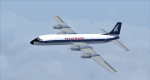
This is a repaint of the Canadair CL-44 in Tradewinds Airways colors. You need the freeware Canadair CL-44 by Mike Stone. Tradewinds was a British air cargo company. In November 1968, Transglobe Airways ceased operations, leaving a fleet of Canadair CL-44s lease-purchased from Seaboard World Airlines in limbo. Later in the month, Bobwood was formed to takeover the aircraft lease. Bobwood's name was changed to Tradewind Airways in January 1969 and all three ex-Transglobe Airways CL-44s were transferred over to the new company. Due to Seaboard World Airlines (a U.S. Cargo airline) having a large interest in Tradewinds, the British Government would not issue a license. Thus, in April, a British group was put together to take over the company. Consequently, a route network was developed primarily to Africa and North America in 1971–1976. Also in 1972, the carrier began flying from London Heathrow, often on all-cargo subcontracts for foreign airlines. In January 1977, Tradewinds became a wholly owned subsidiary of the multinational Lonrho Group. They received the 707-320Cs soon after. In 1978–1979, Tradewinds offered scheduled jet freight services from London to points in Africa, USA, and Canada. Unfortunately, in January 1986, Tradewinds ceased operations, citing overcapacity, undercutting by competing charter services, and stringent new noise abatement rules as cause of the demise. Its assetts were purchased by Tal Air, a British business travel airline, and tried to revive Tradewinds with freight services to Africa and the Middle East, however it was not to be, and they finally shut down for good in 1990.
Textures are 32bit bmp. This aircraft was tested on FSX-SE. It should work on FSX and FS2004.
*This is strictly an FS2004 model. However, I used it on FSX-SE by replacing the FS2004 panel and gauges with an FSX 2D panel, and it worked well. I have included two internet links for users of FSX, who wish to fly the aircraft, with easy instructions on how to go about replacing the FS2004 panels with FSX ones.
| Filename: | Tradewinds_Airways_Canadair_CL44_1977.zip |
| License: | Freeware |
| Added: | 24th January 2019, 05:08:24 |
| Downloads: | 74 |
| Author: | Ted Giana |
| Size: | 711.33 KB |


© 2001-2026 AVSIM Online
All Rights Reserved
Privacy Policy |