
Where Flight Simulation Enthusiasts Gather from Around the World!
AVSIM Library - Search Results

| Category: Flight Simulator X - Scenery | |
| Provincetown Municipal Airport (KPVC) |

|
Images related to this file:
File Description:
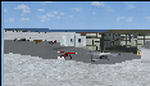
This airport was made using Airport Facilitator X, and Instant Scenery 2. Provincetown Municipal Airport is a small airport located in Provincetown, Massachusetts. Cape Air is the only airline that flies there. I added a more accurate terminal, and an aircraft hangar. I put three fuel trucks on the ramp with a fuel station. I made the taxiways the correct length and width. I also put static aircraft on the ramp and added more gates. I made a parking lot with many cars in it. If you choose to start off from a DOCK gate, you will start off inside the aircraft hanger. Taxiing or starting off inside of the hanger will cause a crash unless you have crashes turned off. This is all based on Google Earth and Bing Maps. Please read the readme for instructions on how to install. This is for Flight Simulator X only.
| Filename: | Provincetown_Municipal_Airport_KPVC.zip |
| License: | Freeware |
| Added: | 21st January 2012, 20:08:09 |
| Downloads: | 607 |
| Author: | Tyler Lawrence |
| Size: | 6.86 MB |
| Category: Flight Simulator X - AFCAD Files | |
| PASD - Sand Point, Alaska |
|
Images related to this file:
File Description:
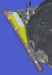
The airport of Sand Point (PASD) has been extended since Microsoft has modeled it and even after the upgrade through Scenery Solution's Ultimate Terrain X Alaska has been produced. This AFCAD is built on the UTX version of the airport and is intended to be used in this environment only.
The file considers the extended runway, VASI4 at both ends with 3.6 deg glideslope and the necessary new water-polygon. Due to the specific coastline bitmaps used by UTX I had to change to Microsoft's default ones being accessible through the wonderful tool Airport Design Editor X. Some additional landclass in the airport's vicinity and three (default) buildings close to the apron are completing the changes. I did not touch the easterly landing stage (or whatever it could have been) even if Google suggests that it disappeared meanwhile except some remaining piles in the water - it's just looking nice. ;-)
| Filename: | PASD__Sand_Point_Alaska.zip |
| License: | Freeware |
| Added: | 17th October 2013, 18:55:00 |
| Downloads: | 377 |
| Author: | Axel Birsul |
| Size: | 646.25 KB |
| Category: Flight Simulator X - Original Aircraft | |
| JELAIR - Spaceshuttle Orbiter Enterprise - v2008-05-22 |
|
File Description:
!!! NEW ZIP-FILE !!! If you had trouble with the previous zip-file (if it didn't unzip at all, or if files where missing after unzipping, etc) you should get this one instead. The filenames have been changed to make sure it unzips on all systems --- About this addon: The approach&landing test spaceshuttle orbiter "Enterprise". This is the orbiter-vehicle NASA used to test the landing phase with before launching the first spaceshuttle into space. It has no 3-D model, but a detailed FDE based on available information. It has panel and sound included. It has addon-scenery for Kennedy Space Center included. It can fly a fully automated flight from lift-off to wheel-stop from anywhere in the FSX-world (the last 22 miles of gliding unpowered approach-phase is fairly realistically simulated, but the lift-off and flight uses slew and engine-power)
| Filename: | JELAIR__Spaceshuttle_Orbiter_Enterprise__v20080522.zip |
| License: | Freeware |
| Added: | 22nd May 2008, 21:13:13 |
| Downloads: | 2,909 |
| Author: | Jacob Larsen |
| Size: | 3.45 MB |
| Category: Flight Simulator X - Scenery | |
| KCOS - Colorado Springs Municipal Airport/Peterson AFB - Colorado Springs, CO |
|
File Description:
Following the tragic passing of Shelly Johnson, I was contacted by Dakota Smith (Smith Graphics) about
upgading Colorado Springs Municipal Airport for the VATSIM Fly-In on November 15, 2008 in Shelly's honor.
Dakota did the "afcad" for the airport, packing in as many parking spaces as possible to accomodate the
Fly-In attendees. He then sent the file to me and I replaced most of the default buildings and added many
more. I adjusted some aprons, added others, added some roads, and static scenery objects.
Please note that the "afcad" was designed for the Fly-In and does not provide accurate airline assignments,
military parking, etc. As stated above, Dakota packed in as many parking spaces as possible, and assigned
many gates to Continental, Shelly's favorite airline.
A second "afcad" will be released by Dakota Smith the day after the Fly-In that will have more realistic
parking.
| Filename: | KCOS__Colorado_Springs_Municipal_AirportPeterson_A.zip |
| License: | Freeware |
| Added: | 8th November 2008, 14:46:50 |
| Downloads: | 2,396 |
| Author: | Jim Cook and Dakota Smith |
| Size: | 29.23 KB |
| Category: Flight Simulator X - Scenery | |
| RAF Folkingham |
|
File Description:
Royal Air Force Station Folkingham or RAF Folkingham is a former Royal Air Force station located south west of Folkingham, Lincolnshire and about 29 miles (47 km) due south of county town Lincoln and 112 miles (180 km) north of London, England.
Opened in 1940, it was used by both the Royal Air Force and United States Army Air Forces. During the war it was used primarily as a troop carrier airfield for airborne units and as a subsidiary training depot of the newly formed Royal Air Force Regiment. After the war it was placed on care and maintenance during 1947 when the RAF Regiment relocated to RAF Catterick.
You will need some additional scenery files by Ted Andrews and Ian Pearson which can be found at http://www.ianpsdarkcorner.co.uk, otherwise on the runway and peri track show. Ted Andrew - small buildings and Ians FSX Object Libraries.
| Filename: | RAF_Folkingham.zip |
| License: | Freeware |
| Added: | 8th October 2015, 17:55:15 |
| Downloads: | 298 |
| Author: | Terry Boissel |
| Size: | 9.59 KB |
| Category: Flight Simulator X - Scenery | |
| KXWA Williston Basin International Airport + Photoscenery 2019 V2.0 |
|
Images related to this file:
File Description:

THIS FILE REPLACES THE EARLIER KXWA_2019.zip. STANDALONE FILE, NO OTHER DOWNLOADS NEEDED. Compatible for FSX & FSX:SE. Not tested in P3D, but I expect it should work there as well. Opened in October 2019, Williston Basin International Airport replaces Sloulin Field as Williston, ND's primary airfield. Previously unavailable in flight sims, this scenery now brings this airport within flying distance. Current as of December 2019. FEATURES: Properly aligned runway, taxiways and aprons perfect for flying online // Correct ILS for Runway 32 // VOR on airport grounds as in real life // Correct designation of taxiways with appropriate taxi signs // 4 gates as well as GA Apron // Accurate-to-size passenger terminal & hangars // Apron lighting // Optional night and day photoreal textures from early 2019 // Custom waterclass meaning that bodies of water use native sim water // Autogen exclusion around airport // New in V2.0 - bug fixes and tweaks + new ground poly.
| Filename: | KXWA_Williston_Basin_International_Airport__Photos.zip |
| License: | Freeware |
| Added: | 17th December 2019, 03:32:14 |
| Downloads: | 418 |
| Author: | Matt Lock |
| Size: | 122.1 MB |
| Category: Flight Simulator X - Scenery | |
| Beja Air Base, V3 |
|
File Description:
Beja Air Base, home of the squadrons 103 (with AlphaJets), 601 (with P-3) and 552 (with Alloette III). This scenery was developed in ADE9X (http://www.airportdesigneditor.co.uk/) from the original of FSX with the help of Google Earth.
In V1, all runways and aprons have the right size, were added default FSX buildings and vegetation and also a representation of the "Terminal Civil de Beja". Changes to V2 are the update of taxiways designations, dimensions of some taxiways, vegetation reviewed, the improved look of the "Terminal Civil de Beja", but the most important,
the Control Tower and its outbuildings and Fire Station created by my friend Mario Cera. In V3 the Control Tower and its outbuildings and Fire Station by Mario Cera have now more details and more textures. If you have V1 or V2 please replace them with new V3.
| Filename: | Beja_Air_Base_V3.zip |
| License: | Freeware |
| Added: | 16th February 2012, 13:55:56 |
| Downloads: | 3,526 |
| Author: | Jorge Ferreira, Mario Cera |
| Size: | 41.51 MB |
| Category: Flight Simulator X - Scenery | |
| Clark International Airport RPLC - CRK |
|
Images related to this file:
File Description:

FSX scenery for Clark International Airport in Angeles city, Papamga Province , Philippines.
Clark International Airport, formerly the Diosdado Macapagal International Airport (IATA: CRK, ICAO: RPLC), is an airport that is an international gateway to the Philippines within Clark Freeport Zone located 80KM northwest of Manila. The airport is located along the border between the cities of Angeles and Mabalacat in the province of Pampanga and is accessible through the Subic-Clark-Tarlac Expressway, which is connected to the North Luzon Expressway.
Clark serves the general vicinity of central and northern Luzon. The name is derived from the former American Clark Air Force Base which was the largest overseas base of the United States Air Force until it was closed in 1991 and handed over to the Government of the Philippines.
Airlines serving CRK include Air Asia, Asiana, Cebu Pacific, Dragonair, Emirates, Jin Air, Qatar Airways, Tigerair, Fedex and Ups
| Filename: | Clark_International_Airport_RPLC__CRK.zip |
| License: | Freeware, limited distribution |
| Added: | 24th September 2016, 02:43:49 |
| Downloads: | 3,073 |
| Author: | Yann Martineau |
| Size: | 515.94 KB |
| Category: Flight Simulator X - Scenery | |
| Ghat HLGT Libya |
|
Images related to this file:
File Description:
Ghat is a medium-sized airport located in the south-west of Libya, near Algerian border, and 10 miles north of the city of Ghat. In early 2010s Ghat was undergoing major renovatios, but civil war in Libya has put these plans on hold. While all runways and taxiways were recently repaved, new passenger terminal is still unfinished, and air traffic is almost non-existent. Except from military and cargo planes, the only regular passenger flight to Ghat nowadays is Air Libyan from Tripoli: their A320 is visiting this place twice a week. This scenery has super-accurate layout, precise marking, and correct navaids according to the latest satellite images and charts. Photo background blends perfectly with ORBX Global. Unfinished new terminal with the construction site. Taxi signs were added for convenience. Enhanced city of Ghat and surrounding landclass. Made for P3Dv3, tested on P3Dv4 and FSX:SE. Made by Dmitriy Kozyrev.
| Filename: | Ghat_HLGT_Libya.zip |
| License: | Freeware |
| Added: | 27th September 2017, 06:18:00 |
| Downloads: | 1,226 |
| Author: | Dmitriy Kozyrev |
| Size: | 31.43 MB |
| Category: Flight Simulator X - Scenery | |
| CYHU Montreal/St-Hubert Airport v1.0 |
|
Images related to this file:
File Description:
Montreal/Saint-Hubert Airport is located 16 km (9.9 mi) east of downtown Montreal.
In operation since 1928, it was Montreal's first and only airport until the construction of Montreal-Pierre Elliott Trudeau International Airport. As of 2011, it is Canada's busiest general aviation airport, and is ranked as Canada's 6th busiest airport by aircraft movements.
What is included in this scenery:
- The airport runways and taxiways had been redone, Taxiway R has been added to better reflect the reality that the default version of FSX;
-All buildings and hangar of the airport;
-All buildings Helicraft (CTG2) and areas for helicopters, static helicopters;
-The new commuter train station;
-Streetlights on 116 highway and Clairevue blvd;
-Several static aircraft and service vehicles and cars parked along the road to the airport;
-Canadian Space Agency;
-The ski resort of St-Bruno;
-All signs track in 3D;
| Filename: | CYHU_MontrealStHubert_Airport_v10.zip |
| License: | Freeware, limited distribution |
| Added: | 29th March 2013, 06:38:12 |
| Downloads: | 5,026 |
| Author: | Pierre Gallant, Jean-Pierre Fillion |
| Size: | 21.31 MB |


© 2001-2026 AVSIM Online
All Rights Reserved
Privacy Policy |