
Where Flight Simulation Enthusiasts Gather from Around the World!
AVSIM Library - Search Results

| Category: Flight Simulator X - AFCAD Files | |
| MDST - Cibao Int'l Airport - Santiago, Dominican Republic |

|
Images related to this file:
File Description:
Cibao International Airport (Spanish: Aeropuerto Internacional del Cibao) (IATA: STI, ICAO: MDST) also known as Santiago Airport, is located in Santiago de los Caballeros, the Dominican Republic's second largest city. It is the country's third busiest airport by passenger traffic and aircraft movements.
Features:
*Taxiways properly designed and signs updated
*Expanded parking apron
*Redesigned terminal building
*Runway markings and lighting corrected
*Parking spots for commercial traffic
*Separate parking area for GA traffic
*Misc airport buildings added
*Cargo ramp
*Airport vehicles and objects throughout the airport
*Fuel service vehicles
*Static vehicles (requires objlib-large-car-parking-fsx.zip)
*Light poles (requires fsx_lts.zip)
| Filename: | MDST__Cibao_Intl_Airport__Santiago_Dominican_Repub.zip |
| License: | Freeware |
| Added: | 8th July 2014, 23:13:21 |
| Downloads: | 660 |
| Author: | Jaison Diaz / Endeavour ai |
| Size: | 74.66 KB |
| Category: Flight Simulator X - AFCAD Files | |
| SVMC - La Chinita International Airport - Maracaibo, Venezuela |
|
Images related to this file:
File Description:

La Chinita International Airport (IATA: MAR, ICAO: SVMC) is an airport located at Maracaibo, Venezuela. It is the second busiest airport in the country by passenger movements.
Features:
*Taxiways properly designed and signs updated
*Expanded parking apron
*Redesigned terminal building (with international concourse added)
*Accurate airline gate assignments
*Runway markings and lighting corrected
*Runways renumbered
*Parking spots for commercial traffic
*Separate parking area for GA traffic
*Misc airport buildings added
*Cargo ramp
*Airport vehicles and objects throughout the airport
*Fuel service vehicles
*Military ramp
*Fire station
*Static vehicles (requires objlib-large-car-parking-fsx.zip)
*Light poles (requires fsx_lts.zip)
*Helipads
| Filename: | SVMC__La_Chinita_International_Airport__Maracaibo_.zip |
| License: | Freeware |
| Added: | 14th July 2014, 21:36:58 |
| Downloads: | 869 |
| Author: | Jaison Diaz / Endeavour ai |
| Size: | 101.08 KB |
| Category: Flight Simulator X - Scenery | |
| KBTR - Baton Rouge Metropolitan Airport - Louisiana, USA |
|
Images related to this file:
File Description:
Baton Rouge Louisiana Metropolitan Airport for FSX. Several improvements have been made to the default airport, including replacing the default terminal with new buildings modelled in FSDS, correctly numbering and coding gates using Airport Design Editor 1.67.5684, drawing new vehicle paths so as to prevent airport vehicles from accessing the taxiways, adding ample GA parking, changing the tower view to the roof of the control tower,and including the option of having all runways open to AI traffic. Also included are Jim Dhaenen's excellent ramp lights and a set of GA flight plans to liven up the GA area. Please read the README FIRST.txt and installation.txt files to insure proper installation of all files.
| Filename: | KBTR__Baton_Rouge_Metropolitan_Airport__Louisiana_.zip |
| License: | Freeware, limited distribution |
| Added: | 8th November 2015, 16:09:12 |
| Downloads: | 1,542 |
| Author: | Patrick Finch |
| Size: | 2.34 MB |
| Category: Flight Simulator X - Scenery | |
| YMHB - Hobart Airport, v2.1 |
|
Images related to this file:
File Description:
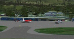
Featuring custom GMAX models, landclass changes, satellite imagery, and AFCAD airport update, Hobart International Airport (YMHB) is the result of several years development. The model itself has been designed with first hand knowledge and is highly accurate to the real airport, with photoreal textures been used. This download includes the nearby Mt. Wellington observatory and signal tower. It is recommended to be flown with FTX landclass installed. A free no restrictions demo of Tasmanian landclass is available from FTX at www.fullterrain.com/freeware.html. v2.1 makes several improvements on the previous version, with upgrades including: updated afcad; enhanced satellite imagery; several new custom models; and a significant improvement to the helicopter area behind the main terminal.
| Filename: | YMHB__Hobart_Airport_v21.zip |
| License: | Freeware, limited distribution |
| Added: | 10th May 2010, 07:30:16 |
| Downloads: | 7,764 |
| Author: | Matthew and Sean Devenish |
| Size: | 16.2 MB |
| Category: Flight Simulator X - Aircraft Repaints, Textures and Modifications | |
| Douglas C-47 (VH-AGU) Adastra Aerial Surveys |
|
Images related to this file:
File Description:
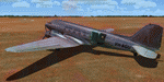
This folder contains a repaint for version 3.14 of the Douglas C-47 by Manfred Jahn and colleagues in the colors of C-47 VH-AGU of Adastra Aerial Surveys. It was originally constructed for the USAAF in 1944 as a C-47B-35-DK and allocated the military serial 44-76336. In February 1945 it was acquired by the RAAF and allocated the serial A65-72. Operated until 1959, it was then sold to Adastra Airways and converted for civil use. In October 1964 the aircraft was re-registered to Sepal Pty Ltd, but in October 1969 it was acquired by Adastra Aerial Surveys Pty Ltd. Adastra Aerial Surveys was acquired by East-West Airlines Ltd in April 1973 and VH-AGU was re-registered to East-West Airlines on 12 November 1974. East-West won the MLS trials support contract in December 1974 and VH-AGU was re-painted in East-West colours at Tamworth in the month prior to positioning at Melbourne/Essendon for the commencement of the contract on 25 January 1975. At some stage in the late 1970s the aircraft was transferred to South Coast Aviation, another East-West subsidiary. The aircraft was withdrawn from service in August 1979 at Essendon at the conclusion of its Departmental charter, and sold to Aerodyne Pty Ltd of Moorabbin. Since then, it has had several owners, and is still airworthy, flying in a USAF Vietnam war scheme from Morwell, Victoria. Repaint by Jan Kees Blom for Manfred Jahn's C-47 version 3.14, based on the paintkit by Gman5250.
| Filename: | Douglas_C47_VHAGU_Adastra_Aerial_Surveys.zip |
| License: | Freeware |
| Added: | 22nd August 2018, 15:12:21 |
| Downloads: | 192 |
| Author: | Jan Kees Blom |
| Size: | 15.68 MB |
| Category: Flight Simulator X - AFCAD Files | |
| Vliet Airport (6NJ1), NJ |
|
File Description:
Located 02 miles SE of Washington, New Jersey, Vliet Airport is a private turf field. Trees border the runway on three sides, and a dirt mound and semi-truck are also obstacles to watch out for at the end of Runway 06 if you land long. At 1300' feet, it is a very short runway so make sure you check the capabilities of your aircraft before attempting to either land or take off here! Don't forget that in order to clear trees, usable runway space is closer to only 1000'. This airport has no lighting so daytime VFR operations only are recommended. Take note that there is also no wind sock, so be sure you are aware of the weather conditions prior to arriving/departing. There is also no hard-surfaced runway and you will be landing on terrain so it's suggested you have your mesh resolution slider as high as possible.
Scenery constructed with use of satellite images/streetview/aerial photos - the author has not been there in person.
This scenery is meant to be used in conjunction with MegaScenery Earth New York 007. It is not required, but apron use is minimized to allow satellite scenery to show through as much as possible, and objects are placed based on the MSE textures - lack of it may make scenery look out of place.
| Filename: | Vliet_Airport_6NJ1_NJ.zip |
| License: | Freeware |
| Added: | 8th February 2011, 23:20:47 |
| Downloads: | 182 |
| Author: | Drew Sikora |
| Size: | 375.28 KB |
| Category: Flight Simulator X - AFCAD Files | |
| Wide Sky Airpark Airport (JY31), NJ |
|
File Description:
Located 03 miles NW of Bridgeton, New Jersey on 23 acres of land, Wide Sky Airpark Airport is a private turf field 2550' in length. There is no fuel available, but there is tiedown space by the main hangar in the middle of the field to the west. You can start in the parking spot there if you have a plane with 40' or less wingspan (collision with static aircraft is disabled so you can put a bigger plane there if you wish with no trouble). The windsock is not lit at night and is located atop the south end of then main hangar's roof. The field is hedged in to the east with bushes but they do not cause aircraft collisions. The runway is lit for night VFR operations. There is no hard surfaced runway so set your terrain mesh settings as high as possible to enjoy rolling around on bare bumpy terrain.
Scenery constructed with use of satellite images/streetview/aerial photos - the author has not been there in person.
This scenery is meant to be used in conjunction with MegaScenery Earth New Jersey/Delaware 004. It is not required, but apron use is minimized to allow satellite scenery to show through as much as possible, and objects are placed based on the MSE textures - lack of it may make scenery look out of place.
| Filename: | Wide_Sky_Airpark_Airport_JY31_NJ.zip |
| License: | Freeware |
| Added: | 10th May 2011, 13:40:36 |
| Downloads: | 157 |
| Author: | Drew Sikora |
| Size: | 1.27 MB |
| Category: Flight Simulator X - Scenery | |
| Columbia SC (KCAE) |
|
Images related to this file:
File Description:
The Columbia Metropolitan Airport Authority has provided substantial information about KCAE online, making it possible to pretty accurately model this airport. The taxiway signs have been placed according to exhibits in the airport's certification manual, and taxiway designations have been revised in accordance with upgrades to be effective mid-Novemer 2012. Most buildings have been custom modeled in accordance with information available on the internet, including Microsoft Bing birdseye views. The airport layout and landclass changes are in accordance with Google Earth imagery.
If you have Jim Dhaenens' lightobj.bgl installed, apron lighting will be included, and if you have
KB_static_aircraft_FSX installed (available at www.kb-sim.com/screens_static_aircraft.html),
additional parked aircraft will be visible. The layout of scenery is optimized for use with
Ultimate Terrain X-USA. FSX runs smoothly with this scenery on my computer, but it has not been
tested on a low-end system. Sometime after starting this project, it came to my attention that a
good scenery for KCAE was already available (but not listed at www.freewarescenery.com) from Jim
Hill that is another option as well as adjusting scenery complexity.
The new taxiway designations are not yet shown in the latest observed FAA airport diagram. An airfield sketch provided to pilots by the Columbia Metropolitan Airport is included in the package to show the taxiway designation changes.
| Filename: | Columbia_SC_KCAE.zip |
| License: | Freeware |
| Added: | 14th December 2012, 01:28:23 |
| Downloads: | 1,695 |
| Author: | Art Poole |
| Size: | 3.43 MB |
| Category: Flight Simulator X - Scenery | |
| Deshi Sceneries - Deshi Dhaka (VGHS/VGZR) Shahjalal/Zia International Airport, Dhaka, Bangladesh |
|
Images related to this file:
File Description:

This is the first and only full freeware scenery released for VGHS/VGZR Dhaka, Bangladesh. This has been a work in progress since 2012, and in 2016 we decided to make it public beta for the Bangladeshi Flight Sim Community. The team wasn't able to work further on this and the project was taken over by another developer who worked alongside our team. After years of hard work, we finally were able to collaborate with Final Approach Design Simulations, and released the full and final version of this scenery for P3D V4-5, in the simMarket as payware. While the FSX version was untouched and not upgraded further, we wanted to publish it online as a freeware scenery and NO MORE A BETA TEST. We hereby have uploaded the scenery, and according to our EULA, we are HEREBY changing the clause that states it is only to be used by Bangladeshi and that it is a limited release. We HEREBY declare it a full release for FSX, and we are allowing all nationalities to use our software. We hope you enjoy this free release and if you are a P3D V4-5 user, go check out our final product in the simMarket under the title "HAZRAT SHAHJALAL DHAKA VGHS DAC P3D4-5" by "Final Approach Design Simulations".
| Filename: | Deshi_Sceneries__Deshi_Dhaka_VGHSVGZR_ShahjalalZia.zip |
| License: | Freeware, limited distribution |
| Added: | 17th July 2022, 15:33:37 |
| Downloads: | 763 |
| Author: | Shafat Hasan, Karib Ahmed, Melus Haque, Imran Uddin |
| Size: | 41.24 MB |
| Category: Flight Simulator X - Missions | |
| NormandieTour2.zip |
|
File Description:
Intermediate Helicopter mission. This is tour number two (2) of three aerial excursions in the Normandy region of France. Requires one additional download of scenery (unless you already have it from tour one). See the instructions in the zip package for details.
| Filename: | NormandieTour2zip.zip |
| License: | Freeware |
| Added: | 4th September 2020, 18:47:55 |
| Downloads: | 81 |
| Author: | Helomissionman |
| Size: | 11.84 MB |


© 2001-2026 AVSIM Online
All Rights Reserved
Privacy Policy |