
Where Flight Simulation Enthusiasts Gather from Around the World!
AVSIM Library - Search Results

| Category: Flight Simulator X - Scenery | |
| Los Roques Archipelago and Airports |

|
Images related to this file:
File Description:
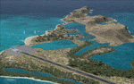
This project rebuilds Venezuela's Los Roques archipelago, adds the Gran Roque (SVRS) and Dos Mosquises (SVDM) airports, and includes AI flight plans, boat traffic, and a custom terrain mesh for Gran Roque. Accurate coastlines and lakes, as well as corrected landclass and waterclass are provided based on the latest available satellite imagery. Although current satellite imagery for this region only exists in relatively low resolution, an abundance of aerial photography was used to add custom features to Gran Roque and Dos Mosquises. Updates were created or rebuilt in a manner which carefully aligned airport data with current satellite imagery, when available. Scenery was created using Airport Design Editor X v1.50.4402, SBuilderX 3.13, and the FSX Object Placement Tool. Scenery objects were added and modified from stock FSX scenery to resemble as closely as possible the actual airports. Thank you to John Hinson and Tiago Besciak for granting permission to adapt their AI flight plans to realistically populate (SVRS) Gran Roque.
| Filename: | Los_Roques_Archipelago_and_Airports.zip |
| License: | Freeware |
| Added: | 27th July 2013, 02:34:10 |
| Downloads: | 1,400 |
| Author: | Carlyle Sharpe |
| Size: | 7.66 MB |
| Category: Flight Simulator X - Scenery | |
| LGSM Samos International Airport, Greece |
|
Images related to this file:
File Description:
LGSM Samos International Airport, Greece.
The island of Samos lies in the Eastern Aegean and is a very popular tourist destination for flights from Berlin, Munich, Gatwick, Oslo, Copenhagen, Rome and many others. It is widely regarded as the most dangerous airport in Greece, mountainous terrain requires a sharp right hand turn onto runway 09 and landings are invariably subject to strong turbulence.
The airport has been designed to sit on the excellent photoreal scenery by Dimitris Ntaskas, which is available here on Avsim and called 'samos_305814.zip'. It also uses many objects from my lgkf_kefallinia.zip scenery also available here at Avsim. The scenery has been designed for and tested with DX9 and FSXA only, if used with the default terrain many objects will be misplaced.
The scenery features a very detailed airport, repositioned according to satellite imagery and is based on real photographs. Full night lighting is included with washed lighting of the apron and carparks. The nearby town of Pythagorio has been modelled and includes some local landmarks. I have included many autogen style buildings based on photographs of Samos and also autogen trees native to the region.
The airport includes many animations, including olive trees, flags, people, windsocks, birds, road traffic and waves. Local Air traffic between the neighbouring islands of Chios, Mykonos, Kos and Rhodes is included, as is a panoramic view from inside the new tower. All the files have been sub-divided and can be switched on or off according to user preference.
Full installation instructions, settings, hints and tips can be found in the readme file. Please enjoy and I hope you like my scenery as much as I enjoyed building it.
| Filename: | LGSM_Samos_International_Airport_Greece.zip |
| License: | Freeware, limited distribution |
| Added: | 27th February 2013, 02:45:01 |
| Downloads: | 23,204 |
| Author: | George Keogh |
| Size: | 47.62 MB |
| Category: Flight Simulator X - Utilities | |
| Flight Log Client V 27 |
|
Images related to this file:
File Description:
This is a windows client software that allows you to log your flights to a database and keep a lifetime flight data history, you can connect to your members area and view all your logged flights in a map.
The SERIES 2 of FLC was born, now with full V.A. itegration and ability to create and submit flightplans to our network, you can also save them in "FPL IVAO compatible format" locally in your hard disk to share with your IVAO application or load them in further flight logs. You can also flight for a V.A. or ask your V.A. to integrate our services.
1,183 hours of flight time logged with our software.
| Filename: | Flight_Log_Client_V_27.zip |
| License: | Freeware |
| Added: | 22nd November 2013, 23:30:22 |
| Downloads: | 141 |
| Author: | Mario Dantas |
| Size: | 4.82 MB |
| Category: Flight Simulator X - Scenery | |
| Vietnam War project - base pack |
|
Images related to this file:
File Description:
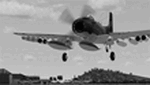
FSX Vietnam War Project - base pack version 0.9. FSX SP1/SP2 needed - Acceleration Pack optionnal, recommended.
About 100 new and redone airfields from SEA (Cam Ranh, Bien Hoa, Phu Cat, Nakhon Phanom, Korat...). French and English documentation (50 pages). Requires Vietnam War project AI airplanes (VnW_AI.zip).
TAD for each airfield. Additional sceneries. 25 flight plans to help you flying over the area.
Included : Al Simms Vietnam war objects, Jim Dhaenens Radars, lights and shelters, Guy Diotte static airplanes.
2 Objects libraries needed : read the quick installation guide.
Visit the project web site : http://vietnamwar.project.free.fr/
To contact us : [email protected]
FSX Vietnam War project: Jacques Godfrin - Xavier Carre
| Filename: | Vietnam_War_project__base_pack.zip |
| License: | Freeware, limited distribution |
| Added: | 11th April 2010, 07:57:17 |
| Downloads: | 2,047 |
| Author: | Jacques Godfrin, Xavier Carre, Vietnam War project |
| Size: | 76.47 MB |
| Category: Flight Simulator X - Missions | |
| The Most Dangerous Airports: The Apls 4 |
|
Images related to this file:
File Description:
You are an experienced pilot who is hired to fly medical supplies to various resorts in the area. You have just finished delivering medical supplies to Meribel airport, which was the first part of this mission, the second part which you are flying now, will take you through same amazing terrain, which you know very well. You are requested by a well know photographer, which you have agreed to take along for the ride, to plot a beautiful route, weather permitting. After dropping the medical supplies you are to fly to Le Versoud to end your medical supply run for this month. Remember it is getting pretty windy, which makes it all the more challenging.
| Filename: | The_Most_Dangerous_Airports_The_Apls_4.zip |
| License: | Freeware |
| Added: | 3rd November 2009, 20:00:08 |
| Downloads: | 1,167 |
| Author: | Robbie Albers |
| Size: | 830 KB |
| Category: Flight Simulator X - Scenery | |
| Missing China Airports - ZUZY (ZYI) Zunyi Xinzhou Airport - ZUBD (BPX) Qamdo Bamda Airport |
|
Images related to this file:
File Description: Zunyi Xinzhou Airport (IATA: ZYI, ICAO: ZUZY) is a dual-use military and
civil airport serving the city of Zunyi in China's southwestern Guizhou
Province. It is located in the town of Xinzhou in Xinpu New Area. Tested with FSX Acceleration and UTX.
Qamdo Bamda Airport (IATA: BPX, ICAO: ZUBD), also known as Changdu Bangda
Airport, is an airport serving Qamdo (Changdu), Tibet, China. It is located in
the town of Bamda (Bangda). This airport features the worlds longest runway at
an elevation of 14219. Visitors are warned before landing to move slowly on
leaving the plane and that they may feel light headed or dizzy because of the
thin air.
| Filename: | Missing_China_Airports__ZUZY_ZYI_Zunyi_Xinzhou_Air.zip |
| License: | Freeware, limited distribution |
| Added: | 28th June 2014, 05:59:47 |
| Downloads: | 659 |
| Author: | Kevin Wynn |
| Size: | 171.14 KB |
| Category: Flight Simulator X - Scenery | |
| YMHL Mount Holland Mine (closed), Western Australia |
|
File Description:
YMHL Mount Holland Mine (closed) - Convergent Minerals Limited. Bounty Gold Mine at Mount Holland was discovered by Aztec Exploration in 1985. The annual evaporation in this area is more than double the rainfall so it is a very dry and hardy location. Mining commenced in 1988 and was completed in 2002 producing 1.2 million ounces of Gold. Further exploration indicates the possibility of expanding the resource and Convergent Minerals have recently aquired the nickel rights. The board has commissioned a desk top study into recommencing mining and gold production at the Bounty Project. REQUIRES Blencowe_LibraryKit.zip
REQUIRES blencowe_librarykit_309494.zip (Available HERE)
| Filename: | YMHL_Mount_Holland_Mine_closed_Western_Australia.zip |
| License: | Freeware |
| Added: | 28th February 2013, 13:57:12 |
| Downloads: | 207 |
| Author: | Alan Blencowe |
| Size: | 2.86 MB |
| Category: Flight Simulator X - Scenery | |
| OAMS – German Camp Marmal ISAF |
|
File Description:
As of early January 2002 approximately 200 soldiers from the 10th Mountain Division, known as Task Force Commando, were operating from the Mazar-e-Sharif Airfield. The Mazar-e-Sharif Airfield's runway has a length of 3,100 meters/10,500 feet.
Germany took command of the International Security Assistance Force’s Regional Area North at the end of March 2006. The airfield functions as main hub for the exchange of personnel as well as air cargo for the international stabilization and peace support forces in Northern Afghanistan. The German government has German Camp Marmal contributed 53 million euros to reconstruction work at Mazari-Sharif airport. Here is the tribute for the german soldiers in afghanistan.
| Filename: | OAMS__German_Camp_Marmal_ISAF.zip |
| License: | Freeware |
| Added: | 1st October 2007, 21:33:18 |
| Downloads: | 1,578 |
| Author: | Volker Gießübl |
| Size: | 9.6 MB |
| Category: Flight Simulator X - Scenery | |
| 17Z - Manakotak Airport - Alaska |
|
Images related to this file:
File Description:
Manokotak Airport (IATA: KMO, ICAO: PAMB, FAA LID: MBA, formerly 17Z) is a state-owned public-use airport located one mile (2 km) north of the central business district of Manokotak, a city in the Dillingham Census Area of the U.S. state of Alaska.
Increased runway 3/21 from 3,300 feet to 4,000 feet. Added aditional aprons and custom buildings. Changes are based on 2006 construction plans.
Created with Airport Design Editor 9x by ScruffyDuck Software using current FAA documentation and Google Earth measurements, this package offers a replacement for FSX's stock airport. All these enhancements are as close to the real airport as I can get with stock library objects and custom buildings.
| Filename: | 17Z__Manakotak_Airport__Alaska.zip |
| License: | Freeware |
| Added: | 16th January 2015, 20:14:02 |
| Downloads: | 790 |
| Author: | Wayne Roberts |
| Size: | 53.55 KB |
| Category: Flight Simulator X - AFCAD Files | |
| MHLC - Goloson International Airport - La Ceiba, Honduras |
|
Images related to this file:
File Description:
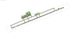
Goloson International Airport (Spanish: Aeropuerto Internacional Goloson) (IATA: LCE, ICAO: MHLC) is an airport located on the western side of the city of La Ceiba, in the Atlantida Department on the north coast of Honduras. It is also known as La Ceiba Airport (Aeropuerto de La Ceiba) and Hector C. Moncada Air Base (Base Aerea Hector C. Moncada). The Airport serves as the headquarters for Aerolineas Sosa.
Features:
*Expanded parking apron
*Taxiways properly designated and aligned
*Runway markings and lighting corrected
*Parking spots for commercial traffic
*Separate parking area for GA traffic
*Misc airport buildings added
*Airport vehicles and objects throughout the airport
*Fuel service vehicles
*Static aircraft
| Filename: | MHLC__Goloson_International_Airport__La_Ceiba_Hond.zip |
| License: | Freeware |
| Added: | 5th February 2014, 23:07:36 |
| Downloads: | 445 |
| Author: | Jaison Diaz / Endeavour AI |
| Size: | 79.61 KB |


© 2001-2026 AVSIM Online
All Rights Reserved
Privacy Policy |