
Where Flight Simulation Enthusiasts Gather from Around the World!
AVSIM Library - Search Results

| Category: Flight Simulator X - Scenery | |
| KIND - Indianapolis Intl, Indiana, USA |

|
Images related to this file:
File Description:
This is an up-to-date version of Indianapolis Intl airport with two optional files and made only for FSX users, do not use in P3D: There is one version with the Crosswind runway 14/32 activated where all 3 runways will be used for takeoff/landing and one version as the default airport runway operation,
This update removes the "jfk jetways" mainly for those who have had issues installing the textures to get these jetways to display, these jetways have now been replaced by jetway extensions that use there own textures, the terminal and its piers completely rebuilt, assigned parking as per their website with extra parking, the Fedex ramp updated and buildings replaced, all taxiways and taxi signs updated to the latest charts, support vehicle roads rebuilt, extra fuel trucks, Helipad added to the GA apron and many other scenery improvements and objects added, airport views are from inside the control tower (when in tower view) please view the readme before installation.
| Filename: | KIND__Indianapolis_Intl_Indiana_USA.zip |
| License: | Freeware, limited distribution |
| Added: | 11th March 2020, 18:46:54 |
| Downloads: | 30,507 |
| Author: | Ray Smith |
| Size: | 4.2 MB |
| Category: Flight Simulator X - Scenery | |
| Kloten/Zurich Airport - LSZH - Zurich,Switzerland |
|
Images related to this file:
File Description:
This is an accurate and up-to-date version of Zurich Airport with two optional files and made only for FSX, do not use in P3D: There is one version with the Crosswind runways activated and in full operation where all 3 runways will be used for takeoff/landing and one version as the default airport runway operation: A few changes have been made to improve the terminals appearance, assigned parking now updated as per their website including a gate (E67) and a parking spot at the maintenance apron for the A380, ILS added to runway 28 with all approaches and frequencies updated to the latest charts, new control tower, taxiways and taxi signs also updated to the latest charts, support vehicle roads rebuilt and many other scenery improvements and objects added, airport views are from the roof of the new control tower (when in tower view) please view the readme before installation.
| Filename: | KlotenZurich_Airport__LSZH__ZurichSwitzerland.zip |
| License: | Freeware, limited distribution |
| Added: | 15th May 2018, 15:53:03 |
| Downloads: | 44,612 |
| Author: | Ray Smith |
| Size: | 3.65 MB |
| Category: Flight Simulator X - Scenery | |
| LFAW - Villerupt-Errouville |
|
Images related to this file:
File Description:
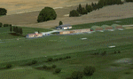
This scenery represents the field of Villerupt-Errouville LFAW where the flying club is based "Nord Lorraine" located in the north of the department 54 a few kilometers from Belgium and Luxembourg borders and the model aircraft club. The buildings have been modeled in GMAX, static devices are also present. Finally the autogen was placed on the same perimeter as the slab photo realistic.
********************************
Cette scene represente le terrain de Villerupt-Errouville LFAW qui est base l'aeroclub Nord Lorraine situe dans le nord du departement 54 a quelques kilometres de la Belgique et du Luxembourg ainsi qu'un club d'aeromodelisme et parachutisme.
L'ensemble des batiments ont ete modelises sous GMAX, des appareils statiques sont egalement presents.
Une dalle photo realiste a ete inseree mais je vous conseille de continuer le sol photo avec des logiciels comme fsEarthTile.
Enfin de l'autogen a ete place sur le meme perimetre que la dalle photo realiste.
| Filename: | LFAW__VilleruptErrouville.zip |
| License: | Freeware, limited distribution |
| Added: | 3rd January 2012, 11:24:06 |
| Downloads: | 1,863 |
| Author: | Alexandre Remy FAF010 |
| Size: | 17.72 MB |
| Category: Flight Simulator X - Scenery | |
| "IKAROS" Airport |
|
Images related to this file:
File Description:
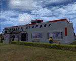
"IKAROS" Airport for FSX SP2
"IKAROS" airport is a private strip, 105km NW of Athens located in the Kopaida plains between the towns of Aliartos, Kastro and Orchomenos and west of Yliki lake. It is a pure general aviation field and the small terminal offers some services and facilities for the convenience of visiting aviators and passengers. The scenery includes a region and landclass bgl for a large area of the Kopaida plains around the airport. Most objects used are custom objects designed from pictures of the real thing. Moving road traffic as well as custom GA traffic are also included.
Note: If you downloaded this file before 10th of March 2011 21:30 GMT then you may wish to re-download. The original file had the hold short lines on the taxiway the wrong way around. The new file will work in your install by just overwriting the old one.
| Filename: | IKAROS_Airport.zip |
| License: | Freeware |
| Added: | 10th March 2011, 22:20:44 |
| Downloads: | 2,347 |
| Author: | Vassilios Dimoulas |
| Size: | 8.96 MB |
| Category: Flight Simulator X - Scenery | |
| Lafayette Louisiana USA Regional Airport |
|
Images related to this file:
File Description:
Lafayette Louisiana USA Regional Airport for FSX. Several improvements have been made to the default airport. The default terminal building has been replaced with a custom building created in FSDS; aircraft gates have been correctly coded using Airport Design Editor 1.70.6042; a new airport vehicle network has been built to prevent airport vehicles from entering the taxiways; extra fuel trucks have been added throughout the airport; the tower view has been changed to display from the roof of the control tower; static FedEx and UPS scenery objects have been placed throughout the airport; all taxiway signs are correctly placed and all taxiway designators are correctly named; there is the option to open both runways to AI traffic; the ILS for Runway 4R has been added; optionally, a set of GA flight plans is included using all default FSX aircraft to liven up the GA area; and Jim Dhaenen's excellent ramp lights are also included. Please read the README.txt file to insure proper installation of all files.
| Filename: | Lafayette_Louisiana_USA_Regional_Airport.zip |
| License: | Freeware, limited distribution |
| Added: | 2nd November 2017, 17:58:44 |
| Downloads: | 689 |
| Author: | Patrick Finch |
| Size: | 3.09 MB |
| Category: Flight Simulator X - Scenery | |
| Fiumicino Intl Airport - LIRF - Rome, Italy |
|
Images related to this file:
File Description:
This is a very accurate version of Fiumicino International Airport with two optional files designed only for FSX: one file with the Crosswind runway activated and in full operation, where all 3 runways will be used for takeoff/landing and one file as the default airport runway operation, runway 16C/34C is closed and now taxiway "D", although 16C/34C is still used under certain visibility conditions FSX will only allow one or the other, assigned parking as per their website with extra parking including gates for the A380, the new Terminal 3 expansion added, gates/parking now numbered in the correct order, all ILS approaches, taxiways and taxi signs updated and corrected to the latest charts, extra fuel trucks, support vehicle roads rebuilt and many other scenery improvements and objects added, airport views are from the roof of the control tower (when in tower view) please view the readme before installation.
| Filename: | Fiumicino_Intl_Airport__LIRF__Rome_Italy.zip |
| License: | Freeware, limited distribution |
| Added: | 24th March 2017, 05:59:39 |
| Downloads: | 45,829 |
| Author: | Ray Smith |
| Size: | 2.55 MB |
| Category: Flight Simulator X - Scenery | |
| Default Military Airbase Upgrade |
|
File Description:
FSX Default military and naval airfields rarely have anything other than a fuel box and I've decided to upgrade them with parking for military combat and cargo aircraft and fuel trucks. Fuel boxes are fine for GA airports but for larger airports they don't make sense. Plus the arrival of the fuel truck to service an AI aircraft prior to clearance adds some realism. There are quite a number of good sceneries already available but they often don't include fuel trucks and aren't always AI-friendly. A new initiative by airsource.us to include a militarycontract division has inspired me to share some of my upgrades with fellow airsource.us pilots. The airfields include: EGQL, EGQS, EGUN, EGVA, EGVN, EHLW, ETAD, ETAR, ETNH, LCRA, LEGT, LFOA, LFOE, LFRJ, LIPA, LLOV, LLRD, LLRM, OETB, OJ40, OJAM, LPLA, KFFO, KNTU, KOFF, KDYS, KHOP, KPOB, KBAD, KLRF, KLUF, KVBG, KWRI (added fuel truck and taxiway lights to Jim Cook's KWRI scenery). I highly recommend KDOV by JB Loney.
| Filename: | Default_Military_Airbase_Upgrade.zip |
| License: | Freeware |
| Added: | 3rd June 2018, 17:44:49 |
| Downloads: | 1,439 |
| Author: | Barry Woodward |
| Size: | 196.26 KB |
| Category: Flight Simulator X - Scenery | |
| CYDA - Dawson Airport - Yukon, Canada |
|
Images related to this file:
File Description:
FSX Scenery - Dawson City Airport (IATA: YDA, ICAO: CYDA) is located 8 nautical miles (15 km; 9.2 mi) east of Dawson City, Yukon, Canada, in the Klondike River valley, and is operated by the Yukon government. It has a terminal building and like most airports in its class, the runway is not paved. The gravel runway is 5,006 ft (1,526 m) long and at an elevation of 1,215 ft (370 m). A number of studies have recommended moving the airport or realigning the runway as it is in a narrow mountain valley. The airport is classified as an airport of entry by Nav Canada and is staffed by the Canada Border Services Agency (CBSA). CBSA officers at this airport can normally handle aircraft with up to 15 passengers, but are equipped to handle daily Boeing 737 charters between Dawson City and Fairbanks (Fairbanks International Airport) during the peak summer tourism season. For your flying pleasure by John B. Loney, Jr.
| Filename: | CYDA__Dawson_Airport__Yukon_Canada.zip |
| License: | Freeware, limited distribution |
| Added: | 7th April 2016, 17:20:42 |
| Downloads: | 907 |
| Author: | John B. Loney, Jr. |
| Size: | 13.92 MB |
| Category: Flight Simulator X - Scenery | |
| BATANES X v1.0 |
|
Images related to this file:
File Description:
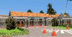
BATANES X v1.0
Archive includes the Photoreal Scenery of Batanes Island, Itbayat Island and its airports
(SLOPING RUNWAY NOT INCLUDED!)
Basco Airport (IATA: BSO, ICAO: RPUO) is an airport serving the province of Batanes in the Philippines. It is located in the provincial capital, Basco, and is one of two airports in the Batanes Islands, the other being Itbayat Airport. The airport is classified as a Class 2 principal (minor domestic) airport by
the Civil Aviation Authority of the Philippines (CAAP), a body of the Department of Transportation and Communications that is responsible for the operations of not only this airport but also of all other airports in the Philippines
except the major international airports.
Jorge Abad Airport (ICAO: RPLT), also known as Itbayat Airport, is an airport serving the island of Itbayat, the largest island in the province of Batanes, Philippines. The province's only other airport, Basco Airport, is located in the provincial capital, Basco, on Batan Island.
| Filename: | BATANES_X_v10.zip |
| License: | Freeware, limited distribution |
| Added: | 24th January 2019, 17:49:19 |
| Downloads: | 1,690 |
| Author: | Aeron M. Tumanut |
| Size: | 28.06 MB |
| Category: Flight Simulator X - Scenery | |
| Albany International Airport (KALB) Albany, New York |
|
Images related to this file:
File Description:
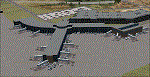
This airport was made using Airport Design Editor, Google Sketchup, and Instant Scenery 2. Albany International Airport, Is an airport located near Albany, New York. The airport has scheduled airline flights. Almost all of the buildings are custom made with photo textures to make it closer to real life. At the main terminal, I added more gates and put moving jetways. The gates have assigned parking codes. There is a parking lot next to the terminal full of cars. I put the airport access road in between the parking lot and the terminal. At the southwest ramp, I put hangars and some you can taxi inside of. If you choose to start off from the southwest DOCK gate, You will start off inside the Million Air Aviation FBO. I also put static aircraft on the ramp too. To the northwest, I put the New York Police hangar. You can start off inside this hangar by choosing the Northwest DOCK gate. Taxiing into or starting off inside a hangar will not cause a crash unless you touch the sides. To the Northeast, I put the cargo terminal with trucks. At the cargo section, I put three FedEx Cessna Caravans. I also put the control tower and the buildings. Tower views are from the roof of the control tower. To the southeast, I put small hangars and the Air National Guard Section with UH-60 helicopters. I extended runway 1/19 to the correct length of 8,500 feet. I also put red, blue, green, and purple Cessna 172s in different places around the airport. There will be more objects if your scenery complexity is set to normal (such as jetways, aircraft, and vehicles). This was all made based on Google Earth Imagery and Bing Maps. There are no night textures for the buildings. This will be added in a future version. An installer program is included to install the airport for you. There will be more versions of this that include night textures and static business jets. This is for Flight Simulator X only. By Tyler Lawrence.
| Filename: | Albany_International_Airport_KALB_Albany_New_York.zip |
| License: | Freeware |
| Added: | 2nd June 2012, 08:14:12 |
| Downloads: | 4,347 |
| Author: | Tyler Lawrence |
| Size: | 47.69 MB |


© 2001-2026 AVSIM Online
All Rights Reserved
Privacy Policy |