
Where Flight Simulation Enthusiasts Gather from Around the World!
AVSIM Library - Search Results

| Category: Flight Simulator X - Scenery | |
| Clark International Airport RPLC - CRK |

|
Images related to this file:
File Description:
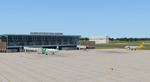
FSX scenery for Clark International Airport in Angeles city, Papamga Province , Philippines.
Clark International Airport, formerly the Diosdado Macapagal International Airport (IATA: CRK, ICAO: RPLC), is an airport that is an international gateway to the Philippines within Clark Freeport Zone located 80KM northwest of Manila. The airport is located along the border between the cities of Angeles and Mabalacat in the province of Pampanga and is accessible through the Subic-Clark-Tarlac Expressway, which is connected to the North Luzon Expressway.
Clark serves the general vicinity of central and northern Luzon. The name is derived from the former American Clark Air Force Base which was the largest overseas base of the United States Air Force until it was closed in 1991 and handed over to the Government of the Philippines.
Airlines serving CRK include Air Asia, Asiana, Cebu Pacific, Dragonair, Emirates, Jin Air, Qatar Airways, Tigerair, Fedex and Ups
| Filename: | Clark_International_Airport_RPLC__CRK.zip |
| License: | Freeware, limited distribution |
| Added: | 24th September 2016, 02:43:49 |
| Downloads: | 3,077 |
| Author: | Yann Martineau |
| Size: | 515.94 KB |
| Category: Flight Simulator X - Scenery | |
| Amsterdam Schiphol - EHAM - The Netherlands |
|
Images related to this file:
File Description:
This is a very accurate version of Schiphol Airport with two optional files and made only for FSX: one version with the Crosswind runways activated and in full operation where all six runways will be used for takeoff/landing and one version as the default airport runway operation, assigned parking as per their website with extra parking including gates for the A380, where there are dual jetways the static jetways are set to "Very Dense", taxiways and taxi signs updated to the latest charts, retention ponds and drainage canals added, aviation museum removed which has now moved to Lelystad Airport, fire brigade practice ground and airport support building included, extra fuel trucks, support vehicle roads rebuilt and many other scenery improvements and objects added, airport views are from the roof of the control tower (when in tower view) please view the readme before installation
| Filename: | Amsterdam_Schiphol__EHAM__The_Netherlands.zip |
| License: | Freeware, limited distribution |
| Added: | 7th December 2017, 07:21:15 |
| Downloads: | 56,093 |
| Author: | Ray Smith |
| Size: | 7.31 MB |
| Category: Flight Simulator X - Scenery | |
| Aéroport de Lyon-Saint Exupéry - LFLL - Lyon, France |
|
Images related to this file:
File Description:
This is an accurate and up-to-date version of Saint Exupéry Intl Airport and made only for FSX users, do not use in P3D: The new expansion now added to Terminal 1 this also includes a gate for the A380 (D41), assigned parking now updated as per their website with extra parking, taxiways and taxi signs updated to the latest charts, the runway number changes due to the polar shift now corrected to 17R/35L and 17L/35R and the approaches also updated and corrected for them, Terminal 3 is now closed and the airlines that were allocated there have now been moved to the main terminal, extra fuel trucks, support vehicle roads rebuilt and many other scenery improvements and objects added, airport views are from the roof of the control tower (when in tower view) please view the readme before installation.
| Filename: | Aroport_de_LyonSaint_Exupry__LFLL__Lyon_France.zip |
| License: | Freeware, limited distribution |
| Added: | 18th September 2018, 02:09:17 |
| Downloads: | 25,778 |
| Author: | Ray Smith |
| Size: | 2.59 MB |
| Category: Flight Simulator X - Scenery | |
| LFMQ - Le Castellet |
|
File Description:
Welcome to Le Castellet Airfield -
This airfield is situated few Nm east of Marseille Provence - LFML, in the south of France. On the 1,000 hectares of plateau he acquired between Marseille and Toulon, Paul Ricard, forever motivated by innovation and development, constructed in 1962 the largest
private airfield in the Provence-Alpes-Côte d’Azur region.
The landing strip at Le Castellet covered a distance of 1,000 metres and allowed for VFR (Visual Flight Rules) operation. Situated on a plateau at the time free of all economic development, it was above all a private airfield. In 1970, the construction
of the Paul Ricard Circuit nearby created an economic dynamic for the first time on Le Castellet plateau. In 1972, Paul Ricard invested in improvements to the runway, lengthening it from 1,000 to 1,750 metres, thus rendering it capable of
receiving business and private airplanes of up to 38 tonnes.
Over twenty years, Le Castellet Airport saw intense periods of activity due to business and private aviation, notably with the arrival of the first F1 French Grand Prix on the Paul Ricard Circuit in 1971, and more recently, with the creation of the Entreprise Zone at Signes, situated only a few kilometres from the airfield. Stop by for an amazing visit at the medieval village as well, situatued on top of a hill.
Nevertheless, from 1972 to 1999, no investment was made at the airfield. In May 1999, the company Excelis S.A. purchased the site (airfield and circuit) and refurbished and modernised the installations.
A truly amazing place to fly to - I have enhanced the entire apron as it is today, all marking correctly set, acces to runway and the Heli area for the "Eggbeater" fan :)
includes the hangar, building and other things around. Hope you'll enjoy your stay at "Le castellet"!
| Filename: | LFMQ__Le_Castellet.zip |
| License: | Freeware |
| Added: | 24th April 2009, 16:28:59 |
| Downloads: | 2,351 |
| Author: | Daniel Louvet |
| Size: | 986.65 KB |
| Category: Flight Simulator X - Scenery | |
| LJLJ Ljubljana Joze Pucnik Airport |
|
File Description:
Ljubljana Joze Pucnik Airport (IATA: LJU, ICAO: LJLJ) also known by its previous name Brnik Airport, is the international airport of Ljubljana, Slovenia. The airport is located near the village of Brnik, 19 km (12 mi) north of Ljubljana
and 11 km (6.8 mi) south of Kranj on the road between Kranj and Menges. It has a 3,300 m �� 45 m (10,827 ft �� 148 ft) paved runway. Letalisce Brnik was opened on December 24, 1963.
In 2007, the central-right government controversially renamed the airport to Ljubljana Joze Pucnik airport. Joze Pucnik was a Slovene public intellectual, dissident, and politician, leader of the Democratic Opposition of Slovenia (Demos)
between 1989 and 1992.
The airport is home to Adria Airways, the Slovenian flag carrier. There are currently two low-cost carriers serving the airport, EasyJet and Wizz Air. A few other airlines also serve the airport.
On December 8, 2004, the airport received its first annual millionth passenger. Overall, the airport handled 1,369,485 passengers in 2011, down from 1,673,050 passengers in 2008. It is the only airport in Slovenia with scheduled air
traffic.
The airport is served by a motorway exit off the A2 motorway and by bus service connecting it with Ljubljana and Kranj. A rail line to both cities is planned as well.
Airport is equipped with ILS Cat IIIb on runway 30. NDB and VOR approach are also available.
The runway of the Ljubljana Joze Pucnik Airport was closed to air traffic in April 2010. During that time, the entire width of the asphalt surface of the runway was renovated, as well as the asphalt surface on some parts of taxiways.
This file has the right coordenates, apron and characteristics of the airport, airport vehicules and buildings, Airport charts included.
| Filename: | LJLJ_Ljubljana_Joze_Pucnik_Airport.zip |
| License: | Freeware |
| Added: | 22nd November 2012, 16:29:14 |
| Downloads: | 1,511 |
| Author: | Anwar Gonzalez |
| Size: | 1.84 MB |
| Category: Flight Simulator X - Scenery | |
| YKEB Kellerberrin, Western Australia |
|
File Description:
YKEB Kellerberrin was modelled at the request of Councillor Cole. In this updated version, the silos have been added and the landclass for the town south of the highway has been masked giving a more realistic impression from the air. Kellerberrin is a town in the Wheatbelt region of Western Australia, 205 kilometres east of Perth on the Great Eastern Highway. The railway line from Northam to Southern Cross was constructed through here in 1893-94, and this section opened for traffic in 1895. Kellerberrin was one of the original stations when the line opened. By 1898 there was a demand for small blocks of land in the area, and the government surveyed a number of 20-acre lots the same year. The area was gazetted as Kellerberrin townsite in 1901, and the government soon made more land available for settlers. Early settlers from 1890 to 1910 from Ireland settled in the area of Kellerberrin and Wittem. Their family name
was English. A road was named after this family. The name Kellerberrin is Aboriginal, and is derived from the name of a nearby hill. The hill was first recorded as "Killaburing Hill" by an explorer in 1861, but in 1864 the explorer Charles Hunt recorded it as Kellerberrin Hill. One source claims that Kellerberrin is the name for the fierce ants that are found in the area, while another gives it as meaning "camping place near where rainbow birds are found" - kalla means camping place or place of, and berrin berrin is the rainbow bird. (repeating the name makes it plural) It also serves as a stop on the Prospector and Avonlink rural train services. REQUIRES Blencowe_LibraryKit.zip
REQUIRES blencowe_librarykit_309494.zip (Available HERE)
| Filename: | YKEB_Kellerberrin_Western_Australia.zip |
| License: | Freeware |
| Added: | 28th February 2013, 13:52:02 |
| Downloads: | 247 |
| Author: | Alan Blencowe |
| Size: | 2.69 MB |
| Category: Flight Simulator X - Scenery | |
| YNUL Nullagine, Western Australia |
|
File Description:
YNUL Nullagine - Shire of East Pilbara with added ORBX textures. Nullagine is serviced by a gravel airstrip. This facility provides a vital air link. RFDS, Police, and local charter operators all rely on this airstrip for the provision of vital services to the communities. Nullagine is an old goldrush town in Western Australia's Pilbara region. It is located on the Nullagine River 296 km south-east of Port Hedland and 1,364 km north-north-east of Perth on the old Great Northern Highway. The town originated from gold being discovered in the area in 1886 by a prospector, N.W. Cooke. The population increased sharply as a result and by the mid 1890s the community wanted to have a town declared. Lots were surveyed and released in 1897 and the state government gazetted the town in 1899. Nullagine comes from the Aboriginal name of a nearby river, the Ngullagine river; the meaning of the word is unknown. Besides gold other minerals were mined in the area including diamonds and other gemstones. Between 1895 and 1914 the town boomed and contained a number of general stores, three hotels, eight stamp mills and a population of over 3,000. Its population was 1,500 prior to World War II. Now, with the decline of gold mining, only about 200 remain. However the town still attracts fossickers and prospectors who visit the surrounding area, which is particularly rich in minerals such as agate, asbestos, antimony, beryl, chalcedony, copper, jade, jasper, manganese, tiger eye and wolfram. The town is also the place of the Yirrangadji Aboriginal Community. The Martu people make up the bulk of this population. REQUIRES Blencowe_LibraryKit.zip
REQUIRES blencowe_librarykit_309494.zip (Available HERE)
| Filename: | YNUL_Nullagine_Western_Australia.zip |
| License: | Freeware |
| Added: | 28th February 2013, 14:00:15 |
| Downloads: | 293 |
| Author: | Alan Blencowe |
| Size: | 5.72 MB |
| Category: Flight Simulator X - Aircraft Repaints, Textures and Modifications | |
| APSA '1966' C-46 |
|
Images related to this file:
File Description:

This is a repaint of the C-46 in Aerolineas Peruanas - APSA, 1966 colors. The freeware C-46 by Libardo Guzman and Tom Gibson is needed for this repaint. American C.W. Shelton, the owner of the Honduran carrier TAN (Transportes Aereas Nacionales), in association with two Peruvian nationals, founded Aerolineas Peruanas SA (APSA) in September 1956. Consequently, APSA began a C-46 international service from Lima (Peru) to Santiago de Chile via Autofagasta on June 17, 1957. By 1960, the company expanded its operations to Mexico City, and Panama City. Also in 1960 the CAB of the USA granted the rights to APSA to fly to Miami. However, before the rights were granted, the CAB forced C.W. Shelton to transfers his interest in APSA to Peruvian owners, as APSA was under "foreign interests" (ie. Shelton). Thus after this ruling, Shelton's airline changed hands and became a 77% owned Peruvian airline. The company entered the jet age with the delivery of its first convair 990 Coronado, which was leased, on 23 December 1963. South American expansion was undertaken in 1964 as services were launched to La Paz, Montevideo, and Asuncion. Eventually, Lima to London via Madrid and Paris flights were inaugurated during the spring of 1969 with a DC-8-52 leased from Iberia. Tragically, due to the high costs of its aircraft leases, the carrier encountered severe financial difficulties in 1970. Aditionally, the government, led by Juan Velasco Alvarado, refused to bail out APSA. Alvarado had plans to establish a state owned airline - AEROPERU, and APSA was standing in his way. Unable to overcome its massive $22-million debt, APSA ceased operations on May 3, 1971. This repaint was tested on FSX-SE. Textures are 32bit bmp. It should work on FSX, P3D v1-3, & FS2004.
| Filename: | APSA_1966_C46.zip |
| License: | Freeware |
| Added: | 1st March 2019, 02:54:57 |
| Downloads: | 78 |
| Author: | Ted Giana |
| Size: | 5.53 MB |
| Category: Flight Simulator X - Aircraft Repaints, Textures and Modifications | |
| FSX/P3D TAI DC-3 1962 |
|
Images related to this file:
File Description:
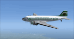
This is a repaint of the DC-3 in TAI (Transports Aeriens Intercontinentaux) colors. The freeware DC-3/C-47 v3 by Manfred Jahn is needed for this repaint. In 1946 the French government allowed the creation of some independent air carriers. On June 1 of that year TAI (Transports Aeriens Internationaux) was formed, and was based in Orly, France. Flights began on July 1, with a Junkers Ju-52. The following year they purchased 7 ex KLM DC-4s, along with 3 Bristol 170 freighters. In 1954 DC-6Bs started to replace the DC-4s. Their route network serviced mainly Africa, the Far East, the French Pacific territories, and Australasia. Prior to 1956 their network wa mainly in Africa, and Asia. On May 6, 1960, a partnership was formed with Air France, whereby TAI flew the South Pacific leg of the state carrier’s around the world service via New Caledonia and Tahiti. Later, on September 4 1960, TAI began a Douglas DC-8-32 service from Paris to Darwin via Athens, Teheran, Karachi, Bangkok, Phnom Penh, and Saigon, and on September 12, it inaugurated a route from Sydney to Los Angeles via Noumea, Nandi, Papeete, and Honolulu with the DC-8. On September 14 1961, TAI agreed, in principle, to a future merger with Union Aeromaritime de Transport (UAT). The two airlines integrated their schedules in 1962 and the amalgamation of TAI and UAT was completed on October 1, 1963, resulting in a new airline: UTA (Union de Transports Aeriens). This DC-3, F-BGXN, flew for TAI from 1956 to 1959. Textures are DXT5. This repaint was tested on FSX-SE and should work on FSX & P3D v1-3.
| Filename: | FSXP3D_TAI_DC3_1962.zip |
| License: | Freeware |
| Added: | 19th March 2019, 17:01:24 |
| Downloads: | 187 |
| Author: | Ted Giana |
| Size: | 8.29 MB |
| Category: Flight Simulator X - Scenery | |
| VOHS-VOBL package for FSX and FSX-SE |
|
Images related to this file:
File Description: Rajiv Gandhi International Airport (IATA: HYD, ICAO: VOHS) is an international airport that serves Hyderabad,
the largest city in the Indian state of Telangana. It is located in Shamshabad, about 24 kilometres (15 mi) south of Hyderabad.
The airport is operated by GMR Hyderabad International Airport Ltd, a public–private venture.
It was opened in March 2008 to replace Begumpet Airport as the primary commercial airport for Hyderabad.
It is named after Rajiv Gandhi, former Prime Minister of India. _______________________________________________________________________________________ Kempegowda International Airport (IATA: BLR, ICAO: VOBL) is an international airport serving Bangalore, the capital of the Indian state of Karnataka.
Spread over 4,000 acres (1,600 ha), it is located about 40 kilometres (25 mi) north of the city near the village of Devanahalli.
It is owned and operated by Bangalore International Airport Limited (BIAL), a public–private consortium.
The airport opened in May 2008 as an alternative to increased congestion at HAL Airport,
the original primary commercial airport serving the city. It is named after Kempe Gowda I, the founder of Bangalore.
Kempegowda International Airport became Karnataka's first fully solar powered airport developed by CleanMax Solar.[2][3] As of 2016, Kempegowda Airport is the third-busiest airport by passenger traffic in the country,
behind the airports in Delhi, Mumbai and is the 35th-busiest airport in Asia. It handled over 22.2 million passengers in 2016 with little less than 500 aircraft movements a day.
The airport also handled about 314,060 tonnes (346,190 short tons) of cargo. By 2020, it is expected to handle at least 40 million passengers per year,
with 45 international airlines and more than 1000 aircraft movements per day.
| Filename: | VOHSVOBL_package_for_FSX_and_FSXSE.zip |
| License: | Freeware |
| Added: | 28th January 2018, 17:03:17 |
| Downloads: | 4,490 |
| Author: | morten thomas van der linden |
| Size: | 171.62 MB |


© 2001-2026 AVSIM Online
All Rights Reserved
Privacy Policy |