
Where Flight Simulation Enthusiasts Gather from Around the World!
AVSIM Library - Search Results

| Category: Flight Simulator X - Scenery | |
| DGAA - Kotoka International Airport |

|
File Description:
Kotoka International Airport (IATA: ACC, ICAO: DGAA) in Accra, Ghana, is the country's premier international airport and has the capacity for large aircraft such as the Boeing 747-8. The airport is operated by Ghana Airports Company Limited (GACL), which has its offices on the airport property. GACL was established as a result of the decoupling of the existing Ghana Civil Aviation Authority (GCAA) in line with the modern trends in the aviation industry.
Airport and runway were corrected also the aprons and buildings. This work is dedicated to West Wind Airlines.
| Filename: | DGAA__Kotoka_International_Airport.zip |
| License: | Freeware |
| Added: | 6th May 2013, 16:21:31 |
| Downloads: | 3,416 |
| Author: | Anwar Gonzalez |
| Size: | 1.25 MB |
| Category: Flight Simulator X - Helicopters | |
| Bo 105 - "Heeresflieger" - Pack 2 |
|
File Description:
Two Repaints for the NemethDesigns Bo105 for FSX. They requires the Installation of the Payware Bo105 from NemethDesigns.com to use the repaints. Both Repaints are fictional. This is Pack 2 for the German Army Aviation - "Heeresflieger".
| Filename: | Bo_105__Heeresflieger__Pack_2.zip |
| License: | Freeware |
| Added: | 11th January 2009, 18:41:55 |
| Downloads: | 749 |
| Author: | Dirk Hüschelrath |
| Size: | 2.46 MB |
| Category: Flight Simulator X - Helicopters | |
| U.S. Navy TPS 696044 |
|
File Description:
This repaint is for the payware Nemeth Design MD500 for FSX. It's done in the guise of the USNTPS 696044. Since the actual heli is an OH6 it will be eventually repainted on the correct model.
| Filename: | US_Navy_TPS_696044.zip |
| License: | Freeware |
| Added: | 27th April 2009, 20:30:22 |
| Downloads: | 515 |
| Author: | Chuck Bosn |
| Size: | 18.65 MB |
| Category: Flight Simulator X - AFCAD Files | |
| ESGJ - Jonkoping Airport - Jonkoping, Sweden V1 |
|
File Description:
It's a nice little edit of the airport. The buildings are not the same as in real but the ground and almost every taxiway is updated and correct. Some fixes for the terminal and tower too.
| Filename: | ESGJ__Jonkoping_Airport__Jonkoping_Sweden_V1.zip |
| License: | Freeware |
| Added: | 12th September 2015, 18:13:40 |
| Downloads: | 228 |
| Author: | Erik Wismen |
| Size: | 5.48 KB |
| Category: Flight Simulator X - Aircraft Repaints, Textures and Modifications | |
| Pacific Western Airlines L-188 'Silver Bullet' |
|
Images related to this file:
File Description:

This is a repaint of the L-188 in Pacific Western Airlines colors. The freeware L-188 by Libardo Guzman is needed for this repaint. PWA operated a total of 4 L-188s from 1971 to 1976. This aircraft is the most intersting of the four. They nicknamed it the "Silver Bullet". It was a fuel tanker and was used to support the arctic oil exploration projects. It was unique in that fuel tankers were rare and this aircraft had the name and logo painted over the shiny unpainted aircraft.
I have included DXT3 textures, which will enable the FS2004 users to fly this plane. Just copy the DXT3 textures in the enclosed folder, then paste them into the main L-188 folder, overwriting the files there.
This repaint was tested on FSX-SE. It should work on FSX boxed & FS 2004.
| Filename: | Pacific_Western_Airlines_L188_Silver_Bullet.zip |
| License: | Freeware |
| Added: | 15th June 2018, 13:14:26 |
| Downloads: | 54 |
| Author: | Ted Giana |
| Size: | 2.66 MB |
| Category: Flight Simulator X - Scenery | |
| EGHA Compton Abbas |
|
File Description:
All additional Buildings were placed using default objects.
AI traffic uses default aircraft which was scheduled by hand using the TrafficDatabaseBuilder from the SDK tools provided by FSX Deluxe.
Any additional roads and modified Landclass & water features were created using FSX-KML.
This package adds the apron , Hangars, clubhouse and the fueling station has been moved to the correct spot between the hangars.
Some of the local roads have been added to allow road access to the airfield.
The main wooded areas have been added to the North and south of the airfield and cropland defined surrounding the immediate area although FSX insists on putting trees on some steeper slopes.
I have also included 3 of the villages nearby , Compton Abbas, Ashmore and Fontmell Magna .
It also provides parking spots and ATC interaction along with some AI traffic.
Hope you like it :)
| Filename: | EGHA_Compton_Abbas.zip |
| License: | Freeware, limited distribution |
| Added: | 1st October 2007, 17:08:37 |
| Downloads: | 1,887 |
| Author: | Len Hickman |
| Size: | 17.45 KB |
| Category: Flight Simulator X - Scenery | |
| CYUL - TSC Building Logo - FIXED |
|
Images related to this file:
File Description:
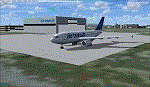
For owners of Blueprint Simulations CYUL Scenery, this will place Air Transat's logo on their maintenance building.
That building is very recognisable due to the logo, which is in proximity of Highway 13, which sees a lot of traffic. The most used approach at CYUL is 24R,and this building is located right next to it, so it will give you an even better feel that you are about to touch ground in Montreal!
Fixed the file, as i had zipped a wrong file. put CYUL_TSC_LIB.BGL instead of CYUL_TSC_LOGO.BGL.
It now works.
NOTE: This file does not alter Blueprint's files, it is completely separate, but must be put in Blueprint's CYUL directory to work. Enjoy!
| Filename: | CYUL__TSC_Building_Logo__FIXED.zip |
| License: | Freeware |
| Added: | 26th January 2010, 04:14:58 |
| Downloads: | 951 |
| Author: | Brian Paquette |
| Size: | 666.14 KB |
| Category: Flight Simulator X - Scenery | |
| Paris Le Bourget LFPB France |
|
Images related to this file:
File Description:
Scenery of a famous French airport Le Bourget, the home of a well-known air show. It is located 12 kilometers southeast of Paris and primarily used by business jets (but can easily accomodate A380 or large cargo planes). Due to close proximity of Charles de Gaulle international airport, Le Bourget has unusual approach to runway 25 to avoid de Gaulle traffic. Oh, and you can see the Eiffel Tower from here! This scenery has super-accurate layout, taxiways, markings and navaids according to the latest charts (May 2017; included) and satellite images. Made for P3Dv3, but works fine in FSX:SE and should work in vanilla FSX and P3Dv4 too. Made by Dmitriy Kozyrev.
| Filename: | Paris_Le_Bourget_LFPB_France.zip |
| License: | Freeware |
| Added: | 8th September 2017, 17:52:01 |
| Downloads: | 4,520 |
| Author: | Dmitriy Kozyrev |
| Size: | 5.31 MB |
| Category: Flight Simulator X - Scenery | |
| St Marys Municipal KOYM |
|
Images related to this file:
File Description:
FSX Scenery - St. Marys Municipal Airport (IATA: STQ, ICAO: KOYM, FAA LID: OYM) is a city-owned public-use airport three miles (5 km) southeast of the central business district of St. Marys, a city in Elk County, Pennsylvania, United States..[1] This general aviation airport is located off South Michael Road in St. Marys. St. Marys Municipal Airport covers an area of 283 acres (115 ha) and contains one runway designated 10/28 with a 4,300 x 75 ft (1,311 x 23 m) asphalt pavement. For the 12-month period ending October 31, 2007, the airport had 6,730 aircraft operations, an average of 18 per day: 85% general aviation, 15% air taxi and
| Filename: | St_Marys_Municipal_KOYM.zip |
| License: | Freeware, limited distribution |
| Added: | 2nd November 2010, 01:35:54 |
| Downloads: | 536 |
| Author: | John B. Loney, Jr. |
| Size: | 1.06 MB |
| Category: Flight Simulator X - Scenery | |
| Yuba Co-Oroville Muni |
|
File Description:
FSX Scenery - Yuba County Airport (IATA: MYV, ICAO: KMYV) is a public airport located three miles (4.8 km) southeast of Marysville, serving Yuba County, California, USA. The airport has two runways and is mostly used for general aviation. Oroville Municipal Airport (IATA: OVE, ICAO: KOVE) is a public airport located 3 miles (5 km) southwest of the city of Oroville in Butte County, California, USA. Oroville Municipal Airport covers 920 acres and has two runways. This airport is about 23nm NW of Yuba Co. An 18 hole golf course is located right next to the facility for you "Fly-in Golfers". EZ Scenry libraries require, some are included. By John B. Loney, Jr. and Robert Lacy.
| Filename: | Yuba_CoOroville_Muni.zip |
| License: | Freeware, limited distribution |
| Added: | 11th May 2010, 21:36:46 |
| Downloads: | 1,306 |
| Author: | John B. Loney, Jr. |
| Size: | 9.77 MB |


© 2001-2026 AVSIM Online
All Rights Reserved
Privacy Policy |