
Where Flight Simulation Enthusiasts Gather from Around the World!
AVSIM Library - Search Results

| Category: Flight Simulator X - Aircraft Repaints, Textures and Modifications | |
| NHSL TTDF Air Division Unit 9Y-TGW and 9Y-TGX - FSX P3D |

|
Images related to this file:
File Description:
For the freeware Eagle Rotorcraft( Nemeth Designs) Sikorsky S76A helicopter.... 9Y-TGX and 9Y-TGW both first flew with the Trinidad and Tobago National Security Air Division Unit. Later on the helicopters branched of to National Helicopter Services Ltd. which came out from the Air Division unit. 9Y-TGX and 9Y-TGW flew for NHSL until the fleet was upgraded to S76++, later fleet upgrade to 3 S76C++, 3 S76D and 1 AW139. the S76A and A++ models are now retired and some are believed to be used at UTT for Training Engineers/Mechanics... Thanks for downloading hope those from TnT enjoy this repaint :)
| Filename: | NHSL_TTDF__Air_Division_Unit_9YTGW_and_9YTGX__FSX_.zip |
| License: | Freeware |
| Added: | 30th May 2021, 06:55:10 |
| Downloads: | 67 |
| Author: | Andre Noreiga / Helirepaints |
| Size: | 20.15 MB |
| Category: Flight Simulator X - Aircraft Repaints, Textures and Modifications | |
| Classic Flyers PT-13 Stearman (ZK-XAF) |
|
Images related to this file:
File Description:

This is a repaint only, for the payware Vertigo Studios Stearman Vol.1 set. This repaint depicts the restored Stearman PT-13 ZK-XAF, owned/operated by Stearman 03 Ltd. at the Classic Flyers museum based at Tauranga Airport, Mount Maunganui, New Zealand. The aircraft, originally manufactured as USAAF 42-17744, was imported to Australia in 1988, and later to New Zealand in 1996, then registered to Bay of Plenty Classic Aircraft Company Ltd. and based with the Classic Flyers Museum. The aircraft is painted in colorful pre-WWII U.S. Naval Fighting Squadron markings and is used to provide scenic flights and flight training to paying customers.
| Filename: | Classic_Flyers_PT13_Stearman_ZKXAF.zip |
| License: | Freeware |
| Added: | 22nd January 2017, 04:10:00 |
| Downloads: | 137 |
| Author: | John Terrell |
| Size: | 23.25 MB |
| Category: Flight Simulator X - AFCAD Files | |
| Vineland-Downstown Airport (28N), NJ |
|
File Description:
Located 04 miles NE of Vineland, New Jersey on 45 acres of land, Vineland-Downstown Airport is a turf field that mainly services crop dusting operations for the surrounding farms. It also can serve firefighting aircraft - in fact the second runway (12/30) is specifically for that purpose along with agricultural use. This airport as modeled in FSX is kind of inbetween the current layout and the past layout. Based on various images both satellite and other, it seems 28N has undergone some serious expansion since the MSE textures were created. A large paved area to the west of the airport has been built and has parking aprons for up to around 25 aircraft. If you use an add-on traffic program you might want to think about reconfiguring it to assign more flights to this airport because it can certainly handle them now. You can fuel up in your plane by stopping near the fuel tank on the north end of the west tarmac or in your helicopter by landing on the concrete patch north of the runway.
Scenery constructed with use of satellite images/streetview, the author has not been there in person.
This scenery is meant to be used in conjunction with MegaScenery Earth New Jersey/Delaware 004. It is not required, but apron use is minimized to allow satellite scenery to show through as much as possible, and objects are placed based on the MSE textures - lack of it may make scenery look out of place.
| Filename: | VinelandDownstown_Airport_28N_NJ.zip |
| License: | Freeware |
| Added: | 11th October 2010, 06:13:42 |
| Downloads: | 206 |
| Author: | Drew Sikora |
| Size: | 324.96 KB |
| Category: Flight Simulator X - Helicopters | |
| CH-47D Chinook Hellenic Army Aviation |
|
File Description:
Greece has 15 CH-47D. The 9 of them are upgraded CH-47C to CH-47DG in 1995. The other 6 are CH-47SD. In 1980 Greece ordered 10 CH-47C Chinook. The first arrived in Greece in 1983. The first Greek Chinooks formally were belonged to Iran but after the fallen of Shahs, they were given to Greece. In 1984 took place the first accident of the Greek Chinooks when the ÅÓ-006 had a heavy landing in Samos Island, during the transportation of a radar. After that the 006 was used as a source. The other 9 in the period of 1992-1994 were upgraded to D (Super D). After the Imia night, the Greek Government wanted to order 11 Chinooks helicopter, 9 SD and 2 SD for the Special Forces. Later 7 Chinooks were ordered. They have analogue cockpit and not glass cockpit in order to be same with the old DG. Also they have the better engine T55-L714A (4.868hp). This Chinook package is only for the FSX, but in case you want to fly it on your FS2004,then the majority of the Gauges will not be appeared. The package is complete. Features: model, Virtual Cockpit, new Panel, Sounds, rework Flight Dynamics, two Textures olive green and a dessert camo. The Original Model belongs to Mark Adams & Tom Woods, the reworked Flight Dynamics to Marwan Latif. The textures represent the olive green witch have now the Hellenic Chinooks and the dessert witch appeared until the upgraded of the CH-47C to CH-47DG.
| Filename: | CH47D_Chinook_Hellenic_Army_Aviation.zip |
| License: | Freeware, limited distribution |
| Added: | 3rd January 2007, 19:23:13 |
| Downloads: | 15,894 |
| Author: | Thanasis Delizisis, Panagiotis Delizisis |
| Size: | 10.75 MB |
| Category: Flight Simulator X - Scenery | |
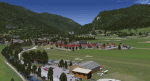
| LOSM Mauterndorf, Austria Version1 for FSX and P3D_v3/v4 |
|
Images related to this file:
File Description: The Airfield Mauterndorf is the highest situated airfield in Austria: 3642 ft or 1110 meters above sealevel.
This Airfield is very common for glider flyers due to the usually good upwinds for flying in the alps. But also small engine aircrafts are approved. Link:
http://www.losm.at/index.php/losm.html The environment of the airfield is adapted by landclasses. Mauterndorf and the surrounding villages, valleys and major roads are included.
As well the field is covered by a photo background, wich includes four different images , each for one of the four seasons spring, summer, autum and winter. The buildings in this scenery are designed mainly new by myself, but also a lot of objects from two very popular freeware libraries.
If these libraries are not installed, many objects are not visible! The following libraries are used: 1. FS-Piloten_Objektlibrary:
http://www.fs-piloten.de/thread.php?threadid=10632 2.FSX_FlightPortLib:
http://www.flightport.de/libraries/flightport-library/ This senery works also with Austria Professional HD.
| Filename: | LOSM_Mauterndorf_Austria_Version1_for_FSX_and_P3D_.zip |
| License: | Freeware |
| Added: | 28th August 2017, 20:01:00 |
| Downloads: | 482 |
| Author: | Wolfgang Allers |
| Size: | 249.9 MB |
| Category: Flight Simulator X - Scenery | |
| Thomas Hudner AFB |
|
File Description:
Thomas Hudner AFB is a fictitious Air Force Base located at Henderson Island, a member of the Pitcairn Islands in the Pacific. Located in a sheltered bay on the east side of the island, the airport features a 7500' x 120' paved runway, several hangars, barracks, and a fire dept. This airport also features a Delta V rocket and launch pad, a container ship being unloaded offshore by hovercrafts, and a small military ship. The default FSX scenery at this island has been completely replaced with custom scenery and terrain based on satellite photos.
This scenery requires the FSX Acceleration expansion pack for all of the objects to show up properly. Also, for some reason, Ground Environment X causes the sand textures to show up as rain forest. This is purely a visual quirk and the airport will still work, but it is up to you. This airport is not designed for FS2004, but you may try it at your own risk. Special thanks to Ashton Lawson for his invaluable help on this project.
| Filename: | Thomas_Hudner_AFB.zip |
| License: | Freeware, limited distribution |
| Added: | 31st January 2009, 01:29:20 |
| Downloads: | 543 |
| Author: | Daniel Otto |
| Size: | 1.57 MB |
| Category: Flight Simulator X - Scenery | |
| Kaipara Flats (NZKF) |
|
File Description:
This download contains fully customised Gmax buildings and objects (with glass reflections, no night textures), phototrees, updated facility information and placed library objects.
Kaipara Flats (ICAO: NZKF) is a small airstrip west of Warkworth, a township north of Auckland in New Zealand. It is a grass strip with an offset thresholds giving a useable length of 839m, width of 30m and a group rating of 6. The runway is aligned 07/25. It isn’t lit and AvGas 100 fuel is available.
I decided to model it after doing a roadtrip north of Auckland and taking lots of reference photos of the smaller airfields suitable for the size of aircraft I fly in real life. I am also planning to model SpringHill and Parakai aerodromes in the near future
The airstrip makes a perfect stopping point for training flights around the Auckland region with Ardmore and Northshore aerodromes to the south, Springhill to the north, and Parakai to the west
| Filename: | Kaipara_Flats_NZKF.zip |
| License: | Freeware, limited distribution |
| Added: | 24th April 2009, 23:56:22 |
| Downloads: | 1,629 |
| Author: | Tim Barnes |
| Size: | 2.26 MB |
| Category: Flight Simulator X - Scenery | |
| KLVK - Livermore Municipal Airport - California, USA |
|
Images related to this file:
File Description:
FSX Scenery - Livermore Municipal Airport (IATA: LVK, ICAO: KLVK) is in Livermore, California, USA, east of San Francisco Bay. The airport is three miles northwest of the downtown area. Near the 650-acre airport are the Water Reclamation Plant and the Las Positas Golf Course. There are two parallel asphalt runways. The main lighted runway is 5,250 ft long and the second runway, unlighted, built in 1985, is 2,700 ft long is used mainly for training. Besides the 2,400 sq ft Terminal building, built in 1969, there are nearly 400 aircraft storage hangar units as well as a corporate-style hangar building containing 20,000 sq ft of space along with an aircraft storage shelter. About 600 aircraft are based on Livermore Airport. For your flying pleasure by John B. Loney, Jr.
| Filename: | KLVK__Livermore_Municipal_Airport____California_US.zip |
| License: | Freeware, limited distribution |
| Added: | 17th July 2015, 17:12:03 |
| Downloads: | 366 |
| Author: | John B. Loney, Jr. |
| Size: | 10.81 MB |
| Category: Flight Simulator X - Scenery | |
| RAF Upper Heyford "1940s" - Oxfordshire, England |
|
File Description:
RAF Upper Heyford was a Royal Air Force station located 5 miles (8 km) north-west of Bicester near the village of Upper Heyford, Oxfordshire, England.
| Filename: | RAF_Upper_Heyford_1940s__Oxfordshire_England.zip |
| License: | Freeware |
| Added: | 21st May 2016, 20:33:23 |
| Downloads: | 156 |
| Author: | Terry Boissel |
| Size: | 1.27 MB |
| Category: Flight Simulator X - AFCAD Files | |
| Salem Airfield Airport (NJ74), NJ |
|
File Description:
Located 01 miles E of Salem, New Jersey on 14 acres of land, Salem Airfield is a private turf strip 2200' in length. The hard surface runway has been removed so have your mesh settings as high as possible to get the most out of landing/taking off on actual terrain. The surrounding area has been highly detailed with as much forestation as possible included to block out the horizon as much as possible considering the many open spaces surrounding the airport. Tie downs are located next to the middle of the runway, look for the marker cones or start in any RAMP_GA_SMALL parking locations. A hangar is available as well, and attendant is on call on NAV2 to open the door. You can start inside the hangar in the DOCK_GA parking spot or outside the hangar in the RAMP_GA parking spot. All parking is for aircraft with wingspans no greater than 40 feet. There is no fuel available. The field is lit for night use, but the windsock is not so check your weather before flying in!
Scenery constructed with use of satellite images/streetview/aerial photos - the author has not been there in person.
This scenery is meant to be used in conjunction with MegaScenery Earth New Jersey/Delaware 004. It is not required, but apron use is minimized to allow satellite scenery to show through as much as possible, and objects are placed based on the MSE textures - lack of it may make scenery look out of place.
| Filename: | Salem_Airfield_Airport_NJ74_NJ.zip |
| License: | Freeware |
| Added: | 10th August 2011, 02:05:51 |
| Downloads: | 176 |
| Author: | Drew Sikora |
| Size: | 910.96 KB |


© 2001-2026 AVSIM Online
All Rights Reserved
Privacy Policy |