
Where Flight Simulation Enthusiasts Gather from Around the World!
AVSIM Library - Search Results

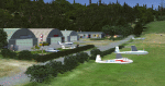
| Category: Flight Simulator X - AFCAD Files | |
| Herr Mountain Airport (5NJ2), NJ |

|
File Description:
Located 02 miles N of Stanton, New Jersey, Herr Mountain Airport is a private turf strip. No aircraft are based here, so don't expect much except for ample room to land and take off again. There is a residence on the property, but no hangar or storage facilities. The runway is 2800x100 feet so not too hard to arrive and depart from. Approaching Runway 25 can be a slight challenge given that you need to level off your descent to cross over a mountain top before diving in to land. There is no hard surface runway, so you will be landing on terrain - be gentle! It's recommended to have your mesh complexity set as high as possible to get the full effect. The runway is not lit so daytime VFR operations only are allowed at this airport.
Scenery constructed with use of satellite images/streetview/aerial photos - the author has not been there in person.
This scenery is meant to be used in conjunction with MegaScenery Earth New Jersey/Delaware 001. It is not required, but apron use is minimized to allow satellite scenery to show through as much as possible, and objects are placed based on the MSE textures - lack of it may make scenery look out of place.
| Filename: | Herr_Mountain_Airport_5NJ2_NJ.zip |
| License: | Freeware |
| Added: | 1st February 2011, 23:06:28 |
| Downloads: | 187 |
| Author: | Drew Sikora |
| Size: | 422.37 KB |
| Category: Flight Simulator X - Aircraft Repaints, Textures and Modifications | |
| US Air Force, Boeing 737-700WL - C-40B Special Mission Aircraft (White) |
|
Images related to this file:
File Description:

PMDG's excellent 737-700WL NGX painted in US Air Force C-40B Special Mission Aircraft White/blue stripe livery. The PMDG NGX base pack AND 600-700 expansion pack are required for use.
The C-40B is a special-mission aircraft that provides airlift with an office-in-the- sky environment for U.S. combatant commanders and other senior government officials. Built for the U.S. Air Force, the 737-700 aircraft is equipped with equipment and capabilities that support a rapid response for global missions. C-40Bs are equipped with the Connexion by Boeing system, providing secure in-flight broadband connectivity -- data/video transmit and receive capability -- to enhance communications, productivity and security.
| Filename: | US_Air_Force_Boeing_737700WL__C40B_Special_Mission.zip |
| License: | Freeware |
| Added: | 10th November 2011, 14:03:49 |
| Downloads: | 1,990 |
| Author: | Chris Hicks |
| Size: | 11.95 MB |
| Category: Flight Simulator X - AFCAD Files | |
| Vliet Airport (6NJ1), NJ |
|
File Description:
Located 02 miles SE of Washington, New Jersey, Vliet Airport is a private turf field. Trees border the runway on three sides, and a dirt mound and semi-truck are also obstacles to watch out for at the end of Runway 06 if you land long. At 1300' feet, it is a very short runway so make sure you check the capabilities of your aircraft before attempting to either land or take off here! Don't forget that in order to clear trees, usable runway space is closer to only 1000'. This airport has no lighting so daytime VFR operations only are recommended. Take note that there is also no wind sock, so be sure you are aware of the weather conditions prior to arriving/departing. There is also no hard-surfaced runway and you will be landing on terrain so it's suggested you have your mesh resolution slider as high as possible.
Scenery constructed with use of satellite images/streetview/aerial photos - the author has not been there in person.
This scenery is meant to be used in conjunction with MegaScenery Earth New York 007. It is not required, but apron use is minimized to allow satellite scenery to show through as much as possible, and objects are placed based on the MSE textures - lack of it may make scenery look out of place.
| Filename: | Vliet_Airport_6NJ1_NJ.zip |
| License: | Freeware |
| Added: | 8th February 2011, 23:20:47 |
| Downloads: | 182 |
| Author: | Drew Sikora |
| Size: | 375.28 KB |
| Category: Flight Simulator X - Scenery | |
| Essweiler Gliderfield, Germany Ver. 1.0 |
|
Images related to this file:
File Description:
Essweiler is actually a classic glider field, but also engine aircrafts up to 2t are approved.
The field is situated in the region Rheinland-Pfalz/Germany at a hillside eastly of the village Essweiler, approximately 7,5 nautical miles north of the well known US-Airbase Ramstein.
The environment of the airfield is adapted by land classes. Surrounding villages and major roads are initially implemented.
As well the field is covered by a photo background, which includes four different images , each for one of the four seasons: spring, summer, autumn and winter. The buildings in this scenery should match quite good the originals. But also a lot of objects from three very popular freeware libraries are used.
If these libraries are not installed, many objects are not visible!
The following libraries are used:
1. FS-Piloten_Objektlibrary:
http://www.fs-piloten.de/thread.php?threadid=1063
2. FSX_FlightPortLib
http://www.flightport.de/libraries/flightport-library/
3: 3d People Library
http://library.avsim.net/download.php?DLID=192454
| Filename: | Essweiler_Gliderfield_Germany_Ver_10.zip |
| License: | Freeware |
| Added: | 29th November 2016, 19:15:50 |
| Downloads: | 605 |
| Author: | Wolfgang Allers |
| Size: | 168.18 MB |
| Category: Flight Simulator X - Scenery | |
| RAF Dalton |
|
File Description:
RAF Dalton was named after a local village although it was closer to RAF Topcliffe who it was intended to be the
satellite for.
RAF Dalton was home to No. 102 Squadron beginning in November 1941. No. 102 Squadron returned to Topcliffe in June
1942 and for a time Dalton hosted No. 1652 Heavy Conversion Unit (HCU) flying Halifaxes. The airfield was improved in
1942 and in early 1943 was allocated to No. 6 Group Royal Canadian Air Force (RCAF). Canadian squadrons stationed
here at one time or another included No. 428 Squadron, No. 424 Squadron, No. 420 Squadron, and No. 1666 Heavy
Conversion Unit (which moved to RAF Wombleton in October 1943). The station also housed no. 1691 Bomber Gunnery Flight
(BGF) RCAF and its successor, No. 1695 Bomber Defence Training Flight (BDTF) RCAF, the last RCAF unit to serve at this
station.
In November 1944, control passed from No. 6 Group to the new No. 7 (Training) Group. By August 1945 all units at
Dalton were disbanded or transferred and the Station closed in 1946.
Source:Wikipedia
| Filename: | RAF_Dalton.zip |
| License: | Freeware |
| Added: | 26th February 2017, 07:30:47 |
| Downloads: | 80 |
| Author: | Terry Boissel |
| Size: | 1.57 MB |
| Category: Flight Simulator X - Scenery | |
| RAF Honeybourne 1945 - Worcestershire, England |
|
File Description:
RAF Honeybourne was a Royal Air Force station located 0.6 miles (0.97 km) south of Honeybourne, Worcestershire, England and 4.6 miles (7.4 km) east of Evesham, Worcestershire, England.
The airfield was home to No. 24 Operational Training Unit RAF (OTU) which used Vickers Wellingtons and Armstrong Whitworth Whitleys from 15 March 1942 until July 1945 flying many operational bombing and leaflet dropping operations.
A number of units from Ferry Command were based here including a ferry training unit using Lockheed Hudsons and Bristol Beauforts.
The airfield was also temporarily home to No. 21 OTU flying Wellingtons from RAF Enstone from August 1945 for two months because the runways at their home base were being repaired. From October 1945 until 1946 107 Sub Storage Unit from No. 8 Maintenance Unit used the airfield for storing Wellingtons and General Aircraft Hamilcar gliders.
The role of the airfield after the war changed with the reduction of flying movements and with a slight change in what the units did on the airfield when No. 107 Sub Storage Unit from 1947 began to collect no longer needed Wellingtons which were then scrapped and taken to Weston Subedge goods yard (which was near to the south-western corner) where the railway would take them to the necessary destination.
In July 1948 the site was closed and much has reverted to farmland with runways being removed in 1968. Since then, the airside area has evolved into the Honeybourne Airfield Trading Estate with the five hangars being used for different purposes.
| Filename: | RAF_Honeybourne_1945__Worcestershire_England.zip |
| License: | Freeware |
| Added: | 3rd June 2016, 11:00:06 |
| Downloads: | 131 |
| Author: | Terry Boissel |
| Size: | 2.29 MB |
| Category: Flight Simulator X - Gauges | |
| Twin jet engine EICAS for Instrument Panel Version 2. |
|
Images related to this file:
File Description:

For Saitek Pro Flight Instrument Panel. This is the second version, you can delete previous one.
This folder contains 17 types of EICAS (Engine Indicating and Crew Alerting System) for Lear45, CRJ700, B737-800, B767-300, MD83, A300B1, A300B2, A350, CRJ100, CRJ300, B777-200, A320, A321, A310-100, A300B4, A350-800, B777-200ER, B787, A310 standard, A310-300, A330-200 and B777-200LR.
They replace older tje xml files, they have been improved and provide following utilities:N1, ITT, N2, fuel flow, Vibration, Oil pressure, Oil temperature, Landing gear position, Flaps positions, Pitch trim, Spoilers positions, Total, main tanks and auxiliaries tanks fuel.
The left knob activate spoilers, the right knob adjusts the N1 bug for autopilot.
Added two extra xml, if you do not find your favorite aircraft you can use the tje_full_range.xml which has total fuel of 6 digits, 5 digits for all tanks and full 8 flaps steps, this should fit with any twin jet engine aircraft. If this is not sufficient then use tje_extra_range.xml with 6 digits for all fuel and 8 steps for flaps. If you need more, that means you are flying a military tanker !
| Filename: | Twin_jet_engine_EICAS_for_Instrument_Panel_Version.zip |
| License: | Freeware |
| Added: | 7th September 2011, 22:24:35 |
| Downloads: | 1,120 |
| Author: | Philippe Verhaege |
| Size: | 567.42 KB |
| Category: Flight Simulator X - Flight Plans | |
| SID/STAR Collection for AIRAC Cycle 1204/1205 |
|
File Description:
SIDSTAR Procedure File for KATL KBOS KBWI KDEN KDFW KLAX KORD KSAN KSEA. PMDG SIDSTARS Cycle 1204/1205 (05APR12-31MAY12) based on FAA National Data from National Flight Data Center, issued every 56d (Two Navigraph Cycles). These procedures include the following enhancements: All procedures are included as-published by the FAA and they are expanded to replace VECTORS with realistic route segments for use in a non-ATC environment (ie not using VATSIM or other service). All STARs include routing from the arrival to the final approach fix of the approach and all SIDs are expanded to include routing from the runway to the departure gate, except where noted in the file header. Each procedure file includes a text header that provides information on all the procedures for that location. For PMDG 737NG / 737NGX / 747-400 / 747-400X / MD-11FS9 / MD-11FSX / BAeJS41
| Filename: | SIDSTAR_Collection_for_AIRAC_Cycle_12041205.zip |
| License: | Freeware, limited distribution |
| Added: | 7th April 2012, 17:14:54 |
| Downloads: | 677 |
| Author: | Dan Downs |
| Size: | 95.82 KB |
| Category: Flight Simulator X - AFCAD Files | |
| Long Beach Airport Updated |
|
File Description:
This file contains the updated Long Beach Airport ( upto 6/30/11 ) Runway 25L now has a threshold, 34R does as well.
Runway 30 has been resized to the current size in the FAA Facility's Directory. This was the first airport I have updated and would love feedback to my email: [email protected].
This is an awesome airport with rich history and I would recommend anyone flying into the LA area to check it out. Also where I have done my flight training.
| Filename: | Long_Beach_Airport_Updated.zip |
| License: | Freeware |
| Added: | 26th June 2011, 05:06:58 |
| Downloads: | 320 |
| Author: | Mitchell Lancaster |
| Size: | 15.97 KB |
| Category: Flight Simulator X - AFCAD Files | |
| Stallone Airport (9NJ5), NJ |
|
File Description:
Located 01 miles SE of Harrisonville, New Jersey, Stallone Airport is a private turf strip 1350' in length. However it should be noted that the actual length from the road to the trees on the opposite end of the runway is actually only around 900'. It is tightly hemmed in by trees so if you are landing on Runway 29 you may want to use Slew to turn your plane around to remove the risk of bumping into a tree instead. If you land on Runway 11 you can cross the road to turn around in the field opposite the runway. The windsock can be seen from both runways. Power lines run along the heights of the trees as well for the Runway 29 approach, on the same side as the trees though so not really any additional worry there. No transient services are available. There is no hard surface runway so make sure your terrain mesh slider is set as high as possible for a suitably bumpy ground experience.
Scenery constructed with use of satellite images/streetview/aerial photos - the author has not been there in person.
This scenery is meant to be used in conjunction with MegaScenery Earth New Jersey/Delaware 004. It is not required, but apron use is minimized to allow satellite scenery to show through as much as possible, and objects are placed based on the MSE textures - lack of it may make scenery look out of place.
| Filename: | Stallone_Airport_9NJ5_NJ.zip |
| License: | Freeware |
| Added: | 5th April 2011, 07:34:54 |
| Downloads: | 170 |
| Author: | Drew Sikora |
| Size: | 332.91 KB |
© 2001-2026 AVSIM Online
All Rights Reserved
Privacy Policy |