
Where Flight Simulation Enthusiasts Gather from Around the World!
AVSIM Library - Search Results

| Category: Flight Simulator X - Scenery | |
| Gatwick Xtreme V3 Demo |

|
Images related to this file:
File Description:
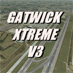
London Gatwick Airport (IATA: LGW, ICAO: EGKK). Extremely accurate scenery for the worlds busiest single runway airport. Includes night lighting, large amount of animation vehicles, replacement AFCAD file. All textures made to the highest standard based on actual photographs.
DEMO FILE, fully functional but has 'demo signs' - Full price is GBP16.49
| Filename: | Gatwick_Xtreme_V3_Demo.zip |
| License: | Commercial demo |
| Added: | 11th February 2011, 14:54:26 |
| Downloads: | 2,485 |
| Author: | Gary Summons, UK2000 scenery |
| Size: | 77.3 MB |
| Category: Flight Simulator X - Utilities | |
| Gauge Face Creator V3 |
|
Images related to this file:
File Description:
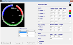
Application to create bitmaps for gauges. Version 3 now incorporates coloured arcs and non-linear scales. (There was no Version 2) Applicable to both FSX and FS9
| Filename: | Gauge_Face_Creator_V3.zip |
| License: | Freeware |
| Added: | 30th November 2011, 02:00:03 |
| Downloads: | 809 |
| Author: | Gerry Howard |
| Size: | 252.97 KB |
| Category: Flight Simulator X - Scenery | |
| Beja Air Base, V3 |
|
File Description:
Beja Air Base, home of the squadrons 103 (with AlphaJets), 601 (with P-3) and 552 (with Alloette III). This scenery was developed in ADE9X (http://www.airportdesigneditor.co.uk/) from the original of FSX with the help of Google Earth.
In V1, all runways and aprons have the right size, were added default FSX buildings and vegetation and also a representation of the "Terminal Civil de Beja". Changes to V2 are the update of taxiways designations, dimensions of some taxiways, vegetation reviewed, the improved look of the "Terminal Civil de Beja", but the most important,
the Control Tower and its outbuildings and Fire Station created by my friend Mario Cera. In V3 the Control Tower and its outbuildings and Fire Station by Mario Cera have now more details and more textures. If you have V1 or V2 please replace them with new V3.
| Filename: | Beja_Air_Base_V3.zip |
| License: | Freeware |
| Added: | 16th February 2012, 13:55:56 |
| Downloads: | 3,526 |
| Author: | Jorge Ferreira, Mario Cera |
| Size: | 41.51 MB |
| Category: Flight Simulator X - Scenery | |
| LSZS - Samedan, Switzerland V3 |
|
Images related to this file:
File Description:
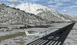
Version 3 of vf-air Samedan LSZS Engadin airport, the highest elevation airport of Europe at 5,600ft near St. Moritz Switzerland. Update to this scenery from previous version includes removal of auto refuel trigger, missing critical steep PAPI lights, parking locations to cooperate properly with GSX for aircraft up to B737-700 like the private Boeing BBJ aircraft that visit Samedan, fix to wrong taxiway night lighting and windsocks. Update is by permission of Guy Nemoz of vf-air.com
| Filename: | LSZS__Samedan_Switzerland_V3.zip |
| License: | Freeware, limited distribution |
| Added: | 5th February 2014, 09:39:17 |
| Downloads: | 7,271 |
| Author: | Kyprianos Biris - Guy Nemoz |
| Size: | 4.8 MB |
| Category: Flight Simulator X - Gauges | |
| Inertial Navigation System V3 |
|
Images related to this file:
File Description:
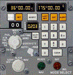
An Inertial Navigation System for FS2004 and FSX. Especially designed for classic airliners, but will work in most aircraft. Allows automatic entry of FS2004 and FSX plans. Easy to use. Stores up to 99 waypoints. Waypoints are saved to a data file which is then loaded by the gauge. Follows flight plans faithfully on autopilot. Has great accuracy. Alignment unit included. Full instructions. Simplified installation.
| Filename: | Inertial_Navigation_System_V3.zip |
| License: | Freeware, limited distribution |
| Added: | 18th September 2014, 16:55:23 |
| Downloads: | 1,082 |
| Author: | Julian Avisenis |
| Size: | 807.6 KB |
| Category: Flight Simulator X - Aircraft Repaints, Textures and Modifications | |
| Cessna 152II (N704PT) v3 |
|
Images related to this file:
File Description:
Repaint textures for the payware Carenado Cessna 152II for FSX showing a
variation of real world N704PT, seen over the years in various paint configurations,
this one having a white nosewheel fairing and a blue solid stripe
on the rudder. Repaint by Tom Tiedman
| Filename: | Cessna_152II_N704PT_v3.zip |
| License: | Freeware |
| Added: | 17th April 2015, 07:27:33 |
| Downloads: | 38 |
| Author: | Tom Tiedman / Carenado |
| Size: | 24.41 MB |
| Category: Flight Simulator X - AI Aircraft | |
| Piper PA31 Chieftain V3 |
|
Images related to this file:
File Description:
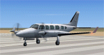
This is version 3 of the FSDS AI PA31 Chieftain for FSX. After some repaints were released on another website, it was apparent that there were a couple of voids in the Spinner Hub textures. This model fixes that, see the readme for more information. Thanks to everyone for downloading my AI models. Includes new model, readjusted textures and paint kit.
| Filename: | Piper_PA31_Chieftain_V3.zip |
| License: | Freeware |
| Added: | 9th June 2017, 21:05:05 |
| Downloads: | 3,494 |
| Author: | Todd Bolgrin |
| Size: | 2.57 MB |
| Category: Flight Simulator X - Scenery | |
| USA East 10 metre mesh, Batch 4, Part 3 of 9 |
|
File Description:
USA EAST USGS 10 metre mesh terrain - FSX only, includes: IA, MN, WI, IL, IN, MI, OH, PA, NY, VT, NH, ME, MA, CT, RI. Part 3 of 9!
This constitutes 10 metre terrain mesh for a section of the USA, The whole USA East mesh files will abutt the US West Coast 10m mesh already available elsewhere, that was made by: Raimondo Taburet. Make sure you have your scenery terrain settings at about 5 metres in the FSX display dialogue for the mesh to show properly!
| Filename: | USA_East_10_metre_mesh_Batch_4_Part_3_of_9.zip |
| License: | Freeware |
| Added: | 11th May 2009, 10:11:50 |
| Downloads: | 1,065 |
| Author: | Wayne Evans |
| Size: | 29.25 MB |
| Category: Flight Simulator X - Scenery | |
| USA East 10 metre mesh, Batch 4, Part 5 of 9 |
|
File Description:
USA EAST USGS 10 metre mesh terrain - FSX only, includes: IA, MN, WI, IL, IN, MI, OH, PA, NY, VT, NH, ME, MA, CT, RI. Part 5 of 9!
This constitutes 10 metre terrain mesh for a section of the USA, The whole USA East mesh files will abutt the US West Coast 10m mesh already available elsewhere, that was made by: Raimondo Taburet. Make sure you have your scenery terrain settings at about 5 metres in the FSX display dialogue for the mesh to show properly!
| Filename: | USA_East_10_metre_mesh_Batch_4_Part_5_of_9.zip |
| License: | Freeware |
| Added: | 11th May 2009, 10:14:06 |
| Downloads: | 613 |
| Author: | Wayne Evans |
| Size: | 33.15 MB |
| Category: Flight Simulator X - Scenery | |
| USA East 10 metre mesh, Batch 4, Part 9 of 9 |
|
File Description:
USA EAST USGS 10 metre mesh terrain - FSX only, includes: IA, MN, WI, IL, IN, MI, OH, PA, NY, VT, NH, ME, MA, CT, RI. Part 9 of 9!
This constitutes 10 metre terrain mesh for a section of the USA, The whole USA East mesh files will abutt the US West Coast 10m mesh already available elsewhere, that was made by: Raimondo Taburet. Make sure you have your scenery terrain settings at about 5 metres in the FSX display dialogue for the mesh to show properly!
| Filename: | USA_East_10_metre_mesh_Batch_4_Part_9_of_9.zip |
| License: | Freeware |
| Added: | 11th May 2009, 10:18:22 |
| Downloads: | 1,021 |
| Author: | Wayne Evans |
| Size: | 28.84 MB |


© 2001-2026 AVSIM Online
All Rights Reserved
Privacy Policy |