
Where Flight Simulation Enthusiasts Gather from Around the World!
AVSIM Library - Search Results

| Category: Flight Simulator X - Scenery | |
| Watsonville Municipal Airport (KWVI) |

|
File Description:
This is a scenery update for Watsonville Municipal Airport in Watsonville, California. Taxiways, runways, building positions, and other aspects were updated using satellite images from Google Earth for accuracy. Many default scenery objects from the FSX libraries were used. View Readme file for installation and notes. Compiled using Airport Design Editor.
| Filename: | Watsonville_Municipal_Airport_KWVI.zip |
| License: | Freeware |
| Added: | 17th October 2008, 09:52:09 |
| Downloads: | 901 |
| Author: | Phillip Coyle |
| Size: | 236.53 KB |
| Category: Flight Simulator X - Aircraft Repaints, Textures and Modifications | |
| Myanmar Airways International Airbus A380-800 Update v3 |
|
File Description:
After the installation this update now works also the analogous instruments, the aircraft look level when cruising at altitude, the induced_drag_scalar is corrected and it is available some camera-positions. You need the original mai388x.zip file to use with this.
| Filename: | Myanmar_Airways_International_Airbus_A380800_Updat.zip |
| License: | Freeware, limited distribution |
| Added: | 5th April 2007, 20:48:07 |
| Downloads: | 498 |
| Author: | HOUSE-RP, Robby Pauletto |
| Size: | 16.55 KB |
| Category: Flight Simulator X - Scenery | |
| Chubu Centrair International Airport (RJGG), Japan |
|
File Description:
Chubu Centrair International Airport (IATA: NGO, ICAO: RJGG) is an airport on an artificial island in Ise Bay, 22 miles south of Nagoya in central Japan.
Chubu is Japan's third off-shore airport, after Nagasaki Airport and Kansai International Airport, and is also the second airport built in Japan on a man-made island.
| Filename: | Chubu_Centrair_International_Airport__RJGG_Japan.zip |
| License: | Freeware |
| Added: | 15th November 2011, 02:24:07 |
| Downloads: | 958 |
| Author: | Morten Thomas van der Linden |
| Size: | 29.15 MB |
| Category: Flight Simulator X - Aircraft Repaints, Textures and Modifications | |
| Southwest Airlines 'California One' Boeing 737-700 (N943WN) |
|
File Description:
Southwest Airlines California one for the NGX
| Filename: | Southwest_Airlines_California_One_Boeing_737700_N9.zip |
| License: | Freeware |
| Added: | 28th January 2018, 01:02:56 |
| Downloads: | 269 |
| Author: | Sean Wheelington & Sionne Taylor |
| Size: | 29.96 MB |
| Category: Flight Simulator X - Scenery | |
| Nnamdi Azikiwe Intl Airport Abuja-DNAA |
|
File Description:
Nnamdi Azikiwe International Airport (IATA: ABV, ICAO: DNAA) is an international airport serving Abuja, in the Federal Capital Territory of Nigeria. It is the main airport serving the Nigerian capital city and was named after Nigeria's first President, Nnamdi Azikiwe. The airport is approximately 20 kilometres (12 mi) west of Abuja, and has an international and a domestic terminal that share its single runway.
| Filename: | Nnamdi_Azikiwe_Intl_Airport_AbujaDNAA.zip |
| License: | Freeware |
| Added: | 8th February 2018, 02:54:32 |
| Downloads: | 2,650 |
| Author: | Raheem Adeleke |
| Size: | 45.6 MB |
| Category: Flight Simulator X - AFCAD Files | |
| KEZF Shannon Airport, Fredericksburg - Virginia, USA |
|
File Description:
This is an uncontrolled airport in Fredericksburg, VA. Created with Airport Design Editor by ScruffyDuck Software using current FAA documentation and Google Earth measurements, this package offers a replacement for FSX's stock airport. All these enhancements are as close to the real airport as I can get with stock library objects.
| Filename: | KEZF_Shannon_Airport_Fredericksburg__Virginia_USA.zip |
| License: | Freeware |
| Added: | 19th October 2012, 18:08:50 |
| Downloads: | 239 |
| Author: | Wayne Roberts |
| Size: | 6.66 KB |
| Category: Flight Simulator X - AFCAD Files | |
| KDAN - Danville Regional Airport - Virginia - USA |
|
File Description:
All changes made were based on overhead photos of airport and information from the Internet. Changed location and added aprons.
Taxiway was adjusted and lights added. Custom buildings were added.
| Filename: | KDAN__Danville_Regional_Airport__Virginia__USA.zip |
| License: | Freeware |
| Added: | 14th March 2013, 23:41:23 |
| Downloads: | 249 |
| Author: | Wayne Roberts |
| Size: | 612.7 KB |
| Category: Flight Simulator X - AFCAD Files | |
| PAKT - Ketchikan airport - Ketchikan, Alaska - USA |
|
Images related to this file:
File Description:
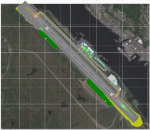
This AFCAD requires payware "Ultimate Terrain Alaska X"!! It will not work without it as it is built on the underlying terrain features and the included file "PAKT_AP.BGL" which has to be renamed or moved to a folder outside the FSX terrain environment. The original file included some errors which I tried to correct. This patch is published with permission.
Changes: The apron layout is corrected including now taxiway "C" leading to GA parking. The pavement has been changed to asphalt as it appears to be when taking aerial pictures as template. The runway got the proper overruns at both sides and the position of the ILS glideslope and localizer has been corrected as well as the DME. The layout of the airport building arrangement including the tower should be now closer to the real world and I added a working jetway. However, I used FSX default objects. As I was dependent on quite rare layout information I just tried to adjust the taxi paths and parking spots probably closer to the reality than before but I did not put any effort to name the parking spots like in real life nor did I take care for taxi signs (only the runway entries got such).
| Filename: | PAKT__Ketchikan_airport__Ketchikan_Alaska__USA.zip |
| License: | Check within download |
| Added: | 25th May 2013, 19:40:38 |
| Downloads: | 442 |
| Author: | Axel Birsul |
| Size: | 1.28 MB |
| Category: Flight Simulator X - AFCAD Files | |
| PAPK - Napaskiak Airport - Napaskiak, Alaska - USA |
|
File Description:
Napaskiak Airport (IATA: PKA, ICAO: PAPK, FAA LID: PKA) is a state-owned, public-use airport located one nautical mile (1.85 km) southwest of the central business district of Napaskiak, a city in the Bethel Census Area of the U.S. state of Alaska.
Changes were made based on 2011 construction plans and photos. Parking area and buildings were changed.
| Filename: | PAPK__Napaskiak_Airport__Napaskiak_Alaska__USA.zip |
| License: | Freeware |
| Added: | 25th May 2013, 21:31:43 |
| Downloads: | 255 |
| Author: | Wayne Roberts |
| Size: | 3.16 KB |
| Category: Flight Simulator X - Scenery | |
| PACD - Cold Bay Airport - Alaska, USA |
|
File Description:
Cold Bay Airport (IATA: CDB, ICAO: PACD, FAA LID: CDB) is a state owned, public use airport located in Cold Bay,a city in the Aleutians East Borough of the U.S. state of Alaska. First built as a United States Army Air Forces airfield during World War II, it is one of the main airports serving the Alaska Peninsula.
There is a National Weather Service (NWS) office (which sends up radiosonde balloons twice a day) colocated with the FAA Flight Service Station at the airport. The NWS ranks Cold Bay as the cloudiest city in the United States.
Changes were made based on 2011 construction plans and photos taken in 2013. Custom buildings were made for all services at the airport.
| Filename: | PACD__Cold_Bay_Airport__Alaska_USA.zip |
| License: | Freeware |
| Added: | 24th July 2013, 00:34:15 |
| Downloads: | 2,536 |
| Author: | Wayne Roberts |
| Size: | 5.53 MB |


© 2001-2026 AVSIM Online
All Rights Reserved
Privacy Policy |