
Where Flight Simulation Enthusiasts Gather from Around the World!
AVSIM Library - Search Results

| Category: Flight Simulator X - Gauges | |
| DC3 Engine Panel for FIP v2 |

|
Images related to this file:
File Description:
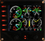
For Saitek Pro Flight Instrument Panel. This folder contains a second version of the engine panel, digital type, for the DC3. After some comments I added a tail wheel warning light which light up in blue when the tail wheel is unlocked. If you already use the DC3 FIP, I recommend to overwrite the previous needles by those coming with this version and which are updated. The package includes a serie of coloured needles that can be changed easily, just replace the default needle by the one of your choice.
DC3_engine_v2.xml provides: Manifold pressure, Exhaust Gas Temperature, Fuel flow, Oil temperature, Oil pressure, Propeller RPM, Fuel quantity for the left, right and center tanks, Flaps position needle, trims for Pitch, Rudder and Aileron, Gears down green light and Gears in transit red light and tail wheel warning light.
.
| Filename: | DC3_Engine_Panel_for_FIP_v2.zip |
| License: | Freeware |
| Added: | 31st March 2012, 16:22:06 |
| Downloads: | 296 |
| Author: | Philippe Verhaege |
| Size: | 836.37 KB |
| Category: Flight Simulator X - Utilities | |
| FS Earth 5.1 for Google Earth and FSX |
|
File Description:
This program acts as an interface link between Flight Simulator X and Google Earth, letting to follow a flight in real time, over the satellite images generated by Google Earth. Flights can be saved, and many options are available for fine tuning the performance, as well as the map's style (zoom, tilt, orientation). Works on a single computer running FSX and Google Earth all together or, for best experience, can be used on two networked computers running respectively FSX (master) and Google Earth (slave). AI and Multiplayer traffic is also displayed in Google Earth, with course prediction and other information. Requires Flight Simulator X and Google Earth. The program running in trial mode works only around Anchorage, Alaska, (PANC / ANC) for a maximum of five minutes per flight session. Version 5.1 has much improved smoothness. A version for FS2004 is available also.
| Filename: | FS_Earth_51_for_Google_Earth_and_FSX.zip |
| License: | Shareware, time limited |
| Added: | 12th November 2007, 23:08:31 |
| Downloads: | 1,587 |
| Author: | Luciano Napolitano |
| Size: | 2.44 MB |
| Category: Flight Simulator X - AFCAD Files | |
| V2 Christchurch Intl - NZCH - New Zealand |
|
File Description:
ADE Home Edition (Freeware) was used to design these BGL files: This is an update of my previous version, my previous version not required, these 2 files are only for the FSX default airport: one with the Xwind rwy 11/29 activated where both rwy's will now be used for takeoff/landing and one as default: all taxiways now updated to the Nov 07 AIP NZ ground movement charts, all taxisigns changed to match the taxiways with missing taxisigns added, assigned parking with extra parking, and for the Canterbury Aero Club the grass rwy 2L/20R is now open and start locations added, support vehicle roads rebuilt, extra fuel trucks and several other improvements, airport views are from the roof of control tower (when in tower view) fully tested with Ultimate Traffic/WOAI but not required, please view the readme before installation
| Filename: | V2_Christchurch_Intl__NZCH__New_Zealand.zip |
| License: | Freeware |
| Added: | 13th December 2007, 08:34:27 |
| Downloads: | 2,405 |
| Author: | Ray Smith |
| Size: | 17.1 KB |
| Category: Flight Simulator X - Scenery | |
| KCHO - Charlottesville-Albemarle Airport - Virginia, USA - BETA |
|
Images related to this file:
File Description:
FSX Scenery--Charlottesville-Albemarle Airport, VA. Beta Ver. Located in Albemarle County, Virginia, the Charlottesville-Albemarle Airport (KCHO) is a regional airport served regularly by American Eagle, Delta, United, and U.S. Airways. The airport also is home of Pegasus, an extension of the Department of Emergency Medicine at the University of Virginia Health System. General Aviation services are handled by Landmark Aviation, while aircraft charter is provided by the Meridian Air Group.
----------------
This 'beta' version of CHO is being released early to provide a destination for the upcoming 'Tom Allensworth Memorial Flight'. As such there are many unfinished features, additions and textures I had hoped to include. It is a Work In Progress. Please see the 'readme' for additional generic and freeware scenery .bgls needed. The finished version will include more accurate terminal, tower/firehouse, and FBO.
| Filename: | KCHO__CharlottesvilleAlbemarle_Airport__Virginia_U.zip |
| License: | Freeware |
| Added: | 27th April 2015, 13:00:48 |
| Downloads: | 906 |
| Author: | Joe Bowers |
| Size: | 9.62 MB |
| Category: Flight Simulator X - Gauges | |
| Multiple Moving Map Gauge |
|
Images related to this file:
File Description:
This Multiple Moving Map ( MMMap) provides a excellent and generic orientation and navigation gauge for any aircraft in FSX. The gauge will be implemented as a separate window in the panel.cfg ( for installation see pdf doc in this ZIP file).
The gauge allows the user to select different terrain presentations e.g. desert areas on the globe ( north of Africa for example ), or areas in the north of Europe/America .
In addition, the user can select a camera lookalike view. This is a dedicated view which allows the user to have a top view from the aircraft to the real FSX terrain.
Control buttons are available to insert into the map displays for airports, flight plans,VOR etc.. The gauge includes a commercial version ( MMMap_Com) and a military version (MMMap_mil). The difference is the gauge body only.
| Filename: | Multiple_Moving_Map_Gauge.zip |
| License: | Freeware |
| Added: | 18th December 2009, 23:34:50 |
| Downloads: | 2,508 |
| Author: | Dietmar Loleit |
| Size: | 2.36 MB |
| Category: Flight Simulator X - Scenery | |
| KICT - Wichita National Airport - Kansas, USA |
|
Images related to this file:
File Description:
This airport update is for Wichita Dwight D. Eisenhower National Airport with two optional files made only for FSX: There is one version with the Crosswind runway 14/32 activated where all 3 runways will be used for takeoff/landing and one version as the default runway operation: The New Terminal/Concourse which opened on June 3, 2015 now included, the new terminal has one concourse with 12 gates, the old terminal demolished to make room for gates 10, 11 and 12, assigned parking as per their website with extra parking, the cargo ramp and buildings updated, taxiways and taxi signs updated to the latest charts, extra fuel trucks, support vehicle roads rebuilt and many other scenery improvements, airport views are from the roof of the control tower (when in tower view) please view the readme before installation.
| Filename: | KICT__Wichita_National_Airport__Kansas_USA.zip |
| License: | Freeware, limited distribution |
| Added: | 2nd November 2015, 14:31:56 |
| Downloads: | 13,304 |
| Author: | Craig Scott |
| Size: | 1.93 MB |
| Category: Flight Simulator X - Scenery | |
| Calgary Intl Airport (CYYC) Alberta, Canada with new Terminal |
|
Images related to this file:
File Description:
This scenery is for CYYC with two optional files and made only for FSX: one version with the Crosswind runways operating where all 4 runways will be used for takeoff and landing and one version as the default airport runway operation: assigned parking as per their website with extra parking, the new international terminal added, concourse D and Concourse E, a new midfield control tower, Sunwest Aviation has now moved to its new location with its buildings and hangar also included, i have also coded the parking spots for Sunwest for those using their flight plans, taxiways and taxi signs updated to the latest charts, lighted helipad, extra fuel trucks, support vehicle roads rebuilt and many other scenery improvements and objects added, airport views are from the roof of the new control tower (when in tower view), please view the readme before installation.
| Filename: | Calgary_Intl_Airport_CYYC_Alberta_Canada_with_new_.zip |
| License: | Freeware, limited distribution |
| Added: | 12th November 2016, 18:56:35 |
| Downloads: | 42,373 |
| Author: | Ray Smith |
| Size: | 2.7 MB |
| Category: Flight Simulator X - Scenery | |
| CYYJ (2017) for FS9, FSX and P3D |
|
Images related to this file:
File Description:

CYYJ (2017), Version 7, is a major upgrade to CYYJ (2014). It portrays the Victoria (British Columbia, Canada) International Airport (CYYJ), aviation museum, Pat Bay floatplane base (CAP5) and Coast Guard station, and nearby industrial park as they appeared in early 2017 - as well as a host of static aircraft. It is fully compatible with Victoria+ (both FS2004 And FSX versions), Ultimate Terrain Canada/Alaska for FS2004 and Ultimate Terrain X - Canada for FSX, ORBX's FTX NA Blue and other FS9 road and shoreline upgrades for the area. CYYJ (2017) includes aircraft and traffic files for a realistic AI scenario other than scheduled airline operations. (Use BC Regional AI - also available from this file library - for scheduled traffic).
Version 7 adds all the recent major new construction and apron expansion at CYYJ, and includes a greater level of detail in many areas.
| Filename: | CYYJ_2017__for_FS9_FSX_and_P3D.zip |
| License: | Freeware, limited distribution |
| Added: | 24th May 2017, 18:30:48 |
| Downloads: | 5,989 |
| Author: | Don Grovestine |
| Size: | 118.7 MB |
| Category: Flight Simulator X - Panels | |
| Boeing 767 |
|
File Description:
FSX Boeing B767 Panel. This comes from an old FS98 panel by Eric Ernst which is one of the best jobs I have seen, even better than many so-called "realistic" panels for later FS releases. Since I greatly missed this panel, then I have reworked it for FSX. All gauges react to panel lights and avionics buses, making it great to flight at night. Also features no-smoking/fasten-seat belts signs, plus tape sliding radar altimeter, regulable seat position and animated yoke. Last but not least, I have included the whole gauges source code under GPL (gauge programmers will love this!). Gauges programmed with an eye towards frame rate. This new version features reworked HSI (arc/rose), reworked autobrake and gauge switches sound. By Alessandro Antonini, author of Super Flight Planner. Older FS2004 version is still available on avsim.com and cpinf.com
| Filename: | Boeing_767.zip |
| License: | Freeware |
| Added: | 9th September 2007, 19:06:47 |
| Downloads: | 19,083 |
| Author: | Alessandro Antonini |
| Size: | 1.02 MB |
| Category: Flight Simulator X - Scenery | |
| KPHL - Philadelphia Intl - Pennsylvania, USA |
|
Images related to this file:
File Description:
This is an accurate and up-to-date version of Philadelphia Intl Airport with two optional files and made only for FSX, do not use in P3D: There is one version with the Crosswind runway 17/35 activated where all 4 runways will be used for takeoff/landing and one file as the default airport runway operation: assigned parking as per their website with extra parking, extra fuel trucks, runway 9R/27L now at its new length, taxiways and taxi signs updated to the latest charts where possible as there is still construction going on by 27L, the Fedex and UPS cargo ramps and buildings replaced, support vehicle roads rebuilt and many other scenery improvements and objects added, airport views are from the roof of the control tower (when in tower view) please view the readme before installation.
| Filename: | KPHL__Philadelphia_Intl__Pennsylvania_USA.zip |
| License: | Freeware, limited distribution |
| Added: | 27th June 2018, 23:37:27 |
| Downloads: | 42,320 |
| Author: | Ray Smith |
| Size: | 6.85 MB |


© 2001-2026 AVSIM Online
All Rights Reserved
Privacy Policy |