
Where Flight Simulation Enthusiasts Gather from Around the World!
AVSIM Library - Search Results

| Category: Flight Simulator X - AI Aircraft | |
| Sky Mali Boeing 737-500 |

|
Images related to this file:
File Description:
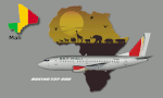
Repaint of Sky Mali Boeing B737-500. There are 2 separate texture for FSX and FS9. To be used with The FAIB_B737-500_L model available separately. This is an AI only aircraft.
Sky Mali is a proposed West African carrier to be based at Bamako Senou International Airport. The start-up plans to operate domestic services to destinations including Kayes, Mopti, Gao and Timbuktu in the near future, followed by the launch of international services to destinations in Africa. Sky Mali took delivery of a Boeing 737-500 (TZ-SMA, MSN 25418), on 24-Mar-2020. The charter carrier plans to launch services in 2020.
Sky Mali received an air operations licence on 22-Jul-2020. The airline is now authorised to commence commercial operations. The carrier intends to operate from Bamako to Kayes, Gao, Mopti and Timbuktu. By Kamil Fryzol.
| Filename: | Sky_Mali_Boeing_737500.zip |
| License: | Freeware |
| Added: | 23rd August 2020, 19:20:29 |
| Downloads: | 253 |
| Author: | Kamil Fryzol |
| Size: | 2.13 MB |
| Category: Flight Simulator X - AFCAD Files | |
| Philippine Domestic Airport AFCAD Package |
|
File Description:
This is package includes nearly every international, class 1, and class 2 domestic airports (that have not been made in FSX) in the Philippines (36 altogether). Changes include:
-Changed runway surfaces, lengths, widths, markings, blastpads, overpads etc.
-Added many gates/parking spots for AI traffic
-Added many buildings/terminals/control towers
-Added many new taxiways
-Added many new aprons
All changes are based of the latest google earth imagery and google image photos to make it look more like the actual airport.
These airports are mostly served by PALex, Philippine Airlines, Cebpac, Air Asia Phili, Air Asia Zest, and Skyjet.
I hope this makes your domestic flying experience in FSX better eliminating many runway only airports. A full list of Airports is located at the "Airports.txt" inside this file.
| Filename: | Philippine_Domestic_Airport_AFCAD_Package.zip |
| License: | Freeware |
| Added: | 27th March 2015, 21:22:26 |
| Downloads: | 703 |
| Author: | Ryan Gonz |
| Size: | 67.35 KB |
| Category: Flight Simulator X - Scenery | |
| KCLL Easterwood Airport College Station Texas USA |
|
Images related to this file:
File Description:
Easterwood College Station Texas Airport for FSX. Several improvements have been made to the default airport. The default terminal building has been replaced with one created in FSDS; aircraft gates have been correctly coded using Airport Design Editor 1.70.6042; a new airport vehicle network has been built to prevent airport vehicles from entering the taxiways; extra fuel trucks have been added throughout the airport; the tower view has been changed to display from the roof of the control tower; all taxiway signs are correctly placed and all taxiway designators are correctly named; there is the option to open all runways to AI traffic; optionally, a set of GA flight plans is included using all default FSX aircraft to liven up the GA area; and Jim Dhaenen's excellent ramp lights are also included. Please refer to the README.txt file to insure proper installation of all files.
| Filename: | KCLL_Easterwood_Airport_College_Station_Texas_USA.zip |
| License: | Freeware, limited distribution |
| Added: | 25th November 2017, 16:08:22 |
| Downloads: | 443 |
| Author: | Patrick Finch |
| Size: | 1.09 MB |
| Category: Flight Simulator X - Utilities | |
| FS Earth 5.2 for Google Earth and FSX |
|
Images related to this file:
File Description:
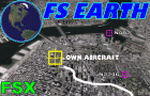
This program acts as a link between Flight Simulator X and Google Earth, letting to follow a flight in real time, over the satellite images generated by Google Earth. Flights can be saved, and many options are available for fine tuning the performance, as well as the map's style (zoom, tilt, orientation). Works on a single computer running FSX and Google Earth all together or, for best experience, can be used on two networked computers running respectively FSX (master) and Google Earth (slave). AI and Multiplayer traffic is also displayed in Google Earth, with course prediction and other information. Requires Flight Simulator X and Google Earth. The program running in trial mode works only around Anchorage, Alaska, (PANC / ANC) for a maximum of five minutes per flight session. Version 5.2 has new aircraft icons & labels and improves the compatibility with Windows Vista. A version for FS2004 is available also.
| Filename: | FS_Earth_52_for_Google_Earth_and_FSX.zip |
| License: | Shareware, time limited |
| Added: | 3rd May 2010, 07:38:23 |
| Downloads: | 2,701 |
| Author: | Luciano Napolitano |
| Size: | 3.46 MB |
| Category: Flight Simulator X - Utilities | |
| FS Earth 4.2 for Google Earth |
|
File Description:
This program acts as an interface between Flight Simulator X and Google Earth, letting to follow a flight in real time, over the satellite images generated by Google Earth. Flights can be saved, and many options are available for fine tuning the performance, as well as the map's style (zoom, tilt, orientation). Works on a single computer running FSX and Google Earth all together or, for best experience, can be used on two networked computers running respectively FSX (master) and Google Earth (slave). AI and Multiplayer traffic is also displayed in Google Earth, with course prediction and other information. Requires Flight Simulator X and Google Earth. The program running in trial mode works only around Anchorage, Alaska, (PANC / ANC) for a maximum of five minutes per flight session. Version 4.2 has improved compatibility with Windows Vista and minor bug fixes. A version for FS2004 is available also. By Luciano Napolitano.
| Filename: | FS_Earth_42_for_Google_Earth.zip |
| License: | Shareware, time limited |
| Added: | 9th March 2007, 13:39:05 |
| Downloads: | 2,213 |
| Author: | Luciano Napolitano |
| Size: | 2.44 MB |
| Category: Flight Simulator X - Utilities | |
| FS Earth 5.0 for Google Earth |
|
File Description:
This program acts as an interface between Flight Simulator X and Google Earth, letting to follow a flight in real time, over the satellite images generated by Google Earth. Flights can be saved, and many options are available for fine tuning the performance, as well as the map's style (zoom, tilt, orientation). Works on a single computer running FSX and Google Earth all together or, for best experience, can be used on two networked computers running respectively FSX (master) and Google Earth (slave). AI and Multiplayer traffic is also displayed in Google Earth, with course prediction and other information. Requires Flight Simulator X and Google Earth. The program running in trial mode works only around Anchorage, Alaska, (PANC / ANC) for a maximum of five minutes per flight session. Version 5.0 has improved compatibility with latest releases of Google Earth and several additional improvements. A version for FS2004 is available also.
| Filename: | FS_Earth_50_for_Google_Earth.zip |
| License: | Shareware, time limited |
| Added: | 19th July 2007, 00:46:27 |
| Downloads: | 1,104 |
| Author: | Luciano Napolitano |
| Size: | 2.44 MB |
| Category: Flight Simulator X - AFCAD Files | |
| MMSD - Los Cabos Intl |
|
File Description:
This afcad file is for MMSD - San Jose Del Cabo, better known as Cabo San Lucas. The default afcad was too small for the substantial scheduled traffic in and out of this airport. The following work has been done:
1. Apron (tarmac) enlarged.
2. Airport vehicle routes added.
3. Perimeter fence realigned. It now meets at the terminal buildings instead of going around them.
4. Incongrous heavy maintenance hanger removed and replaced by generic terminal building. There has been no attempt at any realistic reproduction.
5. Fuel pumps and fuel parking space has been removed.
Because MMSD is a small airport without jetways, there are no gate assignments for airlines. The airport still looks bleak without any surrounding buildings or roads, but should have enough space so that AI scheduled aircraft can park up to the B752 for US Airways. There is also a cargo space and three ramp GA spaces.
| Filename: | MMSD__Los_Cabos_Intl.zip |
| License: | Freeware |
| Added: | 6th July 2007, 15:11:06 |
| Downloads: | 927 |
| Author: | Eric G Hansen |
| Size: | 3.62 KB |
| Category: Flight Simulator X - AI Aircraft | |
| EGO Airways Embraer EMB-190 |
|
Images related to this file:
File Description:

Repaint of EGO Airways Embraer EMB-195. There are 2 separate texture for FSX and FS9. To be used with The AIA_EMB_190 model available separately. This is an AI only aircraft. EGO Airways is a proposed charter carrier to be based in Milan. The carrier plans to operate services with Embraer E170/E190 aircraft. EGO Airways is a public company. In Nov-2020, EGO Airways received its own AOC from ENAC with plans to launch operations from Milan Malpensa Airport in 2021.
In Jan-2021, EGO Airways opened reservations for the launch of operations in spring 2021. The start-up's fleet will originally be composed of two Embraer E190 equipment based at Forli Luigi Ridolfi Airport and Catania Fontanarossa Airport. It will look to develop a point-to-point network across strategic cities in Italy and strengthening feeder services to/from Milan Malpensa Airport. By Kamil Fryzol
| Filename: | EGO_Airways_Embraer_EMB190.zip |
| License: | Freeware |
| Added: | 10th January 2021, 21:39:32 |
| Downloads: | 438 |
| Author: | Kamil Fryzol |
| Size: | 3.41 MB |
| Category: Flight Simulator X - Scenery | |
| PABT PATA UTO 6A8 (Alaska) Upgrades |
|
Images related to this file:
File Description:
This scenery upgrades PABT, PATA, UTO and 6A8 in Alaska. Upgrades include taxiways, hangers, airport buildings, aircraft and ground vehicles, helipads and other objects. It also updates the 2 water runways at PABT as start points which in FSX they aren't start points. The water runway area is updated with marina objects, a float plane dock, float plane support shops and buildings and a private residence with a private dock for boats and float planes. The helipads were an addition because I use Flight 1's heli-traffic and have helo traffic flying back and forth. Future upgrades to several of the small airports in the area will include AI helo and bush plane traffic. Read the text file for info and installation instructions. 4 pictures are included of each airports upgrades. Please enjoy these upgrades and check the Avsim library for future upgrades coming soon. Savageagle.
| Filename: | PABT__PATA__UTO__6A8__Alaska__Upgrades.zip |
| License: | Freeware |
| Added: | 17th November 2011, 07:57:51 |
| Downloads: | 1,628 |
| Author: | Tim Durham |
| Size: | 835.17 KB |
| Category: Flight Simulator X - Gauges | |
| TCAS and Radar for Flight Instrument Panels FS9 Compatible |
|
Images related to this file:
File Description:

TCAS (traffic collision avoidance system) shows aircraft in the vicinity of
your own aircraft and warns when other aircraft are in close proximity or when
they their projected paths cross your path within 40 seconds.
TCAS features:
- It shows AI (artificial intelligence) aircraft
- It shows IVAO and VATSIM traffic when connected to IVAO or VATSIM networks
- It shows traffic on all altitudes
- It shows relative altitude and climbing/descending indication
- It shows intruders and gives proximity alerts (traffic advisories, TA)
- It shows traffic on the ground
- It does not give resolution advisories (RA)
- It shows the callsigns of the 9 aircraft closest to your aircraft
- Range is adjustable from 2 to 40 nm
- Display can be dimmed
- Take a screenshot anytime
(due to the size limit, the thumbnail picture looks a bit blurred. In the zip file, a screenshot of actual resolution (320x240) is included.
| Filename: | TCAS_and_Radar_for_Flight_Instrument_Panels_FS9_Co.zip |
| License: | Freeware |
| Added: | 5th July 2011, 04:09:05 |
| Downloads: | 2,396 |
| Author: | Emile van Gerwen |
| Size: | 69.8 KB |


© 2001-2026 AVSIM Online
All Rights Reserved
Privacy Policy |