
Where Flight Simulation Enthusiasts Gather from Around the World!
AVSIM Library - Search Results

| Category: Flight Simulator X - Scenery | |
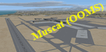
| OOMS - Muscat Intl Airport - Oman |

|
Images related to this file:
File Description:
This airport has been bought up to date and made only for FSX. The airport has now been renamed from Seeb Intl to Muscat Intl. The new midfield terminal added with the new control tower which is expected to be open later this year to complete the first phase, the new runway 8L/26R added with ILS and transitions included, the old runway decommissioned and is now taxiway F, taxiways and taxi signs updated to the latest charts, fuel trucks and support vehicle roads added, new land class for the area around the airport. I have also included Almouj Golf course which was designed by Greg Norman, fire station and many other scenery objects included. Airport views are from inside the new control tower (when in tower view). Please view the readme before installation.
| Filename: | OOMS__Muscat_Intl_Airport__Oman.zip |
| License: | Freeware, limited distribution |
| Added: | 10th May 2016, 10:51:03 |
| Downloads: | 19,898 |
| Author: | Craig Scott |
| Size: | 1.32 MB |
| Category: Flight Simulator X - Scenery | |
| OOMS - Seeb Muscat Int'l Airport 2015 - Oman |
|
Images related to this file:
File Description:
Muscat - Seeb Int'l airport, Oman, serving the the capital of the Sultanate of Oman, is undergoing a major construction of new passenger terminal (North Civilian Apron). The new northern runway (08L/26R) is fully operational with ILS and RNAV, 4000m X 60m.
The current default airport aprons and taxiway remain the same, so simmers could still taxi in and out from the old operational apron to the new runway (A long way though!). An updated version will be pushed once the construction is completed.
Compatible with both FSX and P3D.
| Filename: | OOMS__Seeb_Muscat_Intl_Airport_2015__Oman.zip |
| License: | Freeware, limited distribution |
| Added: | 15th February 2016, 20:23:01 |
| Downloads: | 1,427 |
| Author: | Ahmed Abdessalam |
| Size: | 237.04 KB |
| Category: Flight Simulator X - Scenery | |
| Frankfurt Main Airport v6.1 (EDDF) Scenery Auto Install |
|
Images related to this file:
File Description:

This minor update for Frankfurt-Main Airport supersedes v6.0 and now includes the significant expansion of the area near the site of the new Terminal 3with additional G gates, ramp parking for cargo aircraft, new taxiways S5 and S6, night lighting for the apron, taxiway signs and vehicle roadways. Also included is the soon to be opened A-plus terminal with 7 gates (4xA380) complete with real-world textures and night lighting, a new lighted control tower model plus a whole new set of custom-built Gmax models of airport buildings which help add realism to the airport. Also in this package are the latest airport runways/taxiway designations, ILS frequencies and navaids and airline parking codes as per mid-June 2012. Default FSX scenery is required.
See readme/help file for more details.
| Filename: | Frankfurt_Main_Airport_v61_EDDF_Scenery_Auto_Insta.zip |
| License: | Freeware |
| Added: | 23rd June 2012, 18:54:43 |
| Downloads: | 1,895 |
| Author: | Mark Aldridge |
| Size: | 7.34 MB |
| Category: Flight Simulator X - AFCAD Files | |
| VECC - Netaji Subhash Chandra Bose Intl. - Kolkata, India |
|
Images related to this file:
File Description:
Netaji Subhash Chandra Bose International Airport, Kolkata (ICAO : VECC). This file is targetted for FSX but some reported that this also works with FS9. Though I believe some features can never work on FS9 due to the basic difference in architectures of FS9 and FSX. I do not tested it on FS9 as I don't have FS9 at present.
Features of the file :
1. Latest scenery file (Created in Aug 2013) after complete renovation of the original airport (Finished as on Jan 2013).
2. Scenery file is based on the original airport.
3. Position, orientation is based on google maps image.
4. New Terminal Included. Increased runway length of 01L-19R reflected. New taxiways reflected. ILS for rwy 19R imposed (Freq. 111.300).
5. Use it FREE for personal use. For commercial use, please contact me.
| Filename: | VECC__Netaji_Subhash_Chandra_Bose_Intl__Kolkata_In.zip |
| License: | Freeware |
| Added: | 12th August 2013, 06:50:29 |
| Downloads: | 992 |
| Author: | Anindya Banerjee |
| Size: | 17.25 KB |
| Category: Flight Simulator X - Gauges | |
| GPS2020 – V12.0 |
|
Images related to this file:
File Description:
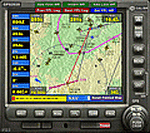
Major upgrade for V10.3, with focus on zooming, Direct-To, inserting waypoints in the flight plan, and User waypoints (waypoints not present in FSX/P3D database).
Key improvements:
- Zooming maps with the mouse wheel now finally like in Google Maps, Google Earth, Bing Maps, Garmin BaseCamp, Little Navmap (FSX utility), etc..
- Direct-To Track Updating: dark red track line continuously follows aircraft movements. For proper operation, the user should install XMLVARS/XMLTools in FSX/P3D (most users will already have done this).
- Visual indication of "Direct-To Active".
- Flight plan: multiple POI's (points clicked on a map) can be inserted in the FPL, they will be named sequentially as TARGET1 to TARGETnnnn.
- Inserting in the flight plan, all sorts of waypoints from all possible sources, can be done with a quicker method with the green buttons alone, without needing to open the Direct-To page.
- Other refinements in code and screen layout since V10.3.
It is recommended to replace V10.3 with this V12.0!
| Filename: | GPS2020__V120.zip |
| License: | Freeware |
| Added: | 29th June 2020, 17:50:18 |
| Downloads: | 560 |
| Author: | Hugo Jansen |
| Size: | 15.7 MB |
| Category: Flight Simulator X - Scenery | |
| RNAS Inskip |
|
File Description:
RNAS Inskip is located a few miles north of a place called Kirkham near Blackpool which is in the county of Lancashire (U.K.). During WWII the Lancashire plain was used extensively for airfields. Most famously, USAAF's BAD2, which General Doolittle labelled
'the world's greatest air depot' was located at Warton, only a few miles south of Inskip. What with RNAS Burscough and RAF Woodvale close by the other side of the river, the skies above the Ribble must have been a dense mass of most of the u.k./u.s.a. aircraft types ever flown during WW2.
Otherwise known as HMS Nightjar (X4IP), it was only open as an active airfield for a few years 1943 - 1946. It was used by the Fleet Air Arm
mainly for Radar Training and bombing practice, but many operational units would disembark from their carriers for upgrades or maintenance during carrier refits. Flying out of Inskip were many FAA types - Fireflies, Swordfish, Ansons, Barracudas, Fulmars, Tarpons (Avengers)
and Martlets (Wildcats).
| Filename: | RNAS_Inskip.zip |
| License: | Freeware |
| Added: | 18th September 2015, 06:01:18 |
| Downloads: | 383 |
| Author: | Ian Robinson |
| Size: | 27.89 MB |
| Category: Flight Simulator X - Scenery | |
| 3N6 - Old Bridge Airport - Old Bridge, NJ |
|
File Description:
Here is an improved version of the stock Old Bridge Airport. This one has a little twist, because located
right next to Old Bridge Airport is Old Bridge Township Raceway Park, sometimes called Englishtown. NHRA
drag racing occurs here on the drag strip including national events. I did the usual upgrade to the airport
with new buildings, fuel depot, static vehicles and planes, etc. Then I went to work on the drag strip. I
added grandstands down both sides, fabricated a Christmas tree, added concession stands, tents and vehicles
in the pit area, cars in the spectator parking area, new buildings, and a building that resembles the tower
and suites located at the starting line.
I've included two scenery files, one for summer with the drag strip active and one for winter with everything
closed up and put away. You should only install ONE of these .bgl files at a time based on the season you're
flying.
| Filename: | 3N6__Old_Bridge_Airport__Old_Bridge_NJ.zip |
| License: | Freeware |
| Added: | 21st November 2008, 01:00:10 |
| Downloads: | 1,095 |
| Author: | Jim Cook |
| Size: | 11.28 KB |
| Category: Flight Simulator X - Utilities | |
| Texture Max Load Editor v1.2.197 |
|
Images related to this file:
File Description:
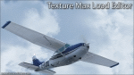
TMLE was designed to make the use of High Definition and Super High Definition textures easier. By default, FSX's maximum texture resolution is set to the 1024x1024 scale. TMLE can modify this to 2048x2048, and even 4096x4096, allowing you to take full advantage of HD textures. TMLE is not available in very many places these days, as the original Frosty Software website is no loner active. One day, a friend asked me if I had the original installer exe. Fortunately, after some searching on my hard drive, I was able to locate it. The idea came to us that it would be cool to make TMLE available to the public again, but not before contacting the original author. I contacted Steve Frost and he was kind enough to grant me permission to upload it. A huge thanks goes out to him for the permission and for developing such a simple, yet useful tool!
| Filename: | Texture_Max_Load_Editor_v12197.zip |
| License: | Freeware |
| Added: | 30th December 2011, 18:18:03 |
| Downloads: | 1,423 |
| Author: | Steve Frost, Brandon Filer |
| Size: | 2.59 MB |
| Category: Flight Simulator X - Scenery | |
| X1BK - RAF Blakehill Farm - Wiltshire, England |
|
File Description:
RAF Blakehill Farm (ICAO X1BK) was an RAF airfield situated in Wiltshire, England. The station was originally allocated to the United States Army Air Forces Ninth Air Force but not used.
It opened in 1944 and was home for transport aircraft of No. 46 Group Transport Command. In 1948 the airfield was a satellite of RAF South Cerney and used by training aircraft before the airfield closed in 1952 and was returned to agricultural use.
After WWII, GCHQ set up an "experimental radio station", a top secret research facility, on the site of the RAF's wartime airfield at Blakehill Farm. It consisted of huge communications masts arranged in mysterious strategic patterns in the middle of the old airfield. The site was still active in some capacity until the mid 1990s and traces of the former antenna bases can still be seen on satellite photographs.
The site is now a Wiltshire Wildlife Trust nature reserve.
| Filename: | X1BK__RAF_Blakehill_Farm__Wiltshire_England.zip |
| License: | Freeware |
| Added: | 18th April 2016, 09:23:07 |
| Downloads: | 162 |
| Author: | Terry Boissel |
| Size: | 2.25 MB |
| Category: Flight Simulator X - Utilities | |
| SimLauncherX v5.9 |
|
Images related to this file:
File Description:
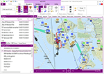
SimLauncherX (or SLX for short) can be used as a launcher application for both FSX:ME, FSX:SE and Prepar3D (v1, v2 and v3). Flights/scenarios can be loaded when launching the simulator or when the simulator is already running. New flights can be created by selecting one of the installed aircraft, selecting the start location (runway or parking position), selecting the type of weather and the time of day. You can also display and create flight plans and attach them to a flight as requested or active flight plan. Version 5.9 adds a flight computer, AI browser, interactive (spoken) checklists, PMDG 737/777 CDUs, approach charts, fleet management and many other improvements. SimLauncherX is a more modern version of my previous SimLauncher application with a lot of additional functionality:
- interactive map.
- display, create and modify flight plans.
- show .kml/.kmz files on the map.
- radio stack.
- instruments panel.
- scenery.cfg editor.
- dll/exe.xml editor.
- process monitor.
Works with FSX:ME, FSX:SE and P3D v1, v2 and v3.
| Filename: | SimLauncherX_v59.zip |
| License: | Freeware, limited distribution |
| Added: | 1st April 2017, 08:18:19 |
| Downloads: | 15,779 |
| Author: | Maarten Boelens |
| Size: | 52.64 MB |
© 2001-2026 AVSIM Online
All Rights Reserved
Privacy Policy |