
Where Flight Simulation Enthusiasts Gather from Around the World!
AVSIM Library - Search Results

| Category: Flight Simulator 2004 - Scenery | |
| Zion National Park South, Hurricane (1L8), Colorado City (KAZC), Utah/Arizona, Photo-Scenery (FS9 & FSX) |

|
Images related to this file:
File Description:
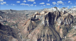
Covers the southern part of Zion National Park extends south along the cities of Hurricane and Colorado City. Zion National Park is another place where erosion of the Colorado Plateau formed the most beautiful colorful stone formations of unique and wonderful shapes. There are nine different layers of stone visible in the park. Most of them consist of sandstone. But there is also limestone, gypsum, siltstone, shale, clay and mudstone. The Virgin River cut a spectacular and famous canyon thru Zion Park that is as narrow as 20ft and up to 2000ft tall.
High resolution versions of this scenery for FS9 and FSX (much sharper, but larger and multiple downloads)
are available at www.blueskyscenery.com/CNY_South3West5.html . The screenies are taken from the high-res versions,
so expect this version to be slightly more blurry. Thanks to Joop Mak for providing custom AFCADs that
correct airport layouts so that they align with the photo-textures! They are available at www.blueskyscenery.com/AFCADs.html . YourDonation@Work: Dedicated to Jerry, Ralph J. and Lance.
| Filename: | Zion_National_Park_South_Hurricane_1L8_Colorado_Ci.zip |
| License: | Freeware, limited distribution |
| Added: | 20th March 2010, 23:26:42 |
| Downloads: | 1,787 |
| Author: | Gottfried Razek - blueskyscenery.com |
| Size: | 95.39 MB |
| Category: Flight Simulator 2004 - Scenery | |
| Tongass Remote Airfield v2 - for Tongass Fjords |
|
Images related to this file:
File Description:
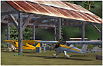
Tongass Remote Airfield v2 - for Tongass Fjords (FS9)
"Tongass Remote Airfield" v2 (RATR) Alaskan bush flying scenery (Fictitious).
This airstrip is for Flight Simulator 2004 and for the "Tongass Fjords" (FS9) addon by Holger Sandmann & Bill Womack; you must have "Tongass Fjords" (FS9) for this to work. Version 2 is a detailed, stand alone, remake of the first version, see PDF file.
Field history and description:
In the early days this area was well known to prospectors and hunters. A small mine was established and later abandoned. Around the late 40s a crew was contracted to clear a small landing area to gain easier access for hunters and campers. Due to the extreme remoteness of this area that clearing took several years. The last phase was the approach, clearing by hand a descending glide slope through just the tops of the tall trees. There is now just enough room for a very experienced pilot to get in and out of this field. The airfield is 26 miles north of Petersburg Alaska (PAPG). This is a tricky narrow approach with a left hand dogleg and then an immediate right hand dogleg turn just before the final approach. Not much time to set up your approach; also, it's a very short runway. For experienced pilots only, and make sure that your life insurance is up to date. Good luck.
| Filename: | Tongass_Remote_Airfield_v2__for_Tongass_Fjords.zip |
| License: | Freeware, limited distribution |
| Added: | 22nd March 2010, 13:16:16 |
| Downloads: | 628 |
| Author: | Jay Langham |
| Size: | 6.18 MB |
| Category: Flight Simulator 2004 - Scenery | |
| St. George (KSGU) / Mesquite (67L), Utah/Nevada, Photo-Scenery (FS9 & FSX) |
|
Images related to this file:
File Description:
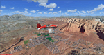
Covers the area between St. George, Utah and Mesquite, Nevada. To the north of St. George
the Pine Valley Mountains with their foothills of scenic red sandstone loom over the city.
St. George Municipal Airport (KSGU) is mostly used for general aviation but is also served by SkyWest Airlines
on behalf of Delta Connection. Because of it's location on a mesa this airport can't be expanded and so a new
airport is currently being built southeast of the city at the site of an abandoned airfield. The opening
is expected in 2011. To the south of the city make sure, you don't miss the Virgin River Gorge where the
Virgin River winds thru a long winding canyon in the transition zone between the red rocks of southern Utahs
Colorado Plateau and Nevadas Mojave Desert. Shortly afterwards you reach Mesquite which is situated just
west of the Arizona stateline. Like nearly all Nevada cities near the stateline Mesquite is home to several
Casinos. Mesquite Airport (67L) lies just north of the city.
High resolution versions of this scenery for FS9 and FSX (much sharper, but larger and multiple downloads)
are available at www.blueskyscenery.com/CNY_South3West6.html . The screenies are taken from the high-res versions,
so expect this version to be slightly more blurry. Thanks to Joop Mak for providing custom AFCADs that
correct airport layouts so that they align with the photo-textures! They are available at www.blueskyscenery.com/AFCADs.html .
YourDonation@Work: Dedicated to Werner, Ralf-Peter and Nels.
| Filename: | St_George_KSGU__Mesquite_67L_UtahNevada_PhotoScene.zip |
| License: | Freeware, limited distribution |
| Added: | 24th March 2010, 19:41:43 |
| Downloads: | 1,658 |
| Author: | Gottfried Razek - blueskyscenery.com |
| Size: | 95.58 MB |
| Category: Flight Simulator 2004 - Scenery | |
| Mormon Range, Enterprise, Beryl (UT82), Utah, Photo-Scenery |
|
Images related to this file:
File Description:
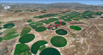
Mormon Range, Enterprise, Beryl (UT82), Utah, Photo-Scenery (FS9 & FSX)
This scenery covers the area of just north of St. George (KSGU) north along the Mormon Range and Enterprise to Beryl (UT82). It completes the southwestern corner of Utah and paves our way into Nevada. High resolution versions of this scenery for FS9 and FSX (much sharper, but larger and multiple downloads)are available at www.blueskyscenery.com/CNY_South2West6.html . The screenies are taken from the high-res versions, so expect this version to be slightly more blurry.
Thanks to Joop Mak for providing a custom AFCADs that correct airport layouts so that they align with the photo-textures! They are available at www.blueskyscenery.com/AFCADs.html . YourDonation@Work: Dedicated to Jean Pierre, Konrad and Juan.
| Filename: | Mormon_Range_Enterprise_Beryl_UT82_Utah_PhotoScene.zip |
| License: | Freeware, limited distribution |
| Added: | 27th March 2010, 11:38:48 |
| Downloads: | 1,371 |
| Author: | Gottfried Razek, blueskyscenery.com |
| Size: | 97.45 MB |
| Category: Flight Simulator 2004 - Scenery | |
| Quetta Airport |
|
File Description:
Quetta scenery for FS2004, requires RWY12 object libraries.
| Filename: | Quetta_Airport.zip |
| License: | Freeware, limited distribution |
| Added: | 30th March 2010, 20:09:26 |
| Downloads: | 392 |
| Author: | Abdul Haseeb Kamal (Virtual PIA WWW.VPIA.ORG) |
| Size: | 46.71 MB |
| Category: Flight Simulator 2004 - Scenery | |
| Emergency Services Incident # 2010-003 |
|
Images related to this file:
File Description:
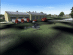
This is a series of missions called Emergency Services. All mission are flown using the Bell 206B Jet Ranger Helicopter. In this mission you will be flying for the Air Med out of Boone Hospital in Columbia MO . Your incident number is 2010-003.
| Filename: | Emergency_Services_Incident__2010003.zip |
| License: | Freeware |
| Added: | 1st April 2010, 02:17:25 |
| Downloads: | 213 |
| Author: | David J Crandall |
| Size: | 7 MB |
| Category: Flight Simulator 2004 - Scenery | |
| Scenery Rand Airport, South Africa |
|
File Description:
Rand Airport (FAGM) is one of the busier GA airports in Johannesburg. A highly detailed airport, containing photo realistic ground textures, hangars and buildings. This scenery uses the 1024x1024Mb texture set. For a smaller download size, download Worx24A.zip which contains the 512x512Mb texture set. Be advised that the texture resolution will be less.
| Filename: | Scenery_Rand_Airport_South_Africa.zip |
| License: | Freeware, limited distribution |
| Added: | 2nd April 2010, 19:49:39 |
| Downloads: | 2,755 |
| Author: | Andre Steyn and Johan van Wyk, Aeroworx |
| Size: | 18.01 MB |
| Category: Flight Simulator 2004 - Scenery | |
| Torrey, Box-Death Hollow Wilderness, Aquarius Plateau, Utah, Photo-Scenery (FS9 & FSX) |
|
Images related to this file:
File Description:
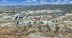
The southern part of this region covers the Box-Death Hollow Wilderness, with its vertical gray-orange walls of Navajo sandstone. Then comes the Aquarius Plateau which is the highest timbered plateau in North America with Boulder Mountain. In the north you'll find the little town of Torrey, which is just eight miles west of Capitol Reef National Park. Extends my Grand Staircase Escalante scenery to the north.
High resolution versions of this scenery for FS9 and FSX (much sharper, but larger and multiple downloads) are available at www.blueskyscenery.com/CNY_SouthWest3.html . The screenies are taken from the high-res versions, so expect this version to be slightly more blurry.
Thanks to Joop Mak for providing a custom AFCADs that correct airport layouts so that they align with the photo-textures! They are available here: www.blueskyscenery.com/AFCADs.html . YourDonation@Work: Dedicated to Ralf-Peter, Jon and Laurent.
| Filename: | Torrey_BoxDeath_Hollow_Wilderness_Aquarius_Plateau.zip |
| License: | Freeware, limited distribution |
| Added: | 3rd April 2010, 00:52:09 |
| Downloads: | 1,206 |
| Author: | Gottfried Razek - blueskyscenery.com |
| Size: | 93.79 MB |
| Category: Flight Simulator 2004 - Scenery | |
| Real NZ Auckland Airports (re-up) |
|
Images related to this file:
File Description:
Auckland city airports from Auckland 2005, reworked to fit into the "Real NZ Auckland City" scenery by Godzone Virtual Flight. The payware "Real NZ Auckland City" or freeware "Auckland 2005" is required. (This is a re-upload of the original file. No changes have been made.)
| Filename: | Real_NZ_Auckland_Airports_reup.zip |
| License: | Freeware, limited distribution |
| Added: | 3rd April 2010, 17:25:13 |
| Downloads: | 1,195 |
| Author: | Deane Baunton, Savern Reweti, Shayne Butler, Rob Diebold |
| Size: | 22.19 MB |
| Category: Flight Simulator 2004 - Scenery | |
| Ivanpah Valley Airport |
|
File Description:
FS2004 Scenery - Ivanpah Valley Airport is the planned relief airport for McCarran International Airport. Since there is only limited space left for expansion at McCarran, a new airport is the only alternative to increase capacity by a significant amount. The airport is planned to open in 2017. Created using Rwy12 and EZ Scenery objects. By Maurice Butz, with Jeff Hurd and John B. Loney, Jr.
| Filename: | Ivanpah_Valley_Airport.zip |
| License: | Freeware, limited distribution |
| Added: | 6th April 2010, 01:41:57 |
| Downloads: | 222 |
| Author: | Maurice Butz with Jeff Hurd and John B. Loney, Jr. |
| Size: | 3.05 MB |


© 2001-2026 AVSIM Online
All Rights Reserved
Privacy Policy |