
Where Flight Simulation Enthusiasts Gather from Around the World!
AVSIM Library - Search Results

| Category: Flight Simulator 2004 - Scenery | |
| California Central Coast Scenery |

|
File Description:
California Central Coast Scenery for FS2004. This scenery covers from Paso Robles down to Santa Barbara. Included is PRB, SBP, L52, SMX, LPC, VBG, IZA and SBA plus other misc.
areas. Gerrish Gray's Trees (TREES304.ZIP or TREES_V3.ZIP) and Matt Fox's California Landclass (LC_CAV2.ZIP) are recommended with this scenery. Author's email contact is [email protected].
| Filename: | California_Central_Coast_Scenery.zip |
| License: | Freeware |
| Added: | 27th December 2003, 20:00:38 |
| Downloads: | 8,205 |
| Author: | Al Wheeler |
| Size: | 6.41 MB |
| Category: Flight Simulator 2004 - Scenery | |
| Perth, Western Australia - Metro Area Pack v1.0 |
|
File Description:
Navigation landmarks for pilots flying around Perth, in particular for pilots flying out of Jandakot Airport. Includes totally reworked coastline, Swan and Canning rivers, and the following nav points - Murdoch open space, Adventure World, Henderson Shipyards, Fremantle harbour, Pt Walter, Cottesloe, Canning, Shelley and Mt Henry bridges, Langley Park, Lake Monger and Herdsmen Lake, Canning Dam, all lakes south of Canning River (Bibra, Thompson etc), Penguin and Carnak Islands. For FS2004 Only, to be used with our Sth West landclass and Jandakot airport. http://www.westsim.com.au/
| Filename: | Perth_Western_Australia__Metro_Area_Pack_v10.zip |
| License: | Freeware, limited distribution |
| Added: | 15th December 2003, 16:13:32 |
| Downloads: | 3,051 |
| Author: | Westsim Design Group - Derek Kippo and Jarrad Marshall |
| Size: | 418.15 KB |
| Category: Flight Simulator 2004 - Scenery | |
| Israel SRTM 90m Mesh Ver. 1.0 |
|
File Description:
Finally, VFR/CVFR pilots are able to enjoy the tall peaks of the Hermon mountain, the Golan heights and the ravines of the Western slopes of the Carmel mountains, the road to Jerusalem and the sub-sea level features of the Sea of Galilee and the famous Dead Sea.
The Negev Desert can finally show off its fascinating topography which includes, among others, the Small Crater and Ramon Crater whose features are clearly visible from space. There are many canyons, ravines, dry streams and other dramatic ground landscapes which can make a Negev Dessert VFR Expedition quite exciting. The trip could end at Eilat. Now you can see this well known touristic resort, bordered on the West and East by the tall and rugged mountains which have been among its more typical features.
| Filename: | Israel_SRTM_90m_Mesh_Ver_10.zip |
| License: | Freeware, limited distribution |
| Added: | 23rd April 2004, 12:54:03 |
| Downloads: | 12,085 |
| Author: | Alexander Lawrence |
| Size: | 7.26 MB |
| Category: Flight Simulator 2004 - Scenery | |
| Humber Bridge and BAe Aircraft Factory Brough. |
|
File Description:
The following GMax scenery is compatible with systems with or without the VFR Photographic Scenery - East and South-East England.
FS2004 doesn't seem to have the Humber Bridge unlike FS2002 which did have it, albeit a rather a poor representation. I therefore took it on myself to rectify this ommission. Included with the bridge is the contol room, toll booths, Country Park Inn, Humber Rescue and some local cottages. At the same time I decided to add the British Aerospace factory buildings at Brough aligned with the aid of the VFR Photographic Scenery package. I used what photographic textures I could legally obtain for many of the buildings. I don't profess it to be totally acurate but it is a fair representation. At least you can now try the tricky approach to runway 12 over the old design offices.
| Filename: | Humber_Bridge_and_BAe_Aircraft_Factory_Brough.zip |
| License: | Freeware |
| Added: | 24th February 2004, 23:12:56 |
| Downloads: | 5,457 |
| Author: | Barry Wells |
| Size: | 4.26 MB |
| Category: Flight Simulator 2004 - Scenery | |
| Z19O - Hamat Airbase - Batroun, Lebanon |
|
Images related to this file:
File Description:
Hamat is a village near the coast of Lebanon, around 25 miles north of Beirut. The airport runway was built during the civil war to the west of Hamat in the late 1970's, between Hamat and another village called Wuajh Al Hajar. The intention was have an alternative to Beirut airport, which could be (and often was) closed by shell fire from any or all of the sides involved in the civil war, or by bombing by those who were not directly part of the civil war but occasionally joined in. It has been used for drag racing, occasional freefall parachuting (this may continue) and is now an army base with mostly helicopter use. The runway is around 5,600 feet of asphalt, 90 feet wide and aligned 02/20. There is no lighting. The apron is set well back from the runway and has hangars at each end; one set is four hangars long, and at the other end of the apron there are three hangars. There are also the remains of some radar to the west of the apron, bombed (in 1982?). The runway has been repositioned and the surrounding landclass modified to reduce one village to it's approximate actual size and to create a second village which was missing entirely. An intrusive road has been deleted, and the airfield grass area also modified.
| Filename: | Z19O__Hamat_Airbase__Batroun_Lebanon.zip |
| License: | Freeware, limited distribution |
| Added: | 23rd May 2015, 10:03:10 |
| Downloads: | 222 |
| Author: | Roger Wensley |
| Size: | 8.53 MB |
| Category: Flight Simulator 2004 - Scenery | |
| Vance W. Amory International Airport, St Kitss and Nevis (TKPN), Version 1.0 |
|
Images related to this file:
File Description:
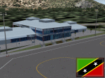
This zip-file contains a detailed yet very frame-rate friendly scenery for the Vance W. Amory International Airport, Newcastle, St. Kitts and Nevis. Version 1.0. Added as much photo-real details as possible. Limited night texture at this time. Included the "Hurricane Hill" so the approach of runway 10 becomes a bit challenging like in real-world. Charts included.
For the trees to show up around the airfield you need to have installed: Gerrish Gray's trees_v3.zip.
| Filename: | Vance_W_Amory_International_Airport_St_Kitss_and_N.zip |
| License: | Freeware, limited distribution |
| Added: | 22nd March 2010, 16:53:20 |
| Downloads: | 2,545 |
| Author: | Marcel Ritzema |
| Size: | 2.77 MB |
| Category: Flight Simulator 2004 - Scenery | |
| Terrace CYXT in BC Canada Updated |
|
Images related to this file:
File Description:
This version of Terrace has night textures that work, good news for the 319 downloaders who did not tell the author that the ones already posted did not work. Why? Terrace is fifteen miles east and inland from Prince Rupert, which is 500 miles north of Vancouver up the BC coast. It is at the point in the mountains where two fjords meet, one coming from Prince Rupert and the other from Kitimat. There are two runways, the main one is a recently-extended 7,500 feet long and lighted 33/15 and the second is 5,373 feet of unlit 03/21. The apron has been enlarged to be able to accomodate a Boeing 737; though I don't think there is an airline using a 737 for flights to Terrace I have parked an Air Canada jet and the pics show the planes that do fly to Terrace, Air Canada and Hawk Air Dash 8-300's. The aircraft and the textures are down-loadable and and can be used for AI.
| Filename: | Terrace_CYXT_in_BC_Canada_Updated.zip |
| License: | Freeware, limited distribution |
| Added: | 3rd July 2010, 03:28:31 |
| Downloads: | 1,063 |
| Author: | Roger Wensley |
| Size: | 3.72 MB |
| Category: Flight Simulator 2004 - Scenery | |
| Alpine-Casparis Municipal Airport, Alpine, Texas (E38) |
|
File Description:
Alpine-Casparis Municipal Airport,(E38), owned and operated by the City of Alpine, is a public-use general aviation airport located in Brewster County, Texas. The airport, which is situated approximately two miles northwest of Alpine, operates two asphalt runways: Runway 01/19, which measures 6,003 feet in length and 75 feet in width; and Runway 05/23, measuring 5,018 feet in length and 60 feet in width. This scenery is compatible with both FS9 Default and Ultimate Terrain. By John B. Loney, Jr.
| Filename: | AlpineCasparis_Municipal_Airport_Alpine_Texas_E38.zip |
| License: | Freeware, limited distribution |
| Added: | 20th September 2008, 20:46:44 |
| Downloads: | 625 |
| Author: | John B. Loney, Jr. |
| Size: | 874.17 KB |
| Category: Flight Simulator 2004 - Scenery | |
| Samedan 2004 for Switzerland Professional |
|
File Description:
This version is only for users who have the photoscenery Switzerland Professional by Flylogic. The original file lszs2004.zip is required. Read the included readme file for correct installation.
| Filename: | Samedan_2004_for_Switzerland_Professional.zip |
| License: | Freeware, limited distribution |
| Added: | 7th February 2006, 23:24:58 |
| Downloads: | 3,259 |
| Author: | Andreas Hegi |
| Size: | 368.57 KB |
| Category: Flight Simulator 2004 - Scenery | |
| Geilenkirchen v1 |
|
File Description:
This airfield, located about 40 NM in the west of Cologne (North-Rhine-Westfalia,
West-Germany) is one of the NATO's E-3A (AWACS, Early Warning and Control System)
Main Operating Bases. Re-upload.
| Filename: | Geilenkirchen_v1.zip |
| License: | Freeware |
| Added: | 8th April 2011, 11:42:08 |
| Downloads: | 811 |
| Author: | Klaus Jone |
| Size: | 619.24 KB |
© 2001-2026 AVSIM Online
All Rights Reserved
Privacy Policy |