
Where Flight Simulation Enthusiasts Gather from Around the World!
AVSIM Library - Search Results

| Category: Flight Simulator 2004 - Scenery | |
| Gates and AFCAD for Austin, Tx., KAUS |

|
File Description:
A simple addon for gates @ stock airport KAUS. This file includes AFCAD. You must have rwy 12 installed
| Filename: | Gates_and_AFCAD_for_Austin_Tx_KAUS.zip |
| License: | Freeware |
| Added: | 17th August 2005, 00:26:54 |
| Downloads: | 534 |
| Author: | Kenneth Rouner |
| Size: | 8.59 KB |
| Category: Flight Simulator 2004 - Scenery | |
| VTUK Project Version 1.0.1 |
|
File Description:
This is VTUK scenery version 1.0.1 upgraded from version 1.0. VTUK or KhonKaen airport located in North-East of Thailand. Friendly with frame rates. Enjoy the flight in KhonKaen all comments welcome at my email. If you already version 1.0 installed. Replace it with this version.
| Filename: | VTUK_Project_Version_101.zip |
| License: | Freeware |
| Added: | 15th November 2003, 17:08:41 |
| Downloads: | 1,022 |
| Author: | Krit Thivavarnvongs |
| Size: | 448.45 KB |
| Category: Flight Simulator 2004 - Scenery | |
| Argentina, Trevelin Scenery |
|
Images related to this file:
File Description:
My 4th installment of the Patagonia scenery enhancements (preview available at http://www.youtube.com/watch?v=PggY68f-tHE), this time Trevelin and its airfield.
As with all the Argntina scenery the idea and information gathering was by Federico Malfu Sanchez
| Filename: | Argentina_Trevelin_Scenery.zip |
| License: | Freeware, limited distribution |
| Added: | 5th January 2011, 20:35:46 |
| Downloads: | 266 |
| Author: | Alf B. Meier |
| Size: | 2.9 MB |
| Category: Flight Simulator 2004 - Scenery | |
| Fix for scenery "LGMG" |
|
File Description:
Instructions how to fix a minor conflict at "lgmg_haa_ga" scenery for Megara (LGMG) Airport, FS2004.
| Filename: | Fix_for_scenery_LGMG.zip |
| License: | Freeware |
| Added: | 27th September 2005, 17:22:43 |
| Downloads: | 3,397 |
| Author: | Dimitris Pastarmatzis |
| Size: | 780 B |
| Category: Flight Simulator 2004 - Scenery | |
| Goviken 2004 Helipad Scenery |
|
File Description:
Helipad scenery in northen part of Östersund/Sweden, called "Göviken" This scenery works both with FS2002 and FS2004. Support and screenshots at: http://fss.nordicair.org/
| Filename: | Goviken_2004_Helipad_Scenery.zip |
| License: | Freeware, limited distribution |
| Added: | 11th December 2005, 21:13:35 |
| Downloads: | 799 |
| Author: | Philip Nordlander |
| Size: | 14.46 MB |
| Category: Flight Simulator 2004 - Scenery | |
| Saskatchewan Floatplane Bases |
|
File Description:
Simple floatplane bases to remedy FS2004's lack of floatplane facilities in Northern Saskatchewan. These files work with both the default scenery and Dwayne Matheson's LOD8 Saskatchewan mesh.
| Filename: | Saskatchewan_Floatplane_Bases.zip |
| License: | Freeware, limited distribution |
| Added: | 9th March 2006, 03:57:12 |
| Downloads: | 564 |
| Author: | Lyle Froese |
| Size: | 287.88 KB |
| Category: Flight Simulator 2004 - Scenery | |
| Joe Foss-Sioux Falls Regl KFSD |
|
File Description:
FS2004 Scenery-Joe Foss Field - Sioux Falls Regional Airport (KFSD) serves Sioux Falls and Minnehaha County and is owned by Sioux Falls Regional Airport Authority. The airport has more than one runway. The longest is a paved runway extending 8999 feet. The facility is at an elevation of 1429 feet at a distance of about three miles from Sioux Falls. South Dakota's 114th Fighter Group, nicknamed the Lobos, is stationed at Joe Foss Field, Sioux Falls, SD. Created entirely with EZ Scenery. New AFCAD2 file with AI flight plans. By John B. Loney, Jr.
| Filename: | Joe_FossSioux_Falls_Regl_KFSD.zip |
| License: | Freeware |
| Added: | 17th July 2006, 01:30:18 |
| Downloads: | 2,308 |
| Author: | John B. Loney, Jr. |
| Size: | 1.39 MB |
| Category: Flight Simulator 2004 - Scenery | |
| Joe Foss Field Fix |
|
File Description:
FS2004 Scenery-This download contains the necessary files for those who downloaded my Joe Foss Field scenery (kfsd_v1.zip) and found the terminal and other buildings missing. The files also contain objects I created for EZ Scenery. kfsd_v1.zip required.
| Filename: | Joe_Foss_Field_Fix.zip |
| License: | Freeware |
| Added: | 19th July 2006, 05:12:34 |
| Downloads: | 1,139 |
| Author: | John B. Loney, Jr. |
| Size: | 907.72 KB |
| Category: Flight Simulator 2004 - Scenery | |
| Dawson Creek CYDQ in British Columbia, Canada UPDATED |
|
Images related to this file:
File Description:
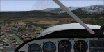
This is a revised version of Dawson Creek CYDQ and the floats base CBD3, made primarily to provide one of the parked planes with it's textures but also to improve the apron markings and the AI. The float AI now includes Beavers and I also removed two planes that were not properly showing their textures in my current FS9 installation. The Beavers were included in my post of Nimpo Lake CAF8 and will need to be installed to show up here. This version is complete in itself and can be installed as-is if you do not have the original scenery. Dawson Creek is at 2,148 feet asl just east of the Rocky Mountains, less than 10 miles west of the BC/Alberta border and where the Rockies are at their narrowest. The population grew when the Northern Alberta Railway was extended to Dawsons Creek in 1932, and grew even more more when the Alaska Highway was built in 1942, starting from Dawsons Creek. In the 1950's the town was linked through the Rockies by a railway and a road to the BC interior, and the town grew again. Now it is static at just under 12,000 and once again has become a farming centre, with Fort St John and Grand Prairie winning out for new industry and commerce. The airport is just to the east of the town. The runway is 5,000 feet of wide asphalt (150 feet) aligned 06/24, lit, and with PAPI and approach lights. There is also a water runway for float planes, separately designated as Dawson Creek CBD3. The two effectively operate as one; traffic for both use the mandatory frequency of 122.2 and talk to one controller in one control tower. However, in FS9 the ATC for two separately designated airfields (or float fields) operates as if they are nowhere near each other and takes no notice of near misses between the two lots of planes. As a result I have put them both in un-manned tower mode so you will announce your position and intentions and select your own parking spots, either next to one of the hangars or on the grass. The aprons vary from asphalt, to concrete, onwards to gravel, and then further onwards to some gravel amid the bare dirt; I have replicated this variation as far as FS9 permits.
| Filename: | Dawson_Creek_CYDQ_in_British_Columbia_Canada_UPDAT.zip |
| License: | Freeware, limited distribution |
| Added: | 17th December 2018, 17:50:08 |
| Downloads: | 203 |
| Author: | Roger Wensley |
| Size: | 26.71 MB |
| Category: Flight Simulator 2004 - Scenery | |
| Dawson Creek CYDQ in British Columbia, Canada |
|
Images related to this file:
File Description:
Dawson Creek is at 2,148 feet asl just east of the Rocky Mountains, less than 10 miles west of the BC/Alberta border. The Peace River, 25 miles north of Dawson Creek, links the two sides of the Rockies, winding through peaks that reach up almost to 8,000 feet. The population grew when the Northern Alberta Railway was extended to Dawsons Creek in 1932, and grew even more more when the Alaska Highway was built in 1942 and Dawsons Creek was where it started from. The airport is just to the east of the town. The runway is 5,000 feet of wide asphalt (150 feet) aligned 06/24, lit, and with PAPI and approach lights. There is a water runway to the north of the main runway with the same alignment, separately designated as Dawson Creek CBD3. The two operate as one; traffic for both use the mandatory frequency of 122.2 and talk to one controller in one control tower. However, in FS9 the ATC for two separately designated airfields operates as if they are nowhere near each other and near misses are the result. I have put them both in un-manned tower mode so you will announce your position and intentions and select your own parking spots etc. There is in reality a lack of apron markings but I have marked the positions of both gates. The apron is not large so there is only one other apron parking spot (see the traffic cone) and most parking is either next to one of the hangars or on the grass. The aprons vary from asphalt, to concrete, onwards to gravel, and then further onwards to some gravel amid the bare dirt; I have replicated this variation as far as FS9 permits. The buildings are bespoke from photos. The AI includes Central Mountain Air with two daily scheduled flights and Northern Cariboo as one of the airlines that occasionally runs charter flights in CYDQ. There are also private GA flights, and float plane flights into and out of CBD3.
| Filename: | Dawson_Creek_CYDQ_in_British_Columbia_Canada.zip |
| License: | Freeware, limited distribution |
| Added: | 22nd November 2013, 23:31:40 |
| Downloads: | 649 |
| Author: | Roger Wensley |
| Size: | 16.65 MB |
© 2001-2026 AVSIM Online
All Rights Reserved
Privacy Policy |