
Where Flight Simulation Enthusiasts Gather from Around the World!
AVSIM Library - Search Results

| Category: Flight Simulator 2004 - Scenery | |
| Bethel PABE in southwest Alaska |

|
Images related to this file:
File Description:
There are four main northwestern Alaska towns which have good airports and are serviced by Alaska Airlines. From these airports local flights connect to nearby villages, "nearby" in Alaska meaning up to 200 miles away. The northernmost is Barrow. Southwest of Barrow is Kotzebue, then Nome, and the furthest south is this one, Bethel. The town of Bethel has a population of just over 6,000 and is 50 miles from the sea on the Kuskowim River, that splits and forks into many tributaries. Bethel Airport is close to the town and provides the only contact with the rest of Alaska, as there is no connecting highway system. There are scheduled flights by Alaska Airlines, ERA (now called Ravn) and Grant Aviation, plus others such as Ryan Air. There are cargo flights by Everts, Northern, and Lynden, and redistribution onwards to nearby villages by the smaller locally-based planes; all of these are included in the AI. There are two main runways, one just under 6,400 feet and another just under 3,900 feet, both of them aligned 19-1. The third runway is around 1,800 feet and mainly gravel, aligned 11-29. Parking at PABE is on three aprons, the northern for smaller commercial planes of Grant, ERA, Ryan etc, the central for larger planes of Alaska, Northern, Everts, and Lynden, and the southern for a large collection of GA; each apron has further hangars for maintenance companies and smaller operators. There is also another separate apron for the local military and Coastguard. There is not much photographic information available for PABE, and I have never been there; as a result it was impossible to make detailed photographic textures for some of the buildings. However, for most hangars I have made textures of at least the right colour etc based on the information I assembled and if it is green with white trim and side windows then that is how it now appears here. The exceptions are the Alaska Airlines terminal building which has complicated curved elements, and the two military hangars and workshops where I had to settle for an Alaska terminal building from another airport and the same for the military. There are numerous small villages in the vicinity of Bethel, all of them being beside either a river tributary or the coast. There are two Google Earth screenshots to show the villages that are served by the flights from Bethel and that are (mostly) included in the AI. Some of these airfields were not included in FS9 but AI will still operate in and out of Bethel. The smaller area screenshot shows the villages that are close to Bethel, and of these eight I have so far made six and they are included in this post: Napaskiak PKA, Napakiak WNA, Kwethluk KWT, Atmautluak 4A2, Nunapitchuk 16A, and Kasigluk Z09. I will work my way through the rest of the area.
| Filename: | Bethel_PABE_in_southwest_Alaska.zip |
| License: | Freeware, limited distribution |
| Added: | 8th March 2019, 00:37:58 |
| Downloads: | 312 |
| Author: | Roger Wensley |
| Size: | 32.02 MB |
| Category: Flight Simulator 2004 - Scenery | |
| Beaver Creek CYXQ in Yukon Territory, Canada |
|
Images related to this file:
File Description:
Beaver Creek is located at mile 1202 of the Alaska Highway, just east of the Alaska/Yukon border. The populaton is around 100 and the main employment is with the Border Agency, the White River First Nation, or with local tourist lodges. The airfield is a mile north of the town and close to the Canadian border post, which is included in the scenery. It was built by Jack Stalberg in the 1960's, and I have no further information beyond the fact that he loved to fly. The airport serves as an "airport of entry", though it is restricted in hours of opening and in the size of aircraft that it can handle; up to a maximum of only 15 seats. The single runway is 3,745 feet long and 100 feet wide, gravel, aligned 13-31 in FS9, lit, and with vasi at both ends. Righthand circuits for runway 13. There is a 340 feet threshold displacement to runway 31, which is of course unmarked on a gravel runway. The terminal building was recently reclad; I don't like it, but they didn't consult me. The ai reflects the sort of traffic the airfield gets; ie brief paperwork stopovers for GA or small charter flights into Canada from Alaska, usually in the mornings.I have adjusted the local scenery terrain levels to remove adjacent hills that I believe do not exist in real life but are part of the Northern Canada terrain mesh that I have installed. If you do not have this mesh you may find that the scenery works fine for you without the API flatten that is included here. The airfield is at 2,129 feet ASL.
| Filename: | Beaver_Creek_CYXQ_in_Yukon_Territory_Canada.zip |
| License: | Freeware, limited distribution |
| Added: | 28th January 2019, 06:19:20 |
| Downloads: | 177 |
| Author: | Roger Wensley |
| Size: | 4.68 MB |
| Category: Flight Simulator 2004 - Scenery | |
| Hope Field near Ottawa Ontario, Canada |
|
Images related to this file:
File Description:
The field is newly included in the Canada Flight Supplement. Unusually for a grass field the runway has the numbers marked out in white; given that this is a private airfield that does not invite unexpected guests and has only one plane based there, and presuming that the owner can remember his own runway headings, it is unlikely that these will still be there in a year's time. There is no hangar as yet. To the west is highway 416 and to the east is the Rideau River, both of which run north-south. Lke Rockcliffe (which is to the north) the airfield is right on the edge of the Ottawa control zone, so you should already be below 1,500 feet ASL when approaching from the south and talking to Ottawa tower when arriving from the north. The runway is 07/25 and 2,800 feet long, which should be enough for almost anybody, and the field is at 315 feet ASL. Manotick is a mile to the north east on the Rideau River and the Rideau Valley Airpark CPL3 is six miles south in the bend of the Rideau where it turns west.
| Filename: | Hope_Field_near_Ottawa_Ontario_Canada.zip |
| License: | Freeware, limited distribution |
| Added: | 10th July 2010, 19:34:51 |
| Downloads: | 202 |
| Author: | Roger Wensley |
| Size: | 3.15 MB |
| Category: Flight Simulator 2004 - Scenery | |
| Fix for ATC43 FIELDS |
|
File Description:
A quick and easy fix for the bug in ATC43_FIELDS that causes FS9 to freeze when you try to file a flight plan at KPBI, Morrison Field at West Palm Beach.
| Filename: | Fix_for_ATC43_FIELDS.zip |
| License: | Freeware |
| Added: | 5th January 2011, 16:02:59 |
| Downloads: | 136 |
| Author: | Glenn Duncan |
| Size: | 6.67 KB |
| Category: Flight Simulator 2004 - Scenery | |
| West Palm Beach PBI / KPBI Version 2.0 |
|
Images related to this file:
File Description:

This scenery was released during Avsim's hiatus at www.frfstudio.net last year. This is a much needed update for Palm Beach,FL. All buildings have been rebuilt from scratch as well as the afcad. All the usual candy is included, but with little frame rate impact. This is a complete scenery, and the Rwy12 libraries are no longer necessary.
| Filename: | West_Palm_Beach_PBI__KPBI_Version_20.zip |
| License: | Freeware |
| Added: | 23rd January 2010, 10:34:22 |
| Downloads: | 7,164 |
| Author: | William Morgan / FRFSTUDIO.NET |
| Size: | 19.05 MB |
| Category: Flight Simulator 2004 - Scenery | |
| Palm Springs International Airport (KPSP) |
|
Images related to this file:
File Description:
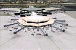
Detailed scenery for Palm Springs International Airport, Palm Springs, California (KPSP). This scenery has been designed and developed to capture the real airport 'feel' as much as possible. [NOTE: Reupload of previous corrupted file - not a new scenery]
| Filename: | Palm_Springs_International_Airport_KPSP.zip |
| License: | Freeware |
| Added: | 6th January 2010, 22:01:45 |
| Downloads: | 16,994 |
| Author: | Shehryar Ansari |
| Size: | 6.96 MB |
| Category: Flight Simulator 2004 - Scenery | |
| Beach Surf |
|
File Description:
Edited and developed wavecontroller and wave effect files to give a rolling beach surf effect as replacement for the default effect. See readme file for further description and installation instructions.
| Filename: | Beach_Surf.zip |
| License: | Freeware |
| Added: | 16th March 2006, 00:05:00 |
| Downloads: | 2,897 |
| Author: | Tim Martyn-Jones |
| Size: | 126.64 KB |
| Category: Flight Simulator 2004 - Scenery | |
| WADL - Praya Lombok International Airport |
|
Images related to this file:
File Description:
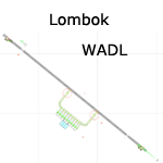
A basic scenery for new Lombok Intl airport which is missing in FS9 stock version. WADL replaced old Mataram airport (WADA/WRRA/AMI) which closed on september 30th 2011.
All features accurately placed/shaped according to charts from AIRAC cycle 1113.
Includes basic default terminal, tower, taxisigns, and the following xml-coded approaches for AI & UI: ILS 13, RNAV 13 & RNAV 31.
| Filename: | WADL__Praya_Lombok_International_Airport.zip |
| License: | Freeware, limited distribution |
| Added: | 10th January 2012, 14:20:07 |
| Downloads: | 3,374 |
| Author: | Yohann Baptiste |
| Size: | 309.24 KB |
| Category: Flight Simulator 2004 - Scenery | |
| Hawaii Coastline Scenery (Low Resolution). |
|
File Description:
The files here make ocean coastlines for Fs2004 Hawaii for use with addon mesh & landclass.
| Filename: | Hawaii_Coastline_Scenery_Low_Resolution.zip |
| License: | Freeware |
| Added: | 22nd October 2005, 13:33:18 |
| Downloads: | 2,787 |
| Author: | Pierre G. Shlimon |
| Size: | 614.91 KB |
| Category: Flight Simulator 2004 - Scenery | |
| SBMO NEW Default Airport Improvement |
|
File Description:
FS2004 SBMO Default Airport Improvement. "Zumbi dos Palmares", city Maceió, Brasil. New simple default airport improvement to make it more realistic. It also includes AFCAD modifications.
| Filename: | SBMO_NEW_Default_Airport_Improvement.zip |
| License: | Freeware |
| Added: | 18th March 2006, 14:35:34 |
| Downloads: | 3,806 |
| Author: | Roberto Zanolli |
| Size: | 1.6 MB |


© 2001-2026 AVSIM Online
All Rights Reserved
Privacy Policy |