
Where Flight Simulation Enthusiasts Gather from Around the World!
AVSIM Library - Search Results

| Category: Flight Simulator 2004 - Scenery | |
| VIBR - Kullu Manali Airport - Bhuntar, India |

|
File Description:
Bhuntar Airport, alternatively known as Kullu Manali Airport or Kullu Airport, (IATA: KUU, ICAO: VIBR) is an airport located in Bhuntar in the Indian state of Himachal Pradesh. Bhuntar is considered a challenging airport for pilots because of its single runway set in a deep valley whose peaks rise several thousand feet higher than the runway. Also, the airport is located on the banks of the river Beas.
| Filename: | VIBR__Kullu_Manali_Airport__Bhuntar_India.zip |
| License: | Freeware |
| Added: | 28th September 2013, 12:39:15 |
| Downloads: | 409 |
| Author: | Billy Guo |
| Size: | 1.13 MB |
| Category: Flight Simulator 2004 - Scenery | |
| Egypt |
|
Images related to this file:
File Description:
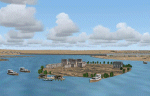
Whole scenery of Egypt. It contains 22 airports and 416 populations plus the temples of Abu Simbel, Pyramides of Giza, Temples of Karnak, Luxor, Edfu, Queen hapshetsup, kom Ombo, Philae, mausoleo Aga Khan in Aswan,Castle in harbor Alexandria Egyptian Museum of El Cairo, Tahrir square. Whole Cairo enhanced. It permits realizer some circuits on the Nile river and the Suez chanel ....
Or Sharm el Sheik, and much more. See readme.txt for more details
| Filename: | Egypt.zip |
| License: | Freeware |
| Added: | 5th May 2011, 10:46:41 |
| Downloads: | 4,564 |
| Author: | Toni Agramont |
| Size: | 100.82 MB |
| Category: Flight Simulator 2004 - Scenery | |
| Himalayas LOD9 Base Mesh, Volume 4 - Kashmir and Jammu |
|
File Description:
Detailed terrain mesh of the Kashmir and Jammu Ranges, N30-39 E76-78. The files in this package are based on Shuttle Radar (SRTM) Version 2 data but with many of the void areas, especially the most significant sections, filled with elevation data generated from topographic maps by Jonathan de Ferranti. While Jonathan's work is unrelated to flight simulation he kindly gave me permission to compile his data for use in FS. The result is a wonderful improvement in detail and accuracy over any existing mesh file, freeware or commercial, based on SRTM or DTED data alone.
Due to the large area of the Himalayas I've compiled the source data as two separate series: the "Himalayan Peaks" series covers prominent mountains and ranges in higher detail and locally overrides any existing LOD9 terrain mesh. In addition, the LOD9 "base mesh" series, with LOD8 and LOD7 "buffer" mesh files, covering the entire Himalayas, is meant for those who do not yet have an add-on terrain mesh of these beautiful mountains.
| Filename: | Himalayas_LOD9_Base_Mesh_Volume_4__Kashmir_and_Jam.zip |
| License: | Freeware, limited distribution |
| Added: | 22nd February 2006, 20:32:50 |
| Downloads: | 7,504 |
| Author: | Holger Sandmann, Jonathan de Ferranti |
| Size: | 29.24 MB |
| Category: Flight Simulator 2004 - Scenery | |
| Pan American Sea Port Midway Island |
|
File Description:
FS2004 Pan American World Airways Clipper Port Sand Island Midway. Scenery by the The Fox's Hangar.
On November 22, 1935, Pan Am began mail service across the Pacific, when the China Clipper took
off with much fanfare from San Francisco Bay and flew to Hawaii, then on to Manila in the Philippines
by way of Midway, Wake, and Guam. In October 1936, Pan American finally inaugurated its first passenger
flights across the Pacific by carrying nine travelers across the largest ocean in the world. Each passenger paid
more than $1,400 for the round-trip from San Francisco to Manila, an astronomical sum at that time.The Pan American
World Airways Clipper Port Sand Island Midway is my recreation of the Clipper port at Sand Island Midway Atoll.
| Filename: | Pan_American_Sea_Port_Midway_Island.zip |
| License: | Freeware |
| Added: | 13th March 2009, 11:54:40 |
| Downloads: | 1,246 |
| Author: | Kenny Fox |
| Size: | 4.85 MB |
| Category: Flight Simulator 2004 - Scenery | |
| Alps LOD10 Topo Mesh - Update 1 |
|
File Description:
Patch files to remove tall spike in terrain near Salzburg at N47 44´ E13 00´ and to add the missing/distorted peaks of La Grande Moucherolle at N45 00´ E5 34´ and Mont Aiguille at N44 50' E5 33'.
Requires the full version of our Alps LOD10 mesh files, alpse_fe.zip and alpsw_fe.zip. Source data by Jonathan de Ferranti, compiled for FS by Holger Sandmann. Fully compatible with FS2002. A big thank-you to those who reported the "Salzbug" and the missing peaks in the French Alps.
| Filename: | Alps_LOD10_Topo_Mesh__Update_1.zip |
| License: | Freeware, limited distribution |
| Added: | 9th February 2006, 15:02:59 |
| Downloads: | 32,359 |
| Author: | Holger Sandmann, Jonathan de Ferranti |
| Size: | 2.57 MB |
| Category: Flight Simulator 2004 - Scenery | |
| Himalayas LOD9 Base Mesh, Volume 2 - Southcentral Ranges |
|
Images related to this file:
File Description:
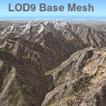
Detailed terrain mesh of the Southcentral Himalayan Ranges, N26-32 E82-90. The files in this package are based on Shuttle Radar (SRTM) Version 2 data but with many of the void areas, especially the most significant sections, filled with elevation data generated from topographic maps by Jonathan de Ferranti. While Jonathan's work is unrelated to flight simulation he kindly gave me permission to compile his data for use in FS. The result is a wonderful improvement in detail and accuracy over any existing mesh file, freeware or commercial, based on SRTM or DTED data alone.
Due to the large area of the Himalayas I've compiled the source data as two separate series: the "Himalayan Peaks" series covers prominent mountains and ranges in higher detail and locally overrides any existing LOD9 terrain mesh. In addition, a LOD9 "base mesh" series, with LOD8 and LOD7 "buffer" mesh files, covering the entire Himalayas, is meant for those who do not yet have an add-on terrain mesh of these beautiful mountains.
| Filename: | Himalayas_LOD9_Base_Mesh_Volume_2__Southcentral_Ra.zip |
| License: | Freeware, limited distribution |
| Added: | 29th May 2010, 09:05:56 |
| Downloads: | 9,450 |
| Author: | Holger Sandmann, Jonathan de Ferranti |
| Size: | 90.25 MB |
| Category: Flight Simulator 2004 - Scenery | |
| "Himalayan Peaks" LOD10 Mesh, Volume 6 - Jammu and Kashmir |
|
Images related to this file:
File Description:
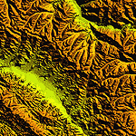
Highly detailed terrain mesh of the Jammu and Kashmir areas, N31-36 E76-78. The files in this package are based on Shuttle Radar (SRTM) Version 2 data but with many of the void areas, especially the most significant sections, filled with elevation data generated from topographic maps by Jonathan de Ferranti. While Jonathan's work is unrelated to flight simulation he kindly gave me permission to compile his data for use in FS. The result is a wonderful improvement in detail and accuracy over any existing mesh file, freeware or commercial, based on SRTM or DTED data alone.
Due to the large area of the Himalayas I've compiled the source data as two separate series: the "Himalayan Peaks" series covers prominent mountains and ranges in higher detail and locally overrides any existing LOD9 terrain mesh. In addition, a LOD9 "base mesh" series covering the entire Himalayas will be available for those who do not yet have an add-on terrain mesh of these beautiful mountains.
| Filename: | Himalayan_Peaks_LOD10_Mesh_Volume_6__Jammu_and_Kas.zip |
| License: | Freeware, limited distribution |
| Added: | 29th May 2010, 08:55:43 |
| Downloads: | 9,663 |
| Author: | Holger Sandmann, Jonathan de Ferranti |
| Size: | 52.19 MB |
| Category: Flight Simulator 2004 - Scenery | |
| Himalayas LOD9 Base Mesh, Volume 5 - Hindu Kush and Pamir |
|
Images related to this file:
File Description:
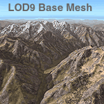
Detailed terrain mesh of the Hindu Kush and Pamir Ranges, N32-40 E70-76. The files in this package are based on Shuttle Radar (SRTM) Version 2 data but with many of the void areas, especially the most significant sections, filled with elevation data generated from topographic maps by Jonathan de Ferranti. While Jonathan's work is unrelated to flight simulation he kindly gave me permission to compile his data for use in FS. The result is a wonderful improvement in detail and accuracy over any existing mesh file, freeware or commercial, based on SRTM or DTED data alone.
Due to the large area of the Himalayas I've compiled the source data as two separate series: the "Himalayan Peaks" series covers prominent mountains and ranges in higher detail and locally overrides any existing LOD9 terrain mesh. In addition, the LOD9 "base mesh" series, with LOD8 and LOD7 "buffer" mesh files, covering the entire Himalayas, is meant for those who do not yet have an add-on terrain mesh of these beautiful mountains.
| Filename: | Himalayas_LOD9_Base_Mesh_Volume_5__Hindu_Kush_and_.zip |
| License: | Freeware, limited distribution |
| Added: | 29th May 2010, 08:57:29 |
| Downloads: | 7,604 |
| Author: | Holger Sandmann, Jonathan de Ferranti |
| Size: | 85.72 MB |
| Category: Flight Simulator 2004 - Scenery | |
| Airports of Nepal 2.1 |
|
File Description:
This is an update to make Einar Aarvik's Nepal scenery 2.0 compatible with the new LOD 10 mesh uploaded by Holger Sandmann. Includes new Taplejung airport. By Einar Aarvik.
Also includes fictional glacier strips and fictional and invisible helipads for the Everest and K2 peaks. By Halfdan Abrahamsen, who also uploaded these files.
| Filename: | Airports_of_Nepal_21.zip |
| License: | Freeware |
| Added: | 2nd March 2006, 01:40:05 |
| Downloads: | 16,654 |
| Author: | Einar Aarvik/Halfdan Abrahamsen |
| Size: | 204.02 KB |
| Category: Flight Simulator 2004 - Scenery | |
| Tulum International Airport MMTL |
|
File Description:
This is a default build of the Tulum International Airport MMTL for FS2004
| Filename: | Tulum_International_Airport_MMTL.zip |
| License: | Freeware |
| Added: | 22nd November 2024, 15:22:21 |
| Downloads: | 143 |
| Author: | Danilo Cekrdzin |
| Size: | 4.5 KB |


© 2001-2026 AVSIM Online
All Rights Reserved
Privacy Policy |