
Where Flight Simulation Enthusiasts Gather from Around the World!
AVSIM Library - Search Results

| Category: Flight Simulator 2004 - Scenery | |
| CYKY - Kindersley Regional Airport, Saskatchewan, Canada |

|
Images related to this file:
File Description:
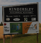
CYKY Kindersley Regional Airport is located in the west-central part of the province of Saskatchewan, Canada. The airport is located 4.6 km north of the town. The scenery consists of custom models of all the buildings at the airport, runway signs, runway and taxiway lighting, rotating beacon, static aircraft, vehicles, animated highway traffic and oil pump jacks, trees that properly change with the seasons, custom tarmac and runway textures, and seasonal ground textures for the airport and surrounding area.
| Filename: | CYKY__Kindersley_Regional_Airport_Saskatchewan_Can.zip |
| License: | Freeware |
| Added: | 14th June 2012, 13:44:10 |
| Downloads: | 1,287 |
| Author: | Gregory Putz |
| Size: | 84.58 MB |
| Category: Flight Simulator 2004 - Scenery | |
| Lucky Lake CKQ5 in Saskatchewan, Canada |
|
Images related to this file:
File Description:
The village of Lucky Lake is 80 miles south of Saskatoon, with a small population of less than 300, most of whom are dependant on agriculture for income, either directly or indirectly. Marijuana is a recently introduced crop after the failure of a government-financed potato growing operation called SPUDCO. The village was previously known as Devil's Lake (don't ask me, I don't know). The airfield is half a mile north of the village, with an asphalt runway just over 3,000 feet long, lit, and aligned 07-25 in FS9; this has now changed to 08-26 with the wandering magnetic north. Circuits on 25 are right handed to avoid over-flying the village. 100LL fuel is available.
| Filename: | Lucky_Lake_CKQ5_in_Saskatchewan_Canada.zip |
| License: | Freeware, limited distribution |
| Added: | 25th May 2017, 17:53:36 |
| Downloads: | 137 |
| Author: | Roger Wensley |
| Size: | 5.36 MB |
| Category: Flight Simulator 2004 - Scenery | |
| Rockland Lighthouse & Knox Reg Co. Airport === Rockland Maine. USA |
|
File Description:
These files include two separate sceneries. The Rockland Lighthouse and Knox Co. Regional Airport. Part of Maine Short Hops series. You will find lots of candies.
| Filename: | Rockland_Lighthouse__Knox_Reg_Co_Airport__Rockland.zip |
| License: | Freeware |
| Added: | 27th November 2005, 14:09:59 |
| Downloads: | 1,568 |
| Author: | Leon Louis |
| Size: | 2.97 MB |
| Category: Flight Simulator 2004 - Scenery | |
| Laconia, New Hampshire - KLCI - lake elevation correction |
|
File Description:
Runway 8 at the Laconia, New Hampshire - KLCI - is situated quite close to a lake. The elevation of the lake in FS2004 is such that it presents a "cliff" of water in the default setting. (see "before" screenshot). This package contains a simple flatten file which brings the lake down to the elevation of the airport and corrects a floating building issue also (see "after" screenshot). Please unzip to a temporary folder and follow the very simple installation instructions. Created with Steve Greenwood's FSTflatten program by David "Opa" Marshall for your flying enjoyment.
| Filename: | Laconia_New_Hampshire__KLCI__lake_elevation_correc.zip |
| License: | Freeware |
| Added: | 20th November 2008, 02:27:08 |
| Downloads: | 593 |
| Author: | David "Opa" Marshall |
| Size: | 116.12 KB |
| Category: Flight Simulator 2004 - Scenery | |
| Laramie Regional KLAR |
|
Images related to this file:
File Description:
FS2004 Scenery-Laramie Regional Airport (KLAR) is located in Laramie Wyoming, home of the University of Wyoming, Wyoming Technical Institute and a number of businesses and organizations. Laramie Regional Airport was built in 1934 and was originally named Brees Field, after General Herbert Jay Brees of the US Army. The original hangar still stands today. In 1944, the runways were paved to allow hundreds of B-24 bombers to land at Laramie and bring crews for rest and recuperation to the UW recreation camp in the Snowy Range. In 1945 Summit Airways began to provide passenger service. The Brees Field Airport Board was formed in 1965 to oversee airport operations. In 1992, the airport's board changed the airport's name to Laramie Regional Airport. Created with EZ Scenery by John B. Loney, Jr.
| Filename: | Laramie_Regional_KLAR.zip |
| License: | Freeware, limited distribution |
| Added: | 23rd May 2010, 01:32:22 |
| Downloads: | 1,329 |
| Author: | John B. Loney, Jr. |
| Size: | 835.24 KB |
| Category: Flight Simulator 2004 - Scenery | |
| Naval Air Station Lemoore, CA USA |
|
Images related to this file:
File Description:

Custom scenery for NAS Lemoore, CA. Scenery includes custom FSDS objects and photoreal ground textures at default resolution. Project scenery can be used as stand-alone but may benefit from addtional downloads (see readme inside). Designed for use with MAIW's excellent Lemoore AI package available at MilitaryAIWorks.com.
User Note: this package replaces basic scenery included with MAIW package.
| Filename: | Naval_Air_Station_Lemoore_CA__USA.zip |
| License: | Freeware, limited distribution |
| Added: | 12th July 2012, 17:07:09 |
| Downloads: | 1,183 |
| Author: | John Stinstrom |
| Size: | 6.22 MB |
| Category: Flight Simulator 2004 - Scenery | |
| Chena Marina AK28 in Fairbanks Alaska |
|
Images related to this file:
File Description:
Chena Marina AK28 is a float plane "pond" close to and southwest of Fairbanks International Airport, with a gravel strip alongside the water; the "strip" is actually a gravel road that functions as a runway when required. Or maybe it's a runway that functions as a road? Though it doesn't come close to the activity level of Lake Hood in Anchorage Alaska it is still a fairly busy place, and in fact Fairbanks is a hub of summer floatplane activity with a water runway at the International Airport and another "pond" known as Metro Field that is between Fairbanks and the river, plus a base on the Chena River. In this download there is a scenery folder, land-class folders, an AFCAD folder, and a "Traffic" folder, and you will definitely need Ultimate Terrain Alaska Canada.
| Filename: | Chena_Marina_AK28_in_Fairbanks_Alaska.zip |
| License: | Freeware, limited distribution |
| Added: | 14th August 2010, 17:11:31 |
| Downloads: | 814 |
| Author: | Roger Wensley |
| Size: | 5.57 MB |
| Category: Flight Simulator 2004 - Scenery | |
| Cap-Tourmente Seaplane Base & Scenery |
|
File Description:
Cap-Tourmente, part of Québec Short Hops is just a few miles downstream from Boischatel, on the North Shore of the St.Lawrence River just past Île d'Orléans. This scenery is a seaplane base. However, with the proper plane you could easily land on the beach. Just mind the swimmers. Should work fine in FS2002 though not tested.
| Filename: | CapTourmente_Seaplane_Base__Scenery.zip |
| License: | Freeware |
| Added: | 11th January 2004, 18:52:45 |
| Downloads: | 2,497 |
| Author: | Leon Louis |
| Size: | 3.36 MB |
| Category: Flight Simulator 2004 - Scenery | |
| NY61 - Eagle Nest Seaplane Base |
|
File Description:
Eagle Nest Seaplane (NY61), located on Blue Mountin Lake / Eagle Lake Extention. Small Private Seaplane Dock located in the picturesque Adirondack mountains. Used for sightseeing and boating and fishing tours located throughout the Adirondacks and one of many lake seaplane locations. Uses photoreal textures. Requires Free Flow NewEngland. By EdGeneer Cox
| Filename: | NY61__Eagle_Nest_Seaplane_Base.zip |
| License: | Freeware |
| Added: | 18th June 2008, 09:21:53 |
| Downloads: | 305 |
| Author: | EdGeneer Cox |
| Size: | 250.71 KB |
| Category: Flight Simulator 2004 - Scenery | |
| Prince Rupert B.C Canada |
|
File Description:
I removed all the wayward Light towers scattered around the field. Added some buildings to approximate those located on the field without going overboard. 2 AI Dc3's flying the circuit. AI is available but not required with any of my sceneries.
| Filename: | Prince_Rupert_BC_Canada.zip |
| License: | Freeware |
| Added: | 28th November 2003, 00:10:23 |
| Downloads: | 3,270 |
| Author: | Frank Betts |
| Size: | 1.04 MB |
© 2001-2026 AVSIM Online
All Rights Reserved
Privacy Policy |