
Where Flight Simulation Enthusiasts Gather from Around the World!
AVSIM Library - Search Results

| Category: Flight Simulator 2004 - Scenery | |
| RJTT - Tokyo (Haneda) International Airport - Tokyo, Japan - **FIX** |

|
Images related to this file:
File Description:

Fix for FS2004 Scenery Haneda Airport (RJTT). Thanks to the many people who reported missing textures for this scenery which may have caused a failure to load or crashing of the sim! Here are the missing textures files needed. Just place them in your X:\FS9\Scenery\World\Scenery folder and you should be good to go. My apologies for the mispackaging and any frustration this has caused. Also for the delay in posting due to my many errors when uploading this patch.
| Filename: | RJTT__Tokyo_Haneda_International_Airport__Tokyo_Ja.zip |
| License: | Freeware, limited distribution |
| Added: | 20th March 2015, 01:55:18 |
| Downloads: | 3,102 |
| Author: | John Stinstrom |
| Size: | 111.73 KB |
| Category: Flight Simulator 2004 - Scenery | |
| Tokyo Bay 2005 |
|
Images related to this file:
File Description:
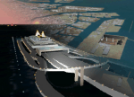
FS2004 Scenery Tokyo Bay Scenery 2005 Ver. 5.0
This add-on scenery improves specific scenerys (Tokyo Bay, Japan) of FS2004.
There are a lot of reclaimed land in Tokyo Bay.
They form an artificial peculiar coastline. This scenery reproduces these coastlines precisely.
And, this scenery reproduces the Keihin industrial area and the Keiyo industrial area in Tokyo Bay located west and east. In this scenery design, the coastline was reproduced as exactly as possible, following the specification of FS2004.
Moreover, 90m mesh geographical data is reproduced by using SRTM 3arc/sec.
The range of detailed coastline and 90m digital elevation data is as follows:
** [detailed coastline] N33:45 E138:45 to N36:55 E141:05 (included Izu Islands)
** [90m digital elevation data] N33:00 E138:00 to N37:00 E141:00 --
The Tokyo Wan AquaLine is arranged in the exact location. By Kazuo Kawamura
| Filename: | Tokyo_Bay_2005.zip |
| License: | Freeware, limited distribution |
| Added: | 3rd December 2011, 23:51:31 |
| Downloads: | 11,801 |
| Author: | Kazuo Kawamura |
| Size: | 9.74 MB |
| Category: Flight Simulator 2004 - Scenery | |
| Port Hardy CYZT in British Columbia, Canada |
|
Images related to this file:
File Description:
Port Hardy airport is on the coast of Vancouver Island in BC, at the far northern end and 5 miles east of the town. The town and the airport are both gateways to local touristic attractions such as Cape Scott Provincial Park, the North Coast and BC Marine Trails, and kayaking, caving, surfing, fishing, camping, and scuba diving (and I discovered just how big orca are). Fishing, logging, and mining have been important and to an extent still are for the town population of just over 4,000. The airport, along with the ferries, connects Port Hardy to the rest of the west coast with Pacific Coastal Saab 340 or Beechcraft 1900C flights to and from Vancouver at least twice a day. There are also Grumman Goose amphibious flights to local float bases such as Port McNeill, Alert Bay, Whaletown, Surge Narrows, Echo Bay, and Minstrel Island. These are all included in the AI and previously posted. There are three runways: 11-29 of 5,000 feet with ILS on 11 and righthand circuits on 29, 07-25 of 4,000 feet with righthand circuits on 25, and 16-34 with a much shortened 3,500 feet on 34 due to a displaced threshold. There is a control tower but it is not manned 24 hours a day; a "mandatory frequency" (MF for short and a Canadian invention) is used by the tower when it is manned, and when there is no tower response the aircraft continues to announce intentions and position. Something I have been meaning to explain to those who query it, is that in real life as well as in FS9 helicopters at a mixed use airport or airfield will act as if they are planes and join downwind, turn on base and then finals, "land" along the runway and then use the taxiway to the parking. This means all aircraft are doing the same thing and an orderly queue avoids collisions. This is one of a series connected in some way with Pacific Coastal airline destinations, the first being Bella Coola. There is AI available for Pacific Coastal online.
| Filename: | Port_Hardy_CYZT_in_British_Columbia_Canada.zip |
| License: | Freeware, limited distribution |
| Added: | 11th November 2018, 16:48:50 |
| Downloads: | 238 |
| Author: | Roger Wensley |
| Size: | 19.26 MB |
| Category: Flight Simulator 2004 - Scenery | |
| NZWT - Whitianga Airfield 2005 - Whitianga, New Zealand |
|
Images related to this file:
File Description:
Whitianga (NZWT) ia a small airfield in the wonderful landscape of the Coromandel Peninsula area in New Zealand. This scenery is a total new development for FS2004 an fully compatible with the great Coromandel Peninsula Photoreal Scenery (by GodZone (TM)). In addition to the airfield, the entire area around of the airfield and a new ADE9-File (former AFCAD) with a few parkings is although part of this package.
| Filename: | NZWT__Whitianga_Airfield_2005__Whitianga_New_Zeala.zip |
| License: | Freeware |
| Added: | 8th April 2015, 11:36:29 |
| Downloads: | 245 |
| Author: | David Kolas |
| Size: | 9.96 MB |
| Category: Flight Simulator 2004 - Scenery | |
| Greenland |
|
Images related to this file:
File Description:
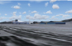
The island-continent of Greenland contains something more of 143 communities of them 88 are represented scenery presently.
14 airports and 5 helipads exist Alone they are inhabited their costs. especially the coast west.
Marine ports: kangerlusuaq,nanortalik,narsarsuak, Nuuk,and Sisimiut
| Filename: | Greenland.zip |
| License: | Freeware |
| Added: | 19th March 2010, 09:09:30 |
| Downloads: | 8,612 |
| Author: | Toni Agramont |
| Size: | 10.39 MB |
| Category: Flight Simulator 2004 - Scenery | |
| Coromandel Photoscenery Compilation *updated* |
|
File Description:
This is a compilation of the various addons developed for the Coromandel region of the North Island, New Zealand.
The basis of this scenery is the simply stunning Godzone Photoscenery developed by Robin Corn and the autogen created for it by Ian Warren. Their combined efforts have produced a wonderfully beautiful and realistic scenery for VFR flying. Lawrie Roache has produced some simply stunning renditions of the airports in the Coromandel area -
Thames (NZTH), Coromandel (NZCX), Pauanui Beach (NZUN), and Whitianaga (NZWT), which were created specifically to fit with the Coromandel Photoscenery by Robin Corn. Charl du Toit has finished and perfected the area with his adjustments to the photo-terrain.
This is simply a compilation (with permission) and re-release of the many fine sceneries these men have produced.
This updated version includes a newer version of the photoscenery and some bug-fixes.
| Filename: | Coromandel_Photoscenery_Compilation_updated.zip |
| License: | Freeware, limited distribution |
| Added: | 5th October 2012, 02:42:03 |
| Downloads: | 823 |
| Author: | Robin Corn, Ian Warren, Lawrie Roache, Charl du Toit, Ephram Matheson |
| Size: | 52.28 MB |
| Category: Flight Simulator 2004 - Scenery | |
| Tehran area SRTM mesh |
|
File Description:
This terrain mesh scenery is centered on Tehran city. Ranging from 34.1°N to 37.5°N and 49.2°E to 54.8°E, it includes Elbourz moutain range as well as Caspian sea shores (28 meters below sea lavel).
Based on SRTM Data (3 arcsec, 90m) and sampled to LOD9 resolution (76m) using Matthew Styles's program "SRTM To BGL v1.04". While only tested with Fs2004, this mesh should also run with FS2002.
SRTM 3 arcsec dataset has numerous and sometimes huge void areas. But thanks to John Child's beautiful and powerful "Blackart" utility it's now easy to patch these areas with lower resolution dataset: I took the coupled interpolation method to merge SRTM 3-arcsec with SRTM 30-arcsec dataset when needed. This gives the best results, as patched areas with 30-arcsec data are blending naturally with surrounding 3-arcsec mesh. Of course the resolution of patched areas is quite poor, but still a bit better than the default LOD5 mesh. However, in exception of Demavend Peak, the SRTM data was quite good for this area and didn't need much patching so that the rendering is allways excellent.
| Filename: | Tehran_area_SRTM_mesh.zip |
| License: | Freeware, limited distribution |
| Added: | 20th June 2004, 14:14:31 |
| Downloads: | 5,588 |
| Author: | Yohann Baptiste |
| Size: | 18.1 MB |
| Category: Flight Simulator 2004 - Scenery | |
| Irish Airports Scenery |
|
File Description:
FS2004 scenery for Dublin and other Irish airports. Originally designed by the IFSD team, unfortunately no longer operational. Contains the original scenery plus the update file. See enclosed readme.txt for installation notes. Uploaded by Ray Proudfoot.
| Filename: | Irish_Airports_Scenery.zip |
| License: | Freeware, limited distribution |
| Added: | 29th November 2008, 17:40:51 |
| Downloads: | 24,153 |
| Author: | Ray Proudfoot and IFSD Team |
| Size: | 29.99 MB |
| Category: Flight Simulator 2004 - Scenery | |
| Arusha Airport (ARK/HTAR) |
|
Images related to this file:
File Description:
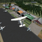
This is Arusha Airport (ARK/ HTAR) located in Northern Tanzania in the town of Arusha. It serves as the main gateway for GA planes for tourists to the National Parks. Built using Sketchup, ADE v1.76, Sbuilder. Needs RWY12 Objects
| Filename: | Arusha_Airport_ARKHTAR.zip |
| License: | Freeware |
| Added: | 2nd March 2019, 04:15:17 |
| Downloads: | 655 |
| Author: | Emmanuel Mwandosya |
| Size: | 10.07 MB |
| Category: Flight Simulator 2004 - Scenery | |
| The Netherlands 2000 scenery v2.9 service pack 2 |
|
Images related to this file:
File Description:
Servicepack 2 for NL2000 scenery version 2.9 (FS2004)
| Filename: | The_Netherlands_2000_scenery_v29_service_pack_2.zip |
| License: | Freeware, limited distribution |
| Added: | 1st March 2010, 02:16:13 |
| Downloads: | 1,387 |
| Author: | The Netherlands 2000 Design Team |
| Size: | 19.48 MB |


© 2001-2026 AVSIM Online
All Rights Reserved
Privacy Policy |