
Where Flight Simulation Enthusiasts Gather from Around the World!
AVSIM Library - Search Results

| Category: Flight Simulator 2004 - Scenery | |
| Etimesgut AB/Ankara(Turkey) Airport (LTAD/ANK) scenery (2016) |

|
Images related to this file:
File Description:
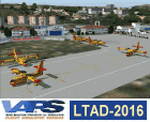
Etimesgut AB/Ankara(Turkey) Airport (LTAD/ANK) scenery (2016) for Flight Simulator 2004 (Fs9). This military airport is in Ankara, the capital of Turkey. Esenboga (LTAC) is very close to the airport. Flight training is given here. The pilot is raised. There are two large and long aprons on either side of the runway. This aprons has a very large number of flight training buildings and hospitals. Bombardier, Gulfstream, Cessna 560XL Excel, Businesss Jet, CL215-Fire fighter, Dash8, Saab-340, CN235, etc. GA airplanes have been configured for parking. Thanks for using. Scenery design by VAPS (vaps.hooxs.com)
| Filename: | Etimesgut_ABAnkaraTurkey_Airport_LTADANK_scenery_2.zip |
| License: | Freeware |
| Added: | 14th April 2017, 07:18:47 |
| Downloads: | 985 |
| Author: | Pilot Hoca (VAPS) |
| Size: | 8.88 MB |
| Category: Flight Simulator 2004 - Scenery | |
| HTMS Moshi |
|
File Description:
Googly scenery for Moshi (ICAO: HTMS), a small airport serving the town of the same name
located in the lower slopes of Africa's highest mountain - Mount Kilamanjaro.
The town boasts good quality education and medical facilities, and industry
includes production of fizzy drinks, beer, flour, animal feed and furniture,
but surprisingly little tourism activity has been developed here so much of
the traffic at this airport is unscheduled and charter work using smaller
aircraft.
Microsoft have only provided wrongly-positioned runways at this airport in
Flight Simulator 2004 and this scenery seeks to redress the situation
so that you and your "AI" traffic can use the airport.
The scenery does not purport to be ultra-accurate. Based on high quality
satellite imagery from Google Earth, the layout is proportionally correct but the
added airport features, such as buildings, are built from default Microsoft objects
and add-on libraries so will not look exactly like the real thing.
You are not obliged to download and install any additional scenery libraries,
but to enjoy this scenery in its entirety, you may wish to. It will work fine,
with or without.
| Filename: | HTMS_Moshi.zip |
| License: | Freeware |
| Added: | 12th October 2008, 10:22:59 |
| Downloads: | 1,080 |
| Author: | John Hinson |
| Size: | 61.84 KB |
| Category: Flight Simulator 2004 - Scenery | |
| OP0C Bandari, Pakistan |
|
File Description:
Googly scenery for Bandari, a minor airport in Palistan served once weekly by
Metroliner turboprops of Royal Airlines. The airport has neither ICAO not IATA
status, but Microsoft have given it an unofficial ICAO code of OP0C.
Flight Simulator 2004 has only provided a runway at this airport and this scenery
seeks to redress the situation so that you and your "AI" traffic can use the
airport.
The scenery does not purport to be ultra-accurate. Based on high quality
satellite imagery from Google Earth, the layout is proportionally correct but the
added airport features, such as buildings, are built from default Microsoft objects
and add-on libraries so will not look exactly like the real thing.
You are not obliged to download and install any additional scenery libraries,
but to enjoy this scenery in its entirety, you may wish to. It will work fine,
with or without.
| Filename: | OP0C_Bandari_Pakistan.zip |
| License: | Freeware |
| Added: | 20th April 2008, 17:04:59 |
| Downloads: | 558 |
| Author: | John Hinson |
| Size: | 74.99 KB |
| Category: Flight Simulator 2004 - Scenery | |
| VABP Bhopal/Bairagarh, India |
|
Images related to this file:
File Description:
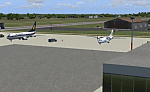
Googly scenery for VABP Bhopal/Bairagarh, India - an enhancement to the
airport provided in Flight Simulator 2004 which is incorrect in many respects.
These scenery files enlarge the apron to a realistic size to accept scheduled
traffic, remove spurious taxiways (they were actually perimeter tracks!), and
add buildings and other airport features so that you and your "AI" traffic
can land, taxi, park and take off in a realistic manner.
This small domestic airport is served by Boeing and Airbus jets of Indian
Airlines and Jet Airways together with local flights operated by ATRs of Air
Deccan.
The scenery does not purport to be ultra-accurate. Based on high-detail satellite
imagery from Google Earth, the layout is proportionally correct but the added
airport features, such as buildings, are built from default Microsoft objects
and add-on libraries so will not look like the real thing.
You are not obliged to download and install any additional scenery libraries,
but to enjoy this scenery in its entirety, you may wish to. It will work fine,
with or without.
[File re-uploaded at request of AVSIM]
| Filename: | VABP_BhopalBairagarh_India.zip |
| License: | Freeware |
| Added: | 7th May 2010, 22:34:06 |
| Downloads: | 1,626 |
| Author: | John Hinson |
| Size: | 64.37 KB |
| Category: Flight Simulator 2004 - Scenery | |
| OAZI (OAZ) - Camp Bastion - Helmand, Afghanistan |
|
Images related to this file:
File Description:
Camp Bastion Base in Afghanistan for US/British to stay in for during missions. FlyDubai flies to airport 3 times a week for military or visitors to airport. The stock FS2004 doesn't have airport. It has been difficult to find details about the airport but I found the airport charts on the Internet.
| Filename: | OAZI_OAZ__Camp_Bastion__Helmand_Afghanistan.zip |
| License: | Freeware |
| Added: | 22nd March 2015, 22:34:06 |
| Downloads: | 782 |
| Author: | Stuart John Gilbert II |
| Size: | 2.61 MB |
| Category: Flight Simulator 2004 - Scenery | |
| Port Hardy, B.C. CYZT Control Tower |
|
File Description:
This is the control tower object that should have been included with the rest of my Port Hardy scenery. Sorry 'bout that. Requires that you already have installed cyzt_ss_v1.zip.
| Filename: | Port_Hardy_BC_CYZT_Control_Tower.zip |
| License: | Freeware |
| Added: | 25th March 2006, 01:51:34 |
| Downloads: | 1,341 |
| Author: | Sidney Schwartz |
| Size: | 28.24 KB |
| Category: Flight Simulator 2004 - Scenery | |
| Cavanaugh Bay 66S Idaho Airport |
|
File Description:
Priest Lake in Idaho is described by their Chamber of Commerce as "...a magnificent 23,000 acre azure lake nestled beneath the majestic Selkirk Mountains — without question, one of the most beautiful wilderness areas you’ll ever see." Cavanaugh Bay is a grass strip right on the lake, with lodges (there's one right next to the end of the runway), campgrounds and boat/plane docks nearby. I think I was able to make a fair approximation of the real thing, based on Google Earth. If you're flying something that floats, choosing RWY S or RWY E from the FS9 airport menu will park you conveniently at a floatplane dock. This scenery was designed for use with Ultimate Terrain USA and has not been tested with the default FS9 scenery.
| Filename: | Cavanaugh_Bay_66S_Idaho_Airport.zip |
| License: | Freeware |
| Added: | 14th July 2008, 13:38:40 |
| Downloads: | 610 |
| Author: | Sidney Schwartz |
| Size: | 654.43 KB |
| Category: Flight Simulator 2004 - Scenery | |
| CYAZ Tofino, B.C. |
|
File Description:
Tofino is a small airport on the southwest coast of Vancouver Island, B.C. Daytime operation only. Right next to the airport are a campground and golf course. This enhancement is based on ground and air photos and is pretty close to the real thing. All default buildings have been replaced. The golf clubhouse (complete with putting green) and the campground office were added. The Budget Rent-A-Car office and North Vancouver Air "terminal building" were custom made by Dave Bedwell. Tofino is a heavily wooded airport and I added trees to simulate that. Many thanks to Vancouver Island resident and flight simmer Irvin McIntyre for the wonderful photos he took for me at Tofino airport. I've included some of them in this zip file so you can see what the real Tofino looks like.
| Filename: | CYAZ_Tofino_BC.zip |
| License: | Freeware |
| Added: | 23rd April 2006, 18:46:27 |
| Downloads: | 1,504 |
| Author: | Sidney Schwartz |
| Size: | 7.32 MB |
| Category: Flight Simulator 2004 - Scenery | |
| St. Maries S72 Idaho |
|
File Description:
St. Maries is a nice little general aviation airport located on the St. Joe River at the southern end of Coeur D' Alene Lake. VFR only, but there is a rotating beacon and runway lighting and night operations are allowed. The runway was moved to its correct location, the taxiways and aprons redone from scratch, and all buildings replaced. Also included is AI traffic that uses the default FS9 aircraft.
| Filename: | St_Maries_S72_Idaho.zip |
| License: | Freeware |
| Added: | 10th July 2008, 09:02:04 |
| Downloads: | 489 |
| Author: | Sidney Schwartz |
| Size: | 875.06 KB |
| Category: Flight Simulator 2004 - Scenery | |
| Boundary County 65S |
|
File Description:
Another airport located in the beautiful mountains of northern Idaho. This scenery is based on aerial photos from Google Earth and other sources. All default buildings have been replaced and new taxiways and buildings have been added. (I couldn't find any information on the taxiway designations, so I made them up.) Some general aviation AI traffic is included.
| Filename: | Boundary_County_65S.zip |
| License: | Freeware |
| Added: | 12th May 2008, 23:30:25 |
| Downloads: | 655 |
| Author: | Sidney Schwartz |
| Size: | 858.23 KB |


© 2001-2026 AVSIM Online
All Rights Reserved
Privacy Policy |