
Where Flight Simulation Enthusiasts Gather from Around the World!
AVSIM Library - Search Results

| Category: Flight Simulator 2004 - Scenery | |
| PACD - Cold Bay - Aleutian Islands, Alaska, USA |

|
Images related to this file:
File Description:
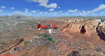
Cold Bay is in the eastern third of the Aleutian chain of islands in Alaska, around 175 miles east of Dutch Harbor. The small town has a population of just over 100 and is in existance solely because of the airport with its long runways, one just over 6,000 feet and the other over 10,000 feet and with an ILS. Goods are flown here for local redistribution. The airport was originally built to this size for use in WW2 and there are still quonset huts from this time visible in the area, though the majority of the rough-and-ready housing has now been cleared away. There are scheduled flights by Grant Aviation to neighbouring local airfields and flights to and from Anchorage by Peninsula Air (included in the AI posted with Adak) and Grant Aviation have space attached to their hangar that serves as a terminal. The Coastguard also make use of Cold Bay.
| Filename: | PACD__Cold_Bay___Aleutian_Islands_Alaska_USA.zip |
| License: | Freeware, limited distribution |
| Added: | 21st January 2015, 10:01:50 |
| Downloads: | 424 |
| Author: | Roger Wensley |
| Size: | 4.88 MB |
| Category: Flight Simulator 2004 - Scenery | |
| PADK - Adak - Aleutians, Alaska - USA |
|
Images related to this file:
File Description:
Adak is near the western end of the Aleutian chain of islands in Alaska. The closed naval air base buildings are mostly still there and once housed over 6,000; the population is now much reduced to around 320, involved in fishing and a fish processing plant, organising caribou hunts for the tourism industry, running the airport, etc. The runways are long and wide (both are over 7,000 feet) and aligned 23-05 (with an ils) and 18-36. There are flights from Anchorage on Thursdays and Sundays by Alaska Airlines (a 737) and occasional charters from Dutch Harbor by Grant Aviation, 445 miles east of Adak. The Ai included here contains these flights. There are revisions included for Dutch Harbor PADU which provide parking for more Grant planes, as Grant are now also running flights to Akun Island, east of Dutch Harbor; more Aleutian posts to follow.
| Filename: | PADK__Adak__Aleutians_Alaska__USA.zip |
| License: | Freeware, limited distribution |
| Added: | 13th January 2015, 23:32:44 |
| Downloads: | 557 |
| Author: | Roger Wensley |
| Size: | 7.59 MB |
| Category: Flight Simulator 2004 - Scenery | |
| Eastern of Russia 10 airports |
|
File Description:
I found out that Aurora Airlines and Taiga Air schedules with some airports are missing in default of FS2004. I created 10 airports. Please read in my readme.txt included. 10 Airports are:
DHG - Dalnegerosk, Russia; UNNB - Bogorodskoye, Russia; UNSI - Iturup, Russia; UHTG - Amgu, Russia; UHTQ - Svetlaya, Russia; UHTR -Preobrazheniye,Russia; UHWE - Yedinka, Russia; UHWK - Kavalerovo, Russia; UHWP - Plastun, Russsia; UHWT - Primorsky Krai,Terney airport, Russia
| Filename: | Eastern_of_Russia_10_airports.zip |
| License: | Freeware |
| Added: | 20th April 2021, 18:18:19 |
| Downloads: | 166 |
| Author: | Stuart John Gilbert II |
| Size: | 17.96 MB |
| Category: Flight Simulator 2004 - Scenery | |
| St. George (KSGU) / Mesquite (67L), Utah/Nevada, Photo-Scenery (FS9 & FSX) |
|
Images related to this file:
File Description:
Covers the area between St. George, Utah and Mesquite, Nevada. To the north of St. George
the Pine Valley Mountains with their foothills of scenic red sandstone loom over the city.
St. George Municipal Airport (KSGU) is mostly used for general aviation but is also served by SkyWest Airlines
on behalf of Delta Connection. Because of it's location on a mesa this airport can't be expanded and so a new
airport is currently being built southeast of the city at the site of an abandoned airfield. The opening
is expected in 2011. To the south of the city make sure, you don't miss the Virgin River Gorge where the
Virgin River winds thru a long winding canyon in the transition zone between the red rocks of southern Utahs
Colorado Plateau and Nevadas Mojave Desert. Shortly afterwards you reach Mesquite which is situated just
west of the Arizona stateline. Like nearly all Nevada cities near the stateline Mesquite is home to several
Casinos. Mesquite Airport (67L) lies just north of the city.
High resolution versions of this scenery for FS9 and FSX (much sharper, but larger and multiple downloads)
are available at www.blueskyscenery.com/CNY_South3West6.html . The screenies are taken from the high-res versions,
so expect this version to be slightly more blurry. Thanks to Joop Mak for providing custom AFCADs that
correct airport layouts so that they align with the photo-textures! They are available at www.blueskyscenery.com/AFCADs.html .
YourDonation@Work: Dedicated to Werner, Ralf-Peter and Nels.
| Filename: | St_George_KSGU__Mesquite_67L_UtahNevada_PhotoScene.zip |
| License: | Freeware, limited distribution |
| Added: | 24th March 2010, 19:41:43 |
| Downloads: | 1,653 |
| Author: | Gottfried Razek - blueskyscenery.com |
| Size: | 95.58 MB |
| Category: Flight Simulator 2004 - Scenery | |
| Abruzzo-Molise L'Aquila, Italy |
|
Images related to this file:
File Description:
Abruzzo & Molise, Italy, Photoreal Scenery (26 june 2007).
Freeware scenery for FS2004.
All files of my scenery ABRUZZO & MOLISE: Abruzzo & Molise 1 - Campobasso.zip
Abruzzo & Molise 2 - Pescara.zip
Abruzzo & Molise 3 - Gran Sasso.zip
Abruzzo & Molise 4 - L'Aquila.zip
Author: Angelo Lanzillotta
e-mail: [email protected]
This photoreal scenery is based on aerial photos grabbed at the resolution of 5 meters per pixel (the same used in FS2004- works in FS 2002 too). I worked hard on these photos to obtain a final product with the real colours and the real positions for all parts of the landscape: if you have any comments or suggests, feel free to email me.
Every single part of this scenery can be used also as a standalone product, so it's not necessary to download all 4 parts of my big scenery.
However i strongly suggest to use all parts in order to obtain a complete photoreal look of this beautiful italian landscape, with famous mountains like Gran Sasso and Maiella.
INSTALLATION: 1) extract the files in a directory of your choice using the option: Use folder names.
2) Open FS and add the scenery to the scenery library (order isn't important).
For best results, use this scenery in association with Pietro Mauri Italymesh2004.
DISCLAIMER
This scenery is released as freeware, so nobody can make money with it.
You cannot include this scenery in any software collection or web site without written permission of author.
You can add objects and autogen (i had no time to work on them).
This software can be used only as FSX/FS2004/FS2002 scenery: no other use is allowed.
I accept absolutely no responsibility for your use of this software.
Re Uploaded in Oct. 2012 by Roberto (Tenex) Italy Terni(TR)
| Filename: | AbruzzoMolise_LAquila_Italy.zip |
| License: | Freeware, limited distribution |
| Added: | 10th October 2012, 22:37:18 |
| Downloads: | 1,095 |
| Author: | Enzo Lanzillotta |
| Size: | 87.93 MB |
| Category: Flight Simulator 2004 - Scenery | |
| Steamboat Springs (KSBS), Flat Tops Wilderness Area, Colorado - Photo-Scenery |
|
Images related to this file:
File Description:

Steamboat Springs (KSBS), Flat Tops Wilderness Area, Colorado, Photo-Scenery (FS9 & FSX)
The Flat Tops Wilderness Area, which is the second largest wilderness area in Colorado, is named for its many flat topped mountains that are clearly visible from the sky. Trappers Lake, located in the north of the area inspired Arthur Carhart, a US Forest Service official, to initiate a plea for Wilderness preservation as early as 1919. Finally in 1975, three years before his death in 1978, the Flat Tops were designated a wilderness area. No wonder he found the area so entrancing: Behind Trappers Lake loom majestic volcanic cliffs, and beyond them a vast subalpine terrain reluctantly yields to alpine tundra with an average elevation of about 10.000 feet. More than 100 lakes dot the country above and below numerous flat-topped cliffs. Steamboat Springs is an internationally known winter resort destination.
To explore the scenery depart from Steamboat Springs Airport (KSBS) or Yampa Valley Airport (KHDN) and head south. High resolution versions of this scenery for FS9 and FSX (much sharper, but larger and multiple downloads) are available at www.blueskyscenery.com/GNB_West2.html . The screenies are taken from the high-res versions, so expect this version to be slightly more blurry. Thanks to Joop Mak for providing custom AFCADs that correct airport layouts so that they align with the photo-textures! They are available at www.blueskyscenery.com/AFCADs.html . YourDonation@Work: Dedicated to James.
| Filename: | Steamboat_Springs_KSBS_Flat_Tops_Wilderness_Area_C.zip |
| License: | Freeware, limited distribution |
| Added: | 26th April 2010, 17:53:25 |
| Downloads: | 1,303 |
| Author: | Gottfried Razek - blueskyscenery.com |
| Size: | 91.57 MB |
| Category: Flight Simulator 2004 - Scenery | |
| Landivisiau Air Base France |
|
Images related to this file:
File Description:

Serving as both operations and primary base for the French Navy's Rafale aircraft, Landivisiau airbase is located in the quiet hedgerow country of West Brittany. Here the pilots of the Aeronavale learn and practice those skills so necessary to carrier operations and the projection of sea power for the French nation. The airbase is equipped with a 2700m runway as well as a carrier practice deck for both pilot and handler training. This scenery is designed for use with the MAIW package 'French Rafales' but of course will work for any aircraft.
| Filename: | Landivisiau_Air_Base_France.zip |
| License: | Freeware, limited distribution |
| Added: | 17th December 2013, 19:04:52 |
| Downloads: | 2,022 |
| Author: | John Stinstrom |
| Size: | 7.05 MB |
| Category: Flight Simulator 2004 - Scenery | |
| Grantley Adams International Airport - Update 1.1 |
|
File Description:
Update for Grantley Adams International Airport Barbados to fix Terrain elevation issues around the airport area plus adds ILS and GPS approaches so ATC now recognises and offers these options. Requires tbpb_v1.zip
| Filename: | Grantley_Adams_International_Airport__Update_11.zip |
| License: | Freeware |
| Added: | 22nd February 2009, 06:09:16 |
| Downloads: | 2,351 |
| Author: | Max Kraus |
| Size: | 1.7 KB |
| Category: Flight Simulator 2004 - Scenery | |
| CYWG Winnipeg 2020 - Building Night Lighting Fix |
|
Images related to this file:
File Description:
CYWG Winnipeg 2020 Scenery Fix -- The Kelly Western FBO and Nav Canada building models were compiled without night lighting. Consequently the buildings are dark from dusk to dawn. This omission went unnoticed through the beta testing phase of development. The night textures for these buildings was included in the original release of the scenery so no new textures are required. This is a simple fix that adds the light map to the existing models. See readme for installation instructions.
| Filename: | CYWG_Winnipeg_2020__Building_Night_Lighting_Fix.zip |
| License: | Freeware, limited distribution |
| Added: | 27th October 2023, 12:08:33 |
| Downloads: | 275 |
| Author: | Gregory Putz |
| Size: | 334.24 KB |
| Category: Flight Simulator 2004 - Scenery | |
| CYWG Winnipeg 2020 Fall Texture Fix |
|
File Description:
This is a small texture fix for CYWG Winnipeg 2020 for FS2004. The fall texture for one of the terrain tiles is the same as the summer texture. This fix provides the correct texture. See readme for further details.
| Filename: | CYWG_Winnipeg_2020_Fall_Texture_Fix.zip |
| License: | Freeware, limited distribution |
| Added: | 6th November 2023, 15:21:11 |
| Downloads: | 139 |
| Author: | Gregory Putz |
| Size: | 116.28 KB |
© 2001-2026 AVSIM Online
All Rights Reserved
Privacy Policy |