
Where Flight Simulation Enthusiasts Gather from Around the World!
AVSIM Library - Search Results

| Category: Flight Simulator 2004 - Scenery | |
| Patch for ISD Milan Orio al Serio LIME update 2013! |

|
Images related to this file:
File Description:
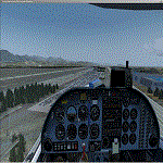
Dear friends, with this update of the '"update", I corrected some flaws of' Orio al serio 2013
I published. With this patch, you will have a better graphic performance at night, and the addition
of new parking areas with better cars and new viw of Bergma Hight City from the airport.
I also entered the hut ILS in the airport area and I corrected the position of several objects within the Scenery.
I believe that as long as I am not going, I or someone else's hand to complete reconstruction of the Scenery linate, this
will be my last job for this airport. Happy Flights alive and go Atalanta Bergamo!
Fabio Ferrari castione of presolana [email protected]
| Filename: | Patch_for_ISD_Milan_Orio_al_Serio_LIME_update_2013.zip |
| License: | Freeware |
| Added: | 1st February 2013, 00:50:24 |
| Downloads: | 3,123 |
| Author: | Fabio Ferrari |
| Size: | 1.26 MB |
| Category: Flight Simulator 2004 - Scenery | |
| Alta circling approach |
|
File Description:
The old circling approach for runway 30 at Alta, Norway (ENAT) is a challenging approach. I don't think it is used anymore, but it was still in use during the 1980:s and perhaps even into the 1990:s when SAS flew DC-9 i northern Norway. During the approach you fly a circle, following lights in the terrain and keeping track of the altitude. Included in this zip-archive are the bgl-files for the lights and the old approach plates for Alta. Recommended additional installations are Norway airports and Norway Mesh.
Happy flying!
| Filename: | Alta_circling_approach.zip |
| License: | Freeware |
| Added: | 20th May 2010, 02:48:06 |
| Downloads: | 438 |
| Author: | Krister Renard |
| Size: | 328.64 KB |
| Category: Flight Simulator 2004 - Scenery | |
| Santo Domingo La Isabela Int'l Airport |
|
File Description:
This is the Scenery of the newest Airport in Dominican Republic. La Isabela Airport (MDJB)
opened in 2006 as a replacement for the old and rather small Herrera (MDHE) airport. This
airport has a higher capacity of receiving General Aviation aircraft and probably a 737/A320
(taking advantage of a 5400 ft runway) opens up a new era in aviation for the Dominican
Republic. This package includes Landclass of the area, includes an AI traffic package of Gen Aviation of Dominican Republic. This is not a demo.
| Filename: | Santo_Domingo_La_Isabela_Intl_Airport.zip |
| License: | Freeware |
| Added: | 30th July 2006, 04:38:08 |
| Downloads: | 4,831 |
| Author: | Dominican Aerodromes |
| Size: | 4.85 MB |
| Category: Flight Simulator 2004 - Scenery | |
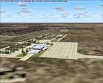
| Sisimiut (BGSS) on the west coast of Greenland |
|
Images related to this file:
File Description:
Sisimiut is on the west coast of Greenland. It is around 125 miles south of Aasiaat, and 80 miles west of Kangerlussuaq airport, which is currently the largest commercial airfield in Greenland. Sisimiut has a population of 5,500 and the main occupations are fishing, tourism, education, and a growing industrial base. It has the northernmost year-round ice-free port in Greenland, though icebergs floating down from the north are commonplace. The airport is across a bridge and along a two mile road on the north side of an inlet, northwest of the town. The runway is 2,600+ feet of asphalt almost 100 feet wide and lit, aligned 20/02 and at 33 feet ASL, with the apron and terminal building at the eastern end. The building is identical to the one at Aasiaat. Air Greenland run regular flights with a Dash-8, Dash-7, or Twin Otters; within FS9 it is impossible to land an Ai Dash-7 on a runway less than 3,000 feet long, so I used a Dash-8. There was no way to replicate both the parking facing away from the terminal AND the "through" taxiing to complete the circle back to the runway; after parking correctly the AI Air Greenland plane will reverse before heading out to take off. The surrounding area is rock with some scruffy grass and low bushes, and there is no grass around the runway; the airfield has compacted gravel instead.
| Filename: | Sisimiut_BGSS_on_the_west_coast_of_Greenland.zip |
| License: | Freeware, limited distribution |
| Added: | 28th April 2012, 22:03:35 |
| Downloads: | 850 |
| Author: | Roger Wensley |
| Size: | 3.71 MB |
| Category: Flight Simulator 2004 - Scenery | |
| St Lawrence Island AK: Gambell PAGM, Savoonga PASA, and Northeast Cape |
|
Images related to this file:
File Description:
St Lawrence Island is in Alaska, but "in" is slightly misleading as it is in fact in the Barents Sea and 120 miles from the Alaska mainland, and only 40 miles offshore of Russia. The island is around 100 miles long, with two villages and at the eastern end an old air force radar base that was cleared away some 25 years ago. Gambell is one of the two villages and is at the far western end of the island, with a population of around 700 living mainly from the sea. This northern airfield is unusual in that it has an asphalt runway and apron, the lit runway being aligned 16-34 and just over 4,500 feet long. The reason for the asphalt becomes apparent if you try walking in the vicinity, as underfoot there are rounded pebbles down to varying depths, and they are quite small and eventually slippery enough to trip you up. To base a flexible gravel runway on top of this would have been difficult, and when it was originally built it was for an air force base (closed long ago). The village is also fairly unique among northern settlements in that it has wind turbines and also solar panels. The second village is Savoonga and is around 40 miles east of Gambell with a similar population. The runway here is lit gravel aligned 5-23 and 4,900 feet long. This village also has wind turbines and solar panels. There are no vehicles (cars, pickups, trucks etc) on the island, mainly because there is nowhere far to go to and in the case of Gambell because roads as such would be difficult to create. ATV's are the standard way to go, along with small boats for fishing and whaling. At the eastern and of the island the remaining traces of the air force radar base are just the gravel runway and aprons, included with the Savoonga scenery. The AI included here is for daily flights from Nome by ERA and Bering Air, along with some GA. Also included here is the EZ library that includes the wind turbines, to save you looking for it. Installing this will also mean that a wind farm in my Cyprus scenery wii now be visible to the north of Larnaca, and there are other libraries in the series that include useful objects. The Lens_EZ_Animated library could go into your static objects folders, which is where I have it; up to you.
| Filename: | St_Lawrence_Island_AK_Gambell_PAGM_Savoonga_PASA_a.zip |
| License: | Freeware, limited distribution |
| Added: | 29th February 2020, 00:09:36 |
| Downloads: | 221 |
| Author: | Roger Wensley |
| Size: | 11.59 MB |
| Category: Flight Simulator 2004 - Scenery | |
| HDAM Military Area |
|
File Description:
Djibouti Ambouli military area of the international airport HDAM french air force BA188 installation , AFCAD file included.
| Filename: | HDAM_Military_Area.zip |
| License: | Freeware, limited distribution |
| Added: | 12th March 2006, 21:39:29 |
| Downloads: | 4,433 |
| Author: | Alexandre Remy |
| Size: | 8.47 MB |
| Category: Flight Simulator 2004 - Scenery | |
| Halo texture |
|
File Description:
This texture file changes the lights at the airport such as runway lights, taxi, center lines, and some lights to different aircraft. This file will not effect the landing light beam only the bulb shape and color. I feel this is the most realistic color and glow effect for this texture.
| Filename: | Halo_texture.zip |
| License: | Freeware |
| Added: | 25th November 2004, 14:18:03 |
| Downloads: | 6,166 |
| Author: | Sandon Lyon |
| Size: | 22.57 KB |
| Category: Flight Simulator 2004 - Scenery | |
| Santa Fe Airport - Argentina |
|
Images related to this file:
File Description:
Sauce Viejo airport serves the city of Santa Fe, capital city of the homonymous province. Among the buildings represented are the terminal (and control tower), the service area of the airport (fuel and other related buildings) and hangars belonging to the Government of Santa Fe and general aviation hangars in the south area of the airport.
| Filename: | Santa_Fe_Airport__Argentina.zip |
| License: | Freeware |
| Added: | 12th February 2010, 10:40:01 |
| Downloads: | 1,592 |
| Author: | Ramon Sola |
| Size: | 8.05 MB |
| Category: Flight Simulator 2004 - Scenery | |
| Ranchi (India) Airport |
|
Images related to this file:
File Description:
Birsa Munda Airport (IATA: IXR, ICAO: VERC), also known as Ranchi Airport, is the primary airport serving the city of Ranchi, the capital city of the Indian state of Jharkhand. It is named after Indian tribal freedom fighter Birsa Munda and is currently managed by Airports Authority of India.
| Filename: | Ranchi_India_Airport.zip |
| License: | Freeware |
| Added: | 29th October 2020, 22:13:38 |
| Downloads: | 177 |
| Author: | Tushar Deshpande |
| Size: | 721.86 KB |
| Category: Flight Simulator 2004 - Scenery | |
| Hong Kong International Airport VHHH 2005b with runway fix |
|
File Description:
The best Hong Kong Intl (VHHH) freeware scenery vhhh2005b. Re-upload after the crash of avsim.net. Including the runway fix file to correct the ILS07R bug on final approach (clk_runways_fix.zip). Hope you enjoy this scenery.
| Filename: | Hong_Kong_International_Airport_VHHH_2005b_with_ru.zip |
| License: | Freeware |
| Added: | 27th August 2010, 14:52:08 |
| Downloads: | 7,173 |
| Author: | Thomas Kwong |
| Size: | 11.98 MB |
© 2001-2026 AVSIM Online
All Rights Reserved
Privacy Policy |