
Where Flight Simulation Enthusiasts Gather from Around the World!
AVSIM Library - Search Results

| Category: Flight Simulator 2004 - Scenery | |
| HTKJ - Kilimanjaro International Airport - Hai District, Tanzania |

|
Images related to this file:
File Description:
Little scenery about Kilimanjaro Airport HTKJ, it hasn't a lot of details but has the fundamental accessories like ILS 09, Light Approach System, Parking...
| Filename: | HTKJ__Kilimanjaro_International_Airport__Hai_Distr.zip |
| License: | Freeware |
| Added: | 15th February 2015, 22:03:57 |
| Downloads: | 693 |
| Author: | Francesco Mura |
| Size: | 4.49 MB |
| Category: Flight Simulator 2004 - Scenery | |
| CYVP - Kuujjuaq - Quebec, Canada |
|
Images related to this file:
File Description:
Kuujjuaq is in northern Quebec at the southern end of Ungava Bay, and 30 miles up the Koksoak River. Kuujjuaq has a population of around 2,400; it was previously called Fort Chimo and in 1830 there was a Hudson Bay trading post established close by, but on the other bank of the river. A nursing station and a school were established in 1948 and the Hudson Bay post moved across the river to the current location. The airport is to the south of the town and, unusally for northern airfields, has two runways. The asphalt runway is 6,000 feet long and aligned 07/25, and the gravel runway is 5,000 feet long and aligned 13/31; 07 has ILS. There is fuel available, both 100LL and JetA, but the 100LL will be in drums and you are required to have your own pump. There are numerous flights that stop at Kuujjuaq; the AI included here has Air Creebec, First Air, Wasaya Airways, and Air Inuit (Kuujjuaq is a maintenance centre for Air Inuit) plus private flights by various aircraft. There is also a flight by my poor representation of a Helicopter Transport Services chopper. There is a float base on the nearby Stewart Lake during the summer months. The base is within the Kuujjuaq control zone, and normally you would talk to the tower and inform them of your intentions, but in FS9 this cannot be replicated.
| Filename: | CYVP__Kuujjuaq__Quebec_Canada.zip |
| License: | Freeware, limited distribution |
| Added: | 11th February 2013, 06:22:50 |
| Downloads: | 812 |
| Author: | Roger Wensley |
| Size: | 5.92 MB |
| Category: Flight Simulator 2004 - Scenery | |
| CYRL & CKS4 - Red Lake & Fishing Lodge Outposts - Ontario, Canada |
|
Images related to this file:
File Description:
Red Lake is in Ontario, 90 miles east of the Manitoba border & 120 miles north of the US border. The town is at what was the northern end of "the road" for many years, & this has led to it becoming a centre for floatplane flights north to fishing lodges etc. It has also become THE centre of Noorduyn Norseman floatplanes in Canada & there is a Norseman on display & an annual Norseman festival. Red Lake CYRL airport is 3 miles north of the town with 5,000 feet of asphalt runway aligned 08-26 with PAPI at both ends. The apron is in two parts; the western for the fire fighting planes & the eastern for the new terminal & the hangars for North Star, Superior, and Wasaya. There is also a scruffy hangar that is used for storage & to the south of the east apron some private hangars. The town & the float base (CKS4) are at the southern end of Howey Bay. Planes taxi north before going to full power for take off, & there are two main companies based at CKS4, Chimo & Green's, both of them using Norsemans (or Norsemen?) among other planes. Chimo service their fishing lodge & outposts in the Roderick Lake area, & Green's (who have a base on the west side of Howey Bay) service their own outposts on Trout Lake & Nungesser Lake in the AI. There are other Red Lake float operations using Norsemans from further north on the lake & they service fishing lodges in the AI on Peisk Lake and Uchi Lake. The AI also includes some GA float planes, & there are numerous GA & scheduled flights into CYRL.
| Filename: | CYRL__CKS4__Red_Lake__Fishing_Lodge_Outposts__Onta.zip |
| License: | Freeware, limited distribution |
| Added: | 15th November 2015, 14:29:42 |
| Downloads: | 499 |
| Author: | Roger Wensley |
| Size: | 32.92 MB |
| Category: Flight Simulator 2004 - Scenery | |
| Saglek CYSV in northern Labrador, Newfoundland Canada |
|
Images related to this file:
File Description:
Kangiqsualujjuaq is in northern Quebec on the east side of Ungava Bay, and the rocky coastline stretches north from there for 130 miles before turning sharply to head south as the Atlantic shore of Labrador. On this shore and 120 miles almost due east of Kangiqsualujjuaq is Saglek, once a US radar base as part of the DEW line, and then a Canadian base with a Long Range Radar sited 1,200 feet above the airstrip on the top of the vertical cliff. The airstrip is still in use today as an access to the Torngat Mountains Canadian National Park area further north, with organised summer camps and walks etc and helicopter relays from airstrip to campsites. Saglek closes the gap between my post of Kangiqsualujjuaq and the string of airfields further south on the Labrador coast, such as Nain, Davis Inlet, Hopedale, Makkovik, and Postville etc. These have all been made by Flight Ontario and posted along with the Goose Bay Air Base, which also functions as a civil airport.
| Filename: | Saglek_CYSV_in_northern_Labrador_Newfoundland_Cana.zip |
| License: | Freeware, limited distribution |
| Added: | 17th August 2017, 17:11:29 |
| Downloads: | 162 |
| Author: | Roger Wensley |
| Size: | 3.86 MB |
| Category: Flight Simulator 2004 - Scenery | |
| 3 Northern Ontario Airports: Kenora (CYQK), Wawa (CYXZ) and Marathon (CYSP) - CanUk Scenery |
|
File Description:
Kenora, Wawa and Marathon airports offer destinations in Northern Ontario and are intended to be used with Flight Ontario's Thunder Bay2 and Toronto sceneries. Ultimate Terrain compatible. Zip file includes 3 separate scenery folders so you can choose which of the sceneries you would like to install. Created in GMAX, these sceneries are fairly accurate representations of their real world counterparts. Custom landclass, automated hanger doors, photoreal buildings, 3-D taxiway lights, custom AFCAD2 and static vehicles included. Please see ReadMe for proper installation.
| Filename: | 3_Northern_Ontario_Airports_Kenora_CYQK_Wawa_CYXZ_.zip |
| License: | Freeware, limited distribution |
| Added: | 19th September 2005, 21:50:30 |
| Downloads: | 4,898 |
| Author: | Adam Bentley and David Madge |
| Size: | 14.5 MB |
| Category: Flight Simulator 2004 - Scenery | |
| Salluit CYZG in Hudson Strait, Quebec, Canada |
|
Images related to this file:
File Description:
Salluit is a village of 1,250 or so inhabitants at N 62 W 75 40 on the shore of Sugluk Inlet, which is off Hudson Strait. It's name means "Skinny Ones" in Inuit, and refers to a time when there was not enough to eat, which is a rather scary reminder of just how fragile Inuit survival used to be. The village does not feature in FS9 but is included in this scenery with approximately the right shape and with the roads that lead to the airfield and what I presume are quarries for building materials and roads. The airfield runway is 3,510 feet of gravel 100 feet wide and is some 740 feet higher than the village on the shoreline. I added the roads, the quarries, a new airfield background, plus of course there is the scenery file and the AFCAD and AI.
| Filename: | Salluit_CYZG_in_Hudson_Strait_Quebec_Canada.zip |
| License: | Freeware, limited distribution |
| Added: | 2nd November 2010, 01:18:55 |
| Downloads: | 372 |
| Author: | Roger Wensley |
| Size: | 1.96 MB |
| Category: Flight Simulator 2004 - Scenery | |
| Eastmain River CZEM in northern Quebec, Canada |
|
Images related to this file:
File Description:
Eastmain River is on the south bank of the river of the same name, close to the eastern shore of James Bay at it's southern end. Moosonee is around 110 miles to the southwest, and Waskaganish (my post October 2010) just 50 miles to the south. The town has a population of around 770 who are mostly Cree speakers. The airport is just to the south of the town with a gravel runway just over 3,500 feet long and aligned 02/20; there is no PAPI and there is no fuel available, unless there is some in drums. There are flights by Air Creebec and Wasaya; their textures are available for download on Flightsim and the planes are as listed in the AI folder. The AI bgl is for both CYAT and CZEM; don't think I have included the wrong one.
| Filename: | Eastmain_River_CZEM_in_northern_Quebec_Canada.zip |
| License: | Freeware, limited distribution |
| Added: | 10th January 2013, 22:00:34 |
| Downloads: | 252 |
| Author: | Roger Wensley |
| Size: | 2.14 MB |
| Category: Flight Simulator 2004 - Scenery | |
| CYGK (2008) - Kingston (Norman Rogers) Airport, Ontario, Canada |
|
Images related to this file:
File Description:
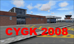
Kingston V2 (2008) - GMAX modeled scenery with custom ground textures. The airport was modeled in its 2008 state.
Kingston Airport or Kingston/Norman Rogers Airport (IATA: YGK, ICAO: CYGK) is located 4.3 nautical miles (7.96 km) west of the downtown of Kingston, Ontario, Canada. CYGK is now as the only airport (except CFB Trenton - restricted) between Toronto, Montreal, and Ottawa that has an ILS approach making it a preferred alternate airport to most aviators.
(This is a re-upload of the scenery to replace the original that was lost in the AVSIM hack. No changes have been made)
| Filename: | CYGK_2008__Kingston_Norman_Rogers_Airport_Ontario_.zip |
| License: | Freeware, limited distribution |
| Added: | 16th May 2010, 10:04:29 |
| Downloads: | 3,293 |
| Author: | Keith Murphy |
| Size: | 25.68 MB |
| Category: Flight Simulator 2004 - Scenery | |
| CYZG - Salluit - Hudson Strait, Quebec, Canada, Modified V1 |
|
Images related to this file:
File Description:
This modified version installs new taxiway lights and windsocks, and updates the AI. This is a complete version and does not require you to have installed the original. Salluit is a village of 1,250 or so inhabitants at N 62 W 75 40 on the shore of Sugluk Inlet, which is in northern Quebec off the Hudson Strait. It's name means "Skinny Ones" in Inuit, and refers to a time when there was not enough to eat, which is a rather scary reminder of just how fragile Inuit survival used to be. The airfield runway is 3,510 feet of gravel 100 feet wide aligned 03-21, and is some 740 feet higher than the village on the shoreline.
| Filename: | CYZG__Salluit__Hudson_Strait_Quebec_Canada_Modifie.zip |
| License: | Freeware, limited distribution |
| Added: | 23rd August 2014, 11:26:53 |
| Downloads: | 254 |
| Author: | Roger Wensley |
| Size: | 11.13 MB |
| Category: Flight Simulator 2004 - Scenery | |
| Landclass Plus Scenery Enhancements - Switzerland |
|
File Description:
FS2002/2004 LandClass and further scenery enhancements for Switzerland. LandClass Version 8 offers actual adjustments around the latest airfields from Daniel Gauthier. Freeware. Small files - big effect ! For VFR pilots and scenery enthusiasts of Switzerland.
| Filename: | Landclass_Plus_Scenery_Enhancements__Switzerland.zip |
| License: | Freeware, limited distribution |
| Added: | 10th January 2004, 01:02:50 |
| Downloads: | 14,456 |
| Author: | Ernst Bosshard |
| Size: | 121.42 KB |
© 2001-2026 AVSIM Online
All Rights Reserved
Privacy Policy |