
Where Flight Simulation Enthusiasts Gather from Around the World!
AVSIM Library - Search Results

| Category: Flight Simulator 2004 - Scenery | |
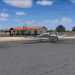
| PAAT (ATU) - Attu - Alaska, USA |

|
Images related to this file:
File Description:
Attu is AT the western end of the Aleutian chain of islands in Alaska, around 40 miles west of Shemya. There was small village on Attu before the Japanese invasion in mid 1942, but the island is now uninhabited. The Coast Guard Loran navigation station remains in place, though it is no longer in operation and visitors to the island are now either tourists or wildlife experts conducting surveys of numbers of nesting birds, etc. The runway still usable is aligned 02-20 and 5,800 feet long; right hand circuits on 02 to stay away from rising ground to the west. The "terminal" building has lost its sign regarding the Horny Bird, removed in 2010 by one of the last of the station operators, but the building is still there, as are some sheds and shacks that lately were used for the uncomfortable accommodation of bird counters. FS9 has used an incorrect icao identification for Attu but correcting it now would make life complicated so ATU it is and shall remain. I have removed the default FS9 roads that came complete with streetlights and telephone poles and replaced and amended the layout with gravel roads to better resemble real life, though the island shape is at best approximate, as is usual in FS9.
| Filename: | PAAT_ATU__Attu__Alaska_USA.zip |
| License: | Freeware, limited distribution |
| Added: | 2nd March 2015, 20:58:09 |
| Downloads: | 279 |
| Author: | Roger Wensley |
| Size: | 3.27 MB |
| Category: Flight Simulator 2004 - Scenery | |
| PAHT - Amchitka - Aleutians, Alaska - USA |
|
Images related to this file:
File Description:
Amchitka is near the western end of the Aleutian chain of islands in Alaska, around 180 miles west of Adak, and was not included in FS9. There is no small town on Amchitka Island, which is why it was used for atom bomb testing after being closed down as an Air Force base. There are three runways from the 1940's, the largest of which is aligned 07-25 and just over 10,000 feet of overgrown asphalt 300 feet wide. The second runway is aligned 15-33 and 6,000 feet (also 300 feet wide) and the third is 05-23 and 5,000 feet. The whole eastern end of the island is crowded with old munitions storage areas and other military paraphernalia, including old quonset huts; some of those are included here. There are also some old buildings still standing but on their way to becoming piles of old wood or rust, and some of these are included. There is almost no visual information available about Amchitka; even Google Earth has snow obscuring what buildings still exist and where they are, so much of this is at best only approximate apart from the two large hangars. There are no markings, lights, signage, or a control tower.
| Filename: | PAHT__Amchitka__Aleutians_Alaska__USA.zip |
| License: | Freeware, limited distribution |
| Added: | 6th February 2015, 00:06:26 |
| Downloads: | 268 |
| Author: | Roger Wensley |
| Size: | 2.6 MB |
| Category: Flight Simulator 2004 - Scenery | |
| Nikolski (IKO), Nelson Lagoon (Z73), & Perryville (AK5) - Alaska, USA |
|
Images related to this file:
File Description:
These are villages in Alaska, spread out east and west of Dutch Harbor in the Aleutians and the peninsula, served by Grant Aviation regional flights from Dutch Harbor, Cold Bay, or King Salmon.
Nikolski is 115 miles west of Dutch Harbor at the western end of Umnak Island, which is just west of Unalaska, the large island adjacent to Dutch Harbor. Nikolski is small, with a population of perhaps only 20 now, and the main claim to fame is the wrecked Reeve Aleutian DC3 at the end of the runway. The runway is 3,500 feet of gravel aligned 08-26. Nelson Lagoon is on the north shore of the peninsula, 55 miles north of Sand Point and on a long spit of land that curves around to make the lagoon. There is no access except by boat or plane for the population of around 50. The airfield is a mile east of the village with a gravel runway 08-26, 4,000 feet long. Perryville is on the south shore of the peninsula, 65 miles east of Sand Point. The population is around 115, and the airfield is southwest of the town with the 3,500 feet of gravel runway aligned 02-20 beside the shore. There is a hangar on the apron, but no terminal building.
| Filename: | Nikolski_IKO_Nelson_Lagoon_Z73__Perryville_AK5__Al.zip |
| License: | Freeware, limited distribution |
| Added: | 14th March 2015, 13:27:53 |
| Downloads: | 255 |
| Author: | Roger Wensley |
| Size: | 11.45 MB |
| Category: Flight Simulator 2004 - Scenery | |
| Barreirinhas 2nd Version |
|
Images related to this file:
File Description:
This is the Lencois Maranhenses National Park and Barreirinhas City at northeast Brazil (2th Verion): a great visual flight experience. Including detailed terminal and runway, the Preguicas river, The Mandacaru Lighthouse and the early works of a new airfield.
| Filename: | Barreirinhas_2nd_Version.zip |
| License: | Freeware, limited distribution |
| Added: | 17th November 2010, 03:15:08 |
| Downloads: | 1,359 |
| Author: | Jorge Amengol |
| Size: | 32.11 MB |
| Category: Flight Simulator 2004 - Scenery | |
| Luc_Scenery_Objects for FS2004 |
|
File Description:
A package of airport scenery objects, including a closed hangar, an open hangar, a highly detailed terminal building with restaurant, tables, chairs, a control tower, benches, treeplanters, etc...To be placed with Object Placer Programs, such as ADE9X, EZ or Instant Scenery. Designed for small to medium airports.
| Filename: | Luc_Scenery_Objects_for_FS2004.zip |
| License: | Freeware |
| Added: | 25th October 2010, 13:39:18 |
| Downloads: | 526 |
| Author: | Luc Vermaut |
| Size: | 2.66 MB |
| Category: Flight Simulator 2004 - Scenery | |
| Scenery Amboise-Dierre (LFEF) France |
|
File Description:
A very detailed and accurate airport located 100 Nm southwest from Paris, in the
region central loire valley. With a concrete and grass runway area with the newest textured airport buildings all made by digital photographs. Static aircrafts, gliders, cars, windsails and visual approach charts are available. Works very well in FS2004 and FS2002.
| Filename: | Scenery_AmboiseDierre_LFEF_France.zip |
| License: | Freeware, limited distribution |
| Added: | 31st August 2003, 00:36:17 |
| Downloads: | 7,310 |
| Author: | Bruno Zurmuehle |
| Size: | 3.1 MB |
| Category: Flight Simulator 2004 - Scenery | |
| Long Beach (KLGB) Terminal Upgrade |
|
File Description:
Upgrade of the default terminal at Long Beach, California (KLGB). I redid the terminal using default-style buildings. It isn't a full-fledged scenery and realistic representation of LGB's terminal, but the shape of the terminal (and adjacent parking garage) are close to accurate, although they are still default buildings. An AFCAD is included that puts Jetblue, Alaska, American, America West, and Delta at their proper places.
| Filename: | Long_Beach_KLGB_Terminal_Upgrade.zip |
| License: | Freeware |
| Added: | 15th April 2006, 06:50:11 |
| Downloads: | 2,708 |
| Author: | Keith Stabbert |
| Size: | 1.54 MB |
| Category: Flight Simulator 2004 - Scenery | |
| Piacenza San Damiano - LIMS |
|
File Description:
Here my scenery Piacenza San Damiano, base of 50th Wing on Tornado ECR. Created with ADE9
| Filename: | Piacenza_San_Damiano__LIMS.zip |
| License: | Freeware |
| Added: | 18th May 2012, 15:45:34 |
| Downloads: | 933 |
| Author: | Giorgio Perotti |
| Size: | 1.02 MB |
| Category: Flight Simulator 2004 - Scenery | |
| Turkey |
|
Images related to this file:
File Description:
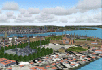
The vedette of this scenery is without a doubt Istanbul. sandal until the meridian 30º East and the whole Turkish coast until Burnhaiyne I have carried out this work dedicated completely to the European capital of Turkey.
This scenery is complemented by Greece.zip, since of the islands next to the frontier that they contain 8 Greek airports is perfect to carry out flights VFR between Greece and Turkey. It contains 13 airports and 64 cities.
| Filename: | Turkey.zip |
| License: | Freeware |
| Added: | 16th July 2010, 18:02:21 |
| Downloads: | 4,271 |
| Author: | Toni Agramont |
| Size: | 54.99 MB |
| Category: Flight Simulator 2004 - Scenery | |
| CYWG Winnipeg International Airport V1.01 |
|
File Description:
CYWG (Winnipeg International Airport) V1.01 for FS2004. This is the first installment of Manitoba Airport Series by Canuk Scenery, which will serve as a base for international, domestic and regional flights as well as a departure point to the north for those bush flying enthusiasts.
| Filename: | CYWG_Winnipeg_International_Airport_V101.zip |
| License: | Freeware |
| Added: | 26th June 2004, 23:53:09 |
| Downloads: | 16,678 |
| Author: | Adam Bentley and David Madge |
| Size: | 3.62 MB |
© 2001-2026 AVSIM Online
All Rights Reserved
Privacy Policy |