
Where Flight Simulation Enthusiasts Gather from Around the World!
AVSIM Library - Search Results

| Category: Flight Simulator 2004 - Scenery | |
| San Jose, Costa Rica Scenery Add-on |

|
File Description:
This adds: the toll road, some restaurants (Rostipollos, La Candela...), some hotels, some malls, and some buildings near MROC to make more realism (for rwy 25 APP vey nice!!!). Please read the text file fot the requirements (IMPORTANT). Good luck.
| Filename: | San_Jose_Costa_Rica_Scenery_Addon.zip |
| License: | Freeware, limited distribution |
| Added: | 24th March 2008, 00:59:21 |
| Downloads: | 3,039 |
| Author: | Robert Gonzales |
| Size: | 2.34 KB |
| Category: Flight Simulator 2004 - Scenery | |
| Landclass Scenery |
|
File Description:
FS2004 Land Class scenery that covers the area between San Luis Obispo to Oxnard California. All towns in this area and that extend east of the coast are also included.
| Filename: | Landclass_Scenery.zip |
| License: | Freeware |
| Added: | 11th October 2008, 02:12:15 |
| Downloads: | 1,696 |
| Author: | Charles Reid |
| Size: | 3.52 MB |
| Category: Flight Simulator 2004 - Scenery | |
| Islamabad Gandhara International, Pakistan - OPIS - UPDATED |
|
File Description:
I found out there are an updated Google Earth Map additional new military hangers and a high-speed exit taxiway. I also additional with
nice feature effect lights for all runways stop flashing lights.
| Filename: | Islamabad_Gandhara_International_Pakistan__OPIS__U.zip |
| License: | Freeware |
| Added: | 1st March 2021, 00:58:38 |
| Downloads: | 507 |
| Author: | Stuart John Gilbert II |
| Size: | 2.81 MB |
| Category: Flight Simulator 2004 - Scenery | |
| Alzintan, Libya - HLZN |
|
File Description:
Alzintan airport has a single runway in the desert area.
| Filename: | Alzintan_Libya__HLZN.zip |
| License: | Freeware |
| Added: | 2nd April 2021, 18:30:17 |
| Downloads: | 134 |
| Author: | Stuart John Gilbert II |
| Size: | 4.04 MB |
| Category: Flight Simulator 2004 - Scenery | |
| Joslin-Magic Valley Regl KTWF |
|
File Description:
FS2004 Scenery-Joslin Field - Magic Valley Regl Airport (KTWF) serves Twin Falls, ID and Twin Falls County and is owned by the City & County Of Twin Falls. The airport has more than one runway. The longest is a paved runway extending 8703 feet. The facility is at an elevation of 4151 feet at a distance of about 4 miles from Twin Falls. Created with EZ Scenery, Rwy12 and Lago's FSE with AFCAD2 and Traffic Tools. Textures for custom EZ Scenery objects included. By John B. Loney, Jr.
| Filename: | JoslinMagic_Valley_Regl_KTWF.zip |
| License: | Freeware |
| Added: | 3rd July 2006, 01:48:04 |
| Downloads: | 1,094 |
| Author: | John B. Loney, Jr. |
| Size: | 891.05 KB |
| Category: Flight Simulator 2004 - Scenery | |
| Mobile 1AZ0 Airport |
|
Images related to this file:
File Description:

Mobile airport is located in Mobile Arizona, some 26 mi from Phoenix. Lufthansa is the current owner of the airport and is mainly used to train it's pilots spending a semester at Goodyear. This package faithfully recreates the desert atmosphere while still retaining good performance. Several features include: Highly detailed airport base, Highly detailed taxiways, 3D custom designed buildings, Custom texture set, Night Textures, Taxiways signs, Much Much More...
| Filename: | Mobile_1AZ0_Airport.zip |
| License: | Freeware |
| Added: | 31st December 2009, 11:04:52 |
| Downloads: | 1,060 |
| Author: | Flyscenery.org Development Group |
| Size: | 42.66 MB |
| Category: Flight Simulator 2004 - Scenery | |
| San Pedro de Atacama SCPE |
|
Images related to this file:
File Description:
San Pedro de Atacama is situated in the Atacama Desert at an average of
7960ft.
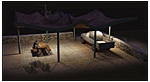
Twentynine Palms Scenery Design - San Pedro de Atacama (SCPE) features:
high resolution textures | baked textures on many objects | large groundpolygon with detail added | animations (car traffic, moving man) | AI-Traffic.
This scenery is for FS9 only, a version for FSX will be released later.
Visit http://twentynine-palms.de/ for more information, news and updates.
| Filename: | San_Pedro_de_Atacama___SCPE.zip |
| License: | Freeware |
| Added: | 20th October 2011, 00:09:52 |
| Downloads: | 1,000 |
| Author: | Twentynine Palms Scenery Design |
| Size: | 36.24 MB |
| Category: Flight Simulator 2004 - Scenery | |
| Vancouver International Airport – Version 4.2 |
|
File Description:
Vancouver International Airport - Final
Version4.2 is the final version of this large airport, and
incorporates files CYVR4.zip; CYVR41.zip; CYVR4fix.zip;
CYVR4com.zip; CYVRup42.zip. Runways coincide with
the default to allow VATSIM fliers to use scenery. Most
buildings are portrayed in essentially correct layout.
(CYVR3.1 for FS2002 won FlightSim Developer’s Award
in March 2003, and had over 11,000 downloads).
| Filename: | Vancouver_International_Airport__Version_42.zip |
| License: | Freeware |
| Added: | 8th August 2005, 05:16:18 |
| Downloads: | 24,770 |
| Author: | P Nigel Grant, Vancouver |
| Size: | 7.1 MB |
| Category: Flight Simulator 2004 - Scenery | |
| Southern California Mesh |
|
File Description:
Terrain mesh from SRTM 3 arc second (90m) data for Southern California.
This file covers the area of latitude N32-34 and longitude W116-118.
Its length roughly from Tijuana Mexico to Barstow in Mojave Desert,
and width from the edge of Salton Sea to Malibu.
This file connects with the "SierraNevadaMesh.Zip", both files
offer a continuous mesh coverage from San Diego California to Reno Nevada.
| Filename: | Southern_California_Mesh.zip |
| License: | Freeware |
| Added: | 5th January 2004, 17:58:40 |
| Downloads: | 6,139 |
| Author: | Bart Dylkiewicz |
| Size: | 7.76 MB |
| Category: Flight Simulator 2004 - Scenery | |
| Himalayas LOD9 Base Mesh, Volume 1 - Southeastern Ranges |
|
Images related to this file:
File Description:
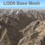
Detailed terrain mesh of the Southeastern Himalayan Ranges, N26-32 E90-98. The files in this package are based on Shuttle Radar (SRTM) Version 2 data but with many of the void areas, especially the most significant sections, filled with elevation data generated from topographic maps by Jonathan de Ferranti. While Jonathan's work is unrelated to flight simulation he kindly gave me permission to compile his data for use in FS. The result is a wonderful improvement in detail and accuracy over any existing mesh file, freeware or commercial, based on SRTM or DTED data alone.
Due to the large area of the Himalayas I've compiled the source data as two separate series: the "Himalayan Peaks" series covers prominent mountains and ranges in higher detail and locally overrides any existing LOD9 terrain mesh. In addition, a LOD9 "base mesh" series, with LOD8 and LOD7 "buffer" mesh files, covering the entire Himalayas, is meant for those who do not yet have an add-on terrain mesh of these beautiful mountains.
| Filename: | Himalayas_LOD9_Base_Mesh_Volume_1__Southeastern_Ra.zip |
| License: | Freeware, limited distribution |
| Added: | 29th May 2010, 09:01:26 |
| Downloads: | 10,301 |
| Author: | Holger Sandmann, Jonathan de Ferranti |
| Size: | 71.82 MB |


© 2001-2026 AVSIM Online
All Rights Reserved
Privacy Policy |