
Where Flight Simulation Enthusiasts Gather from Around the World!
AVSIM Library - Search Results

| Category: Flight Simulator 2004 - Scenery | |
| "Himalayan Peaks" LOD10 Mesh, Volume 3 - Namcha Barwa |

|
File Description:
Highly detailed terrain mesh of the Namcha Barwa area, N29°-31° E94°-96°. The files in this package are based on Shuttle Radar (SRTM) Version 2 data but with many of the void areas, especially the most significant sections, filled with elevation data generated from topographic maps by Jonathan de Ferranti. While Jonathan's work is unrelated to flight simulation he kindly gave me permission to compile his data for use in FS. The result is a wonderful improvement in detail and accuracy over any existing mesh file, freeware or commercial, based on SRTM or DTED data alone. Due to the large area of the Himalayas I've compiled the source data as two separate series: the "Himalayan Peaks" series covers prominent mountains and ranges in higher detail and locally overrides any existing LOD9 terrain mesh. In addition, a LOD9 "base mesh" series covering the entire Himalayas will be available for those who do not yet have an add-on terrain mesh of these beautiful mountains.
| Filename: | Himalayan_Peaks_LOD10_Mesh_Volume_3__Namcha_Barwa.zip |
| License: | Freeware, limited distribution |
| Added: | 18th February 2006, 23:15:17 |
| Downloads: | 12,195 |
| Author: | Holger Sandmann and Jonathan de Ferranti |
| Size: | 15.09 MB |
| Category: Flight Simulator 2004 - Scenery | |
| "Himalayan Peaks" LOD10 Mesh, Volume 4 - Annapurna |
|
Images related to this file:
File Description:
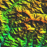
Highly detailed terrain mesh of the Annapurna area, N28-30 E83-85. The files in this package are based on Shuttle Radar (SRTM) Version 2 data but with many of the void areas, especially the most significant sections, filled with elevation data generated from topographic maps by Jonathan de Ferranti. While Jonathan's work is unrelated to flight simulation he kindly gave me permission to compile his data for use in FS. The result is a wonderful improvement in detail and accuracy over any existing mesh file, freeware or commercial, based on SRTM or DTED data alone.
Due to the large area of the Himalayas I've compiled the source data as two separate series: the "Himalayan Peaks" series covers prominent mountains and ranges in higher detail and locally overrides any existing LOD9 terrain mesh. In addition, a LOD9 "base mesh" series covering the entire Himalayas will be available for those who do not yet have an add-on terrain mesh of these beautiful mountains.
| Filename: | Himalayan_Peaks_LOD10_Mesh_Volume_4__Annapurna.zip |
| License: | Freeware, limited distribution |
| Added: | 29th May 2010, 08:59:29 |
| Downloads: | 10,470 |
| Author: | Holger Sandmann, Jonathan de Ferranti |
| Size: | 15.07 MB |
| Category: Flight Simulator 2004 - Scenery | |
| "Himalayan Peaks" LOD10 Mesh, Volume 5 - Garhwal |
|
File Description:
Highly detailed terrain mesh of the Garhwal area, N30°-32° E78°-81°. The files in this package are based on Shuttle Radar (SRTM) Version 2 data but with many of the void areas, especially the most significant sections, filled with elevation data generated from topographic maps by Jonathan de Ferranti. While Jonathan's work is unrelated to flight simulation he kindly gave me permission to compile his data for use in FS. The result is a wonderful improvement in detail and accuracy over any existing mesh file, freeware or commercial, based on SRTM or DTED data alone. Due to the large area of the Himalayas I've compiled the source data as two separate series: the "Himalayan Peaks" series covers prominent mountains and ranges in higher detail and locally overrides any existing LOD9 terrain mesh. In addition, a LOD9 "base mesh" series covering the entire Himalayas will be available for those who do not yet have an add-on terrain mesh of these beautiful mountains.
| Filename: | Himalayan_Peaks_LOD10_Mesh_Volume_5__Garhwal.zip |
| License: | Freeware, limited distribution |
| Added: | 18th February 2006, 23:16:47 |
| Downloads: | 10,141 |
| Author: | Holger Sandmann and Jonathan de Ferranti |
| Size: | 27.72 MB |
| Category: Flight Simulator 2004 - Scenery | |
| "Himalayan Peaks" LOD10 Mesh, Volume 6 - Jammu and Kashmir |
|
Images related to this file:
File Description:
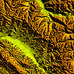
Highly detailed terrain mesh of the Jammu and Kashmir areas, N31-36 E76-78. The files in this package are based on Shuttle Radar (SRTM) Version 2 data but with many of the void areas, especially the most significant sections, filled with elevation data generated from topographic maps by Jonathan de Ferranti. While Jonathan's work is unrelated to flight simulation he kindly gave me permission to compile his data for use in FS. The result is a wonderful improvement in detail and accuracy over any existing mesh file, freeware or commercial, based on SRTM or DTED data alone.
Due to the large area of the Himalayas I've compiled the source data as two separate series: the "Himalayan Peaks" series covers prominent mountains and ranges in higher detail and locally overrides any existing LOD9 terrain mesh. In addition, a LOD9 "base mesh" series covering the entire Himalayas will be available for those who do not yet have an add-on terrain mesh of these beautiful mountains.
| Filename: | Himalayan_Peaks_LOD10_Mesh_Volume_6__Jammu_and_Kas.zip |
| License: | Freeware, limited distribution |
| Added: | 29th May 2010, 08:55:43 |
| Downloads: | 9,675 |
| Author: | Holger Sandmann, Jonathan de Ferranti |
| Size: | 52.19 MB |
| Category: Flight Simulator 2004 - Scenery | |
| "Himalayan Peaks" LOD10 Mesh, Volume 7 - K2 and Karakoram |
|
Images related to this file:
File Description:
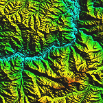
Highly detailed terrain mesh of the Karakoram area, N35-37 E73-77. The files in this package are based on Shuttle Radar (SRTM) Version 2 data but with many of the void areas, especially the most significant sections, filled with elevation data generated from topographic maps by Jonathan de Ferranti. While Jonathan's work is unrelated to flight simulation he kindly gave me permission to compile his data for use in FS. The result is a wonderful improvement in detail and accuracy over any existing mesh file, freeware or commercial, based on SRTM or DTED data alone.
Due to the large area of the Himalayas I've compiled the source data as two separate series: the "Himalayan Peaks" series covers prominent mountains and ranges in higher detail and locally overrides any existing LOD9 terrain mesh. In addition, a LOD9 "base mesh" series covering the entire Himalayas will be available for those who do not yet have an add-on terrain mesh of these beautiful mountains.
| Filename: | Himalayan_Peaks_LOD10_Mesh_Volume_7__K2_and_Karako.zip |
| License: | Freeware, limited distribution |
| Added: | 30th May 2010, 09:56:27 |
| Downloads: | 9,488 |
| Author: | Holger Sandmann, Jonathan de Ferranti |
| Size: | 38.58 MB |
| Category: Flight Simulator 2004 - Scenery | |
| AI Tall Ships sailing on Long Island Sound |
|
Images related to this file:
File Description:
AI Tall Ships sailing on Long Island Sound - A gathering of ten vintage AI Sailing Ships near Fisher's Island, New York. This scenery features incredibly detailed AI Sailing Ships modeled by Ron Jeffers, Pierre de Rotalier and Mike Hill. The project includes a replica of the Pequod - Captain Ahab's whaling ship in the epic novel "Moby Dick". Eight of the ten ships make twice daily trips around Fisher's Island. There is also an animated naval rowboat which makes short demonstration runs daily. With one exception, all required files are included. This scenery has been tested with Ultimate Terrain and the FS2004 default environment. Please unzip to a temporary folder and follow the simple, illustrated instructions. Then sit back, watch the seas come to life and relive a little history. This package works very well with John B.Loney's Elizabeth Airport - 0b8_v1.zip - available here. Compiled for your flying (and sailing) enjoyment by David "Opa" Marshall.
| Filename: | AI_Tall_Ships_sailing_on_Long_Island_Sound.zip |
| License: | Freeware |
| Added: | 10th December 2009, 12:42:56 |
| Downloads: | 2,386 |
| Author: | David "Opa" Marshall |
| Size: | 21.05 MB |
| Category: Flight Simulator 2004 - Scenery | |
| JRM Bahamas EZ Scenery #4 Highly detailed |
|
File Description:
JRM Bahamas EZ Scenery #4 Highly detailed
Salt Cay, Turks, beautiful island that time forgot. Interesting
history and now hot spot for fishing, diving and vacations.
Ships & boats cover entire area through the Turks.
jimmy R martin
[email protected]
| Filename: | JRM_Bahamas_EZ_Scenery_4_Highly_detailed.zip |
| License: | Freeware |
| Added: | 9th April 2006, 15:23:27 |
| Downloads: | 2,022 |
| Author: | jimmy R martin |
| Size: | 123.73 KB |
| Category: Flight Simulator 2004 - Scenery | |
| San Diego VFR Scenery |
|
File Description:
FS2004 San Diego VFR Scenery.
Adds 134 scenery objects to the San Diego
area, including the USS Midway, Petco
Park, the round hangars on North Island
NAS, ships and boats in the bay and lots
more.Programmed in XML, this scenery
is very framerate friendly.
| Filename: | San_Diego_VFR_Scenery.zip |
| License: | Freeware, limited distribution |
| Added: | 2nd April 2004, 04:50:11 |
| Downloads: | 6,377 |
| Author: | Tim Merrell |
| Size: | 94.14 KB |
| Category: Flight Simulator 2004 - Scenery | |
| Lago Amsterdam Schiphol 2004 patch v1.1 |
|
File Description:
Lago Amsterdam Schiphol 2004 patch to make the original Lago Amsterdam Schiphol Fs2002 compatibel with Fs2004. This is version 1.1.
| Filename: | Lago_Amsterdam_Schiphol_2004_patch_v11.zip |
| License: | Freeware |
| Added: | 28th June 2004, 16:03:13 |
| Downloads: | 8,550 |
| Author: | Gerard Salden |
| Size: | 10.57 MB |
| Category: Flight Simulator 2004 - Scenery | |
| Lago Amsterdam Schiphol 2004 V1.0 (Patch) |
|
File Description:
Lago Amsterdam Schiphol 2004. Patch to make the Lago Fs2002 Schiphol work in Fs2004. All runways are having their correct ID numbers.
ATC recognises this too.
A custom made Afcad2 file is also included.
This is version 1.0.
| Filename: | Lago_Amsterdam_Schiphol_2004_V10_Patch.zip |
| License: | Freeware |
| Added: | 11th June 2004, 22:36:00 |
| Downloads: | 3,083 |
| Author: | Gerard Salden |
| Size: | 10.1 MB |


© 2001-2026 AVSIM Online
All Rights Reserved
Privacy Policy |