
Where Flight Simulation Enthusiasts Gather from Around the World!
AVSIM Library - Search Results

| Category: Flight Simulator 2004 - Scenery | |
| Bella Bella AI |

|
File Description:
This scenery is located in B.C Canada. All default enhanced. Traffic starts at 12:00 GMT
Airport name's,
1.Bella Bella(CYJQ). AI traffic doing touch and go's. Tune in 122.8 to listen to traffic at both airstrips.
2.Bella Bella(CAF2) AI doing Touch and go's.
Aircraft involved: Dc3, Both the vega's, and the Ryan.
| Filename: | Bella_Bella_AI.zip |
| License: | Freeware |
| Added: | 9th November 2003, 09:54:41 |
| Downloads: | 1,825 |
| Author: | Frank Betts |
| Size: | 1.61 MB |
| Category: Flight Simulator 2004 - Scenery | |
| Copenhagen Kastrup East addon for Aerosoft EKCH |
|
File Description:
Addon to Aerosoft EKCH scenery. This scenery covers the east aera of Copenhagen Kastrup airport.
The scenery covers the area along the road “Kystvejen”. It starts beside the SAS hangars and
in this scenery it ends just before RWY30. All the buildings along this road are designed and
placed according to the locations, which fits to the Aerosoft scenery.
| Filename: | Copenhagen_Kastrup_East_addon_for_Aerosoft_EKCH.zip |
| License: | Freeware |
| Added: | 31st January 2006, 15:27:00 |
| Downloads: | 3,316 |
| Author: | Claus Hansen |
| Size: | 3.96 MB |
| Category: Flight Simulator 2004 - Scenery | |
| Resized 3D Cloud Texture V.6 |
|
File Description:
Resized default cloud texture (cumulus01.bmp) for 3D clouds in FS2004.
Texture was resized from 512X512 to 64X64, cutting filesize from 1,33MB to 6KB.
This file is recommended for those who prefer speed (FPS) over visual detail.
IN THIS VERSION:
Removed Mip-maps to make the filesize much smaller (6kb).
Texture was modified to make clouds brighter/white instead of blueish-gray.
IMPORTANT: To avoid errors, turn the "Render to texture" box to ON in "Display Settings".
Smaller texture sizes improve framerate (FPS).
TEXTURE ONLY.
| Filename: | Resized_3D_Cloud_Texture_V6.zip |
| License: | Freeware |
| Added: | 29th March 2004, 17:54:41 |
| Downloads: | 16,339 |
| Author: | Bart Dylkiewicz |
| Size: | 54.36 KB |
| Category: Flight Simulator 2004 - Scenery | |
| Resized Sun Textures |
|
File Description:
Resized default Sun textures and flares for FS2004.
Textures were modified from "16-bit" format to "DXT3" format, cutting
overall filesize from 288KB to 165KB.
This file also includes an edited "suneffect.cfg" which makes flares
visible in virtual cockpit
This modification prevents the framerate lag when looking in the
direction of the Sun. Texture dimensions are in original format (128X128).
IMPORTANT: To avoid errors, turn the "Render to texture" box to ON in "Display Settings".
Smaller texture sizes improve framerate (FPS).
TEXTURE ONLY.
| Filename: | Resized_Sun_Textures.zip |
| License: | Freeware |
| Added: | 23rd April 2004, 04:02:47 |
| Downloads: | 7,861 |
| Author: | Bart Dylkiewicz |
| Size: | 91.4 KB |
| Category: Flight Simulator 2004 - Scenery | |
| FS2004 Scenery-UBB9-Sitalcay AB (closed) |
|
File Description:
FS2004 Scenery-UBB9-Sitalçay AB (closed)
Based on open photos available and Ultimate Terrain Europe. Please see Install notes for necessary object files and enjoy.
| Filename: | FS2004_SceneryUBB9Sitalcay_AB_closed.zip |
| License: | Freeware |
| Added: | 28th November 2023, 01:47:31 |
| Downloads: | 33 |
| Author: | Bernd Barsch |
| Size: | 58.18 KB |
| Category: Flight Simulator 2004 - Scenery | |
| Hildesheim Airport - EDVM |
|
File Description:
Fs2004 scenery of Hildesheim Airport -edvm- .
Scenery includes buildings,runways and an afcad2 file.
Special night textures included
It was build using Fs scenery creator and Easy object designer
| Filename: | Hildesheim_Airport__EDVM.zip |
| License: | Freeware, limited distribution |
| Added: | 18th December 2003, 00:38:29 |
| Downloads: | 2,512 |
| Author: | Matthias Peter |
| Size: | 6.31 MB |
| Category: Flight Simulator 2004 - Scenery | |
| FedEx depot, Skagway AK |
|
Images related to this file:
File Description:
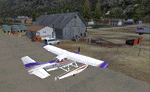
A small scenery enhancement created with EZ Scenery for Skagway, AK (Alaska). Adds a Fed Ex depot to the area. Complete with hangars, buildings, forklifts, etc. Utilizes EZ Scenery objects. EZ Scenery libraries previously installed required.
| Filename: | FedEx_depot_Skagway_AK.zip |
| License: | Freeware |
| Added: | 31st May 2010, 11:02:09 |
| Downloads: | 931 |
| Author: | Brad Allen |
| Size: | 130.79 KB |
| Category: Flight Simulator 2004 - Scenery | |
| FS2004 Scenery-RPRA-Palawan-Pag-Asa or Thitu Island-Rancudo Airfield |
|
File Description:
FS2004 Scenery-RPRA-Palawan-Pag-Asa or Thitu Island-Rancudo Airfield
There are no actual photos available, last from 2016. Please see Install
notes for necessary object files and enjoy. By Bernd Barsch
| Filename: | FS2004_SceneryRPRAPalawanPagAsa_or_Thitu_IslandRan.zip |
| License: | Freeware |
| Added: | 2nd January 2022, 00:11:23 |
| Downloads: | 68 |
| Author: | Bernd Barsch |
| Size: | 2.12 MB |
| Category: Flight Simulator 2004 - Scenery | |
| Lyon - East & South Hospitals, France |
|
Images related to this file:
File Description:

FS2004 Scenery. Lyon - Groupement Hopitaux Est & Sud.
Lyon East & South hospitals scenery add-on for FS2004.
By HAUGER Fredo.
| Filename: | Lyon__East__South_Hospitals_France.zip |
| License: | Freeware |
| Added: | 7th June 2013, 17:33:19 |
| Downloads: | 162 |
| Author: | Hauger Fredo |
| Size: | 1.63 MB |
| Category: Flight Simulator 2004 - Scenery | |
| ULM France Pack1 |
|
File Description:
This is a pack of 4 ultra light runways situated between Valence/St Etienne/Lyon and Grenoble
I recommend you install the mesh of "Couloir du Rhone"
| Filename: | ULM_France_Pack1.zip |
| License: | Freeware |
| Added: | 2nd September 2005, 21:36:21 |
| Downloads: | 1,206 |
| Author: | Bertrand Mercier |
| Size: | 605.74 KB |
© 2001-2026 AVSIM Online
All Rights Reserved
Privacy Policy |