
Where Flight Simulation Enthusiasts Gather from Around the World!
AVSIM Library - Search Results

| Category: Flight Simulator 2004 - Scenery | |
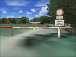
| Memmingen Airbase (ETSM, South-Germany) including MilCom AI-Traffic |

|
File Description:
This airbase, located in the beautiful Allgaeu (Bavaria, South-Germany) about
55 NM in the west of Munich, was the homebase of the JaBoG34 riding the F104
1964 thru 1987 and then the Tornado PA200. After JaboG34 had been dissolved
in 2003, it was decided to use the airfield for commercial air traffic.
In memory of the JaBoG34 at the "Memminger Berg" and to keep the ATC people busy,
I created this airfield with combined military / commercial AI-Traffic.
The included AI-Package contains Lockheed F-104 GAF, Republik F-84F GAF,
Panavia-Tornado GAF, Airbus-A310 GAF, Lockheed-P3 Orion GNY, Boeing-727 with
UN paint, Boeing-737 Lauda, Bombardier CRJ-200 Lufthansa and aircraft.cfg for
MS: Beech-Baron 58, King-Air 350, and Learjet 45.
Several F104's and Tornados perform touch and goes in the local area, further an
UN-B727 leaves IFR to Decimomannu (LIED) and a GAF-A310 goes IFR to Cologne.
Some of the commercial airplanes perform touch and goes also, a CRJ-200 goes
IFR to Munich and a Lauda-737 goes IFR to Vienna per attached flightplan.
Lago's FSE is required in order to see most of the major buildings / objects.
Welcome to the party again.
| Filename: | Memmingen_Airbase_ETSM_SouthGermany_including_MilC.zip |
| License: | Freeware, limited distribution |
| Added: | 16th November 2005, 16:22:23 |
| Downloads: | 7,702 |
| Author: | Klaus Jone |
| Size: | 11.47 MB |
| Category: Flight Simulator 2004 - Scenery | |
| Esslingen-Jaegerhaus glider airfield, Germany |
|
Images related to this file:
File Description:
Grass runway with 0.5m/pixel high-definition background images, surroundings with areal photo textures and landclass, full seasonal textures. Several custom buildings, fences, objects and tons of trees give the closest possible resemblance to it's real-world counterpart northeast of Stuttgart Airport (EDDS).
This airfield is jointly utilized and cared for by the two departments of the Aero-Club Esslingen, the full-scale glider fliers and the RC-model fraction.
| Filename: | EsslingenJaegerhaus_glider_airfield_Germany.zip |
| License: | Freeware, limited distribution |
| Added: | 25th April 2010, 20:23:08 |
| Downloads: | 1,873 |
| Author: | Mathias Elsaesser |
| Size: | 12.01 MB |
| Category: Flight Simulator 2004 - Scenery | |
| LFDN - Rochefort Saint Agnant, France |
|
Images related to this file:
File Description:
Scenery package for Rochefort-Saint Agnant in Western France. This airport has two clubs and the 721 air base's primary mission is to provide support of the Training School for officers of the Air Force. Detailed scenery with all the buildings, static planes, etc.
| Filename: | LFDN__Rochefort_Saint_Agnant_France.zip |
| License: | Freeware, limited distribution |
| Added: | 26th July 2010, 11:17:46 |
| Downloads: | 1,733 |
| Author: | Alexandre Remy - FAF010 |
| Size: | 17.9 MB |
| Category: Flight Simulator 2004 - Scenery | |
| New Alternate Roads for FlightOne "USRoads" |
|
File Description:
USA Roads" is a software add-on for MS Flight Simulator 2004 (FS9) marketed by Flight One Software, Inc. and Scenery Solutions. It replaces the default roads and highways which are sparse and only approximate in location, with correctly placed roads, down to the street level.
It has been said by some that "US Roads" look unrealistic, like looking at a Road-Map, because the roads are too bright and clean. In real life the roads are darker and partially concealed by vegetation. I have spent hours looking at aerial photos on the net, and was surprised at how "US Roads" looks very realistic, especially when comparing FS "top-down" views with map-type color photos. The light color roads are very prominent in the pictures, as are the clean lines. In my new "Alternate US Roads", I have modified the various roads using different methods, including actual road photographs, changes in road color and brightness, and the use of irregular transparency to soften the lines and give the illusion of vegetation partially obscuring the roadse. Most textures use images adapted from "US Roads" by kind permission of the author. Extract to a temporary file, and follow the ReadMe!
| Filename: | New_Alternate_Roads_for_FlightOne_USRoads.zip |
| License: | Freeware |
| Added: | 14th July 2004, 10:50:27 |
| Downloads: | 4,263 |
| Author: | Frank Bergson |
| Size: | 1.69 MB |
| Category: Flight Simulator 2004 - Scenery | |
| Philadelphia Intl (KPHL) Texture Resizer |
|
Images related to this file:
File Description:
Here's a simple batch file that will resize all the biggest textures at KPHL to 512x512 instead of the default 1024x1024, that should improve the micro-stuttering, because VRAM memory requirements are now 4x less. I got this idea from 'virtuali' at http://www.fsdreamteam.com/ .... He did one for their FS9 Honolulu (PHNL) scenery, and I was quite impressed with the results.
| Filename: | Philadelphia_Intl_KPHL_Texture_Resizer.zip |
| License: | Freeware |
| Added: | 21st September 2010, 02:45:46 |
| Downloads: | 1,299 |
| Author: | Bob Ferguson |
| Size: | 857.29 KB |
| Category: Flight Simulator 2004 - Scenery | |
| Roanne Renaison airport (LFLO) |
|
File Description:
Updated and improved release for Roanne Renaison airport, located 50 nm west from Lyon, in France. Very busy center for general aviation, sailplanes, microlights. Located in a plain but very close to mountains areas, it is an interesting airfield for a flight to or from Lyon, the Alps, Loire-valley, and the Auvergne.
| Filename: | Roanne_Renaison_airport_LFLO.zip |
| License: | Freeware |
| Added: | 27th November 2006, 11:09:02 |
| Downloads: | 2,352 |
| Author: | Philippe Coutellier |
| Size: | 1.45 MB |
| Category: Flight Simulator 2004 - Scenery | |
| LTBR Bursa Yenisehir Airport, Turkey |
|
Images related to this file:
File Description:
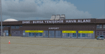
Detailed scenery of Bursa Yenisehir (LTBR) Airport, for FS2004.
The airport has both civil and military use, and is placed about 60 miles south of Istanbul in the southern Marmara region of Turkey. The scenery includes many accurate and detailed airport buildings including the new control tower, afd file, various objects and detailed surroundings. By Sunay KILIC.
| Filename: | LTBR_Bursa_Yenisehir_Airport_Turkey.zip |
| License: | Check within download |
| Added: | 18th September 2011, 17:25:46 |
| Downloads: | 2,772 |
| Author: | Sunay Kilic |
| Size: | 12.62 MB |
| Category: Flight Simulator 2004 - Scenery | |
| ArkScenery V1 |
|
File Description:
Arkansas scenery for Microsoft Flight Simulator 2004
featuring 20 highly-detailed airports. This scenery
features buildings and hangers with night lighting
and signs. The scenery was designed using Jeppesen Airport
Diagrams, Aerial photographs and many other sources.
| Filename: | ArkScenery_V1.zip |
| License: | Freeware |
| Added: | 15th May 2004, 21:24:21 |
| Downloads: | 4,549 |
| Author: | Tom Jones |
| Size: | 6.54 MB |
| Category: Flight Simulator 2004 - Scenery | |
| Cyprus: Airfields plus landmarks and land class for all of Cyprus and AI |
|
Images related to this file:
File Description:
Cyprus, an island in the eastern Mediterranean. Without the benefit of Ultimate Terrain, which does not exist for Cyprus, the land class provided by FS9 stands out as hopelessly inadequate. I have added the extensive farmland and the larger towns and villages, plus the major roads. Four completely new airfields are included here, three in the north and one in the south. Ercan LCEN is in the north and functions as the airport for all of the north. It was recently closed for two years while a new terminal was built and the runway updated and an apron extended etc, and during that time Gecitkale LCGK functioned (barely) as the airport for the north. Gecitkale is now hardly used at all. The third northern airfield is Ilker Karter LCIK and this functions as the HQ base of the Turkish Army Corp in northern Cyprus. The last of the new airfields is Kingsfield LCRE, which is in the Sovereign Base area to the east of Larnaca and is now used for recreational purposes. Ercan is now undergoing further expansion with a new runway and a new terminal building and apron, so this scenery is for the period between 2010 to 2015. My set up of Cyprus already included a payware Larnaca by Aerosoft (now only 12 euros) plus a freeware Paphos, Nicosia, and Akrotiri; that was my starting point. Larnaca has been the major airport for Cyprus since the mid 1970's, with a huge tourist trade that peaks in the summer but which is year long (almost a million Brits visit every year, let alone the other nationalities). I have adapted this (gate sizes etc) to allow parking by a multitude of B737's and others. Nicosia is freeware (posted in 2010) and I have included modifications to reflect its now total disuse. Paphos is at the far western end of the island and freeware, and I have modified this to allow larger and military ai aircraft to function properly; the poster improved his first version to better cater for ai but I was unaware of this and I have stayed with my modifications. Akrotiri is freeware and includes a lot of library object input from MAIW. I have modified the parking somewhat and added further residential areas and munitions storage. The AI is based upon recorded take offs and landings in April, with some further additions in later months. At Ercan the visible gate numbers on the apron are as per real life, but the numbers within FS9 reflect the fact that planes are directed to gates at the centre of the terminal building and not at the far ends. Follow the pink line and obey ATC when it says taxi to gate number 2 even if it is visibly numbered 4.
| Filename: | Cyprus_Airfields_plus_landmarks_and_land_class_for.zip |
| License: | Freeware, limited distribution |
| Added: | 13th August 2017, 21:21:46 |
| Downloads: | 940 |
| Author: | Roger Wensley |
| Size: | 29.61 MB |
| Category: Flight Simulator 2004 - Scenery | |
| Italy,Europe V1.0,Soaring Scenery |
|
File Description:
FS2002/2004 Italy,Europe V1.0,Soaring Scenery
This file adds some lifts to default Microsoft scenery to glider navigation over Italy Region,Europe and includes his whole territory.
It is freeware.
Good Flights and better Landings
12-20-2005 - Volta Redonda - Brazil
Design : Francisco Vargas.
E-mail:[email protected]
| Filename: | ItalyEurope_V10Soaring_Scenery.zip |
| License: | Freeware |
| Added: | 20th December 2005, 23:52:51 |
| Downloads: | 831 |
| Author: | Francisco Augusto Vargas Carneiro |
| Size: | 1.17 MB |
© 2001-2026 AVSIM Online
All Rights Reserved
Privacy Policy |