
Where Flight Simulation Enthusiasts Gather from Around the World!
AVSIM Library - Search Results

| Category: Flight Simulator 2004 - Scenery | |
| Grande Cache CEQ5 in Alberta, Canada |

|
Images related to this file:
File Description:
Grande Cache is at 4,117 feet above sea level, just under 90 miles south of Grande Prairie and 220 miles west of Edmonton. It is among the eastern foothills of the Rockies. The town was established to accommodate employees of a coal mine and their families in the early 1970's. There was a financial roller coaster ride for the coalmine during the next few years and despite the opening of a wood chip plant and a federal prison the town was eventually downgraded to a hamlet by a vote in 2018, as it was essentially bankrupt and had a population of less than 4,500. The airport, some 10 miles east of the town, had two aprons, one for GA and scheduled flights and another, the eastern one, for fire fighting planes. I say "had" as it was closed in January 2017. However, the fire fighting area appears to have been maintained (tanks repainted, for instance) and is presumably able to support operations if required. The date for this scenery is 2009.
| Filename: | Grande_Cache_CEQ5_in_Alberta_Canada.zip |
| License: | Freeware, limited distribution |
| Added: | 29th September 2021, 03:59:20 |
| Downloads: | 91 |
| Author: | Roger Wensley |
| Size: | 7.49 MB |
| Category: Flight Simulator 2004 - Scenery | |
| McKenzie Airfield, Richmond, South Africa |
|
Images related to this file:
File Description:
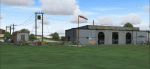
Have you ever visited the "Hangar Cafe"? Great place to have a meal and get lost in conversation with fellow aviators and aviation lovers.
McKenzie Airfield does not appear in the default FS2004, neither is the town of Richmond included. This package will add a custom (Gmax) made McKenzie Airfield (AWK5), Richmond, KwaZulu-Natal, South Africa with photoreal textures and ground textures. The included Landclass file will also add the town.
The small airfield as well as the adjacent McKenzie Plant-hire yard, has been recreated with custom true to life models and photoreal textures. McKenzie airfield is also home to the "Hangar Cafe" and an ex-SAAF Bosbok. The runway is not too challenging, just keep the aircraft in the middle and away from the trees right next to the runway. All the electrical high-wires have also been included in the scenery as it plays a prominent role in the look and feel of the airfield as has the flower beds.
The grass runway is aligned 11/29 and only 800m long.
| Filename: | McKenzie_Airfield_Richmond_South_Africa.zip |
| License: | Freeware, limited distribution |
| Added: | 7th October 2021, 22:56:00 |
| Downloads: | 129 |
| Author: | Kobus van Wyk |
| Size: | 6.5 MB |
| Category: Flight Simulator 2004 - Scenery | |
| FSX SCENERY DAN FRENCH CORE LIBRARY VOL 6 |
|
Images related to this file:
File Description:
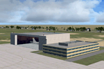
A wide variety of FSX (only) models created
in Google Sketchup and placeable with most
scenery tools (e.g. Instant Scenery).
Includes warehouses, hotels, churches, houses,
rail equipment (for enhancing your rail
lines), and other objects. Vol 6 replaces Vol 1-5
with added buildings, hangars, interior furniture.
Same GUIDs. Some previous crappy models updated/improved.
By Dan French.
| Filename: | FSX_SCENERY_DAN_FRENCH_CORE_LIBRARY_VOL_6.zip |
| License: | Freeware |
| Added: | 14th December 2021, 03:17:00 |
| Downloads: | 161 |
| Author: | Dan French |
| Size: | 30.99 MB |
| Category: Flight Simulator 2004 - Scenery | |
| FS2004 - World Trade Center V1 2021 |
|
Images related to this file:
File Description:

I hope it will improve your flying experience. Its based on google photos, custom textures and personal experience. It might not be 100% accurate in details on the ground level, but it was made to be as close as possible to the real World Trade Center.I also hope this scenery mod will serve as a reminder of tragic event, and as a nice addition to refresh the look of New York in your simulator.
| Filename: | FS2004__World_Trade_Center_V1_2021.zip |
| License: | Freeware |
| Added: | 23rd December 2021, 00:42:17 |
| Downloads: | 373 |
| Author: | Dženis Hadžić |
| Size: | 11.22 MB |
| Category: Flight Simulator 2004 - Scenery | |
| Botswana 30 airports |
|
File Description:
There are 30 airports where most airstrips and few airport concrete. Please follow instructions in my readme.txt.
Airports are code and city:
FB0A - Two Rivers,FB02 - Arizona,FB05 - Cement,FB07 - Chitabe,FB08 - Chobe,FB10 - Deception Valley,FB1T - Tau Pan,FB25 - Hunda,FB29 - Kanana,FB38 - Lebala,FB41 - Linyanti,FB50 - Mombo,FB57 - Nxabega,FB60 - Omdop,FB62 - Piajio,FB66 - Santawani,FB71 - Serunga,FB73 - Shindi,FB74 - Stanley Post,FB82 - Tsodilo Hills,FB88 - Vumbura,FB93 - Xaranna,FB95 - Xigera,FB97 - Xudum,FBCO - Camp Okavango,FBJA - Jao,FBKR - Khwai River Lodge,FBNX - Nxamasen,FBSL - Selinda,FBSV - Savuti, and FBXB - Xaxaba.
| Filename: | Botswana_30_airports.zip |
| License: | Freeware |
| Added: | 24th December 2021, 01:03:17 |
| Downloads: | 207 |
| Author: | Stuart John Gilbert II |
| Size: | 5.07 MB |
| Category: Flight Simulator 2004 - Scenery | |
| FS2004 Scenery-RPRA-Palawan-Pag-Asa or Thitu Island-Rancudo Airfield |
|
File Description:
FS2004 Scenery-RPRA-Palawan-Pag-Asa or Thitu Island-Rancudo Airfield
There are no actual photos available, last from 2016. Please see Install
notes for necessary object files and enjoy. By Bernd Barsch
| Filename: | FS2004_SceneryRPRAPalawanPagAsa_or_Thitu_IslandRan.zip |
| License: | Freeware |
| Added: | 2nd January 2022, 00:11:23 |
| Downloads: | 68 |
| Author: | Bernd Barsch |
| Size: | 2.12 MB |
| Category: Flight Simulator 2004 - Scenery | |
| Simplified FIR Center boundaries for FS2004 |
|
File Description:
Tired to be constantly handed over by the default ATC from one center frequency to another one? Here it comes a simplification of the boundaries for the FIR centers in FS9/FS2004.
The boundaries for Flight Information Regions (FIRs) in some areas (for example around Chicago) are subdivided into many smaller sectors, each with a different Center frequency. The result is that, while flying at >10000ft you constatly get handovered from one frequency to the next one. This file corrects this effect, by assigning the same COM frequency to all sectors a specific FIR is subdivided into. This means, for example, that "Chicago control" will have the same frequency all over the Chicago FIR; and the same applies for all the FIRs in the world. The result is that you are handovered only at the border of a FIR (for example when going from Chicago control to Cleveland Control), resilting in a much more pleasant ATC experience, especially in certain areas rich of FIR partitions.
| Filename: | Simplified_FIR_Center_boundaries_for_FS2004.zip |
| License: | Freeware |
| Added: | 2nd January 2022, 16:53:44 |
| Downloads: | 164 |
| Author: | Antonio Arreghini |
| Size: | 1.2 MB |
| Category: Flight Simulator 2004 - Scenery | |
| Cordova Smith PACV & Municipal CKU in Alaska US |
|
Images related to this file:
File Description:
Cordova is on the south coast of Alaska, around 150 miles east of Anchorage and 45 miles south of Valdez. The town is mainly built on a small but relatively flat area between the east side of Prince William Sound and Eyak Lake, and has a population of around 2,350 in 2010, the approximate date of this scenery.
The Municipal Airfield CKU is on the north side of Eyak Lake to the east of Cordova, with the runway that is 1,800 feet of unlit gravel squeezed between the lake and the road that runs around the lake. The hangars and parking aprons are reached by taxiing across, and to some extent along, the road. Float planes are also taken from the lake to an apron to the west of the runway.
Cordova Airport PACV (named in the real world "Merle K. (Mudhole) Smith", and I will leave you to research this) is known as Cordova Smith in FS9 and is 10 miles to the east of the town on relatively flat ground between mountains to the north and the sea to the south. The runway is 8,080 feet of lit asphalt aligned 09-27 with ILS on runway 27 and VASI on both ends. The aprons are to the north side of the runway and are reached by back-taxiing; there are no taxiways parallel to the runway. The main apron serves Alaska Air via the western of two taxiways. The GA parking and hangars are mainly reached by using the eastern taxiway, though there is in fact a connecting taxiway between the two (for GA, but definitely not for airliner use). The taxiway further to the west serves the separated Alaska Coastguard apron and hangar, which is mainly for helicopter use. There is a nominally grass runway 1,900 feet long and aligned 16-34 to the south of the main runway; in fact it appears to be more gravel than grass. I have left this inactive as otherwise AI Alaska Air planes would be attempting to use this when the wind made it seem like a good idea.
The AI includes Alaska Air (twice a day) and also Coastguard helicopters, along with GA.
| Filename: | Cordova_Smith_PACV__Municipal_CKU_in_Alaska_US.zip |
| License: | Freeware, limited distribution |
| Added: | 22nd January 2022, 21:53:03 |
| Downloads: | 148 |
| Author: | Roger Wensley |
| Size: | 16.93 MB |
| Category: Flight Simulator 2004 - Scenery | |
| Haines Junction CYHT in Yukon Territory Canada |
|
Images related to this file:
File Description:
Haines Junction is a village in the Yukon Territory, Canada, amid the Rocky Mountains and around 80 miles west of Whitehorse. It is sited at the junction of the Haines Highway and the Alaska Highway, hence the name. The village was established in 1942 when the Alaska Highway was under construction, and the Haines Highway was built over the Chilkat Pass to connect to the town of Haines on the Alaska coast.
The date of this scenery is, as usual, around 2010. At that time there was a regular service (not always a daily one, depending on the time of year) by Yukon Air North, and in this case it is by an ATR 42-300. There is a helicopter company based at the airfield, Trans North Helicopters, and there is also Kluane Glacier Air Tours, which, as the name suggests, takes you to a glacier so you can stroll around on ice. And then brings you back. The gravel runway is 5,000 feet long and aligned 04-22, and is lit, with PAPI at both ends. Right hand circuits are required for runway 04 as the terrain is not flat.
This post will be followed by two other airfields to the northwest, Silver City and Burwash, both of which are on or close to the Alaska Highway.
| Filename: | Haines_Junction_CYHT_in_Yukon_Territory_Canada.zip |
| License: | Freeware, limited distribution |
| Added: | 22nd January 2022, 21:53:16 |
| Downloads: | 119 |
| Author: | Roger Wensley |
| Size: | 20.46 MB |
| Category: Flight Simulator 2004 - Scenery | |
| Silver City CFQ5 in Yukon Territory Canada |
|
Images related to this file:
File Description:
Silver City is a ghost town in the Yukon Territory, Canada, amid the Rocky Mountains and around 35 miles northwest of Haines Junction. It is on the southern end of Kluane Lake and in the Kluane National Park and this probably explains it's (minimal) survival after what appears to have been the shutdown of mining for silver. There is little information readily available. The date of this scenery is, as usual, around 2010. There was no recent regular service by Yukon Air North or any other airline, and the primary user of the airfield adjacent to the lake is a company called Icefield Discovery Tours. Their activity is probably very similar to the company at Haines Junction and involves trips to the National Park amid mountains and glaciers. There is also another organisation at the airfield, the Kluane Lake Research Station of the Arctic Institute. They have four buildings there but it is unclear how much aerial activity they generate, or if in fact they fly at all for their work. The runway is 3,000 feet of unlit gravel, aligned north-south. This post will be followed by Burwash, which is at the far northwestern end of the lake. There is no video of the Silver City airfield on Youtube, and it is not the most exciting airfield in the world, but the location is enough in real life for a visit to be made. On YouTube there is a series of posts by Angle of Attack showing the preparation and then the flight of an old Cessna 172 from Homer to Oshkosh for the installation of modern instruments. Interesting for me as they visit or fly over airfields I have made: Homer, Merrill, Tok Junction, Burwash, Silver City, Haines Junction, Watson Lake, Fort Nelson, and Grande Prairie. But they fly in the winter so it all looks very different.
| Filename: | Silver_City_CFQ5_in_Yukon_Territory_Canada.zip |
| License: | Freeware, limited distribution |
| Added: | 22nd January 2022, 21:57:41 |
| Downloads: | 99 |
| Author: | Roger Wensley |
| Size: | 9.86 MB |


© 2001-2026 AVSIM Online
All Rights Reserved
Privacy Policy |