
Where Flight Simulation Enthusiasts Gather from Around the World!
AVSIM Library - Search Results

| Category: Flight Simulator 2004 - Scenery | |
| Chapelco 2004 |

|
File Description:
This patch is to rectify incorrect taxiway signs. Simply replace old files in your scenery folder with this ones.
| Filename: | Chapelco_2004.zip |
| License: | Freeware, limited distribution |
| Added: | 30th April 2006, 02:07:02 |
| Downloads: | 896 |
| Author: | Adrián Fernández Gómez |
| Size: | 14.19 KB |
| Category: Flight Simulator 2004 - Scenery | |
| Niederrhein 2004 |
|
File Description:
Niederrhein 2004. An updated scenery for this now one year old regional airport on the dutch/german border near Weeze and Nijmegen. Niederrhein is the homebase of Vbird airlines, other visitors are Ryanair, Bexx and Sky Airlines. Scenery is both compatible with FS2004 default scenery and the Netherlands 2000 v2.9. includes afcad2 (by Nils Lips).
| Filename: | Niederrhein_2004.zip |
| License: | Freeware, limited distribution |
| Added: | 10th May 2004, 22:00:06 |
| Downloads: | 5,510 |
| Author: | Robert Versluys |
| Size: | 1.18 MB |
| Category: Flight Simulator 2004 - Scenery | |
| Eastern West Virginia Regional Airport *UPDATE* |
|
Images related to this file:
File Description:

Scenery UPDATE for Shephard Field Virginia, home to both the Eastern West Virginia Regional Airport and the 167th Airlift Wing of the Air National Guard. Package contains missing traffic file for Civil Air Patrol and General Aviation Aircraft, updated ILS placement file, and new (tweaked)airport file to correct minor parking and taxi errors. My sincere thanks to the anonymous gentleman who found and helped me resolve these errors.
| Filename: | Eastern_West_Virginia_Regional_Airport_UPDATE.zip |
| License: | Freeware, limited distribution |
| Added: | 8th June 2012, 22:59:00 |
| Downloads: | 987 |
| Author: | John Stinstrom |
| Size: | 19.89 KB |
| Category: Flight Simulator 2004 - Scenery | |
| CYHD - Dryden Regional - Ontario, Canada * Updated v2 * |
|
Images related to this file:
File Description:
This greatly modifies my previous (2009) post of Dryden; this version has bespoke buildings and is stand-alone and does not require you to have the previous post. There will also be follow-up posts of Sioux Lookout and Geraldton. Dryden is in northern Ontario, 110 miles east of the Manitoba border, 40 miles west of Sioux Lookout, and with the US border 90 miles to the south. The town is on the northern shore of Wabigoon Lake and has a population of around 7,800. The main business is pulp and paper, along with agriculture, tourism, and mining. The airport is 5 miles northeast of the town.
Dryden Regional has 6,000' of asphalt which in FS9 is aligned 11-29. The second runway is compacted sand 2,000' long and aligned 05-23. There are two aprons, the western being for the terminal building and some ga parking, and the eastern larger and used in the summer for parking fire fighting planes, along with maintenance hangarage and accomodation etc. The Ontario Fire Service planes were included with my original Geraldton post and are included here again; they fly back and forth and keep Dryden busy along with several Bearskin Airlines and Perimeter Aviation flights.
| Filename: | CYHD__Dryden_Regional__Ontario_Canada___Updated_v2.zip |
| License: | Freeware, limited distribution |
| Added: | 16th March 2013, 09:59:52 |
| Downloads: | 592 |
| Author: | Roger Wensley |
| Size: | 26.99 MB |
| Category: Flight Simulator 2004 - Scenery | |
| KEGE - Eagle Regional Airport - Colorado, USA |
|
Images related to this file:
File Description:

Eagle Regional Airport (KEGE) has an approach through mountainous terrain and challenging departure procedures. It is Home for the Vail Valley Jet Center, the Colorado National Guard High Altitude Training Center and the Army. Because of it's high altitude, it is a very dangerous airport for take-off and landings. This scenery is updated with the new 109,75 ILS, the new Army and National Guard area on the opposite side of the airfield and many trees in the surrounding area.
| Filename: | KEGE__Eagle_Regional_Airport__Colorado_USA.zip |
| License: | Freeware |
| Added: | 7th September 2016, 21:58:26 |
| Downloads: | 772 |
| Author: | David Kolas |
| Size: | 8.55 MB |
| Category: Flight Simulator 2004 - Scenery | |
| Hector International Airport KFAR |
|
Images related to this file:
File Description:
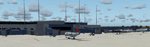
This is my rendition of Hector International Airport in Fargo ND. This completely replaces my previous scenery since this replaces the terminal building and adds all the other buildings at the airport.
| Filename: | Hector_International_Airport_KFAR.zip |
| License: | Freeware |
| Added: | 1st November 2009, 22:35:55 |
| Downloads: | 753 |
| Author: | Eric Cagan |
| Size: | 5.02 MB |
| Category: Flight Simulator 2004 - Scenery | |
| Mary River CMR2 on Baffin Island in Nunavut Canada |
|
Images related to this file:
File Description:
This is a very early version of an airfield in Nunavut built to serve an iron ore mine some 100 miles south of Pond Inlet on Baffin Island. In 2004 the airstrip was just being built, with a very basic camp set up for the construction crew who then went on to develop the roads etc in the immediate area. The original plan was for an opencast mine, with ore being transported south on a new (and expensive) railroad link to a new port on the south shore of Baffin Island. This plan was later changed to a (much cheaper) road to Milne Inlet, north of Mary River. And there my story rests, as although production has now started I have no further information about the operating mine. Nolinor currently flies regular supply flights into the camp; the AI here is for the early days. The gravel runway is 4,800 feet long and 150 feet wide, aligned 124T-304T as all runway headings in the north are given as true rather than the unreliable magnetic, which would be 12-30. Runway lighting and PAPI was installed early on and is included here; signage is not and the apron is the early version.
| Filename: | Mary_River_CMR2_on_Baffin_Island_in_Nunavut_Canada.zip |
| License: | Freeware, limited distribution |
| Added: | 18th August 2018, 02:57:19 |
| Downloads: | 134 |
| Author: | Roger Wensley |
| Size: | 4.82 MB |
| Category: Flight Simulator 2004 - Scenery | |
| Baker Lake CYBK in Nunavut, Canada |
|
Images related to this file:
File Description:
Baker Lake is the only Nunavut community that is not next to the sea. It is, as you might have guessed, on the shore of Baker Lake and 160 miles west and a bit north of Rankin Inlet on the shore of Hudson Bay (a recent post by Sid and Pete). The Hudson Bay Company opened a trading post there in 1916 and the town slowly developed, though as recently as 1946 the population was still only 32. These days the airfield is the support field for several nearby mines and there are now nearly 1,800 folks in Baker Lake using the stores, schools, churches, hospital, etc. The runway is almost 4,200' of 100' wide gravel and lighted; the alignment is 162T and 342T as this is in northern domestic airspace and bearings are given as 'true" and not "magnetic". Both JETA and 100LL fuel is available. The town is to the northeast of the airfield and is made up of a landclass without autogeneration, as this would mean a bunch of trees that would be, to say the least, unrealistic.
| Filename: | Baker_Lake_CYBK_in_Nunavut_Canada.zip |
| License: | Freeware, limited distribution |
| Added: | 23rd November 2011, 09:21:56 |
| Downloads: | 513 |
| Author: | Roger Wensley |
| Size: | 2.45 MB |
| Category: Flight Simulator 2004 - Scenery | |
| Whale Cove CYXN in Hudson Bay, Nunavut, Canada |
|
Images related to this file:
File Description:
Whale Cove is a small village with 300 or so inhabitants at N62 W92 on the west shore of Hudson Bay, 40 miles south of the large airport at Rankin Inlet. The village does not feature in FS9, so the first thing to do was to add it; not all the smaller streets are in place but it is the right shape.
I also had to add the roads, delete the stock airfield background, and add a new background. Plus, although the village isn't near the airfield I thought that if the place is called Whale Cove then the least I could do was create the cove, so there is also "whaleWATER" and "whalecoastDELETE", plus of course the scenery file and the AFCAD and AI.
NOTE: If you have had a problem with textures not showing up in the villages in these northern sceneries there is a note on how to fix it.
| Filename: | Whale_Cove_CYXN_in_Hudson_Bay_Nunavut_Canada.zip |
| License: | Freeware, limited distribution |
| Added: | 15th October 2010, 20:48:12 |
| Downloads: | 418 |
| Author: | roger Wensley |
| Size: | 1.19 MB |
| Category: Flight Simulator 2004 - Scenery | |
| RomaniaVFR Terrain v1.0 |
|
Images related to this file:
File Description:

The scenery replaces default FS2004 Terrain within Romanian territory. It contains improved roads, railroads, rivers, lakes, streams, coastlines, parks, places and beaches.
| Filename: | RomaniaVFR_Terrain_v10.zip |
| License: | Freeware |
| Added: | 28th April 2013, 17:49:08 |
| Downloads: | 1,208 |
| Author: | Fabrica Scenarii Nationale |
| Size: | 5.59 MB |
© 2001-2026 AVSIM Online
All Rights Reserved
Privacy Policy |