
Where Flight Simulation Enthusiasts Gather from Around the World!
AVSIM Library - Search Results

| Category: Flight Simulator 2004 - Scenery | |
| Coal Harbour CAQ3 float base in British Columbia, Canada |

|
Images related to this file:
File Description:
This is number eight in a series of new and renovated float bases in BC. Coal Harbour is in a sheltered cove off Holberg Inlet on the northwest coast of Vancouver Island, close to the village and 10 miles southwest of the Port Hardy float base. There is 100LL fuel and oil available. Due to the deep fjords that run into Vancouver Island from the west coast Coal Harbour is actually closer to the east coast than it is to the west coast. The tortuous route in through Quatsino Sound and Rupert Sound shelters the waters of Holberg Inlet from the stormy seas of the west coast, and fishing boats take advantage of this. The floatplane dock is to the south of the large (and old) hangar, adjacent to the southern end of the fixed dock where the ramp bridge descends to the floating docks. The video makes it clearer. The AI is a further adaptation of the CF36 AI and involves Beavers and Otters as listed in the AI folder. Due to the surrounding hills there may be some interference with AI aircraft, depending on the wind direction, though I have watched succesful Beaver and Otter landings. Amid the hills there is a very large hole in the ground to the east. The village name suggests it may have been for coal but though in fact there was a coal mine, that was a much smaller and unsuccesful venture; this particular scene of enthusiastic digging was for copper, until 1996. The main claim to fame of Coal Harbour was that it was the last whaling station in North America, using the buildings that were part of the RCAF float plane patrol base during WW2. One downloader reported a texture problem with Port McNeill, to which we found a solution. As he was the only person to email me I am going to presume that nobody else had the problem.
| Filename: | Coal_Harbour_CAQ3_float_base_in_British_Columbia_C.zip |
| License: | Freeware, limited distribution |
| Added: | 25th January 2017, 00:29:05 |
| Downloads: | 225 |
| Author: | Roger Wensley |
| Size: | 7.79 MB |
| Category: Flight Simulator 2004 - Scenery | |
| Pearly Beach Airfield, South Africa |
|
Images related to this file:
File Description:
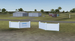
A Gmax representation of Pearly Beach Airfield, Western Cape, South Africa with photoreal textures. Pearly Beach airfield is a small privately owned airfield between the towns of Pearly Beach and Gansbaai in South Africa. Bearly Beach and Gansbaai are both very well known tourist spots for whale watching and even shark-cage diving with Great Whites which are regularly seen just of the coast. The runway is aligned 30/12 and measures 838m x 9m. Even the animated windpump is included.
| Filename: | Pearly_Beach_Airfield_South_Africa.zip |
| License: | Freeware, limited distribution |
| Added: | 24th February 2017, 19:46:06 |
| Downloads: | 246 |
| Author: | Kobus van Wyk, Aeroworx |
| Size: | 1.55 MB |
| Category: Flight Simulator 2004 - Scenery | |
| Columbus, OH - KCMH - John Glenn Int'l Patch fix updated |
|
File Description:
There is my mistake in scenery please read in my readme noted.
| Filename: | Columbus_OH__KCMH__John_Glenn_Intl_Patch_fix_updat.zip |
| License: | Freeware |
| Added: | 1st March 2017, 23:04:39 |
| Downloads: | 346 |
| Author: | Stuart John Gilbert II |
| Size: | 1.51 MB |
| Category: Flight Simulator 2004 - Scenery | |
| Medan, Indonesia - Kualanamu International Airport - WIMM |
|
File Description:
The new airport location from old airport was Polonia. There is more improvement more details nicely. Old airport rename to WIMK is including file enclosed.
| Filename: | Medan_Indonesia__Kualanamu_International_Airport__.zip |
| License: | Freeware |
| Added: | 5th March 2017, 23:57:52 |
| Downloads: | 892 |
| Author: | Stuart John Gilbert II |
| Size: | 2.92 MB |
| Category: Flight Simulator 2004 - Scenery | |
| Harrier Hides Field Operation Airfields |
|
Images related to this file:
File Description:
FS2004 scenery.Two areas of field operation
airfields as used by the Harriers doing VTOL
manoeuvres those days in the 80s. These
sceneries include highly detailed objects and
lots of tweaked models. This package comes with
seasonal textures and VTOL Harrier AI aircraft
models by John Young. Appropriate traffic files
included. Please read the included manual
carefully to bring the sceneries alive.
By Manfred Schyma and Michael Lennig
| Filename: | Harrier_Hides_Field_Operation_Airfields.zip |
| License: | Freeware |
| Added: | 22nd April 2017, 16:39:55 |
| Downloads: | 400 |
| Author: | Manfred Schyma and Michael Lennig |
| Size: | 158.73 MB |
| Category: Flight Simulator 2004 - Scenery | |
| Harrier Hides Field Operation Airfields |
|
Images related to this file:
File Description:
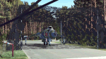
FS2004 scenery.Two areas of field operation airfields as used by the Harriers doing VTOL manoeuvres those days in the 80s. These sceneries include highly detailed objects and lots of tweaked models. This package comes with seasonal textures and VTOL Harrier AI aircraft models by John Young. Appropriate traffic files included. Please read the included manual carefully to bring the sceneries alive. By Manfred Schyma and Michael Lennig
| Filename: | Harrier_Hides_Field_Operation_Airfields.zip |
| License: | Freeware |
| Added: | 27th April 2017, 00:27:01 |
| Downloads: | 211 |
| Author: | Manfred Schyma and Michael Lennig |
| Size: | 115.34 MB |
| Category: Flight Simulator 2004 - Scenery | |
| Hakkari-Yuksekova(Turkey) Airport (LTCW/YKO) scenery 2017 |
|
Images related to this file:
File Description:
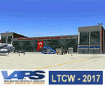
Turkey / Hakkari / Yuksekova-Selahaddin Eyyubi Airport (LTCW / YKO) scenery (2017) for Flight Simulator 2004 (Fs9). It is the civil airport on the border in Turkey's South-East region. The airport, built for 5 years and opened in 2015, cost 102 million TL. It entered full service in September 2016. Thank you for using it. Design by VAPS (vaps.hooxs.com).
| Filename: | HakkariYuksekovaTurkey_Airport_LTCWYKO_scenery_201.zip |
| License: | Freeware |
| Added: | 30th April 2017, 20:56:25 |
| Downloads: | 245 |
| Author: | Pilot Hoca (VAPS) |
| Size: | 1.73 MB |
| Category: Flight Simulator 2004 - Scenery | |
| Lucky Lake CKQ5 in Saskatchewan, Canada |
|
Images related to this file:
File Description:
The village of Lucky Lake is 80 miles south of Saskatoon, with a small population of less than 300, most of whom are dependant on agriculture for income, either directly or indirectly. Marijuana is a recently introduced crop after the failure of a government-financed potato growing operation called SPUDCO. The village was previously known as Devil's Lake (don't ask me, I don't know). The airfield is half a mile north of the village, with an asphalt runway just over 3,000 feet long, lit, and aligned 07-25 in FS9; this has now changed to 08-26 with the wandering magnetic north. Circuits on 25 are right handed to avoid over-flying the village. 100LL fuel is available.
| Filename: | Lucky_Lake_CKQ5_in_Saskatchewan_Canada.zip |
| License: | Freeware, limited distribution |
| Added: | 25th May 2017, 17:53:36 |
| Downloads: | 139 |
| Author: | Roger Wensley |
| Size: | 5.36 MB |
| Category: Flight Simulator 2004 - Scenery | |
| Dixie A05 Forest Service airfield in Idaho USA |
|
Images related to this file:
File Description:
This airfield is in the mountains of Idaho, the first in a series. There are not many mountain airfields that can be succesfully modelled in FS9 because the FS9 terrain does not always match reality; no creek for instance, or the valley too small. There are others where the grass strip is all there is, so there is nothing to model apart from resizing the cleared area. Some are well known, well maintained, have clean shower facilities, and are well used for a weekend by small planes with two people and a tent on board, for instance Johnson Creek. Others are less well known but still in good condition, such as Dixie or Big Creek. And there are also some with cabin rental facilities, such as Sulphur Creek Ranch. Other names come to mind, such as Flying B and Pistol Creek, but unfortunately for one reason or another these could not be made. The other difficulty involving hills is succesful AI landings and take offs. At Johnson Creek, for instance, the wind should be from the south to make AI landings more likely to succeed. Dixie is south of the village of the same name, and not to be confused with the dirt strip that is just beside the village. The runway is at 5,148 feet ASL, just over 4,000 feet long and aligned 18-36, and the parking area is at the northern end, opposite the Forest Service buildings. There is a chart of the area included, and to the south of Dixie is the next in the series, Big Creek U60.
| Filename: | Dixie_A05_Forest_Service_airfield_in_Idaho_USA.zip |
| License: | Freeware, limited distribution |
| Added: | 25th May 2017, 17:53:48 |
| Downloads: | 154 |
| Author: | Roger Wensley |
| Size: | 8.69 MB |
| Category: Flight Simulator 2004 - Scenery | |
| Big Creek U60 public use airfield in Idaho USA |
|
File Description:
This airfield is in the mountains of Idaho, 30 miles south of Dixie A05, which was the first in the series to be posted. Big Creek is now regularly used for picnic fly-ins and overnight camping, or for just a day of fishing in the creek; the creek does not appear in FS9 as it is not exactly huge, and within the Ultimate Terrain USA settings I have in fact turned streams off as in some cases they cross the grass or (in conjunction with the roads) left insufficient runway space. The U60 runway is at 5,743 feet ASl, 3,550 feet long, aligned 01-19, and in good condition. At the southern end there is the new replica of the old original Big Creek Lodge which was built in 1935. This burned down in 2008, and is now being rebuilt by a group of pilots, pilots having formed a large part of the early clientel courtesy of the grass strip. It is shown here as still under construction. There are also Forest Service buildings on the west side of the runway. All of this is located in the Frank Church Wilderness area and the Payette National Forest. The AI is increased at the weekends, reflecting reality, and also revised to use Boise as one of the starting places. Dixie is also reissued here with a revised positioning to fit with the roads. I had concluded that the roads were wrong, while in fact the position of the airstrip was at fault.
| Filename: | Big_Creek_U60_public_use_airfield_in_Idaho_USA.zip |
| License: | Freeware, limited distribution |
| Added: | 25th May 2017, 17:53:58 |
| Downloads: | 132 |
| Author: | Roger Wensley |
| Size: | 11.06 MB |


© 2001-2026 AVSIM Online
All Rights Reserved
Privacy Policy |