
Where Flight Simulation Enthusiasts Gather from Around the World!
AVSIM Library - Search Results

| Category: Flight Simulator 2004 - Scenery | |
| WV71 - Lieving Airport - West Virginia, USA |

|
Images related to this file:
File Description:
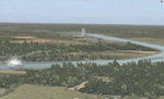
Racine Locks & Dam is a local vfr landmark for transits across the lower Allegheny Plateau. Included files are xml autogen, ezlandclass and custom bgl files with textures. I've named the files so that they are self explainable. This scenery is made to blend with autogen scenery (default) for FS9 and my Central Appalachia Land Class project. I've added the lower Big Sandy Valley project, too. It corrects a few default mistakes and adds bridges like at I-64 and in the Ashland Kentucky and Huntington WV area.
| Filename: | WV71__Lieving_Airport__West_Virginia_USA.zip |
| License: | Freeware |
| Added: | 9th July 2015, 17:29:21 |
| Downloads: | 213 |
| Author: | Rick Connolly |
| Size: | 5.64 MB |
| Category: Flight Simulator 2004 - Scenery | |
| 4NC9 - Lake Norman - North Carolina, USA |
|
Images related to this file:
File Description:
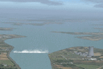
This float plane scene is based on the terra server. Lake Norman is in close proximity to the city of Charlotte, NC. The dam has dynamic spray and adjoining industry. A map of the state camp ground is included for your adding to my custom made scenery. I pulled this from my personal archives...
| Filename: | 4NC9__Lake_Norman__North_Carolina_USA.zip |
| License: | Freeware |
| Added: | 11th July 2015, 11:20:14 |
| Downloads: | 235 |
| Author: | Rick Connolly |
| Size: | 3.02 MB |
| Category: Flight Simulator 2004 - Scenery | |
| O12 - Grand Lake St. Marys Seaplane Base - Ohio, USA |
|
Images related to this file:
File Description:
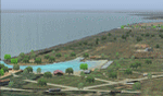
Grand Lake St. Marys Seaport O12 rests in Ohio's largest inland lake at Celina, Ohio. Float and soar plane enthusiasts will find thermals (several are placed within about a 60 mile radius) and plenty of docks or moors around the lake for your Amphib and afcads. Grand Lake St. Marys Seaport O12 scenery is made to blend with autogen scenery and default mesh. I used custom made objects & default objects. Grand_thermals.BGL is the troublesome file with winds aloft for sail planning thermals. Some people may want to remove it for smoother landing at one of the airports. Airports: Lakefield KCQA - Mulholland OI99 - Fortman 1OH4 and Grand Lake St Marys O12. I pulled this from my old archives.
| Filename: | O12__Grand_Lake_St_Marys_Seaplane_Base__Ohio_USA.zip |
| License: | Freeware |
| Added: | 11th July 2015, 11:22:45 |
| Downloads: | 242 |
| Author: | Rick Connolly |
| Size: | 13.53 MB |
| Category: Flight Simulator 2004 - Scenery | |
| Ontario Small Fields in Canada: #01 Leamington (CLM2) |
|
Images related to this file:
File Description:
This is the first of a series of small airfields in southern Ontario, Canada. It is Leamington CLM2, a field near a small town of the same name beside Lake Erie. The airfield has an asphalt runway of 3,820 feet, though with displaced thresholds at each end due to electric cable strung along the roads for an effective landing length of around 2,800. Right-hand circuits for runway 19 to avoid over-flying a nature reserve around a stretch of shallow water to the northeast. The intention is that downloaders will add further posts to the first, which will avoid unnecessary texture duplication (for instance for parked cars or planes) and avoid adding yet another small field to the FS9 scenery library. The second airfield will probably be Harrow CGL2, a grass field to the west of Leamington.
| Filename: | Ontario_Small_Fields_in_Canada_01_Leamington_CLM2.zip |
| License: | Freeware, limited distribution |
| Added: | 18th July 2015, 15:03:26 |
| Downloads: | 163 |
| Author: | Roger Wensley |
| Size: | 3.23 MB |
| Category: Flight Simulator 2004 - Scenery | |
| Ontario Small Fields in Canada: #02 Harrow CGL2 |
|
Images related to this file:
File Description:
This is the second in a series of small airfields in southern Ontario, Canada. It is Harrow CGL2, a field near a small town of the same name close to Lake Erie. The airfield has a grass runway of 3,000 feet, with short displaced thresholds (400 feet) at each end; the south due to the trees and the north due to a road and fence. The electric cable strung along this road (unlike Leamington, with it's warning visibility spheres) is buried for a short stretch the width of the runway, but avoid the poles. The intention is that downloaders will add further posts to the earlier ones, which will avoid unnecessary texture duplication (for instance for parked cars or planes) and avoid adding yet another small field to the FS9 scenery library. The third airfield will probably be Essex CNE9, a grass field to the west of Harrow.
| Filename: | Ontario_Small_Fields_in_Canada_02_Harrow_CGL2.zip |
| License: | Freeware, limited distribution |
| Added: | 19th July 2015, 19:44:00 |
| Downloads: | 182 |
| Author: | Roger Wensley |
| Size: | 1.54 MB |
| Category: Flight Simulator 2004 - Scenery | |
| Ontario Small Fields in Canada: #03 Essex CNE9 |
|
Images related to this file:
File Description:
This is the third in a series of small airfields in southern Ontario, Canada. It is Essex CNE9, a field near a small town of the same name close to Lake Erie and just northwest of Harrow (visible in one of the screenshots). The airfield has a grass runway of just 1,935 feet, with electric cables strung along the west side of the road on the approach to 09, buried for a short stretch the width of the runway (but avoid the poles). The airfield has three hangars, not the first farm strip to have more than the expected one-for-the-farmer. The intention is that downloaders will add further posts to the earlier ones, which will avoid uneccesary texture duplication etc. The fourth airfield will probably be Stoney Point CRML, a grass field to the northeast of Essex, close to Lake St. Clair.
| Filename: | Ontario_Small_Fields_in_Canada_03_Essex_CNE9.zip |
| License: | Freeware, limited distribution |
| Added: | 21st July 2015, 16:11:05 |
| Downloads: | 154 |
| Author: | Roger Wensley |
| Size: | 3.64 MB |
| Category: Flight Simulator 2004 - Scenery | |
| Ontario Small Fields in Canada: #04 Stoney Point (Le Cunff) CRML V1 |
|
Images related to this file:
File Description:
This is the fourth in a series of small airfields in southern Ontario, Canada. It is Stoney Point (Le Cunff) CRML, a field near a small town (Stoney Point) close to Lake St Clair. The airfield has a grass runway of 2,250 feet, aligned 18/36; with trees around the house gardens between road and runway the south threshold is displaced by 250 feet. The markers approximately show the touchdown point north of the runway end. Le Cunff is the family name of the owners, included to differentiate between this and another Stoney Point field, CRJ2. I found the default FS9 airfield at the correct elevation of 625 feet, but sitting on a plateau, despite my Genesis Mesh. This looked so unreal that I have revised this to an incorrect lower elevation of 580. So if you find the airfield sitting in a hole in your installation you now know the reason. Let me know, with a screenshot please.
| Filename: | Ontario_Small_Fields_in_Canada_04_Stoney_Point_Le_.zip |
| License: | Freeware, limited distribution |
| Added: | 29th July 2015, 16:08:32 |
| Downloads: | 146 |
| Author: | Roger Wensley |
| Size: | 1.6 MB |
| Category: Flight Simulator 2004 - Scenery | |
| Ontario Small Fields in Canada: #05 Pelee Island (CYPT) |
|
Images related to this file:
File Description:
This is the fifth in a series of small airfields in southern Ontario Canada, Pelee Island CYPT, an airfield on the island in Lake Erie and the southernmost airfield in Canada. The airfield has an asphalt runway of 3,300 feet, aligned 09/27 in FS9 while today in real life it is 10/28 due to the wandering magnetic pole. There is also a second runway, 36/18 and around 1,500 feet of gravel. There is a small terminal building which now has blue cladding; here it is still in the dirty yellow of the original colour scheme.
This version is based upon what appears to be a "lost" 2005 scenery of Pelee Island. When I started to make Pelee Island I discovered that in fact I already had a version installed; my memory can be excused, as I installed it in 2005. I modified the scenery to include parking, taxiways that connected, revised runway markings, new windsocks, new signage, larger apron, parked cars and planes, revised landclass, AI, etc. My intention was to instruct you to download and install the original and then incorporate my changes. Problem: it does not appear to exist for download; perhaps it was washed away when the Avsim site crashed. I have included it in this post. If anyone knows who made it please let me know.
| Filename: | Ontario_Small_Fields_in_Canada_05_Pelee_Island_CYP.zip |
| License: | Freeware, limited distribution |
| Added: | 5th August 2015, 18:52:25 |
| Downloads: | 171 |
| Author: | Roger Wensley |
| Size: | 4.39 MB |
| Category: Flight Simulator 2004 - Scenery | |
| KHAF - Half Moon Bay Airport - San Mateo County, California - USA |
|
Images related to this file:
File Description:
FS2004 Scenery - Half Moon Bay Airport (IATA: HAF, ICAO: KHAF, FAA LID: HAF) is a county-owned public use airport in San Mateo County, California, United States. It is located five nautical miles (9 km) northwest of the central business district of Half Moon Bay, California. The airport is on the Pacific Coast, south of San Francisco. The Half Moon Bay Airport is located approximately 20 miles south of San Francisco. It was constructed by the California State Highway Department for the U.S. Army in 1942 as an auxiliary airfield for Salinas Army Air Base. Following the end of World War II, San Mateo County acquired the airport from the Navy in 1947. The airport has served a variety of roles over the years and is currently an important business, transportation and emergency service asset to the community. For your flying pleasure by John B. Loney, Jr.
| Filename: | KHAF__Half_Moon_Bay_Airport__San_Mateo_County_Cali.zip |
| License: | Freeware, limited distribution |
| Added: | 5th August 2015, 18:58:17 |
| Downloads: | 318 |
| Author: | John B. Loney, Jr. |
| Size: | 11.87 MB |
| Category: Flight Simulator 2004 - Scenery | |
| ENRA - Mo I Rana Rossvoll Airport - Nordland, Norway |
|
File Description:
This is a very reduced FS9 scenery from my FSX ENRA-Scenery.
The environment of the airport is only partly adapted by new landclasses.
The airport has a no photo background.
The buildings in this scenery come from the fantastic XPlane scenery of Bert alias "almosquito" who kindly gave me the permission to convert them for my scenery.
| Filename: | ENRA__Mo_I_Rana_Rossvoll_Airport__Nordland_Norway.zip |
| License: | Freeware |
| Added: | 10th August 2015, 23:09:27 |
| Downloads: | 468 |
| Author: | Wolfgnang Allers |
| Size: | 8.18 MB |


© 2001-2026 AVSIM Online
All Rights Reserved
Privacy Policy |