
Where Flight Simulation Enthusiasts Gather from Around the World!
AVSIM Library - Search Results

| Category: Flight Simulator 2004 - Scenery | |
| Boundary Bay CZBB - Traffic |

|
Images related to this file:
File Description:
This traffic file is for Boundary Bay, and has five planes making touch and goes at this airfield with its five training companies. The planes are FS standard Cessna 172 (2 of them) and Cessna 182 and Piper Cherokee, and a Piper Super Cub which can be downloaded from Avsim. For the Cub look for the pa18_v3 zip by J. E. Narcijo and install it; I presume you know how to do that.
There are new scenery bgl's as I have added more parking spots for AI. The pic shows a Cessna 150, but that you won't be able to download as it is a custom texture of the plane that I learnt to fly on at Rockcliffe Flying Club in Ottawa. You should already have installed my Boundary Bay post (boundary_bay.zip).
| Filename: | Boundary_Bay_CZBB__Traffic.zip |
| License: | Freeware, limited distribution |
| Added: | 13th May 2011, 15:14:44 |
| Downloads: | 556 |
| Author: | Roger Wensley |
| Size: | 950.48 KB |
| Category: Flight Simulator 2004 - Scenery | |
| Ulukhaktok (Holman) CYHI in the Northwest Territories, Canada |
|
Images related to this file:
File Description:
Ulukhaktok (Holman) is an airfield on the west side of Victoria Island, off the northern coast of Canada. It is 320 miles west of Cambridge Bay (and you should download and install the recent post of CYCB by Sid and Pete, as I use it for the AI included in this post) and around 400 miles east of Inuvik (my post of a few months ago). It has been officially called Ulukhaktok since 2006, and before that it's name was Holman.
The village of Ulukhaktok has been placed around the bay and is approximately the right shape; it houses some 460 people who used to rely solely on hunting and fishing. The village is close to 71 degrees north, and there are only four months of the year when the average high is above zero centigrade. The photograph with snow (and of course a frozen sea) is typical; for the frozen sea download my Frozen Rivers & Lakes post which will provide this. The buildings on the field have been modelled specifically for this scenery, and as in real life there is only JetA available. The AI visiting aircraft are an Aklak Air DC3 (based in Inuvik and operated by Kenn Borek Air) and a Canadian North Dash 8-100. Note that the runways are signed as "true" headings instead of magnetic; in the Canadian Northern Domestic Airspace all headings are given as true. Unfortunately FS9 doesn't accommodate this in ATC.
| Filename: | Ulukhaktok_Holman_CYHI_in_the_Northwest_Territorie.zip |
| License: | Freeware, limited distribution |
| Added: | 24th May 2011, 20:05:47 |
| Downloads: | 454 |
| Author: | Roger Wensley |
| Size: | 2.3 MB |
| Category: Flight Simulator 2004 - Scenery | |
| SACO - Ingeniero Aeronautico Ambrosio L.V. Taravella Int. - Cordoba, Argentina |
|
Images related to this file:
File Description:
FS2004 Scenery Airport Cordoba - Pajas Blancas, Argentina. Ing. Aeronautico Ambrosio Taravella - Argentina
| Filename: | SACO__Ingeniero_Aeronautico_Ambrosio_LV_Taravella_.zip |
| License: | Freeware |
| Added: | 5th June 2011, 15:18:07 |
| Downloads: | 1,806 |
| Author: | Ivano Marongiu |
| Size: | 6.36 MB |
| Category: Flight Simulator 2004 - Scenery | |
| Moore-Murrell Airport KMOR |
|
Images related to this file:
File Description:
FS2004 Scenery - Moore-Murrell Airport (KMOR) serves Morristown and Hamblen County and is owned by the City Of Morristown, TN. The paved runway extends for 5701 feet. The facility is at an elevation of 1313 feet at a distance of about 4 miles from Morristown. This scenery employs the usual scenery objects libraries. Check the readme file for more information. Original concept and design by Maurice Butz in collaboration with John B. LOney, Jr.
| Filename: | MooreMurrell_Airport_KMOR.zip |
| License: | Freeware, limited distribution |
| Added: | 10th June 2011, 09:07:28 |
| Downloads: | 301 |
| Author: | Maurice Butz and John B Loney Jr |
| Size: | 1.2 MB |
| Category: Flight Simulator 2004 - Scenery | |
| Arctic Runway Signs in the "Northern Domestic Airspace", Canada |
|
Images related to this file:
File Description:
These are scenery bgl's to replace those previously posted for Cape Dorset, Gjoa Haven, Igloolik, and Whale Cove. All of these airfields are within what is marked on the chart as "Northern Domestic Airspace" and their runway signage is not given as a magnetic bearing but as a true bearing. This is because at those latitudes, close to magnetic north, the magnetic field is more vertical than horizontal and magnetic readings become unreliable. Planes report their course as a true course, and fly at a height that reflects their true course instead of their magnetic course. The picture shows the runway sign for Qikiqtarjuaq CYVM (which used to be called Broughton Island) which I am working on right now, and I realised that my training was so far behind me that I had forgotten all of the above. The boundary line of the two air spaces is not a straight line; the furthest south it reaches is on the west coast of Hudson Bay just north of Churchill. To the east it passes through the southern end of Baffin Island, and to the west it is north of the coast at the Alaskan border, and there is an illustration included here.
| Filename: | Arctic_Runway_Signs_in_the_Northern_Domestic_Airsp.zip |
| License: | Freeware, limited distribution |
| Added: | 11th June 2011, 03:06:36 |
| Downloads: | 310 |
| Author: | Roger Wensley |
| Size: | 1.21 MB |
| Category: Flight Simulator 2004 - Scenery | |
| Syracuse NY (KSYR) |
|
Images related to this file:
File Description:
This is Syracuse NY (KSYR)based upon photos I took when I flew there and Bing maps photos.
| Filename: | Syracuse_NY_KSYR.zip |
| License: | Freeware |
| Added: | 11th June 2011, 22:47:51 |
| Downloads: | 1,591 |
| Author: | Eric Cagan |
| Size: | 5.7 MB |
| Category: Flight Simulator 2004 - Scenery | |
| KSBY Salisbury-Ocean City Wicomico Regional Airport |
|
Images related to this file:
File Description:

Added new terminal with extra hangars and gates for Piedmont Airlines.
Requires RWY12 object library and two other downloads listed inside the READ ME FILE.
| Filename: | KSBY_SalisburyOcean_City_Wicomico_Regional_Airport.zip |
| License: | Freeware, limited distribution |
| Added: | 18th June 2011, 19:20:10 |
| Downloads: | 644 |
| Author: | Rob Touchtone |
| Size: | 8.72 MB |
| Category: Flight Simulator 2004 - Scenery | |
| KDBQ Dubuque Regional Airport |
|
Images related to this file:
File Description:

KDBQ Dubuque IA. Replaced default airport with a new terminal and hangers. Added gate for American Eagle, and general aircraft ramps.
Requires RWY12 object library and some extra downloads available from the read me file.
| Filename: | KDBQ_Dubuque_Regional_Airport.zip |
| License: | Freeware, limited distribution |
| Added: | 19th June 2011, 23:59:40 |
| Downloads: | 787 |
| Author: | Rob Touchtone |
| Size: | 10.73 MB |
| Category: Flight Simulator 2004 - Scenery | |
| KENV Wendover Utah 2011 |
|
Images related to this file:
File Description:
My second scenery to date. This time it features Wendover Utah.
Includes
-Photoreal textures and ground poly.
-3D Taxiway Lights
-Taxiway Signs
-Correct afcad and scasm lighting
| Filename: | KENV_Wendover_Utah_2011.zip |
| License: | Freeware |
| Added: | 20th June 2011, 13:17:46 |
| Downloads: | 1,154 |
| Author: | Ryan Whitford |
| Size: | 6.61 MB |
| Category: Flight Simulator 2004 - Scenery | |
| Cape Dyer CWFD in Nunavut, Canada |
|
Images related to this file:
File Description:
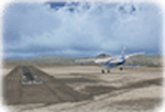
Cape Dyer is on the southeast corner of Baffin Island, around 120 miles east of Pangnirtung at approximately N66 45 W61 30. There is a fine view north up the Davis Strait between Baffin Island and Greenland, and this is the whole reason for the airfield's existance as it was built to support the construction and operation of a DEW line radar station, which has now been updated to a North Warning System site. There are two camps; the upper camp is on the east side of the Cape and is where the radars are located, linked by a gravel road to the lower camp, which is on the west and more sheltered side of the Cape on the clifs above Sunneshine Fjord. The runway is 5,000' of 150' wide gravel, and it is lighted and at 1,320' feet ASL. Cape Dyer is now listed as abandoned in the Canada Flight Supplement. It is, however, still there and presumably is still used for access to the North Warning System equipment, which is automated and generally unmanned. The buildings were modeled for this scenery and include a hanagar large enough to accommodate a C-130. Ultimate Terrain is not required as it does not cover northern Canada.
| Filename: | Cape_Dyer_CWFD_in_Nunavut_Canada.zip |
| License: | Freeware, limited distribution |
| Added: | 21st June 2011, 19:30:07 |
| Downloads: | 491 |
| Author: | Roger Wensley |
| Size: | 1.9 MB |


© 2001-2026 AVSIM Online
All Rights Reserved
Privacy Policy |