
Where Flight Simulation Enthusiasts Gather from Around the World!
AVSIM Library - Search Results

| Category: Flight Simulator 2004 - Scenery | |
| Burg Military Airfield |

|
Images related to this file:
File Description:
Burg military airfield, Paratrooper-training base-40. The airfield Cottbus is the one field of a row of military airfield sceneries. In the scenery are included the airfield and the technical supplies.
The airfield was put into operation in 1982 in duty of the NVA. Here were trained paratroopers of the NVA and other airborne-units.
| Filename: | Burg_Military_Airfield.zip |
| License: | Freeware |
| Added: | 4th May 2012, 15:51:13 |
| Downloads: | 480 |
| Author: | Volker Loew, Frithjof Koch |
| Size: | 1.38 MB |
| Category: Flight Simulator 2004 - Scenery | |
| Whitney Airport and Float Base, Ontario |
|
File Description:
Whitney Airport and Float Base lays just a few miles to the Southeast of the East Portal of Algonquin Provincial Park near Whitney, Ontario. I own and operate the facility as the far North terminus of normally scheduled Wacker Excursions and Transport Service (WETS) flights. Headquartered in Syracuse, NY, WETS, like its operating locations and bases, exists only in the Virtual World.
| Filename: | Whitney_Airport_and_Float_Base_Ontario.zip |
| License: | Freeware, limited distribution |
| Added: | 7th May 2012, 00:01:38 |
| Downloads: | 216 |
| Author: | Robert J. "Stew" Stewart, Jr. |
| Size: | 4.71 MB |
| Category: Flight Simulator 2004 - Scenery | |
| Doha International Airport (OTBD) - (AIRAC update May 2012) |
|
Images related to this file:
File Description:
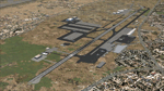
This is a very simple rendition of Doha airport as of May 2012 with default and library objects. It updates my previous version of this scenery with recent changes implemented as of AIRAC1205:
- Runway designator changed to 15/33
- New aprons and parking stands
- Many other features and fixes
All taxiways, aprons, parkings are perfectly accurate according to airport charts and personal experience. Buildings and airport objects are placed according to real life but are not themselves a real depiction. I have used default objects as well as library objects found on the Internet. If anyone downloading this airport has knowledge on how to create custom buildings and objects to improve the scenery, please let me know, I'll be happy to share photos of the real thing for you.
| Filename: | Doha_International_Airport_OTBD__AIRAC_update_May_.zip |
| License: | Freeware, limited distribution |
| Added: | 12th May 2012, 23:09:38 |
| Downloads: | 5,288 |
| Author: | Frederic Revol |
| Size: | 6.79 MB |
| Category: Flight Simulator 2004 - Scenery | |
| Tuktoyaktuk CYUB in Northwest Territories, Canada |
|
Images related to this file:
File Description:
Tuktoyaktuk is on the northern coast of Canada, 70 miles north of Inuvik and to the east of the Mackenzie River delta. It has a population of around 900 and because of its natural harbour is a centre for oil exploration activity on the surrounding land and on the Beaufort Sea, with sizeable but now under-used yards dating back to the peak of activity in the late 1970's. On land work is restricted to the winter half of the year, as only the freeze-up makes it possible to move on land with heavy equipment, and during the winter further supples are driven over an ice road from Inuvik up to Tuk. The ice-free summer months are used for floating equipment from Yuk along the coast on barges and then up the rivers to inland sites in preparation for the winter activity. Before the oil there was a DEW line station here, and there is still an automated station on the same site and included here, as are the yards. The airfield is on the coast close to the town and the yards, at 15' ASL. The gravel runway 09/27 is 5,000' feet long and 150' wide; both thresholds are displaced by 200', but of course there are no markings on the gravel. The large apron is on the north side at the centre of the runway and is large enough to accomodate several large planes. Inuvik revised should be installed first, now Tuk, then last of the three Sachs Harbour which has AI for Aklak Airlines flights (operated by Kenn Borek) for all three airfields. There is a separate AI file included here, featuring freight delivery by Buffalo Airways and small planes.
| Filename: | Tuktoyaktuk_CYUB_in_Northwest_Territories_Canada.zip |
| License: | Freeware, limited distribution |
| Added: | 14th May 2012, 17:19:20 |
| Downloads: | 621 |
| Author: | Roger Wensley |
| Size: | 8.99 MB |
| Category: Flight Simulator 2004 - Scenery | |
| Sachs Harbour CYSY in Northwest Territories, Canada |
|
Images related to this file:
File Description:
Sachs Harbour is on the southwest coast of Banks Island on the north side of Amundsen Gulf, around 240 miles northeast of Tuktoyaktuk and 180 miles northwest of Ulukhaktok. The village is the only permanent settlement on the island, and is located where it is to benefit from the harbour shelter provided by offshore land. The population is only 130 or so folks, who live on hunting and fishing with some tourism. One claim to fame is that the island is home to threequarters of the world's population of muskoxen and the second is the largest goose colony in North America. The airfield is on the plateau just above the village at 282 feet ASL. The gravel runway 084T/264T (true bearings in Northern Domestic Airspace) is 4,000' long and 100' wide and lit. The apron is on the south side at the centre of the runway and there is a new terminal building; there is JetA fuel available and perhaps 100LL in drums. To the west of the airfield are the deserted buildings of what was once a Department Of Transport weather station. Aklak Airlines flights (operated by Kenn Borek) fly to Sachs Harbour from Inuvik three times a week in summer and twice a week at other times; the AI will be included in the post of a revised Aklavik, and Inuvik revised and Tuktoyaktuk should be fully installed BEFORE Sachs Harbour.
| Filename: | Sachs_Harbour_CYSY_in_Northwest_Territories_Canada.zip |
| License: | Freeware, limited distribution |
| Added: | 14th May 2012, 17:20:09 |
| Downloads: | 395 |
| Author: | Roger Wensley |
| Size: | 6.16 MB |
| Category: Flight Simulator 2004 - Scenery | |
| LIED - Decimomannu |
|
Images related to this file:
File Description:
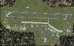
Hello all, this is a representation of Italian base Decimomannu LIED created with ADE9
| Filename: | LIED__Decimomannu.zip |
| License: | Freeware |
| Added: | 20th May 2012, 17:13:45 |
| Downloads: | 865 |
| Author: | Giorgio Perotti |
| Size: | 178.62 KB |
| Category: Flight Simulator 2004 - Scenery | |
| UNNT Tolmachevo 2012 - Novosibirsk |
|
Images related to this file:
File Description:
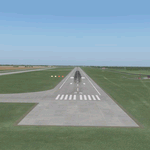
Tolmachevo airport is the largest airport complex in Siberia and the Far East of a Class A-1 with of a cargo capacity of more than 50,000 tonnes per year, 750 passengers per hour on international flights and 1,800 per hour on domestic routes.
The airport has two runways, the second one was put into operation in autumn 2010. It doesn't have any restrictions on take-off weight, and is certified for ICAO CAT II. Tolmachevo airport is included in a list of international hubs of Russia. In 2011 the airport handled 2,765,884 passengers (22.3% more than in 2010).
| Filename: | UNNT_Tolmachevo_2012__Novosibirsk.zip |
| License: | Freeware |
| Added: | 4th June 2012, 17:36:11 |
| Downloads: | 2,207 |
| Author: | Tolmachevo TEAM |
| Size: | 80.88 MB |
| Category: Flight Simulator 2004 - Scenery | |
| SKPP, Guillermo Leon Valencia, Popayan, Colombia |
|
File Description:
Based on GoogleEarth I added ramp, taxiways and standard objects as well as landclass for the town to the default scenery.
| Filename: | SKPP_Guillermo_Leon_Valencia_Popayan_Colombia.zip |
| License: | Freeware |
| Added: | 22nd June 2012, 21:55:15 |
| Downloads: | 504 |
| Author: | Detlev J. Rohmer |
| Size: | 2.43 MB |
| Category: Flight Simulator 2004 - Scenery | |
| KHXD - Hilton Head Airport, South Carolina |
|
Images related to this file:
File Description:

Hilton Head South Carolina Airport KHXD. For FS2004. New terminal, FBO, GA Hangars. Made with ADE and EZ Scenery library. Requires the complete EZ Scenery Library.
| Filename: | KHXD__Hilton_Head_Airport_South_Carolina.zip |
| License: | Freeware |
| Added: | 8th July 2012, 19:32:02 |
| Downloads: | 543 |
| Author: | Rob Touchtone |
| Size: | 13.06 MB |
| Category: Flight Simulator 2004 - Scenery | |
| Buffalo Narrows CYVT in Saskatchewan, Canada |
|
Images related to this file:
File Description:
Buffalo Narrows is a small town (around 1,400 folks) 130 miles west and a bit north of La Ronge in Saskatchewan, and I discovered that the Buffalo Narrows airfield, wrongly positioned in FS9, had been flooded out by Ultimate Terrain's lake; this is the rescue package. Actually that would be several lakes as the place is surrounded by water including Churchill Lake, Little Peter Pond Lake, and of course Big Peter Pond Lake.
There are two runways, the longest being 5,006' of 100' wide asphalt aligned 11/29, and the other 2,297 and 75' wide, also asphalt. Both runways are lit, and there is JetA and 100LL fuel available. I have placed taxiway lights, but I haven't made proper signage or placed runway lights, or a ton of other things, but it is now landable and with the buildings and fire chemical retarder tanks etc, and there is AI that includes a CL-415. The roads have also been modified to fit.
| Filename: | Buffalo_Narrows_CYVT_in_Saskatchewan_Canada.zip |
| License: | Freeware, limited distribution |
| Added: | 15th July 2012, 19:31:20 |
| Downloads: | 500 |
| Author: | Roger Wensley |
| Size: | 1.8 MB |


© 2001-2026 AVSIM Online
All Rights Reserved
Privacy Policy |