
Where Flight Simulation Enthusiasts Gather from Around the World!
AVSIM Library - Search Results

| Category: Flight Simulator 2004 - Scenery | |
| Durban Island CWFB FOX-E DEW line station in Nunavut, Canada |

|
Images related to this file:
File Description:
Durban Island is 40 miles north of Cape Dyer on the southeast corner of Baffin Island, and around 60 miles southeast of Qikiqtarjuaq (known as Broughton until recently). Sitting on the top of the island is FOX-E, an intermediate station that was part of the DEW line. There is no runway (and once you have seen the island you will know why) and the station and its (usually) five man crew were supported by helicopter flights from Cape Dyer. The main feature is a 300' high mast, topped by comms gear to link both to Broughton to the north and Cape Dyer to the south. There was only one really habitable building, 80' x 30' in round figures, and this contained the generators, technical spaces, sleeping areas, kitchen, mess, and showers etc. There were also what were known as Anderson shelters, originally put up to house the construction crew and used in the summer for any maintenance people who visited for short periods. There was also a garage for a snow cat and tanks for fuel. And a view.
This post also includes new bgls for Cape Dyer to provide the 300' tower there too.
| Filename: | Durban_Island_CWFB_FOXE_DEW_line_station_in_Nunavu.zip |
| License: | Freeware, limited distribution |
| Added: | 1st July 2011, 22:11:33 |
| Downloads: | 316 |
| Author: | Roger Wensley |
| Size: | 1.87 MB |
| Category: Flight Simulator 2004 - Scenery | |
| Alternates for Durban Island CWFB FOX-E DEW line station in Nunavut, Canada |
|
File Description:
These are alternative bgls that include a flatten. They will change the shape of the hill that the FOX-E station sits on top of, but they will also make sure that there are no "floating" or "buried" scenery objects. If you are having that problem then just throw these into the scenery folder that you already created when you installed Durban Island, and say Yes! to over-write or whatever the question is. If you have a mesh that is compatible with what I use then you won't be having that problem, so don't do anything.
| Filename: | Alternates_for_Durban_Island_CWFB_FOXE_DEW_line_st.zip |
| License: | Freeware, limited distribution |
| Added: | 1st July 2011, 22:12:35 |
| Downloads: | 268 |
| Author: | Roger Wensley |
| Size: | 353.65 KB |
| Category: Flight Simulator 2004 - Scenery | |
| Vargarda airfield |
|
Images related to this file:
File Description:
Version 1.1 ; Vargarda airfield is a small airfield outside allingsas used by the Parachute Club Cirrus Goteborg, more info here: http://www.flygkartan.se/053695/Vargarda_flygfalt ; I used AFCAD to do the layout and instant scenery to place the building.
| Filename: | Vargarda_airfield.zip |
| License: | Freeware, limited distribution |
| Added: | 2nd July 2011, 17:53:22 |
| Downloads: | 158 |
| Author: | Max August, Larsson Kuhla |
| Size: | 52.52 KB |
| Category: Flight Simulator 2004 - Scenery | |
| KMYR Myrtle Beach, SC. |
|
Images related to this file:
File Description:

KMYR for FS9. Complete new terminal with jetways and correct airline parking. New hangers and general aviation area. Added Hotels on the beach front.
Requires the complete RWY12 object library and the complete EZ Scenery object library. Links included in the READ ME file.
| Filename: | KMYR_Myrtle_Beach_SC.zip |
| License: | Freeware |
| Added: | 8th July 2011, 01:34:40 |
| Downloads: | 1,535 |
| Author: | Rob Touchtone |
| Size: | 24.33 MB |
| Category: Flight Simulator 2004 - Scenery | |
| Cape Hooper CWFH and FOX-4 DEW Line Station in Nunavut, Canada |
|
Images related to this file:
File Description:
Cape Hooper is around 60 miles north of Kivitoo (FOX-D) and 140 miles south of Clyde River CYCY on the northeast-facing coast of Baffin Island. FOX-4 is still in use as a new and mostly-unmanned North Warning System site was established there in 1990 before the DEW line station was closed in 1991. Actually the DEW line station was not "closed" as such, they just stopped using it. The site of FOX-4 is on the top of a bump at the end of one of many long promontories that stick out into the Davis Strait between Baffin Island and Greenland, close to the far eastern end that is called Cape Hooper. There is a gravel runway to the west, down at 65' ASL; it is only just over 3,000' long and most material was delivered by sea to the beach at the southern end of the runway. The runway is signed as
"324T - 144T" as this is Northern Domestic Airspace where all runways are signed "true" and not "magnetic"; it is 013/193 magnetic with a huge magnetic variation of 48.9 degrees in this area where the magnetic field is mostly vertical, and so useless for navigation.
| Filename: | Cape_Hooper_CWFH_and_FOX4_DEW_Line_Station_in_Nuna.zip |
| License: | Freeware |
| Added: | 11th July 2011, 00:28:40 |
| Downloads: | 416 |
| Author: | Roger Wensley |
| Size: | 1.65 MB |
| Category: Flight Simulator 2004 - Scenery | |
| LETF - "Aerodromo Tomas Fernandez Espada", Villamartin (Cadiz, Spain) V3 |
|
File Description:
Basic scenery for LETF, with several improvements on previuos versions. Although this airfield has activity from 1997, just in 2007 it has received its ICAO code "LETF". You can get information about aeronautical and general questions in the web "www.fly-pedro.com" and "www.volaralsur.com". Many thanks to Jon Masterson for his wonderful ADE.
| Filename: | LETF__Aerodromo_Tomas_Fernandez_Espada_Villamartin.zip |
| License: | Freeware, limited distribution |
| Added: | 12th July 2011, 21:03:53 |
| Downloads: | 347 |
| Author: | Felix Fernandez de Castro |
| Size: | 2.36 KB |
| Category: Flight Simulator 2004 - Scenery | |
| Clyde River CYCY & Cape Christian in Nunavut Canada |
|
Images related to this file:
File Description:
Clyde River is a village on the northeast coast of Baffin Island, 250 miles above the Arctic Circle and around 150 miles north of Cape Hooper. It is on the shore of Patricia Bay at the entrance to Cylde Inlet, a fjord which stretches over 60 miles inland. The population is around 880 folks, and it was named by the explorer John Ross in 1818. The airfield is just east of the village and the lighted runway is 3,501' of 100' wide gravel at 87' ASL, aligned 018 True 198 True; "True" as opposed to magnetic in the Northern Domestic Airspace. There are two aprons, one with the new terminal building and one with the old terminal and the garage. Five miles northeast of Clyde River is Cape Christian, where there is a gravel runway around 3,000' long and adjacent to the beach, built to serve what was started as a weather station and later became a LORAN navigation system station. The station is still there, though it was closed some time ago and is now the subject of decontamination work. The runway is usable, though only for light planes as it is a bit rough. First Air and Canadian North are the AI planes visting Clyde River.
| Filename: | Clyde_River_CYCY__Cape_Christian_in_Nunavut_Canada.zip |
| License: | Freeware |
| Added: | 14th July 2011, 20:26:14 |
| Downloads: | 457 |
| Author: | Roger Wensley |
| Size: | 3.33 MB |
| Category: Flight Simulator 2004 - Scenery | |
| ENRY - Rygge Airport, Oslo |
|
Images related to this file:
File Description:

This is my first attempt at making a scenery, so do not expect much! It's only an enhancement of the default scenery to make it look a little bit more realistic than the plain stock airport. I have added jetways to gates 3, 4 and 5, as per real life, a couple of hangars, and static aircraft, as well as some de-icing trucks in the de-icing area. I have also redone the taxiway signs my own way, and also equipped the runway with ILS at both ends. Gates are numbered and some have assignments for Ryanair, which is the chief airline serving this airport.
You MUST have the Runway 12 library objects installed to make this scenery work properly. Details of where to find them are included in the readme. Enjoy!
| Filename: | ENRY__Rygge_Airport_Oslo.zip |
| License: | Freeware |
| Added: | 31st July 2011, 17:25:13 |
| Downloads: | 1,606 |
| Author: | Chris Horsfield |
| Size: | 128.91 KB |
| Category: Flight Simulator 2004 - Scenery | |
| BCATP (British Commonwealth Air Training Plan) Canada 1940s |
|
Images related to this file:
File Description:
This British Commonwealth Air Training Plan (BCATP) scenery will install approximately 160 BCATP stations across Canada and they will resemble what they appeared like in the 1940s. You will see an abundance of aircraft from that era and the buildings were produced in GMax from drawings used when those stations were operational. The scenery will be self installed. Start your favourite Harvard, Tiger Moth or Anson and take yourself back in history to WWII.
| Filename: | BCATP_British_Commonwealth_Air_Training_Plan_Canad.zip |
| License: | Freeware, limited distribution |
| Added: | 2nd August 2011, 15:39:52 |
| Downloads: | 537 |
| Author: | Flight Ontario, Al Gay, Grant Wilson |
| Size: | 55.01 MB |
| Category: Flight Simulator 2004 - Scenery | |
| LGAD Andravida AFB v1.1 |
|
Images related to this file:
File Description:
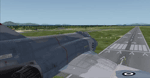
Anadravida AFB upgrade AFCAD and scenery files. LGAD located in West Peloponossos and it is one of the major Hellenic AFB.
HAFv uses this area for training and Special Operations trials.
Hope you enjoy it!
| Filename: | LGAD_Andravida_AFB_v11.zip |
| License: | Freeware, limited distribution |
| Added: | 7th August 2011, 16:10:08 |
| Downloads: | 710 |
| Author: | Dimitris Pastarmatzis |
| Size: | 99.45 KB |


© 2001-2026 AVSIM Online
All Rights Reserved
Privacy Policy |