
Where Flight Simulation Enthusiasts Gather from Around the World!
AVSIM Library - Search Results

| Category: Flight Simulator 2004 - Scenery | |
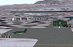
| Lake Hood Floatplane Base, Anchorage, Alaska |

|
File Description:
This is a representation of part of the Lake Hood floatplane base. It contains numerous buildings and docks, several static Beavers scattered about, and touch and go traffic with a Lake Renegade. There is a string of channel bouys so that you can find your way around after landing. It is not a pretty scenery- you will not find any comfy cabins and fishing camps- it is strictly a functional area, but it blends in nicely with the default Anchorage airport.
| Filename: | Lake_Hood_Floatplane_Base_Anchorage_Alaska.zip |
| License: | Freeware |
| Added: | 24th October 2005, 22:20:39 |
| Downloads: | 1,817 |
| Author: | John L. Woodward |
| Size: | 1.41 MB |
| Category: Flight Simulator 2004 - Scenery | |
| Graham Field in Anchorage, Alaska |
|
File Description:
This scenery is located in Anchorage Alaska. All default enhanced.
Airport name,
1.Graham field(48AK). 2 Aircraft doing touch and go's around the field. will start at 22:00GMT.
Aircraft involved: Vega5c. call sign 41 bravo charlie. Vega5b. call sign 10 bravo delta.
| Filename: | Graham_Field_in_Anchorage_Alaska.zip |
| License: | Freeware |
| Added: | 24th January 2004, 23:43:02 |
| Downloads: | 2,253 |
| Author: | Frank Betts |
| Size: | 1.28 MB |
| Category: Flight Simulator 2004 - Scenery | |
| Hope Airfield |
|
File Description:
This scenery is located in Alaska. All default enhanced.
Airport name,
1.Hope airfield(5HO) default enhanced. Aircraft doing touch and go's around the field. will start at 22:00GMT.
Aircraft involved: Piper cherokee 180. call sign 91 alpha. Cessna amphib. call sign 77 whiskey.
| Filename: | Hope_Airfield.zip |
| License: | Freeware |
| Added: | 23rd January 2004, 04:45:38 |
| Downloads: | 1,854 |
| Author: | Frank Betts |
| Size: | 1.36 MB |
| Category: Flight Simulator 2004 - Scenery | |
| Black Pond Airstrip - N46 |
|
Images related to this file:
File Description:
Welcome to Black Pond airstrip. This is an airstrip located in Farmers Mill, NY. It is a privately owned airstrip and it has a very mysterious history. Farmer's Mill is located east of KPOU and on the other side of the Hudson River east from KSWF near the Taconic state parkway. This is the first airport I have ever created. It includes one 3500' tarmac runway, 1000' grass strip, and a 4500' water runway. This was created for FS2004, but it might work with FSX. Happy flying!
| Filename: | Black_Pond_Airstrip__N46.zip |
| License: | Freeware |
| Added: | 11th October 2010, 00:02:03 |
| Downloads: | 273 |
| Author: | Sean Zottarelli |
| Size: | 87.5 KB |
| Category: Flight Simulator 2004 - Scenery | |
| Venezia Tessera & Venezia San Nicolo (LIPZ, LIPV) AI Traffic Patch |
|
File Description:
This patch, for FS2004 only, fixs the problem of AI Traffic in LIPZ & LIPV 2003 scenery. A new AFCAD2 file is included.
| Filename: | Venezia_Tessera__Venezia_San_Nicolo_LIPZ_LIPV__AI_.zip |
| License: | Freeware, limited distribution |
| Added: | 4th February 2004, 04:14:19 |
| Downloads: | 31,646 |
| Author: | ISD Project |
| Size: | 622.05 KB |
| Category: Flight Simulator 2004 - Scenery | |
| Cardington Version 2 |
|
File Description:
Cardington (UK) Airship Station for FS2004 by John McKeon - Version 2 - 17/10/2005
Location correct to VFR photoreal scenery and compatible with default and Golden Wings scenery
The British hub for inter-continental airship travel in 1918-1935 and site of Short Brothers airship factory, which built R31- R38. The facilities are, a conventional grass strip for departure, a 300 ft mooring mast with docking device for arrival, two enormous sheds with pilot-controlled opening doors, static aircraft, vehicles, people, and equipment; refuelling and regassing station, smoking chimney, terminal buildings, repair and maintenance sheds. Package includes carrier operations "rcbp-20.zip" for docking device.
| Filename: | Cardington_Version_2.zip |
| License: | Freeware |
| Added: | 18th October 2005, 03:55:52 |
| Downloads: | 1,790 |
| Author: | John McKeon |
| Size: | 2.36 MB |
| Category: Flight Simulator 2004 - Scenery | |
| Sunnyvale Air Station circa 1933 |
|
Images related to this file:
File Description:

FS2004 Scenery for Sunnyvale Air Station circa 1933. Known for 75 years as Moffett Field Naval Air Station, this unique site started life as Sunyvale Field (then Air Station) and was planned as the west coast base of the new Dirigible U.S.S. Macon.
The Macon was a new direction for airships in that it carried a squadron of fighter/scout aircraft and would provide for the U.S. Navy a 'carrier in the sky'. To provide for this new queen of the skies a new base was created with a unique hangar, for many years the largest free-standing wood construction in world.
This scenery attempts to capture Sunnyvale as it was first opened in 1933. I have taken a few liberties like adding in full grown trees that were part of the original master plan but I believe you will find this base captures the spirit of the original. Scenery contains custom FSDS and Gmax models as well as period AI from J.R. Lucariny (F9C SParrowhawk) and a custom repaint of the default Ford Trimotor by Ed Moore and Gary Smith.
| Filename: | Sunnyvale_Air_Station_circa_1933.zip |
| License: | Freeware, limited distribution |
| Added: | 2nd April 2012, 11:51:11 |
| Downloads: | 436 |
| Author: | John Stinstrom |
| Size: | 6.59 MB |
| Category: Flight Simulator 2004 - Scenery | |
| DBWsim NAS Alameda 2005 PATCH |
|
File Description:
This patch is for the DBWsim Alameda 2005 scenery pack, fixing a issue where the runways at NAS Alameda were marked with incorect designation numbers. Requires the original scenery pack (DBWAlameda05.zip)
| Filename: | DBWsim_NAS_Alameda_2005_PATCH.zip |
| License: | Freeware |
| Added: | 8th September 2005, 11:58:03 |
| Downloads: | 4,583 |
| Author: | Derek and Brendan Webb |
| Size: | 84.99 KB |
| Category: Flight Simulator 2004 - Scenery | |
| Indianapolis Executive KTYQ |
|
Images related to this file:
File Description:
FS2004 Scenery - Indianapolis Executive Airport (Formally known as Indianapolis Terry Airport) KTYQ, serves Indianapolis and Boone County and is owned by R. Vansickle. The paved runway extends for 5500 feet. The facility is at an elevation of 922 feet at a distance of about 14 miles from Indianapolis. Created with FSDS2, Rwy12 and Lago's FSE. AFCAD2 and Traffic Tools required. By John B. Loney, Jr.
| Filename: | Indianapolis_Executive_KTYQ.zip |
| License: | Freeware, limited distribution |
| Added: | 17th May 2010, 22:30:47 |
| Downloads: | 786 |
| Author: | John B. Loney, Jr. |
| Size: | 984.06 KB |
| Category: Flight Simulator 2004 - Scenery | |
| PAIW Wales, Alaska, USA |
|
Images related to this file:
File Description:
Googly scenery for Wales - a small domestic airport on the western coast of Alaska that is poorly provided for in Flight Simulator 2004. These scenery files add taxiways, aprons, buildings and other airport features, so that you and your "AI" traffic can land, taxi, park and take off in a realistic manner.
Wales is a small village with a population of just over 150 people, so the facilities at this 4000 foot gravel airstrip are fairly limited. The airport is allocated the ICAO code PAIW, although Microsoft has ignored this in Flight Simulator and uses the IATA ticket code IWK. Wales is served by light aircraft from airlines such as Bering Air, Cape Smythe Air, Frontier Flying Service, and Hageland Aviation Services. You might find it a convenient stopping-off point for a quick trip across to Russia - this is about as close as you can get and a nip across the Bering Strait will find you there in no time.
The scenery does not purport to be ultra-accurate. Based on high-detail satellite imagery from Google Earth, the layout is proportionally correct but the added airport features, such as buildings, are built from default Microsoft objects and add-on libraries so will not look like the real thing.
You are not obliged to download and install any additional scenery libraries, but to enjoy this scenery in its entirety, you may wish to. It will work fine, with or without.
[File re-uploaded at request of AVSIM]
| Filename: | PAIW_Wales_Alaska_USA.zip |
| License: | Freeware |
| Added: | 26th June 2010, 13:51:45 |
| Downloads: | 1,266 |
| Author: | John Hinson |
| Size: | 76.81 KB |
© 2001-2026 AVSIM Online
All Rights Reserved
Privacy Policy |